


Why visit Harlow
Townapedia lists 22 museums and landmarks, 75 parks and trails, 146 places to eat, 12 places to stay and 8 attractions in and around town.
Highlights include Cineworld, Cineworld, Harlow Museum & Walled Gardens and Henry Moore Foundation.
Weather in Harlow
Forecast from MET Norway (CC BY 4.0). Full forecast
About Harlow
Harlow is a town and local government district located in the west of Essex, England. Harlow was a small town until the mid-20th century. In 1947 it was designated as a new town. Housing estates, industrial areas and a new town centre were subsequently developed, lying mostly to the west and south of the old town, which became known as Old Harlow.
From the Wikipedia article Harlow (this version), under CC BY-SA 4.0.
Travel tips from other travellers: Harlow on Wikivoyage (CC BY-SA 4.0).
Photos of Harlow


Things to do8



Museums and landmarks22


Henry Moore Foundation
Museum · 4.3 mi
Charity and museum in England, United Kingdom

10 more on the map.
Parks, trails and playgrounds75




63 more on the map.
Restaurants and cafes146
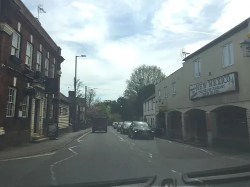
New Mexico Restaurant
Restaurant · Tex-Mex · 2.9 mi
1-10 London Road, Sawbridgeworth
Mo-Su 16:00-22:00
Star of India
Restaurant · Indian · 3.0 mi
51 London Road, Sawbridgeworth
Tu closed, We-Mo 12:00-14:00, We-Mo 17:30-23:30

Cafe Belle Vie
Cafe · Regional, Coffee Shop, Sandwich, Salad, Breakfast, Burger · 0.7 mi
4A Mill Court, Harlow
Mo,We-Sa 08:00-17:00; Su 09:00-16:00

Golden City
Restaurant · Chinese · 3.0 mi
13 Bell Street, Sawbridgeworth
Mo,We-Th 16:30-22:30 "Collection"; Fr-Sa 16:30-22:00 "Collection";...
Novo Lounge
Restaurant · British · 1.0 mi
2 Civic Walk, Harlow
Mo-Th 09:00-22:00, Fr-Sa 09:00-23:00, Su 09:00-22:00
PizzaExpress
Restaurant · Pizza · 1.0 mi
1 Civic Walk, Harlow
Mo-Th 11:30-21:00, Fr-Sa 11:30-23:00, Sa 11:30-21:00
Sévine
Restaurant · Mediterranean · 0.9 mi
Civic Walk, Harlow
Mo-Th 10:00-22:00, Fr-Sa 10:00-23:00, Su 10:00-21:00
Waffles and More
Restaurant · Dessert, Waffle, Coffee · 0.9 mi
21 Broad Walk, Harlow
Mo-Su 11:00-20:00
134 more on the map.
History
Some Neolithic and Bronze Age finds have been found in the area, with more substantial evidence of occupation from the late Iron Age onwards. Excavations at the Iron Age mound at Stanegrove Hill have additionally found some features from the Paleolithic era, and evidence that flint tools were made at the site during the Mesolithic era.
In Roman times, Harlow was the site of a small town. As well as the temple at Stangrove Hill, a Roman villa stood to the north of Old Oak Way.
The Domesday Book of 1086 lists four estates or manors at the vill of Herlaua. The vill also gave its name to one of the hundreds of Essex. The manors were not individually named in the Domesday Book, but the largest of the four, owned by Bury St Edmunds Abbey, was later recorded as Harlowbury.
No church or priest is explicitly mentioned at Harlow in the Domesday Book, but a church is known to have been built on the site of the current parish church around 1044, probably replacing an earlier church on the site. The current church was built in the mid-12th century. It was initially dedicated to St Mary, but is now jointly dedicated to St Mary and St Hugh. The building has been significantly remodelled and extended on numerous occasions, leaving little older fabric visible.
Read more of the history
In 1218, the abbots of Bury St Edmunds secured a market charter, allowing for a weekly market and annual fairs to be held at Harlow. Whereas the church is on Churchgate Street, possibly indicating an earlier centre of the settlement, the market was established 0.7 miles (1.1 km) to the west, in a new market place between Market Street and Fore Street. The fairs were held in the large open space of Mulberry Green, in between Churchgate Street and the market place.
There is some evidence that there was a further area of settlement to the north of Mulberry Green around the manor house of Harlowbury, but by the 13th century this area had become depopulated, leaving Harlowbury just comprising the manor house and its private chapel. The chapel was built around 1180.
Medieval Harlow therefore comprised a number of closely adjoining but distinct centres: the market place, Mulberry Green, Churchgate Street, and the manor house complex at Harlowbury. These gradually coalesced into a single urban area. The wider parish of Harlow also included an extensive surrounding rural area with a number of other hamlets. The parish stretched from the banks of the Stort in the north down to the common land of Harlow Common in the south. The largest hamlet in the parish was Potter Street, which grew up near Harlow Common on the main road towards London.
A mill is mentioned in the Domesday Book. A watermill called Harlow Mill stands on the River Stort near the bridge on the main road to the north. The current building appears to have been built in the 17th century. The mill buildings have been converted to a restaurant.
The main road from London to Bishop's Stortford historically came into the old town from the south via London Road, turned sharply east at the market place to run along High Street, then turned north again at Mulberry Green to follow the road now called Old Road to reach the bridge over the River Stort by Harlow Mill. A shorter road from the market place to the bridge was built around 1830, later known as Station Road. As thus shortened, this north-south route was subsequently numbered as part of the A11 from London to Norwich.
Harlow's original market did not endure. It seems to have ceased operating sometime between 1592 and 1600, possibly as a result of the decline in the wool trade. The market was re-established in the early 19th century, but ceased operating again in 1850. The old market place between Market Street and Fore Street was gradually filled in by buildings.
Harlow railway station opened in 1841 on the Northern and Eastern Railway from London to Bishop's Stortford, which was later extended to Cambridge. Another station to the west called Burnt Mill also opened with the line, serving a small hamlet of that name.
Prior to the designation of the new town in 1947, Harlow was usually described as a small town, although it was sometimes referred to as a large village.
Following the Second World War, the government adopted a policy of building new towns as part of the post-war reconstruction. The new towns were intended to ease overcrowding in London and other bomb-damaged towns and cities. Their modern housing estates and separate industrial areas were also designed to allow for subsequent population growth and to give industries which relocated to the new towns room to grow. The New Towns Act 1946 set the legislative framework for building the new towns. Harlow was formally designated as a new town on 25 March 1947. It was the fourth such new town to be designated, after Stevenage, Crawley, and Hemel Hempstead.
The masterplan for Harlow was drawn up in 1947 by Frederick Gibberd, who was later knighted in recognition of his work at Harlow and elsewhere. The town was planned from the outset and was designed to respect the existing landscape. Sylvia Crowe, the landscape architect, worked on Harlow New Town between 1948 and 1958. A number of green landscape wedges were designed to cut through the town and separate the neighbourhoods of the town. The old town became known as Old Harlow. Other settlements across the designated area for the new town included Great Parndon, Latton, Tye Green, Potter Street, Little Parndon, and Netteswell. Each of the town's neighbourhoods was designed to have its own shopping precincts, community facilities and pubs. Gibberd invited many of the country's leading post-war architects to design buildings in the town, including Philip Powell and Hidalgo Moya, Leonard Manasseh, Michael Neylan, E C P Monson, William Crabtree, Maxwell Fry, Jane Drew, Graham Dawbarn, H. T. Cadbury-Brown and Gerard Goalen. Goalen designed his first church in the town, Our Lady of Fatima, which is a Grade II* listed building.
From the History section of Harlow on Wikipedia, under CC BY-SA 4.0.
More about Harlow
Economy
Harlow was originally expected to provide a majority of employment opportunities in manufacturing, with two major developments of The Pinnacles and Templefields providing the biggest employers in the region; as with the rest of the country, this manufacturing base has declined and Harlow has had to adjust.
The original manufacturing took the form of a biscuit factory, on the Pinnacles. Owned and run as a co-op, it provided employment to the town for over 50 years, before closing in 2002. It has since been demolished and the site now has small industrial units. At its peak, the factory employed over 500 people.
Raytheon and GlaxoSmithKline both have large premises within the town.
In July 2017 Public Health England had bought the vacant site from GSK (GlaxoSmithKline) hoping to move altogether 2,745 jobs there, of which about 500 are from Porton Down.
Nortel had a large site on the eastern edge of the town, acquired when STC was bought in 1991, and it was here that Charles K. Kao developed optical fibre data transmission. Nortel had a much reduced presence prior to the firm's closure in 2013. The site now is host to electronics, education and housing companies.
One of Europe's leading online golf stores, Onlinegolf, is based in Harlow.
Education
St. Nicholas School is a private school in the town while Harlow College provides sixth form and further education. St Mark's West Essex Catholic School and BMAT STEM Academy also provide sixth form education.
Brays Grove Community School and Specialist Arts College closed down in June 2008 due to decreasing pupil numbers over a number of years. Following the schools closure, the site was demolished and redeveloped into a £23 million state of the art Academy which Passmores School and Technology College relocated to in September 2011 opening as Passmores Academy.
In the 1980s, a further two secondary schools were closed, Latton Bush (now a commercial centre and recreational centre) and Netteswell (now forms part of the Harlow College Campus) is a major further educational centre, covering GCSEs, A-Levels, and many vocational subjects including Hair and Beauty Therapy, Construction, Mechanics, ICT, and a new centre for engineering recently opened. The college is currently under major regeneration and is due to open a new university centre in partnership with Anglia Ruskin University, covering mostly Foundation degrees in a variety of subjects relevant to local employers' needs.
An international campus of Memorial University of Newfoundland is located in Old Harlow.
From the Wikipedia article Harlow, under CC BY-SA 4.0.
Notable people from Harlow
 Rupert GrintEnglish actor (born 1988)Photo: User:Celestinesucess, CC BY-SA 4.0
 Shaun MurphyEnglish snooker player (born 1982)Photo: DerHexer, CC BY-SA 4.0
 Carl JenkinsonEnglish association football player (born 1992)Photo: Egghead06, CC BY-SA 4.0
 Laura KennyBritish cyclist (1992-)Photo: Nicola, CC BY-SA 4.0
 Richard KeoghIrish association football playerPhoto: John Feinberg, CC BY 2.0
 Charlie DanielsEnglish association football player (born 1986)Photo: Timmy96, CC0
 SuRieEnglish singerPhoto: Dewayne Barkley, EuroVisionary, CC BY-SA 4.0
 Hannah FryBritish mathematician and TV presenter (1984-)Photo: Sebastiaan ter Burg from Utrecht,..., CC BY 2.0
 Charlotte SpencerEnglish actressPhoto: W!ZARD Radio Media, CC BY 3.0
- Victoria BeckhamEnglish businesswoman, fashion designer and singer (born 1974)
- Luke YoungEnglish association football player, born 1979
- Rik MayallEnglish actor, comedian and writer (1958–2014)
Born in Harlow, according to Wikidata (CC0). Each name links to its Wikipedia article.
Where to stay12
Churches and places of worship44
Church of St Paul Including Attached Bell Tower, Church Hall, Flat Raised Pavement And Steps
Church · 1.0 mi
Shopping31
Gas and EV charging8
Schools, colleges and libraries54
Healthcare15
Map of Harlow
250 places. The map loads OpenStreetMap tiles when you open it.
Getting there and nearby towns
London Stansted Airport (STN) is the nearest airport with scheduled flights listed in OpenStreetMap, 9 miles away.
- Hoddesdon 5 mi west, about 9 min by car
- Epping 5 mi south, about 9 min by car
- Broxbourne 6 mi west, about 10 min by car
- Ware 6 mi west, about 10 min by car
- Waltham Abbey 8 mi southwest, about 13 min by car
- Hertford 8 mi west, about 13 min by car
- Waltham Cross 9 mi southwest, about 14 min by car
- Enfield Lock 9 mi southwest, about 15 min by car
- Chigwell 11 mi south, about 18 min by car
- Enfield Town 12 mi southwest, about 19 min by car
Drive times are estimates from straight-line distance, not routes.
Towns near Harlow


Keep exploring
Local news
Headlines from INDB.
Reviews, tips and questions
Loading what members have shared...
Sources and licences
- GeoNames (CC BY 4.0): population, coordinates, regions and time zone
- Mapillary (see each image): photos
- OpenStreetMap contributors (ODbL 1.0): places, airports, map data
- Wikidata (CC0 1.0): elevation, founding date, time zone, website, landmarks and historic places
- Wikimedia Commons (see each image): photos
- Wikipedia (CC BY-SA 4.0): overview and history text
Photo credits
- Bird by Hebe Comerford, Steve Cadman from London, U.K., CC BY-SA 2.0
- Our Lady of Fatima Roman Catholic Church, Harlow, Essex, England 03, Acabashi, CC BY-SA 4.0
- Our Lady of Fatima Roman Catholic Church, Harlow, Essex, England 04, Acabashi, CC BY-SA 4.0
- Our Lady of Fatima Roman Catholic Church, Harlow, Essex, England 07, Acabashi, CC BY-SA 4.0
- Our Lady of Fatima Roman Catholic Church, Harlow, Essex, England 06, Acabashi, CC BY-SA 4.0
- Our Lady of Fatima Roman Catholic Church, Harlow, Essex, England 02, Acabashi, CC BY-SA 4.0
- Our Lady of Fatima Roman Catholic Church, Harlow, Essex, England 05, Acabashi, CC BY-SA 4.0
- Our Lady of Fatima Roman Catholic Church, Harlow, Essex, England 12 darker, Acabashi, CC BY-SA 4.0
- Our Lady of Fatima Roman Catholic Church, Harlow, Essex, England 12 lighter, Acabashi, CC BY-SA 4.0
- Our Lady of Fatima Roman Catholic Church, Harlow, Essex, England 12 lightest, Acabashi, CC BY-SA 4.0
- Our Lady of Fatima Roman Catholic Church, Harlow, Essex, England 09, Acabashi, CC BY-SA 4.0
- Our Lady of Fatima Roman Catholic Church, Harlow, Essex, England 08, Acabashi, CC BY-SA 4.0
- Our Lady of Fatima RC church-Harlow Essex-circular window in west wall, Ojwelch, CC BY-SA 4.0
- Our Lady of Fatima RC church-Harlow Essex-Interior facing north-west, Ojwelch, CC BY-SA 4.0
- Our Lady of Fatima RC church-Harlow Essex-window detail with maker's names, Ojwelch, CC BY-SA 4.0
- Our Lady of Fatima RC church-Harlow Essex-Interior facing south-west, Ojwelch, CC BY-SA 4.0
- Our Lady of Fatima RC church-Harlow Essex-window detail, Ojwelch, CC BY-SA 4.0
- Our Lady of Fatima RC church-Harlow Essex-Interior facing east, Ojwelch, CC BY-SA 4.0
- Our Lady of Fatima Roman Catholic Church, Harlow, Essex, England 11 lighter, Acabashi, CC BY-SA 4.0
- Our Lady of Fatima Roman Catholic Church, Harlow, Essex, England 11 darker, Acabashi, CC BY-SA 4.0
- Our Lady of Fatima Roman Catholic Church, Harlow, Essex, England 10, Acabashi, CC BY-SA 4.0
- Our Lady of Fatima Roman Catholic Church, Harlow, Essex, England 13 crucifix, Acabashi, CC BY-SA 4.0
- Empty service bay units, The Stow, Harlow, Essex - April 2021 (2), Mutney, CC BY-SA 4.0
- Empty service bay units, The Stow, Harlow, Essex - April 2021 (7), Mutney, CC BY-SA 4.0
- Empty service bay units, The Stow, Harlow, Essex - April 2021 (1), Mutney, CC BY-SA 4.0
- Empty service bay unit, The Stow, Harlow, Essex - April 2021, Mutney, CC BY-SA 4.0
- Empty service bay units, The Stow, Harlow, Essex - April 2021 (6), Mutney, CC BY-SA 4.0
- Empty service bay units, The Stow, Harlow, Essex - April 2021 (3), Mutney, CC BY-SA 4.0
- Service Bays signage, The Stow, Harlow, Essex - April 2021, Mutney, CC BY-SA 4.0
- Empty service bay units, The Stow, Harlow, Essex - April 2021 (4), Mutney, CC BY-SA 4.0
- Empty service bay units, The Stow, Harlow, Essex - April 2021 (5), Mutney, CC BY-SA 4.0
- Interior of empty service bay unit, The Stow, Harlow, Essex - April 2021 (4), Mutney, CC BY-SA 4.0
- Interior of empty service bay unit, The Stow, Harlow, Essex - April 2021 (1), Mutney, CC BY-SA 4.0
- Interior of empty service bay unit, The Stow, Harlow, Essex - April 2021 (3), Mutney, CC BY-SA 4.0
- Interior of empty service bay unit, The Stow, Harlow, Essex - April 2021 (2), Mutney, CC BY-SA 4.0
- Henry Moore's house, DeFacto, CC BY-SA 4.0
- Hawkenbury Meadow 8, Dudley Miles, CC BY-SA 4.0
- Church Lane Flood Meadow 9, Dudley Miles, CC BY-SA 4.0
- Harlow Marsh, view from Maymeads Marsh bird hide, Dudley Miles, CC BY-SA 4.0
- Nazeing Triangle 6, Dudley Miles, CC BY-SA 4.0
- Roughtalley's Wood 3, Dudley Miles, CC BY-SA 4.0
- St Mary-at-Latton Church, Stmaryatlatton, CC0
- St Paul, Harlow, Steve Cadman from London, U.K., CC BY-SA 2.0
- Briggens House, Abstractrabbit, CC BY-SA 4.0
- -2018-07-01 Princess Alexandra, Hamstel Road, Harlow, Kolforn ( Kolforn ) I'd appreciate if you could mail me ([email protected]) if you want to use this picture out of the Wikimedia project scope. This file is licensed under the Creative Commons..., CC BY-SA 4.0
- Harlow Library, Harlow, Richard Nevell, CC BY-SA 4.0
- Harlow Museum from the garden, Muskham Road, Harlow, Essex, Mutney, CC BY-SA 4.0
- The Gibberd Garden (4), Steve Cadman from London, U.K., CC BY-SA 2.0
- Victoria Hall, Old Harlow - from St John's Avenue, Mutney, CC BY-SA 4.0
- Street-level photo, essexboy, CC BY-SA 4.0
- Street-level photo, essexboy, CC BY-SA 4.0
- Street-level photo, essexboy, CC BY-SA 4.0
- Street-level photo, essexboy, CC BY-SA 4.0
- Street-level photo, essexboy, CC BY-SA 4.0
- Street-level photo, essexboy, CC BY-SA 4.0
- Street-level photo, essexboy, CC BY-SA 4.0
- Street-level photo, essexboy, CC BY-SA 4.0
- Street-level photo, essexboy, CC BY-SA 4.0
- Street-level photo, essexboy, CC BY-SA 4.0
- Street-level photo, essexboy, CC BY-SA 4.0
- Street-level photo, essexboy, CC BY-SA 4.0
- Street-level photo, essexboy, CC BY-SA 4.0
- Street-level photo, edloach, CC BY-SA 4.0
- Street-level photo, essexboy, CC BY-SA 4.0


Page built November 10, 2026. Spotted a mistake? Tell us or suggest a place.