


Why visit Grays
Townapedia lists 3 museums and landmarks, 13 parks and trails, 65 places to eat and 8 attractions in and around town.
Highlights include Queen Elizabeth II Bridge, State Cinema, Thurrock Museum and Essex Fire Museum.
Weather in Grays
Forecast from MET Norway (CC BY 4.0). Full forecast
About Grays
Grays (or Grays Thurrock) is the largest town in the borough of Thurrock, in southern Essex, England. The town is located on the north bank of the River Thames, approximately 20 miles (32 km) east of central London, and 2 miles (3.2 km) east of the M25 motorway. Its economy is linked to Port of London industries, its own offices, retail and the Lakeside Shopping Centre at West Thurrock. At the 2021 census the Grays built up area as defined by the Office for National Statistics (which does not include the adjoining Chafford Hundred) had a population of 44,345.
From the Wikipedia article Grays, Essex (this version), under CC BY-SA 4.0.
Photos of Grays


Things to do8

Queen Elizabeth II Bridge
Bridge · 3.0 mi
Bridge across the River Thames in south east England

State Cinema
Cinema and theater
Former cinema and theatre in Grays, England

Theatre Royal, Gravesend
Cinema and theater · 2.9 mi
Theatre in the UK
Woodville Halls Theatre
Cinema and theater · 3.1 mi
Theatre in Gravesend, England


Museums and landmarks3

Thurrock Museum
Museum
Orsett Road, Grays
Mo-Th 09:00-19:00; Tu-We,Fr 09:00-17:00; Sa 09:00-13:00; Su,PH off

Parks, trails and playgrounds13

Chafford Gorges Nature Park
Park · 1.4 mi
Essex Wildlife Trust Nature reserve



1 more on the map.
Restaurants and cafes65
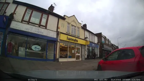
Bombay
Restaurant · Indian · 1.1 mi
55 Lodge Lane, Grays
Tu-Th,Su 17:00-22:30; Fr-Sa 17:00-23:00; Mo off
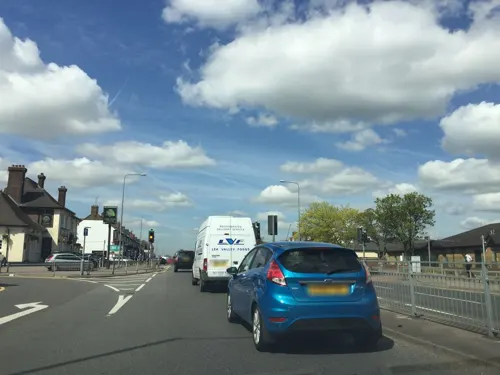
Village Indiya
Restaurant · Indian · 1.1 mi
29 Lodge Lane, Grays
Mo-Th,Su 12:00-14:00,17:30-23:00; Fr-Sa 12:00-14:00,17:30-23:30
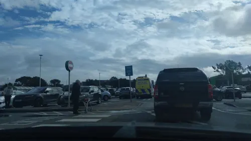
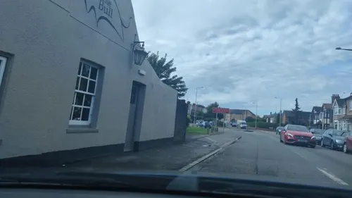

New Dehli
Restaurant · Indian
53-55 Orsett Road, Grays
Mo-Th 17:00-22:30; Fr-Sa 17:00-23:00; Su 16:00-22:00
The Bilash
Restaurant · Indian · 0.7 mi
19 Southend Road, Grays
Mo,We-Sa 17:00-22:30; Su 17:00-22:00; Tu off



53 more on the map.
History
Archaeological evidence indicates that the area now occupied by Grays has been inhabited by humans since the Palaeolithic period.
The Domesday Book of 1086 records seven estates or manors at a vill called Thurrock. Two of the Thurrock manors were in the hundred of Barstable and the other five were in the hundred of Chafford. The Domesday Book does not otherwise distinguish between the Thurrock manors by name. No church or priest is explicitly mentioned under any of the Thurrock entries. The area subsequently became three parishes: Little Thurrock, covering the two manors in Barstable hundred; Grays Thurrock, broadly covering the manor in Chafford hundred that had been owned by William Peverel at the time of the Domesday Book; and West Thurrock, covering the remainder of the Thurrock manors in Chafford hundred.
Read more of the history
The name Thurrock means the place where dirty water or bilge collects. The name was typically applied to the bottom of a ship, but in this case is thought to refer to marshy areas on the banks of the Thames. By 1190, the manor which had been owned by William Peverel in 1086 had come to be under the tenancy of a Jewish man called Isaac, son of Josce the Rabbi. In 1194, Isaac's son, another Josce, lost possession of the manor when it was seized by the crown. The following year, 1195, the crown granted the manor to Henry de Grey, who also purchased Josce's remaining interest in the manor. The manor thereafter remained in the possession of the de Grey family until the 16th century, and so the manor and its associated parish both became known as Grays Thurrock. Over time, Grays Thurrock generally became known just as Grays. Today, the Royal Mail just uses Grays as the name for the post town, and the Office for National Statistics likewise calls the built up area just Grays.
A church is known to have existed at Grays by the late 12th century. The church is dedicated to St Peter and St Paul. Fragments of late 12th century and 13th century fabric survive, notably in the tower, but most of the building was rebuilt in 1846. The Church of England ecclesiastical parish it serves is still officially called Grays Thurrock.
Samuel Pepys recorded in his diary that he visited Grays on 24 September 1665 and apparently bought fish from the local fishermen.
The London, Tilbury and Southend Railway opened its line from London as far as Tilbury in April 1854, and Grays railway station opened a few months later on 13 August 1854.
Parts of Grays and Chafford Hundred are set within three Victorian chalk pits; the largest two are the Lion Gorge and the Warren Gorge. Another area of the Chafford Hundred residential development is built on a Victorian landfill site.
In 1903 a Free Library was opened on Orsett Road, financed in part by Andrew Carnegie. It was demolished after the 2nd World War to make way for the Thameside Complex.
Thurrock Town Hall on New Road in Grays was built in the 1980s; work on an extension began in January 2020.
On 23 October 2019, the bodies of 39 people were found in the back of a lorry at Waterglade Industrial Park in Eastern Avenue. They are believed to have been victims of human trafficking, or migrants being smuggled into Britain. The vehicle, registered in Bulgaria, was thought to have travelled to the UK through Purfleet from Zeebrugge. A 25-year-old lorry driver from Northern Ireland was arrested by Essex Police on suspicion of murder and pleaded guilty to manslaughter in April 2020. Essex Police launched an investigation afterwards and the lorry was moved to the nearby Port of Tilbury. It is the biggest murder investigation in the history of Essex police. On 26 May 2020, a total of 26 further suspects, most of them Vietnamese nationals, were arrested in Belgium and France.
From the History section of Grays, Essex on Wikipedia, under CC BY-SA 4.0.
More about Grays
Geography
Grays contains the wards and residential areas of Grays Riverside, Grays Thurrock, Stifford Clays, Little Thurrock Blackshots, Little Thurrock Rectory and Chadwell St Mary. Parts of Chafford Hundred and North and South Stifford are also in Grays.
The town is approximately 20 miles (32 kilometres) east of London on the north bank of the River Thames and two miles (three kilometres) east of the M25 motorway. Its economy is linked to Port of London industries, its own offices, retail and Lakeside, West Thurrock. Its variously used riverside (from homes through wild bird-habitat marshland to importation, storage and distribution) faces Broadness Lighthouse in Kent.
Education
Quarry Hill Academy (formerly Quarry Hill Primary and Pre School)
West Thurrock Academy (formerly West Thurrock Primary School)
Quarry Hill Primary and Pre School and Thameside Primary School were formed from the amalgamations of failing infant and junior schools. Since then, both schools have received favourable grades from education watchdog Ofsted. Belmont Castle Academy was renamed in honour of Belmont Castle, a demolished gothic mansion that was located on the school site. The Gateway Primary Free School is situated on the site of Gateway Academy, and is the only primary school with free school status in Grays.
A Christian private school, The Light Christian School, opened in Grays in 2025.
Hathaway Academy (formerly the Grays School Media Arts College)
William Edwards School (formerly William Edwards School and Sports College)
From the Wikipedia article Grays, Essex, under CC BY-SA 4.0.
Notable people from Grays
 Russell BrandEnglish comedian, actor, and podcaster (born 1975)Photo: Gage Skidmore, CC BY-SA 4.0
 John WhitmoreBritish racing driver, author, management consultant (1937–2017)Photo: David Brown, CC BY-SA 4.0
 Joe PasqualeEnglish comedianPhoto: Lyndasteele, CC BY 3.0
- Mick JacksonEnglish film director (born 1943)
- Ian AbercrombieBritish actor (1934–2012)
- Phil DavisBritish actor and film director
- Michael RowlandSouth African bishop (1929–2012)
- Greg BerryEnglish footballer (born 1971)
- Michelle HarrisonBritish writer
- Archie ClementEnglish footballer (1901-1984)
- Steve CraneEnglish footballer (born 1972)
- Jack BaileyEnglish footballer, born 1901
Born in Grays, according to Wikidata (CC0). Each name links to its Wikipedia article.
Churches and places of worship29
Shopping9
Gas and EV charging4
Schools, colleges and libraries17
Healthcare11
Map of Grays
159 places. The map loads OpenStreetMap tiles when you open it.
Getting there and nearby towns
Rochester Airport (RCS) is the nearest airport with scheduled flights listed in OpenStreetMap, 12 miles away.
- Tilbury 2 mi southeast, about 3 min by car
- Swanscombe 2 mi south, about 3 min by car
- South Ockendon 3 mi northwest, about 5 min by car
- Stanford-le-Hope 6 mi northeast, about 9 min by car
- Longfield 6 mi south, about 9 min by car
- Hartley 6 mi south, about 10 min by car
- Rainham 6 mi northwest, about 10 min by car
- Upminster 6 mi northwest, about 10 min by car
- Bexley 8 mi west, about 13 min by car
- Basildon 9 mi northeast, about 14 min by car
Drive times are estimates from straight-line distance, not routes.
Towns near Grays


Keep exploring
Local news
Headlines from INDB.
Reviews, tips and questions
Loading what members have shared...
Sources and licences
- GeoNames (CC BY 4.0): population, coordinates, regions and time zone
- Mapillary (see each image): photos
- OpenStreetMap contributors (ODbL 1.0): places, airports, map data
- Wikidata (CC0 1.0): elevation, founding date, time zone, website, landmarks and historic places
- Wikimedia Commons (see each image): photos
- Wikipedia (CC BY-SA 4.0): overview and history text
Photo credits
- Civic Offices, New Road, Grays, Richard Kelly, CC BY-SA 4.0
- St Peter's and St Paul's Church, Grays, Richard Kelly, CC BY-SA 4.0
- Charlestons downstairs bar2, Peter Hammond, Public domain
- St Clements Thurrock, PJDelaney, Public domain
- St Georges Church, Agw19666, CC BY-SA 3.0
- Thurrock Civic Offices, Richard Kelly, CC BY-SA 4.0
- Thurrock Civic Offices 2022 wing, Richard Kelly, CC BY-SA 4.0
- Thurrock Civic Offices from west, Richard Kelly, CC BY-SA 4.0
- Queen Elizabeth II bridge Penny Mayes, Penny Mayes, CC BY-SA 2.0
- Street-level photo, abeorch, CC BY-SA 4.0
- Street-level photo, abeorch, CC BY-SA 4.0
- Street-level photo, abeorch, CC BY-SA 4.0
- Street-level photo, essexboy, CC BY-SA 4.0
- Street-level photo, essexboy, CC BY-SA 4.0
- Street-level photo, Semir_Mapillary, CC BY-SA 4.0
- Street-level photo, Semir_Mapillary, CC BY-SA 4.0
- Street-level photo, Semir_Mapillary, CC BY-SA 4.0
- Street-level photo, essexboy, CC BY-SA 4.0
- Street-level photo, abeorch, CC BY-SA 4.0
- Street-level photo, abeorch, CC BY-SA 4.0
- Street-level photo, essexboy, CC BY-SA 4.0
- Street-level photo, Semir_Mapillary, CC BY-SA 4.0
Page built November 10, 2026. Spotted a mistake? Tell us or suggest a place.