


Broadstone, United Kingdom
Broadstone is a town of 10,289 people in England, United Kingdom.
Why visit Broadstone
Townapedia lists 2 museums and landmarks, 19 parks and trails, 29 places to eat, 2 places to stay and 6 attractions in and around town.
Highlights include Lady Wimborne Bridge, The Lighthouse, Museum of East Dorset and Poole Museum.
Weather in Broadstone
Forecast from MET Norway (CC BY 4.0). Full forecast
About Broadstone
Broadstone is a town and civil parish and electoral ward of the Bournemouth, Christchurch and Poole district, in the ceremonial county of Dorset, England. It is located three miles (five kilometres) from Hamworthy railway station and seven miles (eleven kilometres) from Bournemouth Airport. The ward had a population of 10,289 at the 2021 census.
From the Wikipedia article Broadstone, Dorset (this version), under CC BY-SA 4.0.
Things to do6

Lady Wimborne Bridge
Bridge · 2.5 mi
Bridge in Poole, Dorset, England, UK

The Lighthouse
Cinema and theater · 2.5 mi
Arts centre (concert hall, theatre and cinema) in Poole, Dorset, UK
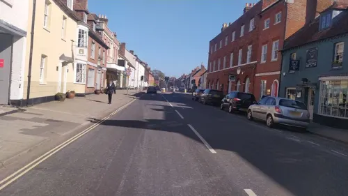
Tivoli Theatre
Cinema and theater · 3.1 mi
Theatre in Wimborne Minster, England



Museums and landmarks2
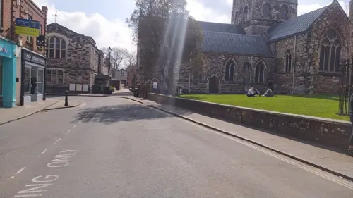

Poole Museum
Museum · 3.1 mi
Grade I listed local museum in Poole, United Kingdom
Parks, trails and playgrounds19



Pergin Way Park
Park · 1.3 mi
Small park for dog walking, also has swing set and climbing frame.


7 more on the map.
Restaurants and cafes29
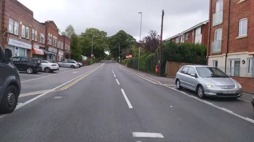
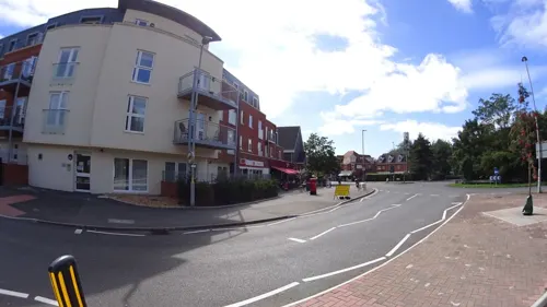
Costa
Cafe · Coffee Shop
Retail Units 2 & 3 Dunyeats Road, Broadstone
Mo-Su 08:00-17:00



Jackie's Cafe
Cafe · 0.8 mi
Technology Road, Poole
Mo-Fr 09:00-15:00; Sa 09:00-13:00; Su 10:00-13:00
Beany’s Coffee Co
Cafe · Coffee Shop · 1.3 mi
Unit 7a Neighbourhood Centre, Culliford Cres,, Poole
17 more on the map.
History
In 1840, "Broadstone Farm" was built, and a railway line bypassed it in 1847. Its first church was built in 1853, which later became the Scout Association hall. The first Broadstone railway station was built in 1872; initially named "New Poole Junction", it became "Broadstone" in 1890. Broadstone First School originated as a Dame school, founded in 1871. At the turn of the century, lavender oil started being produced. This ceased in 1935 when the factory burnt down, but much lavender can still be found in the area. Rapid expansion of the town has since occurred, with the development of the Pine Springs housing estate and the opening of additional schools to cope with the increase in population. On 1 April 2026 Broadstone became a civil parish.
From the History section of Broadstone, Dorset on Wikipedia, under CC BY-SA 4.0.
More about Broadstone
Education
Broadstone follows the three-tier education model and contains two first schools (Broadstone First and Springdale First) and a middle school (Broadstone Middle School). Corfe Hills School, an academy school, is also located in Broadstone and is one of the largest secondary schools in Dorset. Its catchment area serves Broadstone, Poole, Corfe Mullen, Wimborne, Merley as well as other areas.
From the Wikipedia article Broadstone, Dorset, under CC BY-SA 4.0.
Notable people from Broadstone
- Stuart HibberdBritish radio broadcaster (1893–1983)
Born in Broadstone, according to Wikidata (CC0). Each name links to its Wikipedia article.
Where to stay2
Churches and places of worship20
Shopping8
Gas and EV charging3
Schools, colleges and libraries19
Healthcare4
Map of Broadstone
112 places. The map loads OpenStreetMap tiles when you open it.
Getting there and nearby towns
Bournemouth Airport (BOH) is the nearest airport with scheduled flights listed in OpenStreetMap, 7 miles away.
- Wimborne Minster 2 mi north, about 3 min by car
- Poole 3 mi south, about 5 min by car
- Bournemouth 6 mi southeast, about 9 min by car
- Christchurch 9 mi east, about 15 min by car
- Verwood 10 mi northeast, about 16 min by car
- Swanage 10 mi south, about 17 min by car
- Ringwood 11 mi northeast, about 17 min by car
- New Milton 14 mi east, about 23 min by car
- Dorchester 19 mi west, about 31 min by car
- Lymington 20 mi east, about 32 min by car
Drive times are estimates from straight-line distance, not routes.
Towns near Broadstone


Keep exploring
Local news
Headlines from INDB.
Reviews, tips and questions
Loading what members have shared...
Sources and licences
- GeoNames (CC BY 4.0): population, coordinates, regions and time zone
- Mapillary (see each image): photos
- OpenStreetMap contributors (ODbL 1.0): places, airports, map data
- Wikidata (CC0 1.0): elevation, founding date, time zone, website, landmarks and historic places
- Wikimedia Commons (see each image): photos
- Wikipedia (CC BY-SA 4.0): overview and history text
Photo credits
- Former Broadstone Baptist Church, Basher Eyre, CC BY-SA 2.0
- PooleCentrePan1, LordHarris at English Wikipedia, CC BY 2.5
- Poole (2021-11-13) 113, Simon Cobb, CC0
- PooleParkLake2, LordHarris at English Wikipedia, Public domain
- St George's Church Oakdale Poole Dorset, Dave Kelly, CC BY-SA 2.0
- Lower Parkstone, St. Peter's Church, Wulfrunian1, CC BY-SA 3.0
- Poole (2021-11-13) 01, Simon Cobb, CC0
- Poole, St James, Wulfrunian1, CC BY-SA 3.0
- Lady Wimborne Bridge, Dorset, JackPeasePhotography, CC BY 2.0
- Street-level photo, noid, CC BY-SA 4.0
- Street-level photo, noid, CC BY-SA 4.0
- Street-level photo, noid, CC BY-SA 4.0
- Street-level photo, noid, CC BY-SA 4.0
- Street-level photo, southglos, CC BY-SA 4.0
- Street-level photo, noid, CC BY-SA 4.0
- Street-level photo, noid, CC BY-SA 4.0
- Street-level photo, daddymouse, CC BY-SA 4.0
- Street-level photo, noid, CC BY-SA 4.0
- Street-level photo, noid, CC BY-SA 4.0
- Street-level photo, noid, CC BY-SA 4.0
- Street-level photo, noid, CC BY-SA 4.0
- Street-level photo, noid, CC BY-SA 4.0
- Street-level photo, noid, CC BY-SA 4.0
- Street-level photo, noid, CC BY-SA 4.0
- Street-level photo, noid, CC BY-SA 4.0


Page built November 10, 2026. Spotted a mistake? Tell us or suggest a place.