


Brockley, United Kingdom
Brockley is a town of 17,156 people in England, United Kingdom.
Why visit Brockley
Townapedia lists 79 museums and landmarks, 106 parks and trails, 182 places to eat, 17 places to stay and 14 attractions in and around town.
Highlights include Brockley Jack Theatre, Broadway Theatre, The Albany and 198 Contemporary Arts and Learning.
Weather in Brockley
Forecast from MET Norway (CC BY 4.0). Full forecast
About Brockley
Brockley is a district and an electoral ward of south London, England, in the London Borough of Lewisham 5 miles (8 km) south-east of Charing Cross. In 2021 it was named the best area of London to live in. It is an area rich in Victorian and Edwardian domestic architecture, historic trees and original lanes and mews. This is protected by a conservation area and the Brockley Society.
From the Wikipedia article Brockley (this version), under CC BY-SA 4.0.
Photos of Brockley


Things to do14
Brockley Jack Theatre
Cinema and theater · 0.7 mi
Pub theatre in Crofton Park, Lewisham, London, England
Brockley Road, London

Broadway Theatre
Cinema and theater · 1.4 mi
Theatre and former cinema in Catford, Lewisham, London, England
Catford Road, London


Blue Elephant Theatre
Cinema and theater · 2.9 mi
Community theatre in Camberwell, London

O2 Academy Brixton
Cinema and theater · 3.4 mi
Music venue in London, a former cinema


Deptford Spider
Bridge · 1.2 mi
Lifting bridge, steel frame towers, over Deptford Creek, between Deptford and Greenwich. The present structure was built in 1963, to...

Piehouse Co-op
Cinema and theater · 1.2 mi
A not-for-profit, worker run, music and arts venue in Deptford
Railway Arches 213-214 Edward Street, London
2 more on the map.
Museums and landmarks79


198 Contemporary Arts and Learning
Museum · 3.0 mi
Arts gallery/organisation in London

African and Caribbean War Memorial
Monument and historic site · 3.4 mi
War memorial in London

Cherry Groce Memorial Pavilion
Monument and historic site · 3.4 mi
Memorial to Cherry Groce in Brixton, London SW9


Dulwich College War Memorial
Monument and historic site · 2.6 mi
War memorial in London

Dulwich Old College War Memorial
Monument and historic site · 2.4 mi
War memorial in London

Dulwich Picture Gallery
Museum · 2.5 mi
Art gallery in Dulwich, South London, United Kingdom

Fashion and Textile Museum
Museum · 3.1 mi
Building in the United Kingdom


Horniman Museum and Gardens
Museum · 1.9 mi
Museum in Forest Hill, London, England, United Kingdom

House of Dreams Museum
Museum · 1.9 mi
Art museum of tiles and sculpture in East Dulwich, London
67 more on the map.
Parks, trails and playgrounds106

Brookmill Park
Park · 0.8 mi
Park in London Borough of Lewisham, United Kingdom

Bermondsey Spa Gardens
Park · 2.7 mi
Park in Bermondsey, London, England

Blythe Hill Fields
Park · 0.8 mi
Park in London Borough of Lewisham, United Kingdom




Folkestone Gardens
Park · 1.4 mi
March 7, 1945, a German V2 hit this area, destroying a row of homes and killing 53 people.
94 more on the map.
Restaurants and cafes182

The Blythe Hill Tavern
Bar and pub · Local · 1.5 mi
319 Stanstead Road, London
Mo-We 11:00-23:00; Th-Sa 11:00-24:00; Su 12:00-23:00

The Ivy House
Bar and pub · 0.8 mi
London's first co-operatively owned pub
40 Stuart Road, London
Mo-Th 12:00-23:00; Fr-Sa 12:00-24:00; Su 12:00-22:30

New Cross Inn
Bar and pub · 0.8 mi
323 New Cross Road, London
Mo-Th 18:00-27:00; Fr-Sa 18:00-28:00; Su 18:00-26:00

Royal Albert
Bar and pub · 0.9 mi
460 New Cross Road, London
Mo-Th 16:00-23:00; Fr-Sa 12:00-01:00; Su 12:00-22:30

The Rose
Bar and pub · 0.8 mi
272 New Cross Road, London
Su-Tu 11:30-23:00; We-Th 11:30-24:00; Fr-Sa 11:30-25:00

The Watch House
Bar and pub · 1.1 mi
198-204 Lewisham High Street, London
Su-Th 08:00-24:00; Fr-Sa 08:00-25:00

The Five Bells
Bar and pub · 0.9 mi
155 New Cross Road, London
Mo-Th 12:00-23:00; Fr-Sa 12:00-24:00; Su 12:00-23:00
Amrutha
Restaurant · International · 1.0 mi
37-39 Honor Oak Park, London
Mo off; Tu-Th 18:00-22:00; Fr 12:30-14:30; Sa 13:00-22:00; Su 13:00-21:00
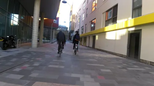

170 more on the map.
History
The name Brockley is derived from "Broca's woodland clearing", a wood where badgers are seen (broc is the Old English for badger) or Brook (Stream) by a wood (Ley). In the late 12th century, a small Premonstratensian house was founded there, before being transferred to Bayham (Sussex) in 1208.
Formerly part of the county of Kent, Brockley fell into both the Metropolitan Borough of Lewisham and the Metropolitan Borough of Deptford in the County of London from 1900. The division was roughly around Hilly Fields, with the area to the north falling within Deptford. Brockley was subsequently reunified with the creation of Greater London in 1965 under the London Borough of Lewisham, which incorporated the Metropolitan Borough of Deptford.
Brockley has its origins in a small agricultural hamlet of the same name located in the area of the "Brockley Jack" (rebuilt 1895), a large public house that today houses the Brockley Jack Theatre. Brockley Hall (demolished 1931) stood nearby and now gives its name to a road on a 1930s housing estate. Crofton Park railway station was built nearby in 1892 by the London, Chatham and Dover Railway.
Read more of the history
Brockley railway station opened on 6 March 1871 and is currently served by London Overground's Windrush line and Southern in London fare zone 2. As is often the case in London, the location of the station defines the geography of the district and areas to the north and west of Brockley Station, previously considered as Hatcham, New Cross, Telegraph Hill (SE14) and St Johns (SE8), are now considered Brockley. Ordnance Survey maps of Brockley up to the 1940s tend to centre on the location of the Jack, the Hall, and Crofton Park railway station, but recent maps are now more centred on Brockley Station and nearby areas, such as with the electoral ward map demarcating Brockley. While the name Crofton Park was invented by the railway company, it was given official sanction with the naming of Crofton Park Library, a fine arts and crafts building, in 1905, and is now the name of an electoral ward to the south.
The oldest surviving house in the area of what is now considered to be the northern extent of Brockley is the "Stone House" on Lewisham Way (opposite LeSoCo) built in 1773 by the architect George Gibson the Younger. which is a Grade II* Listed building and was historically considered to be in Deptford.
Brockley market gardens were famous for their enormous Victoria rhubarb which were fertilised by 'night soil' from London. There were orchards too and some ancient fruit trees survive in local gardens. Until the late 19th century a small river flowed northward from Crofton Park and east of Malpas Rd to join the River Thames via Deptford Creek. It is now covered over.
Industrial development arrived in 1809 in the form of the Croydon Canal running from Croydon to Bermondsey. This was later filled in and replaced by the London & Croydon railway which runs through the original canal cutting between Brockley (opened in 1871) and New Cross Gate stations. Some of the oldest houses in Brockley are the cottages and shops which form a small terrace on Coulgate Street, just east of Brockley station. These are believed to date from 1833 and were probably originally associated with the canal.
From 1872 until 1917, Brockley Lane railway station provided access to the Greenwich Park branch line and the remains of the old station entrance are still visible at Brockley Cross.
In the latter half of the nineteenth century, the Tyrwhitt-Drake family developed the north side of Brockley with grand villas, large terraces and semi-detached houses (Tyrwhitt Road and Drake Road are named after the family). Development started south of Lewisham Way in the late 1840s with the modest cottages at 2–22 Upper Brockley Rd and spread south and east towards Hilly Fields. In 1900 Chalsey Rd was the last road to be completed within the current conservation area. However, open farmland remained south of Brockley Grove and west of the railway line into the early 1930s.
Many grand houses in Brockley were occupied by the owners and managers of factories in neighbouring industrial areas such as Deptford and Bermondsey. At 63 Breakspears Road lived Edwin Watts, owner of 'ER Watts and Son', a mathematical instrument making company in Camberwell Road. Charles Booth's Map of London Poverty (1900) describes the residents of Wickham Road and Breakspears Road as "well-to-do" or "wealthy". The actress Lillie Langtry was one notable resident during this period. The terraced streets west of Brockley Rd were more mixed: "comfortable and poor". The artist/poet David Jones, whose father was a printer, grew up in Howson Road. Some of David Jones's paintings and illustrations depict his parents' house and garden. The writer Henry Williamson, the son of a bank clerk, was born in nearby Braxfield Road.
Brockley contains several fine churches: St. Mary Magdalen's RC Church on Howson Road (completed in 1901), St. Peters on Wickham Road (completed 1870), the Grade II listed St Andrews, Brockley Rd (1882) – originally a Presbyterian Church, which contains the modern stained glass New Cross Fire memorial window (2002) – and the Grade II listed St Hilda's, Crofton Park 1908. The latter was designed by J E Newberry in the Arts and Crafts movement style and still contains its original interior. A Methodist Church stood on Harefield Road (Now demolished).
After World War I, Brockley began to lose its exclusivity as the wealthy began to relocate to the outer suburbs and the big houses were increasingly sub-divided into multiple occupation. The typical inter-war houses on Upper Brockley Gardens and on Harefield Rd are clearly more modest than their Victorian neighbours and in the case of Harefield Road, were built on a large house's garden. Small industrial workshops also became established in the mews behind the large houses.
From the History section of Brockley on Wikipedia, under CC BY-SA 4.0.
Notable people from Brockley
 Kae TempestBritish poet, spoken word artist and playwrightPhoto: Selbymay, CC BY 4.0
 Peter JarmanBritish speedway rider (1935-2007)Photo: Lawson Speedway, Public domain
 Mista SilvaBritish rapperPhoto: Mistasilva333, CC BY-SA 4.0
- David LodgeEnglish writer (1935–2025)
- David Jonespainter and British modernist poet (1895-1974)
- Elsie GoldsackBritish tennis player
- John SewellEnglish footballer and manager (born 1936)
- Monty Garland-Wellscricketer (1907-1993)
- Irene BacheBritish artist (1901–1999)
- Freddie SharpeEnglish footballer (born 1937)
- John QuintonRecipient of the George Cross (1921-1951)
- Alec WorcesterBritish actor (1887-1952)
Born in Brockley, according to Wikidata (CC0). Each name links to its Wikipedia article.
Where to stay17
Churches and places of worship73
Shopping83
Gas and EV charging14
Schools, colleges and libraries47
St John's and St Clement's Church of England Primary School
School · Anglican · 1.5 mi
Adys Road, London
St Mary's Lewisham Church of England Primary School
School · Anglican · 1.1 mi
329 Lewisham High Street, London
Healthcare32
Waldron Health Centre
Clinic and pharmacy · 0.9 mi
Stanley Street, London
Map of Brockley
250 places. The map loads OpenStreetMap tiles when you open it.
Getting there and nearby towns
London City Airport (LCY) is the nearest airport with scheduled flights listed in OpenStreetMap, 5 miles away.
- Ladywell 1 mi southeast, about 1 min by car
- Blackheath 2 mi east, about 3 min by car
- Lee 2 mi east, about 3 min by car
- Kidbrooke 3 mi east, about 4 min by car
- Shadwell 3 mi north, about 5 min by car
- Crystal Palace 4 mi southwest, about 6 min by car
- Charlton 4 mi northeast, about 6 min by car
- Stepney 4 mi north, about 6 min by car
- Brixton Hill 4 mi west, about 6 min by car
- London 5 mi northwest, about 8 min by car
Drive times are estimates from straight-line distance, not routes.
Towns near Brockley


Keep exploring
Local news
Headlines from INDB.
Reviews, tips and questions
Loading what members have shared...
Sources and licences
- GeoNames (CC BY 4.0): population, coordinates, regions and time zone
- Mapillary (see each image): photos
- OpenStreetMap contributors (ODbL 1.0): places, airports, map data
- Wikidata (CC0 1.0): elevation, founding date, time zone, website, landmarks and historic places
- Wikimedia Commons (see each image): photos
- Wikipedia (CC BY-SA 4.0): overview and history text
Photo credits
- Dégustation, Brockley, SE4, Ewan-M, CC BY-SA 2.0
- Toads Mouth Too Cafe, Brockley, London (2239183665), Ewan Munro from London, UK, CC BY-SA 2.0
- Gantry, Brockley, SE4, Ewan-M, CC BY-SA 2.0
- Wetherspoon carpets- Brockley Barge, Matt From London, CC BY 2.0
- Orchard, Brockley, SE4, Ewan-M, CC BY-SA 2.0
- Gulen's Bar, Brockley, SE4, Ewan-M, CC BY-SA 2.0
- Brockley Barge, Brockley, SE4 (2663875044), Ewan Munro from London, UK, CC BY-SA 2.0
- Brockley station - 2012-12-09, Ewan-M, CC BY-SA 2.0
- 5 Coulgate Street Browns of Brockley, Brockley, SE4 - 6441777241, Ewan Munro, CC BY-SA 2.0
- 5 Coulgate Street Browns of Brockley, Brockley, SE4, Ewan Munro, CC BY-SA 2.0
- 5 Coulgate Street Dandelion Blue, Brockley, SE4, Ewan Munro, CC BY-SA 2.0
- Brockley railway station 1917548 f4d9bb9f, Ben Brooksbank, CC BY-SA 2.0
- Broadway Theatre - Catford, Steve Cadman derivative work: MrPanyGoff, CC BY-SA 2.0
- Blue Elephant Theatre, secretlondon123, CC BY-SA 2.0
- Brixton Academy, Brixton, SW9 (3380443064), Ewan Munro from London, UK, CC BY-SA 2.0
- London - London Tower Bridge - 140806 171049, Barcex, CC BY-SA 3.0
- Albany Theatre in Deptford, SilkTork, CC BY-SA 3.0
- External view of 198 Contemporary Arts and Learning, 2010, Barby Asante, CC BY-SA 4.0
- African and Caribbean Memorial, 31 July 2017 02 (cropped), Kelly Foster, CC BY-SA 4.0
- At Brixton 2026 03, Photograph by Mike Peel ( www.mikepeel.net )., CC BY-SA 4.0
- Dulwich College War Memorial, 2018, No Swan So Fine, CC BY-SA 4.0
- The Dulwich Estate - DSC05986, Rept0n1x, CC BY-SA 3.0
- Fashion and Textile Museum, Bermondsey, SE1 (3612012652), Ewan Munro from London, UK, CC BY-SA 2.0
- Flat Time House facade, Ken Adlard, CC BY-SA 4.0
- Horniman Museum tower, 2015, No Swan So Fine, CC BY-SA 4.0
- House of Dreams, 42 Melbourne Grove, East Dulwich, 2018 (2), No Swan So Fine, CC BY-SA 4.0
- Spa Gardens, London Borough of Southwark, SE1 (2817806403), Ewan Munro from London, UK, CC BY-SA 2.0
- BrockwellParkHut, Richard Irons, CC BY-SA 3.0
- Burgess Park, London Borough of Southwark, SE5 SE15 (3038879613), Ewan Munro from London, UK, CC BY-SA 2.0
- Centre for Wildlife Gardening, JoshuaAnthonyGill, CC BY-SA 4.0
- LewishamShopping, The original uploader was Secretlondon at English Wikipedia ., CC BY-SA 3.0
- St Paul Deptford4, stevecadman, CC BY-SA 2.0
- St Dunstan's College, 2008, Steve Cadman from London, U.K., CC BY-SA 2.0
- Waldron Health Centre (9175959157), Reading Tom from Reading, UK, CC BY 2.0
- University Hospital Lewisham Riverside02, Gilo1969, CC BY-SA 3.0
- New Cross Gate Cutting 4, Dudley Miles, CC BY-SA 4.0
- Ivy House, Nunhead, SE15 (5478867910), Ewan Munro from London, UK, CC BY-SA 2.0
- Royal Albert, New Cross, SE14 (2538821107), Ewan Munro from London, UK, CC BY-SA 2.0
- St Swithun's Church, Hither Green (01), Ethan Doyle White, CC BY-SA 4.0
- Church of St Stephen, Lewisham, Ethan Doyle White, CC BY-SA 4.0
- St John's and St Clement's, East Dulwich, 2018, No Swan So Fine, CC BY-SA 4.0
- The Chapel at Camberwell New Cemetery, Ethan Doyle White, CC BY-SA 4.0
- Church of St Augustine, One Tree Hill, Honor Oak, SilverMilkshake, CC BY-SA 4.0
- Rye Lane Chapel (8668906416), Reading Tom from Reading, UK, CC BY 2.0
- The Five Bells Public House, Jwslubbock, CC BY-SA 4.0
- 71-75, Greenwich South Street, Hjamesberglen, CC0
- Deptford Borough War Memorial (9175974877), Reading Tom from Reading, UK, CC BY 2.0
- PeckhamPlex cinema, Rhagfyr, CC0
- Watch House, Lewisham, SE13 (2663057161), Ewan Munro from London, UK, CC BY-SA 2.0
- Blythe Hill Tavern, Forest Hill, SE23 (3756867279), Ewan Munro from London, UK, CC BY-SA 2.0
- Creekside lift bridge (5671685561), John Lord from Edinburgh, Scotland, CC BY 2.0
- Rose, New Cross, SE14, Ewan Munro, CC BY-SA 2.0
- The New Cross Inn, New Cross (01), Ethan Doyle White, CC BY-SA 4.0
- Brookmill Road LNR 1, Dudley Miles, CC BY-SA 3.0
- Dulwich Picture Gallery, June 2018 (3), No Swan So Fine, CC BY-SA 4.0
- Brookmill Park, London Borough of Lewisham, SE8, Ewan-M, CC BY-SA 2.0
- London skyline from Blythe Hill fields, Amakuru, CC BY-SA 4.0
- Camberwell Green Park - panoramio, jeffwarder, CC BY-SA 3.0
- Street-level photo, athuler, CC BY-SA 4.0
- Street-level photo, lefty74, CC BY-SA 4.0
- Street-level photo, rskedgell, CC BY-SA 4.0
- Street-level photo, erias, CC BY-SA 4.0
- Street-level photo, rskedgell, CC BY-SA 4.0
- Street-level photo, ris, CC BY-SA 4.0
- Street-level photo, wpoi, CC BY-SA 4.0
- Street-level photo, ris, CC BY-SA 4.0
- Street-level photo, jjhaslanded, CC BY-SA 4.0
- Street-level photo, ris, CC BY-SA 4.0
- Street-level photo, agatefilm, CC BY-SA 4.0
- Street-level photo, jjhaslanded, CC BY-SA 4.0
- Street-level photo, wmorland, CC BY-SA 4.0
- Street-level photo, asturksever, CC BY-SA 4.0
- Street-level photo, wasd42, CC BY-SA 4.0
- Street-level photo, erias, CC BY-SA 4.0
- Street-level photo, wasd42, CC BY-SA 4.0
- Street-level photo, wasd42, CC BY-SA 4.0
- Street-level photo, wpoi, CC BY-SA 4.0
- Street-level photo, matth81, CC BY-SA 4.0
- Street-level photo, paulbiv, CC BY-SA 4.0
- Street-level photo, wasd42, CC BY-SA 4.0
- Street-level photo, wasd42, CC BY-SA 4.0
- Street-level photo, kieran, CC BY-SA 4.0
- Street-level photo, tomchance, CC BY-SA 4.0
- Street-level photo, paulbiv, CC BY-SA 4.0
- Street-level photo, rskedgell, CC BY-SA 4.0
- Street-level photo, athuler, CC BY-SA 4.0
- Street-level photo, athuler, CC BY-SA 4.0
- Street-level photo, wibbit, CC BY-SA 4.0
- Street-level photo, ris, CC BY-SA 4.0


Page built November 10, 2026. Spotted a mistake? Tell us or suggest a place.