


Why visit Lee
Townapedia lists 56 museums and landmarks, 72 parks and trails, 285 places to eat, 4 places to stay and 9 attractions in and around town.
Highlights include Broadway Theatre, Bob Hope Theatre, Royal Observatory Greenwich and Ranger's House.
Weather in Lee
Forecast from MET Norway (CC BY 4.0). Full forecast
About Lee
Lee, also known as Lee Green, is an area of South East London, England, straddling the border of the London Borough of Lewisham and the Royal Borough of Greenwich. It is located northwest of Eltham and southeast of Lewisham. It was in Kent before becoming part of the County of London in 1889, and then Greater London in 1965.
From the Wikipedia article Lee, London (this version), under CC BY-SA 4.0.
Photos of Lee


Things to do9

Broadway Theatre
Cinema and theater · 1.3 mi
Theatre and former cinema in Catford, Lewisham, London, England
Catford Road, London

Bob Hope Theatre
Cinema and theater · 1.9 mi
Community theatre in Eltham, Royal Borough of Greenwich, London, England

Bromley Little Theatre
Cinema and theater · 3.3 mi
Community theatre in London Borough of Bromley, England

Greenwich Theatre
Cinema and theater · 1.8 mi
Theatre in Greenwich, London, England

The Albany
Cinema and theater · 2.1 mi
Theatre and arts centre in Deptford, London, England


Brockley Jack Theatre
Cinema and theater · 1.9 mi
Pub theatre in Crofton Park, Lewisham, London, England
Greenwich Playhouse
Cinema and theater · 1.8 mi
Former pub theatre in Greenwich, London, England
Museums and landmarks56

Royal Observatory Greenwich
Museum · 1.5 mi
Blackheath Avenue, London
Mo-Su 10:00-18:00; Dec 24-26 off

Ranger's House
Monument and historic site · 1.3 mi
May 23-Sep 20 Sa-Su 11:00-16:00;May 25,Aug 31 11:00-16:00;Aug 15 off


Baltic Exchange Memorial Glass
Monument and historic site · 1.8 mi
Stained glass war memorial windows


Horniman Museum and Gardens
Museum · 3.0 mi
Museum in Forest Hill, London, England, United Kingdom


Livesey Hall War Memorial
Monument and historic site · 2.5 mi
War memorial in Sydenham, London


National Maritime Museum
Museum · 1.8 mi
Museum in London, England, United Kingdom

Goldsmiths CCA
Museum · 2.3 mi
Art gallery located at the University of London

Memorial to Peter the Great
Monument and historic site · 2.2 mi
Memorial in London by the sculptor Mihail Chemiakin
44 more on the map.
Parks, trails and playgrounds72


Brookmill Park
Park · 1.5 mi
Park in London Borough of Lewisham, United Kingdom

Brookmill Road Local Nature Reserve
Hiking and trails · 1.4 mi
Nature reserve in Lewisham, London, England

Manor House Gardens
Park
Public park and gardens situated in Lee, in south east London


Blythe Hill Fields
Park · 1.7 mi
Park in London Borough of Lewisham, United Kingdom



Beckenham Place Park
Park · 3.0 mi
Park in London Borough of Lewisham, England, UK
Charlton Park, Greenwich
Park · 2.4 mi
Park in Royal Borough of Greenwich, United Kingdom
60 more on the map.
Restaurants and cafes285
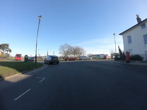
The Hare and Billet
Bar and pub · 0.9 mi
1a Eliot Cottages, London
Mo-Th 12:00-23:00; Fr 12:00-24:00; Sa 11:00-24:00; Su 11:00-22:30

The Watch House
Bar and pub · 0.8 mi
198-204 Lewisham High Street, London
Su-Th 08:00-24:00; Fr-Sa 08:00-25:00

The Pavilion Café
Cafe · Pizza, Tea, Cake, Sandwich, Coffee Shop, Ice Cream, Burger · 1.5 mi
Mo-Su 08:00-16:00
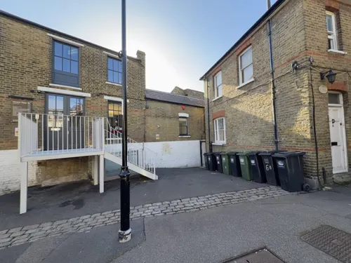
Zero Degrees
Restaurant · Pizza · 0.8 mi
Microbrewery, bar and restaurant
29-33 Montpelier Vale, London
Su-Th 12:00-24:00; Fr-Sa 12:00-25:00
Catford Bridge Tavern
Bar and pub · Burger · 1.5 mi
Station Approach, London
Mo-Th 12:00-23:00; Fr 12:00-24:00; Sa 00:00-01:00,12:00-24:00; Su...
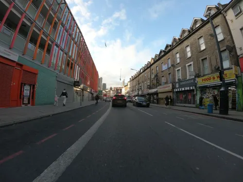
Cow Cow BBQ
Restaurant · Barbecue, Korean · 0.7 mi
47-49 Lee High Road, London
Mo-Tu, Th-Sa 13:00-22:00; Su 13:00-22:30
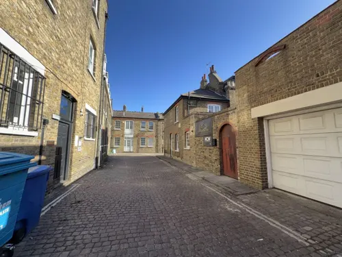


Cafe East Pho
Restaurant · Vietnamese · 0.8 mi
3,5 Montpelier Vale, London
Mo,We-Fr 11:00-15:00,17:00-22:00; Sa 11:00-16:00,17:00-22:00; Su...
Cha-Louis
Restaurant · Thai · 0.7 mi
1 Blackheath Grove, London
Tu-Th 12:00-14:30,17:00-21:30; Fr-Sa 12:00-14:30,17:00-22:00; Su...
Everest Inn
Restaurant · Indian, Nepalese · 0.8 mi
41 Montpelier Vale, London
Tu-Th 16:00-22:30; Fr 16:00-23:00; Sa 13:00-23:00; Su 13:00-22:00
273 more on the map.
History
The Manor of Lee was a historic parish of the Blackheath hundred and existed up to 1900 when it along with the parish of Lewisham became part of the Metropolitan Borough of Lewisham. While modern Lee is centred on Lee railway station and the road of Burnt Ash Hill, the parish was based around Lee High Road which today stretches into the town centre of Lewisham. The River Quaggy formed much of the boundary between the two parishes, though at Lee Bridge (at the western end of Lee High Road) it is now almost completely hidden.
The Lee Manor Society have produced a comprehensive history of the area. The Domesday Book of 1086 describes Lee as a small area of cultivation set in extensive woodland. The earliest map available (Rocque's Country Near Ten Miles Round map of 1746) shows a cluster of about a dozen houses around a triangular village green. This hamlet was then largely surrounded by fields, with the Wricklemarsh estate of Sir Gregory Page to the north, and a manor house (Lee Place) to the north-west, with St Margaret's Church just beyond. Lee Green Farm occupied the south-east quadrant from the 1660s (roughly on the site of the present Leegate shopping centre). The farm was demolished in the 1840s and rebuilt as Tudor House further east.
Read more of the history
The Old Tiger's Head and the New Tiger's Head pubs are important and striking features of the crossroads. Confusingly, the original (Old) Tiger's Head is thought to have been built on the site currently occupied by the New Tiger's Head. The original pub is thought to have been built before 1730. It was rebuilt on its present site, the north-west quadrant, in 1750–1770 and then rebuilt (in its third incarnation) in 1896 – the date carried on its frontage. It became an important mail and coaching inn. The New Tiger's Head started life as a beer shop known as the Tiger Tavern in the 1830s. It was situated in the end of four cottages known as Prospect Terrace, built around the same time. Three of these cottages remain, housing a post office/newsagent and a hairdresser. In 1868 it is referred to as the Tiger's Head Inn. The present building is thought to have replaced the original cottage a few years after 1896 – the date of the rebuilding of the Old Tiger's Head. The New Tiger's Head has now closed down.
In 1815 cavalry and foot regiments passed through Lee Green on their way to the Battle of Waterloo:
"The space in front of the Tiger's Head and the Green were very commodious for the transfer of baggage to the waggons of the farmers from the other side of London to those of the farmers in this neighbourhood which were pressed for that purpose, to convey them 15 miles further on the journey to Dover."
Lee is where, in 1837, Robert Cocking died in the first parachute accident.
In the early nineteenth century boxing matches took place at the Old Tiger's Head. Horse racing and (human) foot racing took place in the 1840s but the police put a stop to these events, probably under pressure from local citizens. At that time the green was the centre of village life with cricket matches, bare knuckle boxing and other entertainments. In the 1850s further housebuilding prompted the installation of proper sewers and the Lee Green horse pond was filled in. In the 1860s John Pound, a developer, erected houses in the south-east quadrant, Orchard Terrace on Eltham Road and Crown Terrace on Burnt Ash Lane (now Road).
The opening of Lee station in 1866 prompted more housebuilding at the crossroads. The site of Lee Green Farm was built on as Carston Mews. In the same year Charles Henry Reed, a linen draper, moves into 1 Orchard Terrace and established a department store. Reed died in 1895 and in 1903 the business was taken over by Griffith & Co.
In the south-west quadrant the Prince Arthur pub was built at 422 Lee High Road in 1870 (closed 2005). It was originally one of a row of early nineteenth-century cottages of which three – nos 424–428 – survived behind modern shop fronts. In 1898 No 345 Lee High Road was built in front of the former Old Tiger's Head stables. It incorporated a fire station but the London County Council built a replacement in 1906 in Eltham Road. It is still in use. A police station was built at 418 Lee High Road in 1904, replacing one built before 1860. It was converted to apartments in 2003.
On 1 April 1904 the civil parish was abolished and merged with Lewisham. At the 1901 census (the last before the abolition of the parish), Lee had a population of 18,649. In the early 1960s the south-east quadrant, including Carston Mews, was demolished to make way for Leegate shopping centre. This declined following the opening of Sainsbury's on the opposite side of Burnt Ash Road in the late 1980s. Owners of the centre, St. Modwen Properties have recently proposed a £40m regeneration plan for the centre, including the demolition of the current shopping precinct to be replaced with an Asda supermarket as well as the conversion of the existing office block into a hotel.
From the History section of Lee, London on Wikipedia, under CC BY-SA 4.0.
Notable people from Lee
 Ernest DowsonEnglish writer (1867-1900)Photo: Unknown author Unknown author, Public domain
 Estelle WinwoodBritish actress (1883–1984)Photo: Shadowland; Campbell Studio, photographer, Public domain
 Reggie SchwarzEnglish-South African cricketer and rugby union footballer (1875-1918)Photo: George Beldam, Public domain
 Rosamund Edith Nesbit BlandauthorPhoto: Evelyn Stuart Hardy, Public domain
 Alex RoweEnglish rugby league footballerPhoto: Fleets, CC BY-SA 4.0
- Muriel PavlowBritish actress (1921-2019)
- Nick Yatesbadminton player
- U. A. FanthorpeEnglish poet (1929–2009)
- Dick PennEnglish cricketer (1855-1889)
- John GriffithsEnglish cricketer for Gloucestershire (1931-1982)
- Edmund Whitecricketer (1928-2004)
- Aramide OtehEnglish association football player (born 1998)
Born in Lee, according to Wikidata (CC0). Each name links to its Wikipedia article.
Where to stay4
Churches and places of worship73
Shopping47
Gas and EV charging17
Schools, colleges and libraries61
All Saints' Church of England Primary School Blackheath
School · Anglican · 1.0 mi
2 Blackheath Vale, London
St Mary's Lewisham Church of England Primary School
School · Anglican · 0.9 mi
329 Lewisham High Street, London
Healthcare31
Map of Lee
250 places. The map loads OpenStreetMap tiles when you open it.
Getting there and nearby towns
London City Airport (LCY) is the nearest airport with scheduled flights listed in OpenStreetMap, 4 miles away.
- Blackheath 1 mi north, about 1 min by car
- Kidbrooke 1 mi northeast, about 2 min by car
- Charlton 3 mi northeast, about 4 min by car
- Chislehurst 4 mi southeast, about 6 min by car
- Plumstead 4 mi northeast, about 6 min by car
- Bickley 4 mi southeast, about 7 min by car
- Crystal Palace 4 mi southwest, about 7 min by car
- Shadwell 5 mi northwest, about 8 min by car
- Stepney 5 mi northwest, about 8 min by car
- Sidcup 5 mi southeast, about 8 min by car
Drive times are estimates from straight-line distance, not routes.
Towns near Lee


Keep exploring
Local news
Headlines from INDB.
Reviews, tips and questions
Loading what members have shared...
Sources and licences
- GeoNames (CC BY 4.0): population, coordinates, regions and time zone
- Mapillary (see each image): photos
- OpenStreetMap contributors (ODbL 1.0): places, airports, map data
- Wikidata (CC0 1.0): elevation, founding date, time zone, website, landmarks and historic places
- Wikimedia Commons (see each image): photos
- Wikipedia (CC BY-SA 4.0): overview and history text
Photo credits
- St Margaret's Church, Lee, QuintusPetillius, CC BY-SA 4.0
- Broadway Theatre - Catford, Steve Cadman derivative work: MrPanyGoff, CC BY-SA 2.0
- Eltham highstreet 3, PeterEltham, CC BY-SA 3.0
- Greenwichtheatre, Burnley, CC BY-SA 3.0
- Albany Theatre in Deptford, SilkTork, CC BY-SA 3.0
- Stained glass window from Baltic Exchange, Heidi De Vries, CC BY 2.0
- The Fan Museum (3400819225), Visit Greenwich from Greenwich, United Kingdom, CC BY 2.0
- Horniman Museum tower, 2015, No Swan So Fine, CC BY-SA 4.0
- Livesey War Memorial, Bell Green, David Anstiss, CC BY-SA 2.0
- EH1211481 National Maritime Museum 10 (cropped), Katie Chan, CC BY-SA 3.0
- Manor House Gardens, Hohlroller ( talk ), Public domain
- Birdbrook Road Nature Reserve 4, Dudley Miles, CC BY-SA 4.0
- Burnt Ash Pond, Dudley Miles, CC BY-SA 3.0
- All Saints Peckham, Swanseaeu1 at English Wikipedia, CC BY-SA 3.0
- GreenwichParcRoyal, Photograher and original uploader was Sebjarod at fr.wikipedia, Public domain
- LewishamShopping, The original uploader was Secretlondon at English Wikipedia ., CC BY-SA 3.0
- EH1218679 The Ranger's House, Katie Chan, CC BY-SA 3.0
- University Hospital Lewisham Riverside02, Gilo1969, CC BY-SA 3.0
- St John's Church Blackheath, Mdhsmith, CC BY-SA 3.0
- View over the Greenwich Park Barrow Cemetery, Ethan Doyle White, CC BY-SA 4.0
- The Clarendon Hotel (9175930801), Reading Tom from Reading, UK, CC BY 2.0
- AllSaints Blackheath, Taken by Mark Duwe, Vbloke at English Wikipedia, Public domain
- St Swithun's Church, Hither Green (01), Ethan Doyle White, CC BY-SA 4.0
- Church of St Stephen, Lewisham, Ethan Doyle White, CC BY-SA 4.0
- Lewisham War Memorial (9178133262), Reading Tom from Reading, UK, CC BY 2.0
- Blackheath Quaker Meeting House, south aspect (rotated), EEye, CC BY-SA 4.0
- Watch House, Lewisham, SE13 (2663057161), Ewan Munro from London, UK, CC BY-SA 2.0
- The Bookshop on the Heath (cropped), Reading Tom from Reading, UK, CC BY 2.0
- Pavilion Tea Rooms (4520968305), Garry Knight from London, England, CC BY 2.0
- Ignatius Sancho Cafe (long shot), Greenwich Park, Harry Bond, CC BY 4.0
- Lewisham Shopping Centre 1, Mx. Granger, CC0
- St Matthew Academy 1, Mx. Granger, CC0
- West Face of the Church of St Margaret, Lee (II), Ethan Doyle White, CC BY-SA 4.0
- Brookmill Road LNR 1, Dudley Miles, CC BY-SA 3.0
- Brimmington Gardens, London Borough of Southwark, SE15 (2476992512), Ewan Munro from London, UK, CC BY-SA 2.0
- Close-up of the inscription (OpenBenches 9372), Anonymous Unknown author, CC BY-SA 4.0
- Close-up of the inscription (OpenBenches 9370), Anonymous Unknown author, CC BY-SA 4.0
- Bromley Blues Club at the Bromley Little Theatre, Back ache, CC BY-SA 4.0
- EH1289615 Point House, Katie Chan, CC BY-SA 3.0
- Royal Observatory Greenwich - Altazimuth Pavilion (8142814614), Elliott Brown from Birmingham, United Kingdom, CC BY 2.0
- Entrance to the Migration Museum in Lewisham, London, Hanyu001, CC BY 4.0
- Brookmill Park, London Borough of Lewisham, SE8, Ewan-M, CC BY-SA 2.0
- Sutcliffe Park 1, Dudley Miles, CC BY-SA 3.0
- London skyline from Blythe Hill fields, Amakuru, CC BY-SA 4.0
- Street-level photo, wasd42, CC BY-SA 4.0
- Street-level photo, wasd42, CC BY-SA 4.0
- Street-level photo, wibbit, CC BY-SA 4.0
- Street-level photo, wasd42, CC BY-SA 4.0
- Street-level photo, wasd42, CC BY-SA 4.0
- Street-level photo, jjhaslanded, CC BY-SA 4.0
- Street-level photo, wasd42, CC BY-SA 4.0
- Street-level photo, wasd42, CC BY-SA 4.0
- Street-level photo, wasd42, CC BY-SA 4.0
- Street-level photo, jjhaslanded, CC BY-SA 4.0
- Street-level photo, wasd42, CC BY-SA 4.0
- Street-level photo, firefishy, CC BY-SA 4.0
- Street-level photo, wibbit, CC BY-SA 4.0
- Street-level photo, jjhaslanded, CC BY-SA 4.0
- Street-level photo, jjhaslanded, CC BY-SA 4.0
- Street-level photo, wibbit, CC BY-SA 4.0
- Street-level photo, wmorland, CC BY-SA 4.0
- Street-level photo, athuler, CC BY-SA 4.0
- Street-level photo, vlivyur, CC BY-SA 4.0
- Street-level photo, wasd42, CC BY-SA 4.0
- Street-level photo, wasd42, CC BY-SA 4.0
- Street-level photo, wasd42, CC BY-SA 4.0
- Street-level photo, wasd42, CC BY-SA 4.0
- Street-level photo, wasd42, CC BY-SA 4.0
- Street-level photo, erias, CC BY-SA 4.0
- Street-level photo, wasd42, CC BY-SA 4.0
- Street-level photo, wmorland, CC BY-SA 4.0
- Street-level photo, wasd42, CC BY-SA 4.0
- Street-level photo, wasd42, CC BY-SA 4.0
- Street-level photo, wasd42, CC BY-SA 4.0
- Street-level photo, wasd42, CC BY-SA 4.0


Page built November 10, 2026. Spotted a mistake? Tell us or suggest a place.