


Charlton, United Kingdom
Charlton is a town of 14,385 people in England, United Kingdom.
Why visit Charlton
Townapedia lists 59 museums and landmarks, 69 parks and trails, 223 places to eat, 7 places to stay and 14 attractions in and around town.
Highlights include Odeon IMAX, Tramshed Theatre, Brick Lane Music Hall and Building 20.
Weather in Charlton
Forecast from MET Norway (CC BY 4.0). Full forecast
About Charlton
Charlton is an area of southeast London, England, in the Royal Borough of Greenwich. It is east of Greenwich and west of Woolwich, on the south bank of the River Thames, 7.2 miles (11.6 km) southeast of Charing Cross. An ancient parish in the county of Kent, it became part of the metropolitan area of London in 1855 and is home to Charlton Athletic and Charlton House.
From the Wikipedia article Charlton, London (this version), under CC BY-SA 4.0.
Things to do14


Cody Dock Rolling Bridge
Bridge · 3.0 mi
Unpowered rolling bridge in Cody Dock, Canning Town, London

Greenwich Theatre
Cinema and theater · 2.1 mi
Theatre in Greenwich, London, England

Leamouth Lifting Footbridge
Bridge · 2.5 mi
Pedestrian bridge over Bow Creek


The Albany
Cinema and theater · 3.0 mi
Theatre and arts centre in Deptford, London, England

Biota!
Monument and historic site · 1.3 mi
Proposed aquarium in Docklands, London

Greenwich Playhouse
Cinema and theater · 2.4 mi
Former pub theatre in Greenwich, London, England

Thames Gateway Bridge
Bridge · 2.6 mi
Proposed new crossing of the River Thames, in east London, England
2 more on the map.
Museums and landmarks59


Northern Entrance to Woolwich Foot Tunnel
Monument and historic site · 1.3 mi
Pier Road, London


Baltic Exchange Memorial Glass
Monument and historic site · 2.0 mi
Stained glass war memorial windows


London Museum Docklands
Museum · 3.2 mi
Museum in the London Borough of Tower Hamlets

Memorial to Peter the Great
Monument and historic site · 2.6 mi
Memorial in London by the sculptor Mihail Chemiakin
47 more on the map.
Parks, trails and playgrounds69

Thames Barrier Park
Park · 1.1 mi
Architects: Allain Provost (Groupe Signes) and Patel Taylor
Jan 07:00-16:45; Feb 07:00-17:30; Mar 07:00-18:30; Apr...


Maryon Park
Park
Park located in Charlton in the Royal Borough of Greenwich


Bartlett Park
Park · 3.4 mi
Park in the London Borough of Tower Hamlets


Bow Creek Ecology Park
Park · 2.5 mi
Park in the London Borough of Newham

Brookmill Park
Park · 2.8 mi
Park in London Borough of Lewisham, United Kingdom

East Greenwich Pleasaunce
Park · 1.1 mi
Park in the United Kingdom
Jan-Feb 08:00-16:00, Mar-Apr 08:00-18:00, May 08:00-20:00, Jun-Aug...

57 more on the map.
Restaurants and cafes223

The Royal Standard
Bar and pub · 1.1 mi
44 Vanbrugh Park, London
Mo-Th 12:00-23:00; Fr-Sa 12:00-24:00; Su 12:00-22:30

The Vanbrugh
Bar and pub · 1.4 mi
91 Colomb Street, London
Mo-Tu 15:00-23:00; We-Fr 12:00-23:00; Sa 11:00-24:00; Su 11:00-21:00
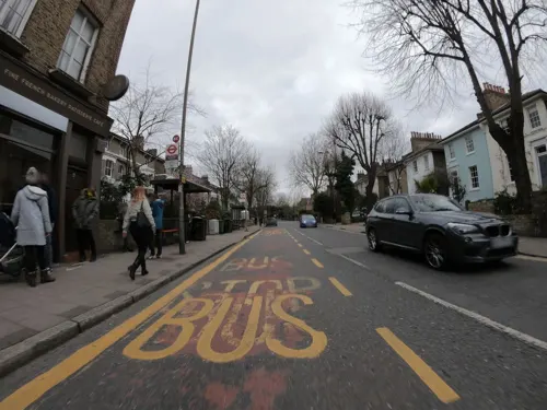
Boulangerie Jade
Cafe · French, Coffee Shop, Cake · 1.1 mi
48 Vanbrugh Park, London
Mo-Sa 08:00-17:00; Su 08:00-16:00
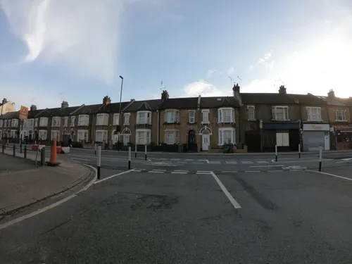
Castellano's Pizza
Restaurant · Pizza · 1.1 mi
139 Woolwich Road, London
Mo 16:00-22:00; Tu-Sa 12:00-23:00; Su 12:00-22:00
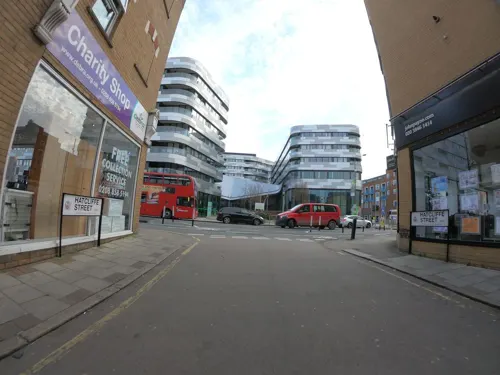
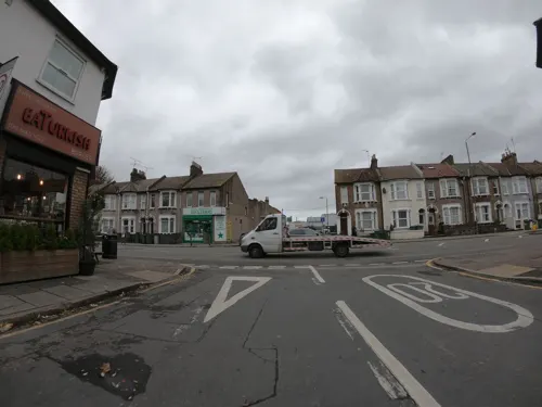
EaTurkish
Restaurant · Kebab · 0.9 mi
172 Woolwich Road, London
Mo-Th 12:00-22:30; Fr 14:00-23:00; Sa 12:00-23:00; Su 13:00-22:30

Kaabo Lounge
Restaurant · Grill, Restaurant&bar, African, Nigerian Cuisines, Lounge, Takeaway · 1.1 mi
25 Calderwood Street, London
Mo-Su 11:00-23:30
Pizzaza Pizza
Restaurant · Pizza · 1.2 mi
1 Albert Road, London
Mo-Th 12:00-23:00; Fr 15:00-23:00; Sa, Su 13:00-23:00

Gurkha's Inn
Restaurant · Nepalese, Indian · 1.4 mi
17 Colomb Street, London
Su-Th 17:00-22:30; Fr-Sa 17:00-23:00
211 more on the map.
History
Charlton is recorded in the 1086 Domesday Book as Cerletone. It is formed from Old English 'ceorl' and 'tūn' and means 'farmstead of the freemen or peasants'. It is a common English placename and the parish was also known as Charlton next Woolwich to distinguish it from Charlton by Dover. During the 19th century the riverside portion of the area became known as New Charlton.
Charlton is assessed in the Domesday Book of 1086 at one "sulung", which is commonly held to have been the equivalent of two hides. In 1086 it was in the fee of Gundulf, bishop of Rochester, but in 1066 it had been held from the king as two estates, by two brothers, named Godwine and Alweard. Though assessed at only one sulung, it had a slightly higher value than might be expected, at £7, both in 1066 and in 1086. A church dedicated to St Luke is recorded in the village as early as 1077, although no trace of the medieval building survives.
In 1093, the manor of Charlton was given to Bermondsey Abbey by Bishop Robert Bloet of Lincoln. In 1268, the Abbey was granted a Monday market at Charlton, as well as an annual fair of three days, centred on Trinity Sunday, the eighth Sunday after Easter.
Read more of the history
Between 1607 and 1612, Sir Adam Newton, tutor to Prince Henry, eldest son of James I, had a new manor house, Charlton House, built in the village. The Jacobean mansion by architect John Thorpe was never used by the prince, who died in 1612. On the northern edge of the house's garden is a mulberry tree planted in 1608 by order of King James in an effort to cultivate silkworms. On the death of Sir Adam, his executors Peter Newton and David Cunningham of Auchenharvie were charged to rebuild St Luke's Church.
The manor was subsequently acquired by the colonial administrator Sir William Langhorne, 1st Baronet, who is buried in the parish church. Upon his death without issue in 1715, his possessions in Charlton and Hampstead passed to the Conyers baronets, and subsequently to the Maryon-Wilson baronets.
In the early 18th century, Charlton was described by Daniel Defoe as:
a village famous, or rather infamous for the yearly collected rabble of mad-people, at Horn-Fair; the rudeness of which I cannot but think, is such as ought to be suppressed, and indeed in a civiliz'd well govern'd nation, it may well be said to be unsufferable. The mob indeed at that time take all kinds of liberties, and the women are especially impudent for that day; as if it was a day that justify'd the giving themselves a loose to all manner of indecency and immodesty, without any reproach, or without suffering the censure which such behaviour would deserve at another time. (from A Tour through Great Britain)
The Horn Fair (or Charlton Fair) was held regularly on 18 October each year, and retained its reputation for lawlessness; in 1833, for example, police arrested a swindler who had cheated several artillerymen. In 1857, following the abolition of nearby Greenwich Fair, Charlton Fair was described in the Morning Chronicle as "more like a carnival of the very worst and most vulgar class than any fair in the country." The Horn Fair was abolished, along with the livestock fairs of nearby Blackheath, by order of Henry Austin Bruce, the reforming Home Secretary, in 1872.
In the early nineteenth century, Spencer Perceval, the only British Prime Minister to be assassinated, was buried at St Luke's church; Perceval's wife having been a member of the Maryon-Wilson family. In 1843, Charlton was the site of the death and burial of murdered civil servant Edward Drummond, whose assassination led to the establishment of the M'Naghten Rules for legal insanity.
The flat land adjoining the Thames at Charlton Riverside has been a significant industrial area since Victorian times. The establishment of heavy industry centred on Charlton Pier, and led to a number of serious fires in the area in the mid 19th century. A notable establishment was the Siemens Brothers Telegraph Works (although largely in the parish of Woolwich) opened in 1863, which manufactured two new transatlantic cables in the 1880s, and contributed to PLUTO in World War 2. It was in this industrialised area that Charlton Athletic F.C. was established in 1905, before moving a short distance to The Valley in 1919.
From 1903 to 1913, the Italian writer Italo Svevo lived in a house on Charlton Church Lane which now bears a blue plaque in his honour. He had arrived there in his capacity as a director in a Trieste firm selling high-quality underwater paint for ships, on whose behalf he established a factory in Charlton's Anchor and Hope Lane, fulfilling a big contract with the British Royal Navy.
The non-ferrous foundry of J. Stone & Co moved to Charlton from Deptford in 1917, and produced 22,000 propellers for the Royal Navy during World War II (its products being fitted to battleships, aircraft carriers, cruisers and numerous smaller vessels), plus propellers and water-tight doors for RMS Queen Mary, RMS Queen Elizabeth and Royal Yacht Britannia. In 1963 Stone's marine propeller business merged with Manganese Bronze (also originally founded in Deptford, in 1882, before relocating to Millwall and then Birkenhead in 1941) and manufacture moved to Birkenhead. Stone Foundries still operates at Charlton, in a plant established in 1939 to produce aluminium and magnesium light alloy castings mainly for the aircraft industry, and production of nails and rivets continues at nearby Stone Fasteners.
The estates surrounding Charlton House were gradually broken up, and once the Maryon-Wilson family died out in 1925, the surviving open spaces were converted into public parks, two of which bear the family name. The house itself became the property of the local authority (currently the Royal Borough of Greenwich) and is used as a library and community centre. Maryon Park was used as the filming location for the pivotal murder scene in Michelangelo Antonioni's film Blow-Up (1966).
From the History section of Charlton, London on Wikipedia, under CC BY-SA 4.0.
More about Charlton
Geography
The centre of Charlton, known as Charlton Village, lies on the edge of high ground about 7 miles east-south-east of central London, on the B210. West of the village the main road is called Charlton Road, and to the east, Charlton Park Road; the road itself is called 'The Village' in the village centre. A preserved model K2 red telephone box stands on Charlton Road. A minor road called Charlton Church Lane leads north down the hill from St Luke's Church to the station and the A206. Beyond the railway line lies the more heavily industrial riverside area referred to as New Charlton or Charlton Riverside.
Charlton is also home to several parks of varying features, namely Maryon Park, Maryon Wilson Park, Hornfair Park, named in reference to the old Horn Fair, and Charlton Park, which is largely made up of sports pitches or playing fields. Adjoining Maryon Park is the Gilbert's Pit Site of Special Scientific Interest, which was formerly a major site of sand extraction. Most of the parks lie in the area once covered by Hanging Wood.
Economy
Charlton Village retains a number of traditional businesses including an ironmonger. However, a much larger shopping area is located in New Charlton, to the north, including the Greenwich Shopping Park, the Peninsula Retail Park and Stone Lake Retail Park. A new Sainsbury's superstore opened in 2015 between Woolwich Road and Bugsby's Way. This new store replaced the Greenwich Peninsula branch, itself less than 15 years old and hailed at the time of its opening as a 'supermarket of the future'. Sainsbury's also has a large distribution centre in New Charlton; it was rebuilt and expanded in 2012 and re-opened by deputy prime minister Nick Clegg in 2013.
New Charlton is also home to the area's surviving heavy industry. In the 19th century the area was dominated by a large ropewalk and other maritime businesses. In recent years marine aggregates have predominated, including the major facility at Angerstein Wharf which incorporates the former Christie's Wharf site.
Until the 19th century, mineral extraction was a major local industry. The Valley stadium stands on the site of a large chalk pit, while Gilbert's Pit once supplied central London with most of its sand for domestic use. Gilbert's Pit is the only remnant of this industry which has not been built over.
From the Wikipedia article Charlton, London, under CC BY-SA 4.0.
Notable people from Charlton
 Andy FordhamEnglish darts player (1962–2021)Photo: Ruben Meijer, CC BY-SA 4.0
 Burke CuppageBritish Army generalPhoto: Rijksmuseum, CC0
 Charles Perceval, 2nd Baron ArdenBritish politicianPhoto: John Salmon, CC BY-SA 2.0
- Flinders PetrieBritish Egyptologist (1853–1942)
- Walter de la MareEnglish poet and fiction writer (1873–1956)
- Ralph Lilley TurnerIndic languages philologist and university administrator (1888–1983)
- Henry Burrsport shooter (1872–1946)
- Frank PetleyBritish actor (1872-1945)
- Alan DickieProfessional footballer (born 1944)
- Syd EllisEnglish footballer (1931-2001)
- Jane KellyBritish artist
- Bert HoweEnglish footballer (born 1938)
Born in Charlton, according to Wikidata (CC0). Each name links to its Wikipedia article.
Where to stay7
Churches and places of worship56
Shopping41
Gas and EV charging13
Schools, colleges and libraries54
Christ Church Church of England Primary School
School · Anglican · 1.5 mi
45 Commerell Street, London
Healthcare31
Map of Charlton
250 places. The map loads OpenStreetMap tiles when you open it.
Getting there and nearby towns
London City Airport (LCY) is the nearest airport with scheduled flights listed in OpenStreetMap, 1 miles away.
- Kidbrooke 1 mi southwest, about 2 min by car
- Plumstead 2 mi east, about 3 min by car
- Blackheath 2 mi southwest, about 3 min by car
- Abbey Wood 3 mi east, about 5 min by car
- West Ham 3 mi north, about 6 min by car
- Barking 4 mi northeast, about 6 min by car
- Stepney 4 mi northwest, about 7 min by car
- Ilford 5 mi north, about 8 min by car
- Shadwell 5 mi northwest, about 7 min by car
- Bexley 6 mi southeast, about 9 min by car
Drive times are estimates from straight-line distance, not routes.
Towns near Charlton


Keep exploring
Local news
Headlines from INDB.
Reviews, tips and questions
Loading what members have shared...
Sources and licences
- GeoNames (CC BY 4.0): population, coordinates, regions and time zone
- Mapillary (see each image): photos
- OpenStreetMap contributors (ODbL 1.0): places, airports, map data
- Wikidata (CC0 1.0): elevation, founding date, time zone, website, landmarks and historic places
- Wikimedia Commons (see each image): photos
- Wikipedia (CC BY-SA 4.0): overview and history text
Photo credits
- Charlton House 01, Steve Cadman from London, U.K., CC BY-SA 2.0
- Charlton V Preston North End, Ewan-M, CC BY-SA 2.0
- Charlton Athletic v Rochdale (2019-05-04 - 6), Timmy96, CC0
- Charlton Athletic v Rochdale (2019-05-04 - 3), Timmy96, CC0
- Charlton Athletic v Rochdale (2019-05-04 - 4), Timmy96, CC0
- Square Dock View Cody Dock Rolling Bridge, Dominicos, CC BY-SA 4.0
- Greenwichtheatre, Burnley, CC BY-SA 3.0
- Leamouth Lifting Footbridge north abutment, IIVQ, CC BY-SA 4.0
- Royal Victoria Dock Bridge, Liline sur Flickr, CC BY 2.0
- Albany Theatre in Deptford, SilkTork, CC BY-SA 3.0
- Stained glass window from Baltic Exchange, Heidi De Vries, CC BY 2.0
- The Fan Museum (3400819225), Visit Greenwich from Greenwich, United Kingdom, CC BY 2.0
- Museum of London Docklands - Joy of Museums, Joyofmuseums, CC BY-SA 4.0
- Gilberts Pit, London Borough of Greenwich, SE7 (2252315297), Ewan Munro from London, UK, CC BY-SA 2.0
- Maryon Park, Charlton, South East London, The original uploader was Sue Wallace at English Wikipedia ., CC BY 2.0
- Bartlett Park 19, Gordon Joly, CC BY-SA 2.5
- Beckton District Park South, Dudley Miles, CC0
- All Saints Poplar, Matt Brown, CC BY 2.0
- AllSaints Blackheath, Taken by Mark Duwe, Vbloke at English Wikipedia, Public domain
- The Valley North and West Stands, en:User:Superbfc, CC BY-SA 3.0
- 2017-Woolwich, Tramshed Theatre, Kleon3, CC BY-SA 4.0
- Charlton House, London, Bencherlite, CC BY-SA 3.0
- Church Army chapel 018, Linda Spashett Storye_book, CC BY 3.0
- New Wine Church building, Danny Robinson, CC BY-SA 2.0
- London-Woolwich, St Mary Magdalene Church & crucifix 2, Kleon3, CC BY-SA 4.0
- Thamesbarrierpark, The original uploader was Suttonpubcrawl at English Wikipedia ., Public domain
- Severndroog, Veghead, Public domain
- Ark Greenwich Free School buildings, Paul W, CC BY-SA 4.0
- St John's Church Blackheath, Mdhsmith, CC BY-SA 3.0
- 200248 Woolwich Church of St Luke, Simon Armstrong, CC BY-SA 3.0
- Memorial Hospital, Woolwich, Secretlondon, CC BY-SA 4.0
- London-Woolwich, Second Boer War Memorial 03, Kleon3, CC BY-SA 4.0
- North Entrance To Woolwich Pedestrian Tunnel, The wub, CC BY-SA 4.0
- Royal Arsenal Building number 20, Catcushion, CC BY-SA 4.0
- Odeon Cinema Greenwich, Harry Bond, CC BY-SA 4.0
- East Greenwich Gas Works War Memorial (01), Ethan Doyle White, CC BY-SA 4.0
- Christ Church, Shooter's Hill, Ethan Doyle White, CC BY-SA 4.0
- Royal Standard, Blackheath, SE3, Ewan-M, CC BY-SA 2.0
- Ignatius Sancho Cafe (long shot), Greenwich Park, Harry Bond, CC BY 4.0
- Eltham Common path, Dudley Miles, CC BY-SA 3.0
- London, Silvertown, former St Mark's church, Kleon3, CC BY-SA 4.0
- Maryon Wilson Park, London Borough of Greenwich, SE7 (2242759112), Ewan Munro from London, UK, CC BY-SA 2.0
- Bow Creek Ecology Park, Matthew Black, CC BY-SA 2.0
- Brookmill Park, London Borough of Lewisham, SE8, Ewan-M, CC BY-SA 2.0
- The Vanbrugh Closing Note, RedAuburn, CC BY-SA 4.0
- Street-level photo, wasd42, CC BY-SA 4.0
- Street-level photo, wasd42, CC BY-SA 4.0
- Street-level photo, wasd42, CC BY-SA 4.0
- Street-level photo, wasd42, CC BY-SA 4.0
- Street-level photo, wasd42, CC BY-SA 4.0
- Street-level photo, wasd42, CC BY-SA 4.0
- Street-level photo, wibbit, CC BY-SA 4.0
- Street-level photo, wasd42, CC BY-SA 4.0
- Street-level photo, wasd42, CC BY-SA 4.0
- Street-level photo, wasd42, CC BY-SA 4.0
- Street-level photo, wasd42, CC BY-SA 4.0
- Street-level photo, jjhaslanded, CC BY-SA 4.0
- Street-level photo, wasd42, CC BY-SA 4.0
- Street-level photo, wasd42, CC BY-SA 4.0
- Street-level photo, IpswichEdits, CC BY-SA 4.0
- Street-level photo, wasd42, CC BY-SA 4.0
- Street-level photo, wasd42, CC BY-SA 4.0
- Street-level photo, zymurgic, CC BY-SA 4.0
- Street-level photo, edloach, CC BY-SA 4.0
- Street-level photo, IpswichEdits, CC BY-SA 4.0
- Street-level photo, dankarran, CC BY-SA 4.0
- Street-level photo, dankarran, CC BY-SA 4.0
- Street-level photo, smsm1, CC BY-SA 4.0
- Street-level photo, edloach, CC BY-SA 4.0


Page built November 10, 2026. Spotted a mistake? Tell us or suggest a place.