


Why visit Burbage
Townapedia lists 2 museums and landmarks, 3 places to eat and 2 attractions in and around town.
Highlights include Bedwyn Church Lock, Crofton Pumping Station and Wolfhall.
Weather in Burbage
Forecast from MET Norway (CC BY 4.0). Full forecast
About Burbage
Burbage is a village and civil parish in the Vale of Pewsey, Wiltshire, England. It is about 6 miles (9.7 km) south of Marlborough and 20 miles (32 km) west of Newbury.
From the Wikipedia article Burbage, Wiltshire (this version), under CC BY-SA 4.0.
Things to do2


Museums and landmarks2

Crofton Pumping Station
Museum · 2.0 mi
Grade I listed pumping station in Great Bedwyn, United Kingdom

Restaurants and cafes3
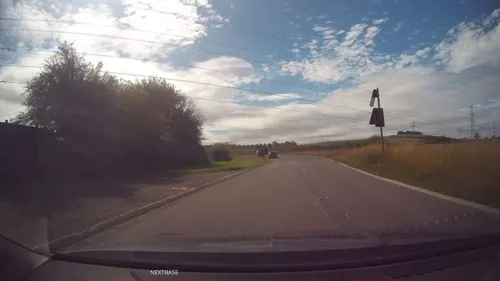
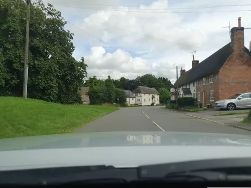

Churches and places of worship4

Church of St Andrew
Church · 2.3 mi
Church in Wootton Rivers, Wiltshire, England, UK

Church of St Mary the Virgin, Great Bedwyn
Church · 3.4 mi
Church in Great Bedwyn, Wiltshire, England, UK

Church of All Saints
Church
Church in Burbage, Wiltshire, England, UK
History
The name Burbage derives from the Old English burh bæc meaning 'fortification by a stream', or 'fortification by a ridge'.
The 1086 Domesday survey recorded a church, four landholders and 15 households, and a further eight households at the settlement later known as Wulfhall or Wolfhall, about three-quarters of a mile to the east. In the 16th century, Wulfhall was the seat of the Seymour family; among them Jane Seymour, who was queen to Henry VIII. The Seymour manor house was demolished in 1723 and replaced by a larger house nearby. Wulfhall was anciently a tithing of Great Bedwyn parish and was transferred to Burbage parish in the late 19th century.
The Kennet and Avon Canal, completed in 1810, crosses the parish just north of the village, where it passes through the Bruce Tunnel. Burbage Wharf was further west, where the canal passes under the present-day A346.
The Great Western Railway's Berks and Hants Extension Railway from Hungerford to Devizes was built close to the canal in the 1860s, eventually becoming part of the Reading to Plymouth section of the main line from London Paddington in 1906. The GWR built Savernake Low Level north of the village, above the canal tunnel; British Railways closed it in 1966 but the line remains in use. Until 1947 there was also a goods-only station at Burbage Wharf.
Read more of the history
The Midland and South Western Junction Railway opened from Andover to Grafton and Burbage in 1882, the latter station being situated in nearby West Grafton. The northern section of the M&SWJR line from Swindon to Marlborough Low Level had opened in 1881, and this was joined to the southern section from 1883 by using the Great Western Railway's branch between Savernake and Marlborough High Level. In 1898 the M&SWJR got its own route between Marlborough and Grafton and a new station opened at Savernake High Level. The M&SWJR had therefore become a route between Southampton Central and Cheltenham and the Midlands. British Railways closed it in 1961.
The population of Burbage peaked at around 1600 with the building of the railway in 1860, declining to a low point of 1000 a century later. It has since increased steadily, regaining its 1860s level in the 21st century.
The first school in the village was built at Eastcourt in 1806, rebuilt in 1856 and supplemented by a separate building for younger children in 1861. This school was taken over by the county council around 1906, and educated children of all ages until Marlborough secondary school opened in 1946. The 19th-century buildings (designated Grade II listed in 1988) were closed in 1989 upon the opening of the new school, and became a private residence.
From the History section of Burbage, Wiltshire on Wikipedia, under CC BY-SA 4.0.
More about Burbage
Geography
Burbage stands on a watershed at the eastern end of the Vale of Pewsey, with streams to the east draining to the Thames via the Dun and Kennet; to the south draining to the Salisbury Avon via the River Bourne; and to the north and west direct to the Avon.
The village High Street was the main north–south road from Marlborough to Andover, now the A346 primary route, until a bypass was built to the west in 1991. A more minor route from Pewsey to Hungerford and the M4 (designated A338 to the east and B3087 to the west) passes to the south of the village. Burbage no longer has a station on the nearby Reading to Taunton line, the nearest stations being at Great Bedwyn (which has commuter services to London) and Pewsey.
Burbage lies in the heart of the North Wessex Downs, a designated Area of Outstanding Natural Beauty.
From the Wikipedia article Burbage, Wiltshire, under CC BY-SA 4.0.
Shopping1
Gas and EV charging1
Schools, colleges and libraries2
Map of Burbage
15 places. The map loads OpenStreetMap tiles when you open it.
Getting there and nearby towns
Upavon Airfield (UPV) is the nearest airport with scheduled flights listed in OpenStreetMap, 7 miles away.
- Great Bedwyn 4 mi northeast, about 6 min by car
- Ramsbury 7 mi northeast, about 11 min by car
- Tidworth 8 mi south, about 13 min by car
- Netheravon 10 mi southwest, about 15 min by car
- Andover 12 mi southeast, about 20 min by car
- Amesbury 13 mi south, about 21 min by car
- Devizes 14 mi west, about 22 min by car
- Swindon 15 mi north, about 24 min by car
- Newbury 15 mi east, about 25 min by car
- Calne 16 mi northwest, about 25 min by car
Drive times are estimates from straight-line distance, not routes.
Towns near Burbage


Keep exploring
Local news
Headlines from INDB.
Reviews, tips and questions
Loading what members have shared...
Sources and licences
- GeoNames (CC BY 4.0): population, coordinates, regions and time zone
- Mapillary (see each image): photos
- OpenStreetMap contributors (ODbL 1.0): places, airports, map data
- Wikidata (CC0 1.0): elevation, founding date, time zone, website, landmarks and historic places
- Wikimedia Commons (see each image): photos
- Wikipedia (CC BY-SA 4.0): overview and history text
Photo credits
- St Andrews Wotton Rivers, Alexander Williams, CC BY-SA 4.0
- Church of St Mary the Virgin Graveyard, Stephen1704prince, CC BY-SA 3.0
- Crofton Pumping Station Exterior 04, Rodw, CC BY-SA 4.0
- Street-level photo, swinetown, CC BY-SA 4.0
- Street-level photo, russmcd, CC BY-SA 4.0
- Street-level photo, swinetown, CC BY-SA 4.0
Page built November 10, 2026. Spotted a mistake? Tell us or suggest a place.