
Why visit Burley
Townapedia lists 2 museums and landmarks, 1 park or trail, 8 places to eat, 7 places to stay and 5 attractions in and around town.
Highlights include Burley War Memorial.
Weather in Burley
Forecast from MET Norway (CC BY 4.0). Full forecast
About Burley
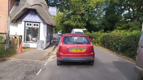
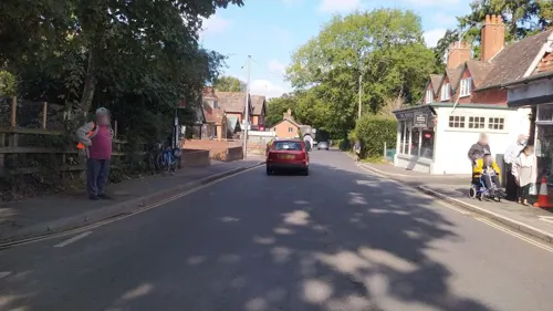
Burley is a village and civil parish in the New Forest, Hampshire, England. It has ancient origins and is now somewhat tourist-oriented.
From the Wikipedia article Burley, Hampshire (this version), under CC BY-SA 4.0.
Travel tips from other travellers: Burley on Wikivoyage (CC BY-SA 4.0).
Things to do5

Museums and landmarks2
Parks, trails and playgrounds1
Restaurants and cafes8


History
People have lived in the Burley area since prehistoric times. At least 23 Bronze Age barrows are known in the Burley area. The site of an Iron Age hillfort can be seen just to the west of the village at Castle Hill.
There is evidence of Saxon occupation as the name Burley is composed of two Saxon words 'burgh', which means fortified palace, and 'leah', which means an open meadow or clearing in a wood.
Burley is not specifically mentioned in the Domesday Book of 1086, but the entry for nearby Ringwood may well refer to Burley when it mentions lands in the forest with "14 villagers and 6 smallholders with 7 ploughs; a mill at 30d; and woodland at 189 pigs from pasturage."
Burley was part of the royal lands of the New Forest. By the beginning of the 13th century the family of de Burley was firmly established here. Richard de Burley held the estate from Edward I who gave the village of Burley and Manor of Lyndhurst as dowry to his second wife Margaret, sister of Philip IV of France. The manor is said to have belonged to the Crown down to the time of James I.
There was a watermill belonging to the manor of Burley, which ceased operating around 1820. The mill is commemorated in names of Mill Lawn and Mill Lawn Brook, but the only building which survives is the grist house in the grounds of Mill Cottage.
Read more of the history
The first known church in Burley was the Calvinistic Burley Chapel erected in 1789. The ecclesiastical parish of Burley was formed in 1840 out of Ringwood., this was served by the Anglican church of John the Baptist which was built in 1839 and added to in 1886–7. A school was built in Burley in 1854 large enough to accommodate 120 children.
In 1852 the manor passed into the possession of Colonel Esdaile who pulled down the old manor house and built a new one. Further changes to the building have been made since that time, and the manor house is now a hotel.
2 miles (3 km) to the north-east of the Burley village lies Burley Lodge, whose history dates back to the 15th century. It was part of the lands of the "bailiwick of Burley" which was held in the 18th century by the Paulets, Dukes of Bolton and Marquesses of Winchester.
The civil parish of Burley was formed in 1868 from Burley Walk and Holmsley Walk, extra-parochial parts of the New Forest, together with the ancient vill of Burley. From 1847 to 1964, Burley was served by trains at nearby Holmsley railway station, about 1.5 miles (2.4 km) southeast of the village. The station buildings still stand, and are now tea rooms.
Arthur Clough (son of Arthur Hugh Clough) and his wife Eleanor Freshfield built Castletop House on Castle Hill Lane in 1898: Eleanor's father Douglas Freshfield was President of the Royal Geographical Society and brought back many exotic plants from his travels which were planted at Castletop.
Burley has a long connection with witches; in the late 1950s, Sybil Leek, a self-styled white witch, lived in the village. She could be seen walking around Burley with her pet jackdaw on her shoulder before she moved to America. Some of the gift shops in Burley now sell witch-related gifts and ornaments.
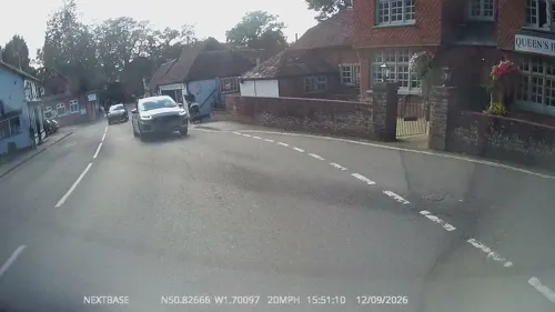
Burley was also once a favourite haunt for smugglers, and a secret cellar in the Queens Head pub was discovered during renovation work, where pistols, coins, and other unusual items were discovered.
From the History section of Burley, Hampshire on Wikipedia, under CC BY-SA 4.0.
Notable people from Burley
 Harry Forbes WitherbyBritish ornithologist (1873–1943)Photo: Unknown author Unknown author, Public domain
- Kevin ReevesEnglish footballer (born 1957)
- Harry Warner FarnallNew Zealand politician (1838-1891)
Born in Burley, according to Wikidata (CC0). Each name links to its Wikipedia article.
Where to stay7
Churches and places of worship2
Shopping5
Gas and EV charging1
Schools, colleges and libraries1
Map of Burley
32 places. The map loads OpenStreetMap tiles when you open it.
Getting there and nearby towns
Bournemouth Airport (BOH) is the nearest airport with scheduled flights listed in OpenStreetMap, 7 miles away.
- Ringwood 4 mi west, about 7 min by car
- New Milton 5 mi south, about 8 min by car
- Christchurch 7 mi southwest, about 12 min by car
- Verwood 8 mi northwest, about 13 min by car
- Lymington 9 mi southeast, about 14 min by car
- Ferndown 9 mi west, about 14 min by car
- Bournemouth 11 mi southwest, about 17 min by car
- Totton 11 mi northeast, about 18 min by car
- Wimborne Minster 13 mi west, about 21 min by car
- Southampton 14 mi east, about 22 min by car
Drive times are estimates from straight-line distance, not routes.
Towns near Burley


Keep exploring
Local news
Headlines from INDB.
Reviews, tips and questions
Loading what members have shared...
Sources and licences
- GeoNames (CC BY 4.0): population, coordinates, regions and time zone
- Mapillary (see each image): photos
- OpenStreetMap contributors (ODbL 1.0): places, airports, map data
- Wikidata (CC0 1.0): elevation, founding date, time zone, website, landmarks and historic places
- Wikipedia (CC BY-SA 4.0): overview and history text
Photo credits
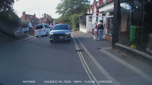
- Street-level photo, OrangeHurst97, CC BY-SA 4.0
- Street-level photo, OrangeHurst97, CC BY-SA 4.0
- Street-level photo, noid, CC BY-SA 4.0
- Street-level photo, OrangeHurst97, CC BY-SA 4.0
- Street-level photo, OrangeHurst97, CC BY-SA 4.0
- Street-level photo, noid, CC BY-SA 4.0
- Street-level photo, noid, CC BY-SA 4.0
- Street-level photo, OrangeHurst97, CC BY-SA 4.0
- Street-level photo, OrangeHurst97, CC BY-SA 4.0
- Street-level photo, OrangeHurst97, CC BY-SA 4.0
- Street-level photo, OrangeHurst97, CC BY-SA 4.0
- Street-level photo, OrangeHurst97, CC BY-SA 4.0
- Street-level photo, OrangeHurst97, CC BY-SA 4.0
Page built November 10, 2026. Spotted a mistake? Tell us or suggest a place.