


Ferndown, United Kingdom
Ferndown is a town of 17,650 people in England, United Kingdom.
Why visit Ferndown
Townapedia lists 6 museums and landmarks, 16 parks and trails, 40 places to eat, 2 places to stay and 3 attractions in and around town.
Highlights include Adventure Wonderland, Barrington Centre, Dudsbury Camp and Parley Barrow.
Weather in Ferndown
Forecast from MET Norway (CC BY 4.0). Full forecast
About Ferndown
Ferndown is a town and civil parish (under the name Ferndown Town) in Dorset in southern England. It lies immediately to the north of Bournemouth and Poole, and about 4 miles (6 km) east of Wimborne Minster. The parish, which until 1986 was called Hampreston, includes the communities of Ameysford, Hampreston, Longham, Stapehill and Trickett's Cross. At the 2021 census the population of the parish was 17,501.
From the Wikipedia article Ferndown (this version), under CC BY-SA 4.0.
Things to do3
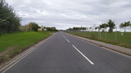
Adventure Wonderland
Monument and historic site · 3.2 mi
Theme park in Hurn, Dorset, England

Museums and landmarks6

Dudsbury Camp
Monument and historic site · 1.9 mi
Hillfort in Dorset, England, UK
Belle View Bunker
Monument and historic site · 1.4 mi
WWII bunker for Ferndown Auxillary Unit. Located between 3.5 to 4.5 meters underground, and constructed of corrugated metal sheets over...
Parks, trails and playgrounds16


Ferndown Golf Club
Golf course · 1.1 mi
18 hole Par 71 Old Course & 9 hole Par 35 Presidents Course
119 Golf Links Road, Ferndown
Millennium Park
Park
Has benches, various wooden carvings, a memorial and the millenium stone.


4 more on the map.
Restaurants and cafes40
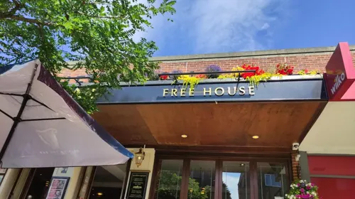
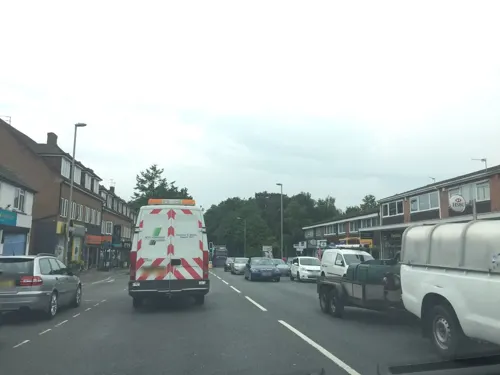
Chianti
Restaurant · Italian · 0.6 mi
378 Ringwood Road
12:00-14:00,18:00-23:00
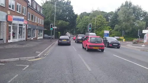
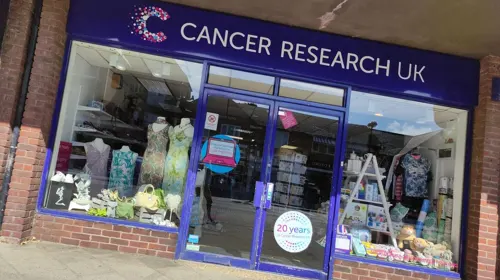
Costa
Cafe · Coffee Shop · 0.5 mi
77-79 Victoria Road
Mo-Fr 07:00-17:30; Sa 08:00-17:00; Su 09:00-16:30
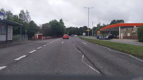


Cinnamon Restaurant
Restaurant · Indian · 0.5 mi
52 Victoria Road, Ferndown
17:00-23:00

28 more on the map.
History
Domesday Book of 1086 recorded a settlement with 25 households at Hame, in Cranborne Hundred. The other ancient settlements were at Canford and Longham, all three built on gravel terraces on the north bank of the River Stour.
The 1892 Ordnance Survey map shows Hampreston parish. Besides Hampreston hamlet – with All Saints, the 14th-century parish church – there are small groups of dwellings at Canford Bottom, Stapehill, Longham and Fern Down. In 1898, Cricket's Cross appears as the label where the road from Wimborne Minster meets the Poole–Ringwood road.
In 1913, 944 acres in the west of the parish, including Canford Bottom, were transferred to Colehill parish. Residential development at Ferndown was distant from the parish church at Hampreston, so St Mary's church was begun at Ferndown in 1933, as a replacement for smaller buildings in use since the turn of the century; the outbreak of war and lack of funds meant the church would not be completed until 1972.
Read more of the history
Horticulture contributed to the growth of Ferndown, beginning in 1864 when the Stewart family established a nursery to grow plants in warmer conditions than at their principal site in Scotland. At first their business was concerned with landscaping tennis courts and golf courses; in 1955 they opened at Ferndown one of the first garden centres in Britain. Around that time Ferndown was "a village with gravel road and a scattering of shops", and much of the present town was built in the subsequent 20–30 years.
In 1956, when Ferndown was expanding rapidly, land in the east was transferred from West Parley to Hampreston. The name of the parish was changed from Hampreston to Ferndown Town on 1 February 1986.
Today, Stapehill and Trickett's Cross are identified on maps although they are effectively part of the Ferndown built-up area. Hampreston, Little Canford and Ameysford remain as small settlements on the edges of the parish.
From the History section of Ferndown on Wikipedia, under CC BY-SA 4.0.
More about Ferndown
Education
Schooling in Ferndown, as in much of Dorset, is based on a three-tier system of first, middle and upper schools. Ferndown Upper School is a co-educational comprehensive school for students aged between 13 and 19, with up to 320 pupils admitted each year from its feeder middle schools in Ferndown, West Moors and Verwood.
Ferndown Middle School (on the former Gorsemoor Middle School site) takes pupils at age 9 from Ferndown First School (on the old Ferndown Middle School site), Hampreston First School and Parley First School. The Ferndown school changes occurred in the late 1980s and early 1990s, when the original first school was demolished to make way for a small residential area named Old School Close, and former Dorset Council offices, now called Enterprise House and owned by logistics company Hoare Lea. The two middle schools combined and one became the new first school.
From the Wikipedia article Ferndown, under CC BY-SA 4.0.
Notable people from Ferndown
 Ben DickensonBritish footballerPhoto: CJT2024, CC0
- Malcolm HeathEnglish cricketer (1934-2019)
Born in Ferndown, according to Wikidata (CC0). Each name links to its Wikipedia article.
Where to stay2
St Leonards Farm Caravan and Camping Park
Campground · 1.4 mi
Ringwood Road, Ferndown
Churches and places of worship12
Shopping6
Gas and EV charging4
Schools, colleges and libraries8
St Mary's Church of England First School and Nursery
School · Anglican · 1.5 mi
240 Station Road, Ferndown
Healthcare3
Map of Ferndown
100 places. The map loads OpenStreetMap tiles when you open it.
Getting there and nearby towns
Bournemouth Airport (BOH) is the nearest airport with scheduled flights listed in OpenStreetMap, 3 miles away.
- Wimborne Minster 4 mi southwest, about 6 min by car
- Verwood 5 mi north, about 8 min by car
- Broadstone 5 mi southwest, about 9 min by car
- Bournemouth 6 mi south, about 10 min by car
- Ringwood 6 mi northeast, about 9 min by car
- Poole 7 mi southwest, about 12 min by car
- Christchurch 7 mi southeast, about 12 min by car
- New Milton 11 mi east, about 17 min by car
- Blandford Forum 12 mi west, about 19 min by car
- Swanage 14 mi south, about 23 min by car
Drive times are estimates from straight-line distance, not routes.
Towns near Ferndown


Keep exploring
Local news
Headlines from INDB.
Reviews, tips and questions
Loading what members have shared...
Sources and licences
- GeoNames (CC BY 4.0): population, coordinates, regions and time zone
- Mapillary (see each image): photos
- OpenStreetMap contributors (ODbL 1.0): places, airports, map data
- Wikidata (CC0 1.0): elevation, founding date, time zone, website, landmarks and historic places
- Wikimedia Commons (see each image): photos
- Wikipedia (CC BY-SA 4.0): overview and history text
Photo credits
- Hampreston Church, John Smitten, CC BY-SA 2.0
- St andrews church kinson, User:Jbattersby, CC BY-SA 3.0
- Longham United Reformed Church, Dorset, JackPeasePhotography, CC BY 2.0
- Ferndown St Mary's, Bellminsterboy, CC BY 3.0
- Dog meet Dog, JackPeasePhotography, CC BY 2.0
- Asparagus Soup, Liana Green, CC BY-SA 4.0
- Street-level photo, noid, CC BY-SA 4.0
- Street-level photo, honeyfox, CC BY-SA 4.0
- Street-level photo, noid, CC BY-SA 4.0
- Street-level photo, essexboy, CC BY-SA 4.0
- Street-level photo, noid, CC BY-SA 4.0
- Street-level photo, honeyfox, CC BY-SA 4.0
- Street-level photo, noid, CC BY-SA 4.0
- Street-level photo, essexboy, CC BY-SA 4.0
- Street-level photo, noid, CC BY-SA 4.0
- Street-level photo, noid, CC BY-SA 4.0
- Street-level photo, honeyfox, CC BY-SA 4.0
- Street-level photo, honeyfox, CC BY-SA 4.0
- Street-level photo, noid, CC BY-SA 4.0
- Street-level photo, noid, CC BY-SA 4.0
- Street-level photo, essexboy, CC BY-SA 4.0
- Street-level photo, noid, CC BY-SA 4.0
- Street-level photo, noid, CC BY-SA 4.0
- Street-level photo, essexboy, CC BY-SA 4.0
- Street-level photo, honeyfox, CC BY-SA 4.0
- Street-level photo, honeyfox, CC BY-SA 4.0
- Street-level photo, southglos, CC BY-SA 4.0
- Street-level photo, essexboy, CC BY-SA 4.0
- Street-level photo, essexboy, CC BY-SA 4.0
- Street-level photo, honeyfox, CC BY-SA 4.0
- Street-level photo, honeyfox, CC BY-SA 4.0
Page built November 10, 2026. Spotted a mistake? Tell us or suggest a place.