


Why visit Buxton
Townapedia lists 7 museums and landmarks, 11 parks and trails, 86 places to eat, 15 places to stay and 8 attractions in and around town.
Highlights include Poole's Cavern, Buxton Opera House, Buxton Museum and Art Gallery and Lismore Fields.
Weather in Buxton
Forecast from MET Norway (CC BY 4.0). Full forecast
About Buxton
Buxton is a spa town in the borough of High Peak, Derbyshire, in the East Midlands region of England. It is England's highest market town, sited at some 1,000 feet (300 m) above sea level. It lies close to Cheshire to the west and Staffordshire to the south, on the edge of the Peak District National Park. In 1974, the municipal borough merged with other nearby boroughs, including Glossop, to form the local government district and borough of High Peak.
From the Wikipedia article Buxton (this version), under CC BY-SA 4.0.
Travel tips from other travellers: Buxton on Wikivoyage (CC BY-SA 4.0).
Photos of Buxton


Things to do8

Poole's Cavern
Monument and historic site · 0.8 mi
2 million year old, natural limestone cave on the edge of Buxton in the Peak District, in the county of Derbyshire, England


Pavilion Arts Centre
Cinema and theater
Theatre and arts centre in Buxton, England, formerly also a cinema


Museums and landmarks7

Buxton Museum and Art Gallery
Museum
Museum and gallery in Buxton, Derbyshire, England, United Kingdom

Lismore Fields Mesolithic and Neolithic settlement
Monument and historic site · 0.7 mi
Archaeological site in Buxton, High Peak, England, UK

The Bull Ring
Monument and historic site · 3.2 mi
Neolithic henge monument in Derbyshire, England, UK


The Green Man Gallery
Museum
Hardwick Square South, Buxton
Tu-We 10:30-14:00; Fr-Su 10:30-16:30
Parks, trails and playgrounds11

Buxton Pavilion Gardens
Park · 0.4 mi
Park in Buxton, Derbyshire, England, UK





Restaurants and cafes86


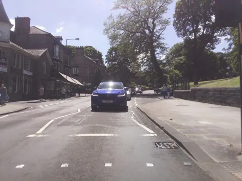
Kwei Lin
Restaurant · Chinese
1-2 Lower Hardwick Street, Buxton
Su-Tu,Th 17:00-20:00; Fr,Sa 12:00-14:00,17:00-22:30
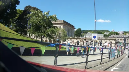
La Gaby
Restaurant · Pizza
3 Spring Gardens, Buxton
We,Th 17:00-21:30; Fr 17:00-22:00; Sa 12:30-22:00; Su...
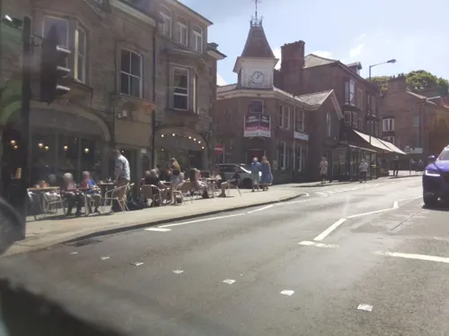



Sacro Lounge
Restaurant · British
The Springs Shopping Centre, Buxton
Su-Th 09:00-22:00; Fr,Sa 09:00-23:00
74 more on the map.
History
The origins of the name are unclear. It may derive from the Old English for Buck Stone or for Rocking Stone. The town grew in importance in the late 18th century, when it was developed by the Dukes of Devonshire, with a resurgence a century later as Victorians were drawn to the reputed healing properties of its waters.
The first inhabitants of Buxton made homes at Lismore Fields some 6,000 years ago. This Stone Age settlement, a scheduled monument, was rediscovered in 1984, with remains of a Mesolithic timber roundhouse and Neolithic longhouses.
The Romans developed a settlement known as Aquae Arnemetiae ("Baths of the grove goddess"). Coins found show the Romans were in Buxton throughout their occupation of Britain.
Batham Gate ("road to the bath town") is a Roman road from Templebrough Roman fort in South Yorkshire to Navio Roman Fort and on to Buxton.
The name Buckestones was first recorded in the 12th century as part of the Peverel family's estate. From 1153 the town was within the Duchy of Lancaster's Crown estate, close to the Royal Forest of the Peak on the Fairfield side of the River Wye. Monastic farms were set up in Fairfield in the 13th century and in the 14th; its royal ownership was reflected in the name of Kyngesbucstones.
By 1460, Buxton's spring had been pronounced a holy one dedicated to St Anne, who was canonised in 1382. A chapel had appeared there by 1498.
Read more of the history
Built on the River Wye, and overlooked by Axe Edge Moor, Buxton became a spa town for its geothermal spring, which gushes at a steady 28 °C.
The spring waters are piped to St Ann's Well, a shrine since medieval times at the foot of The Slopes, opposite the Crescent and near the town centre. The well was called one of the Seven Wonders of the Peak by the philosopher Thomas Hobbes in his 1636 book De Mirabilibus Pecci: Being The Wonders of the Peak in Darby-shire.
The Dukes of Devonshire became involved in 1780, when William Cavendish, 5th Duke of Devonshire used profits from his copper mines to develop it as a spa in the style of Bath. Their ancestor Bess of Hardwick had brought one of her four husbands, the Earl of Shrewsbury, to "take the waters" at Buxton in 1569, shortly after he became the gaoler of Mary, Queen of Scots, and took Mary there in 1573. She called Buxton "La Fontagne de Bogsby". She stayed at the site of the Old Hall Hotel, where the Earl of Shrewsbury had built a lodging for visitors. According to John Jones of Derby, author of Buxtone's Bathes Benefyte (1572), the visitors to Shrewsbury's "goodly house" enjoyed a game of table bowls known as trou madame.
The area features in the works of W. H. Auden, Jane Austen and Emily Brontë. Buxton's profile was boosted by a recommendation from Erasmus Darwin of the waters there and at Matlock, addressed to Josiah Wedgwood I. The Wedgwood family often visited Buxton and commended the area to their friends. Two of Charles Darwin's half-cousins, Edward Levett Darwin and Reginald Darwin, settled there. The arrival of the railway in 1863 stimulated growth: the population of 1,800 in 1861 exceeded 6,000 by 1881.
Buxton held a base for British and Canadian troops in the First World War. Granville Military Hospital was set up at the Buxton Hydropathic Hotel, with the Palace Hotel annexed. The author Vera Brittain trained as a Voluntary Aid Detachment nurse at the Devonshire Hospital in 1915. The Royal Engineers based in Buxton used the Pavilion Gardens' lakes for training to build pontoon bridges. Prisoner of war camps at Ladmanlow and Peak Dale were established in 1917 to supply workers for the local limestone quarries.
RAF Harpur Hill became an underground bomb-storage facility during World War II and the country's largest munitions dump. It was also the base for the Peak District section of the RAF Mountain Rescue Service. Prisoner of war camps for Italians and Germans were set up on Lismore Road, off Macclesfield Road and at Dove Holes.
After a decline as a spa resort in the earlier 20th century, Buxton had a resurgence in the 1950s and 1970s. The Playhouse Theatre kept a repertory company and pop concerts were held at the Octagon (including the Beatles in 1963). The Opera House re-opened in 1979 with the launch of the Buxton Festival, and the town was being used as a base for exploring the Peak District.
After the 2022 Russian invasion of Ukraine, Buxton received 150 refugees. In 2024 it was announced that Buxton town centre would have a £100m regeneration project.
From the History section of Buxton on Wikipedia, under CC BY-SA 4.0.
More about Buxton
Geography
Although outside the National Park boundary, Buxton is in the western part of the Peak District, between the Lower Carboniferous limestone of the White Peak to the east and the Upper Carboniferous shale, sandstone and gritstone of the Dark Peak to the west. The early settlement (of which only the parish church of St Anne, built in 1625, remains) was largely made of limestone, while the present buildings of locally quarried sandstone, mostly date from the late 18th century.
At the south edge of the town, the River Wye has carved an extensive limestone cavern known as Poole's Cavern. More than 330 yards (300 metres) of its chambers are open to the public. It contains Derbyshire's largest stalactite and some unique "poached egg" stalagmites. Its name recalls a local highwayman.
Buxton has an oceanic climate with short, mild summers and long, cool winters. At about 1,000 feet (300 m) above sea level, Buxton is the highest market town in England. Buxton's elevation makes it cooler and wetter than surrounding towns, with a daytime temperature typically about 2 °C lower than Manchester.
A Met Office weather station has collected climate data for the town since 1867, with digitised data from 1959 available online. In June 1975, the town suffered a freak snowstorm that stopped play during a cricket match.
Economy
Buxton's economy covers tourism, retail, quarrying, scientific research, light industry and mineral water bottling. The University of Derby is a noted employer. Surrounded by the Peak District National Park, it offers a range of cultural events; tourism is a major industry, with over a million visitors to Buxton each year. Buxton is the main centre for overnight accommodation in the Peak District, with over 64 per cent of the park's visitor bed space.
The Buxton Mineral Water Company, owned by Nestlé, extracts and bottles mineral waters. The Buxton Advertiser appears weekly. Potters of Buxton is the town's oldest department store, founded in 1860.
The Buxton lime industry has shaped the town's development and landscape since its 17th-century beginnings. Buxton Lime Firms (BLF) was formed by 13 quarry owners in 1891. BLF became part of Imperial Chemical Industries (ICI) in 1926 and Buxton was the headquarters for I.C.I. Lime Division until the 1970s. Several limestone quarries lie close, including the "Tunstead Superquarry", the largest producer of high-purity industrial limestone in Europe, employing 400. The quarrying sector also provides jobs in limestone processing and distribution. Other industrial employers include the Health & Safety Laboratory, which engages in health and safety research and incident investigations and maintains over 350 staff locally.
Arts and culture
Cultural events include the annual Buxton Festival, festivals and performances at the Buxton Opera House, and shows running at other venues alongside them. Buxton Museum and Art Gallery offers year-round exhibitions.
Buxton Festival, founded in 1979, is an opera and arts event held in July at the Opera House and other venues. It includes some literary events in the mornings, concerts and recitals in the afternoon, and operas, many rarely performed, in the evenings. The quality of the opera programme has improved in recent years, after decades when, according to critic Rupert Christiansen, the festival featured "work of such mediocre quality that I just longed for someone to put it out of its misery." Running alongside is the Buxton Festival Fringe, known as a warm-up for the Edinburgh Fringe. The Buxton Fringe features drama, music, dance, comedy, poetry, art exhibitions and films around the town. In 2018, 181 entrants signed up and comedy and theatre categories were at their largest.
The week-long Four Four Time music festival in February brings a variety of rock, pop, folk, blues, jazz and world music. The International Gilbert and Sullivan Festival, a three-week theatre event from the end of July through the first half of August, was held in Buxton from 1994 to 2013; it moved to Harrogate in 2014 but returned to Buxton in 2023.
Education
The town hosts a University of Derby campus at the site of the former Devonshire Royal Hospital, as well as the Buxton & Leek College formed by the August 2012 merger of the university with Leek College.
Secondary schools include Buxton Community School, at the former College Road site of Buxton College, and St. Thomas More Catholic School. Others include Buxton Junior School, St Anne's Catholic Primary, Harper Hill School, Buxton Infant School, John Duncan School, Fairfield Infant & Nursery, Burbage Primary, Dove Holes CE Primary, Fairfield Endowed Junior, Peak Dale Primary, Leek College, Old Sams Farm Independent School, Hollinsclough CE Primary, Flash CE Primary, Earl Sterndale CE Primary, Peak Forest CE Primary and Combs Infant School.
From the Wikipedia article Buxton, under CC BY-SA 4.0.
Notable people from Buxton
 Tim Brooke-TaylorEnglish comedian and actor (1940-2020)Photo: Ed g2s, CC BY-SA 4.0
 Lloyd ColeEnglish singer and songwriterPhoto: Michiel1972, CC BY-SA 3.0
 Mick AndrewsEnglish international motorcycle trials riderPhoto: Insomnia Cured Here, CC BY-SA 2.0
 Lorraine FarlamEnglish darts playerPhoto: Czech darts official Youtube channel, CC BY 3.0
 Carl MasonEnglish professional golferPhoto: Pvt pauline, CC BY-SA 3.0
- Robert StevensonBritish film director (1905-1986)
- Elizabeth SpriggsBritish actress (1929–2008)
- Frank SooEnglish footballer (1914-1991)
- Abbie WoodBritish female swimmer
- Andrew BinghamBritish politician (born 1962)
- Ben BurgessIrish footballer
- Mark HigginsEnglish footballer (born 1958)
Born in Buxton, according to Wikidata (CC0). Each name links to its Wikipedia article.
Where to stay15
Churches and places of worship13
Shopping16
Gas and EV charging2
Schools, colleges and libraries12
Healthcare10
Buxton Hospital & Corbar Birth Centre
Hospital · 0.6 mi
London Road, Buxton
Map of Buxton
180 places. The map loads OpenStreetMap tiles when you open it.
Getting there and nearby towns
Manchester Airport (MAN) is the nearest airport with scheduled flights listed in OpenStreetMap, 17 miles away.
- New Mills 8 mi northwest, about 13 min by car
- Poynton 11 mi northwest, about 17 min by car
- Marple 11 mi northwest, about 18 min by car
- Leek 12 mi southwest, about 19 min by car
- Hazel Grove 12 mi northwest, about 20 min by car
- Glossop 13 mi north, about 21 min by car
- Cheadle Hulme 14 mi northwest, about 23 min by car
- Congleton 14 mi southwest, about 23 min by car
- Wilmslow 14 mi west, about 23 min by car
- Stockport 15 mi northwest, about 24 min by car
Drive times are estimates from straight-line distance, not routes.
Towns near Buxton


Keep exploring
Local news
Headlines from INDB.
Reviews, tips and questions
Loading what members have shared...
Sources and licences
- GeoNames (CC BY 4.0): population, coordinates, regions and time zone
- Mapillary (see each image): photos
- OpenStreetMap contributors (ODbL 1.0): places, airports, map data
- Wikidata (CC0 1.0): elevation, founding date, time zone, website, landmarks and historic places
- Wikimedia Commons (see each image): photos
- Wikipedia (CC BY-SA 4.0): overview and history text
Photo credits
- Buxton Museum and Art Gallery - June 2020, Douglal, CC BY-SA 4.0
- Buxton (6302751919), Hugh Llewelyn, CC BY-SA 2.0
- 08.02.86 Buxton 50012 (6107167594), Phil Richards from London, UK, CC BY-SA 2.0
- Longden Court, Buxton, Douglal, CC BY-SA 4.0
- Roman Milestone to Navio from Buxton, Douglal, CC BY-SA 4.0
- Roman coins from the Buxton Hoard found in 1979, Douglal, CC BY-SA 4.0
- Replica Roman lead ingots on display in Buxton Museum, Douglal, CC BY-SA 4.0
- Pooles Cavern 2, Dave Pape, Public domain
- Buxton Opera House, Dave Pape, Public domain
- Buxton Cinema at the Pavilion Arts Centre, Douglal, CC BY-SA 4.0
- BullRingDoveHoles, Dave.Dunford, CC BY-SA 3.0
- Benkid77 Pavilion Gardens, Buxton 2 080809, Rept0n1x, CC BY-SA 3.0
- St Anne's Church on Bath Road, Higher Buxton, Douglal, CC BY-SA 4.0
- Church of St. John the Baptist, Charlesdrakew, Public domain
- University of Derby Library, Lianne99, CC BY-SA 4.0
- Buxton, The Crescent, Eugene Birchall, CC BY-SA 2.0
- Grinlow Tower aka Solomon's Temple, Stevekraken, CC BY-SA 4.0
- Joseph Holt Brewery, JosephHolt1849, CC BY-SA 4.0
- Benkid77 Old Hall Hotel, Buxton 080809, Rept0n1x, CC BY-SA 3.0
- St Peter's Church, Fairfield, Graham Hogg, CC BY-SA 2.0
- Old Sun Inn at Buxton, Douglal, CC BY-SA 4.0
- St Mary's Church, Buxton, Michael Dibb, CC BY-SA 2.0
- The Slopes, Buxton, Dave.Dunford, CC BY-SA 4.0
- Lismore Fields Stone Age Site at Buxton, Douglal, CC BY-SA 4.0
- The Crescent Hotel in Buxton 2020, Douglal, CC BY-SA 4.0
- Bandstand and Milner Bridge in Buxton Pavilion Gardens, Douglal, CC BY-SA 4.0
- Buxton, pump room, Derbyshire, England, Photochrom Print Collection, Public domain
- On the Rails (1429675918), Ian Parkes from Buxton, United Kingdom, CC BY 2.0
- De Mirabilibus Pecci Being The Wonders of the Peak in Darby-shire by Thomas Hobbes 1678, Douglal, CC BY-SA 4.0
- Lismore Stone Age Pot, Douglal, CC BY-SA 4.0
- Centurion Stone from Navio Roman Fort, Douglal, CC BY-SA 4.0
- Street-level photo, southglos, CC BY-SA 4.0
- Street-level photo, southglos, CC BY-SA 4.0
- Street-level photo, southglos, CC BY-SA 4.0
- Street-level photo, southglos, CC BY-SA 4.0
- Street-level photo, southglos, CC BY-SA 4.0
- Street-level photo, southglos, CC BY-SA 4.0
- Street-level photo, southglos, CC BY-SA 4.0
- Street-level photo, southglos, CC BY-SA 4.0
- Street-level photo, southglos, CC BY-SA 4.0
- Street-level photo, southglos, CC BY-SA 4.0
- Street-level photo, southglos, CC BY-SA 4.0
- Street-level photo, southglos, CC BY-SA 4.0
- Street-level photo, mappo2, CC BY-SA 4.0
- Street-level photo, southglos, CC BY-SA 4.0
- Street-level photo, southglos, CC BY-SA 4.0


Page built November 10, 2026. Spotted a mistake? Tell us or suggest a place.