


Why visit Glossop
Townapedia lists 4 museums and landmarks, 10 parks and trails, 85 places to eat, 6 places to stay and 3 attractions in and around town.
Highlights include The Partington Players Theatre, Glossop War Memorial, Abbot's Chair and Swallows Wood.
Weather in Glossop
Forecast from MET Norway (CC BY 4.0). Full forecast
About Glossop
Glossop is a market town in the borough of High Peak, Derbyshire, England, 13 miles (21 km) east of Manchester, 24 miles (39 km) west-northwest of Sheffield and 32 miles (51 km) north-west of Matlock. Near Derbyshire's borders with Cheshire, Greater Manchester, South Yorkshire and West Yorkshire, between 150 and 300 metres (492 and 984 ft) above sea level, it is bounded by the Peak District National Park to the south, east and north. In 2021, it had a population of 17,825.
From the Wikipedia article Glossop (this version), under CC BY-SA 4.0.
Travel tips from other travellers: Glossop on Wikivoyage (CC BY-SA 4.0).
Photos of Glossop


Things to do3
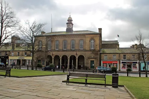

Museums and landmarks4

Glossop War Memorial
Monument and historic site
Grade II listed war memorial in Glossop, High Peak, Derbyshire, England, UK

Abbot's Chair
Monument and historic site · 2.4 mi
Remains of former monastic cross in Derbyshire
Parks, trails and playgrounds10



Howard Park
Park · 0.6 mi
Public park in Glossop, Derbyshire, England, UK


Restaurants and cafes85

Coriander Curry House
Restaurant · Indian · 0.6 mi
1 Shepley Street, Glossop
Mo-Th 17:00-23:00; Fr-Sa 17:00-24:00; Su 16:00-22:00
Distant Hills Brewing
Restaurant · British · 0.8 mi
Hope Street, Old Glossop
Th 12:00-20:00; Fr,Sa 12:00-21:00; Su 12:00-18:30
Two Hares
Restaurant · Tapas
3-5 High Street East, Glossop
Tu-We 10:00-16:00; Th-Sa 10:00-22:00; Su 10:00-16:00

The Commercial Inn
Bar and pub · 0.4 mi
137 Manor Park Road, Glossop
Tu 16:00-12:00, Mo 16:00-12:00, Su 00:00-22:30, We-Sa 00:00-12:00
Kota Lapo Indonesian Street Food
Restaurant · Indonesian · 1.5 mi
101 Station Road, Hadfield
Th 18:00-22:00; Fr-Sa 18:00-23:00; Su 18:00-22:00

Lorraine's Sandwich Bar
Cafe · Sandwich · 1.5 mi
108 Station Road, Hadfield
Mo-Fr 08:30-14:30,Sa 08:30-13:30
The Coffee Shop at Wimberry Hill
Cafe · Coffee Shop · 0.8 mi
Cemetery Road, Glossop
Mo-Sa 09:30-17:00; Su 10:00-16:00
Alison's Cafe
Cafe · Breakfast, Burger, Coffee Shop, Sandwich · 1.5 mi
105 Station Road, Hadfield
Mo-Fr 08:30-15:00
Dukes Coffee Shop
Cafe · Breakfast, Local
19-21 High Street East, Glossop
Mo 10:00-17:00; Tu-Sa 09:00-17:00; Su off
73 more on the map.
History
The name Glossop is thought to be of Anglo-Saxon origin, named during the Angles' settlement in the 7th century, and derived from Glott's Hop—where hop could mean a valley, a small valley in a larger valley system, or a piece of land enclosed by marshes and Glott was probably a chieftain's name. Because of its size and location, Glossop had many definitions. The village of Glossop is now called Old Glossop. Howard Town and Milltown gained importance. They were named New Town and then Glossop. Local government reorganisations had caused the Glossopdale villages to be promoted to a municipal borough and then have that status removed. Land has been added to Glossop and other lands removed. From a small settlement it became an ancient parish, a manor, a borough and a township. Currently, two county divisions in High Peak Borough, Derbyshire, have Glossop as part of their names.
Read more of the history
There is evidence of a Bronze Age burial site on Shire Hill (near Old Glossop) and other possibly prehistoric remains at Torside (on the slopes of Bleaklow). The Romans arrived in 78 AD. At that time, the area was within the territory of the Brigantes tribe, whose main base was in Yorkshire. In the late 1st century the Romans built a fort, Ardotalia, on high ground above the river in present-day Gamesley. The site of this fort was rediscovered in 1771 by an amateur historian, John Watson. It subsequently acquired the name Melandra Castle. The extensive site has been excavated, revealing fort walls, a shrine and the fort headquarters. The area has been landscaped to provide parking and picnic areas.
King William I awarded the manor of Glossop to William Peverel, who began construction of Glossop Castle, but the entire estate was later confiscated. In 1157 King Henry II gave the manor of Glossop to Basingwerk Abbey in Wales. They gained a market charter for Glossop in 1290, and one for Charlesworth in 1328.
In 1433, the monks leased all of Glossopdale to the Talbot family, later Earls of Shrewsbury. In 1494, an illegitimate son of the family, Dr John Talbot, was appointed vicar of Glossop. He founded a school, and paved the packhorse route over the moors; this is known as Doctor's Gate.
At the Dissolution of the Monasteries in 1537 the manor of Glossop was given to the Talbot family. In 1606 it came into the ownership of the Howard family, the Dukes of Norfolk, who held it for the next 300 years. Glossop was usually given to the second son of the family.
The land was too wet and cold to be used for wheat but was ideal for the hardy Pennine sheep, so agriculture was predominantly pastoral. Most of the land was owned by the Howards and was leasehold and it was only in Whitfield that there was any freehold land. The few houses were solid, built of the local stone, and allowed for the development of home industries such as wool spinning and weaving.
The medieval economy was based on sheep pasture and the production of wool by farmers who were tenants of the Abbot of Basingwerk and later the Talbot family. During the Industrial Revolution of the 18th century Glossop became a centre for cotton spinning. A good transport network between Liverpool and Glossop brought in imported cotton which was spun by a labour force with wool spinning skills. The climate of Glossopdale provided abundant soft water that was used to power mills and finish the cloth, and also gave the humidity necessary to spin cotton under tension. Initial investment was provided by the Dukes of Norfolk. By 1740, cotton in an unspun form had been introduced to make fustians and lighter cloths.
The first mills in Glossop were woollen mills. In 1774, Richard Arkwright opened a mill at Cromford. He developed the factory system and patented machines for spinning cotton and carding. In 1785, his patents expired and many people copied Arkwright's system and his patents, exemplified by the Derwent Valley Mills. By 1788 there were over 200 Arkwright-type mills in Britain. At the same time there were 17 cotton mills in Derbyshire, principally in Glossop. By 1831 there were at least 30 mills in Glossopdale, none of which had more than 1,000 spindles. The mill owners were local men: the Wagstaffs and Hadfields were freeholders from Whitfield; the Shepleys, Shaws, Lees, Garlicks and Platts had farmed the dale. The Sidebottoms were from Hadfield, the Thornleys were carpenters and John Bennet and John Robinson were clothiers.
John Wood of Marsden came from Manchester in 1819 and bought existing woollen mills which he expanded. These were the Howard Town mills. Francis Sumner was a Catholic whose family had connections with Matthew Ellison, Howard's agent. He built Wren Nest Mill. The Sidebottoms built the Waterside Mill at Hadfield. In 1825, John Wood installed the first steam engine and power looms. Sumner and Sidebottom followed suit and the three mills, Wren Nest, Howardtown and Waterside, became very large vertical combines (a vertical combine was a mill that both spun the yarn and then used it to weave cloth). With the other major families, the Shepleys, Rhodes and Platts, they dominated the dale. In 1884, the six had 82% of the spinning capacity with 892,000 spindles and 13,571 looms. Glossop was a town of very large calico mills. The Glossop Tramway was opened in 1903 to connect workers to the various mills along the main routes between Glossop and Hadfield.
The calico printing factory of Edmund Potter (located in Dinting Vale) in the 1850s printed 2½ million pieces of printed calico, of which 80% was for export. The paper industry was created by Edward Partington who, as Olive and Partington, bought the Turn Lee Mill in 1874 to produce high-quality paper from wood pulp by the sulphite method. He expanded rapidly with mills in Salford and Barrow-in-Furness. He merged with Kellner of Vienna and was created Lord Doverdale in 1917. He died in 1925; his factories in Charlestown created nearly 1,000 jobs.
From the History section of Glossop on Wikipedia, under CC BY-SA 4.0.
More about Glossop
Geography
Glossop is at the north-western extreme of England's East Midlands region, 184 miles (296 km) north-west of London, 13 miles (21 km) east of the city of Manchester, 24 miles (39 km) west-northwest of the city of Sheffield and 48 miles (77 km) north-east of Derby. It nestles in the foothills of the Pennines, with Bleaklow to the north-east and Kinder Scout to the south. It lies on Glossop Brook, a tributary of the River Etherow, in the area of peat moorland commonly known as the Dark Peak. The moors, which rise to over 1,960 feet (600 metres), are cut by many deep V-shaped valleys known as cloughs, each formed by a stream known as a brook. Shelf Brook passes through Old Glossop where it joins Hurst Brook to form Glossop Brook, which passes westward through Milltown, Howard Town and Dinting to the River Etherow, which in turn runs south to join the River Goyt at Marple Bridge. Two other notable brooks are Padfield Brook and Gnat Hole Brook.
Economy
Glossop was a product of the wealth of the cotton industry. Glossop's economy was linked closely with a spinning and weaving tradition that had evolved from developments in textile manufacture during the Industrial Revolution. Before the First World War, Glossop had the headquarters of an international paper empire, the largest calico printworks in the world, a large bleach works and six spinning weaving combines with over 600,000 spindles and 12,000 looms and two niche manufacturers: grindstones and industrial belts. In the 1920s, these firms were refloated on the easily available share capital—thus were victims of the stock market crash of 1929. Their product lines were vulnerable to the new economic conditions.
The main street contains a variety of shops, restaurants and food outlets.
Glossop is located close to the border of the Peak National Park, and to the east are the open moorlands of the Dark Peak. The local economy benefits from the many thousands of tourists who visit the park each year and who use Glossop as the "Gateway to the Peak".
Arts and culture
Partington Theatre is an amateur theatre with a 120-seat venue in the centre of the town. It runs six plays each season and was established in 1954. The building was started in 1914 and completed in 1917.
Glossop Improv is an improvisation group for adults, running drop-in workshops online and in-person.
Glossop & District Choral Society is a community choir founded in 1949 by Margaret Lomas.
Glossop Operatic and Dramatic Society was an amateur musical/drama society established in 1976.
Glossop Victorian Weekend was the biggest weekend event in Glossop and was featured on the BBC's Songs of Praise. The weekend included many activities, including a Grand Victorian Costume Competition and a Shop Window Competition. The Victorian Weekend was discontinued in 2009 due to lack of local support. Running parallel with the Victorian Weekend was Glossop Beer Festival, run by the Campaign for Real Ale (CAMRA) and featuring over 30 beers and a barbecue in Glossop's Labour Club.
Glossop has a range of other cultural activities including Peak Film Society, a film club. Many other activities, including Glossop Folk Club take place at Glossop Labour Club. Also at Glossop Labour Club is the monthly Glossop Record Club, which holds vinyl listening sessions on the second Thursday of each month.
From the Wikipedia article Glossop, under CC BY-SA 4.0.
Notable people from Glossop
 Ellie SimmondsBritish Paralympian swimmerPhoto: Duk3L1xon, CC BY-SA 4.0
 Libby LaneBritish Anglican bishop (born 1966)Photo: Roger Harris, CC BY 3.0
 Keith MohanEnglish cricketer (born 1935)Photo: Tigerlilly33, CC BY-SA 4.0
- Hilary MantelBritish writer (1952–2022)
- Andy WilmanEnglish television producer
- James VincentBritish footballer (born 1989)
- Alexandra FullerZimbabwean writer
- Michael BowlerEnglish footballer (born 1987)
- Jeremy HeywoodBritish civil servant (1961-2018)
- Samuel Hill-WoodEnglish cricketer (1872-1954)
- David J. DarlingEnglish astronomer
- Thomas FosterEnglish cricketer (1848-1929)
Born in Glossop, according to Wikidata (CC0). Each name links to its Wikipedia article.
Where to stay6
Churches and places of worship15
Shopping17
Gas and EV charging3
Schools, colleges and libraries16
Dinting Church of England Voluntary Aided Primary School
School · Anglican · 0.9 mi
Dinting Vale, Glossop
Healthcare4
Map of Glossop
163 places. The map loads OpenStreetMap tiles when you open it.
Getting there and nearby towns
Manchester Airport (MAN) is the nearest airport with scheduled flights listed in OpenStreetMap, 15 miles away.
- Stalybridge 5 mi northwest, about 9 min by car
- New Mills 6 mi south, about 9 min by car
- Marple 6 mi southwest, about 9 min by car
- Saddleworth 8 mi north, about 12 min by car
- Hazel Grove 8 mi southwest, about 13 min by car
- Lees 8 mi northwest, about 13 min by car
- Stockport 9 mi west, about 14 min by car
- Hollinwood 9 mi northwest, about 15 min by car
- Poynton 9 mi southwest, about 15 min by car
- Oldham 10 mi northwest, about 16 min by car
Drive times are estimates from straight-line distance, not routes.
Towns near Glossop


Keep exploring
Local news
Headlines from INDB.
Reviews, tips and questions
Loading what members have shared...
Sources and licences
- GeoNames (CC BY 4.0): population, coordinates, regions and time zone
- Mapillary (see each image): photos
- OpenStreetMap contributors (ODbL 1.0): places, airports, map data
- Wikidata (CC0 1.0): elevation, founding date, time zone, website, landmarks and historic places
- Wikimedia Commons (see each image): photos
- Wikipedia (CC BY-SA 4.0): overview and history text
Photo credits
- Drinking trough outside the Norfolk Arms, Glossop, Dave.Dunford, CC BY-SA 4.0
- Glossopmap1954, OS, Public domain
- Pair of telephone kiosks in central Glossop, Dave.Dunford, CC BY-SA 4.0
- GlossopMapBit, Clem Rutter. Rochester, Kent, CC BY-SA 3.0
- Glossop - 54730922944, Jorge Franganillo, CC BY 4.0
- Glossop4813, Clem Rutter, Rochester Kent, CC BY-SA 3.0
- 8–14, High Street East, Glossop, Dave.Dunford, CC BY-SA 4.0
- Headzaklys, Norfolk Street, Glossop (5983166610), Alan Stanton, CC BY-SA 2.0
- National Westminster Bank, Glossop, Dave.Dunford, CC BY-SA 4.0
- Glossop6175, Clem Rutter, Rochester Kent, CC BY-SA 3.0
- Glossop banner, Jorge Franganillo from Barcelona, Spain, CC BY 2.0
- Glossop (30089309935), Jorge Franganillo from Barcelona, Spain, CC BY 2.0
- Glossop War Memorial, Dave.Dunford, CC BY-SA 4.0
- Mottram Church 01, A. Carty at English Wikipedia, Public domain
- Old glossop 037320 e61434a6, Roger May, CC BY-SA 2.0
- St Luke's Church, Glossop, Derbyshire, David Dixon, CC BY-SA 2.0
- St Andrew, Hadfield 03, Braveheart, CC BY-SA 4.0
- The South Pennines (8187219042), Mikey, CC BY 2.0
- Swallows Wood 013, Clem Rutter, Rochester, Kent., CC BY-SA 3.0
- Glossop - Manor Park, Jorge Franganillo, CC BY 4.0
- Street-level photo, wasd42, CC BY-SA 4.0
- Street-level photo, jerome_pietri, CC BY-SA 4.0
- Street-level photo, jerome_pietri, CC BY-SA 4.0
- Street-level photo, stevedrury, CC BY-SA 4.0
- Street-level photo, mappo2, CC BY-SA 4.0


Page built November 10, 2026. Spotted a mistake? Tell us or suggest a place.