


Canning Town, United Kingdom
Canning Town is a town of 42,667 people in England, United Kingdom.
Why visit Canning Town
Townapedia lists 93 museums and landmarks, 96 parks and trails, 209 places to eat, 28 places to stay and 14 attractions in and around town.
Highlights include ArcelorMittal Orbit, Greenwich Theatre, Brick Lane Music Hall and House Mill.
Weather in Canning Town
Forecast from MET Norway (CC BY 4.0). Full forecast
About Canning Town
Canning Town is a district of the London Borough of Newham, East London, England, north of the Royal Victoria Dock. Its urbanisation was largely due to the creation of the dock. The area was part of the ancient parish and County Borough of West Ham, which was a local government district in the south west of Essex from 1886 to 1965. It forms part of the London E16 postcode district.
From the Wikipedia article Canning Town (this version), under CC BY-SA 4.0.
Photos of Canning Town


Things to do14

ArcelorMittal Orbit
Monument and historic site · 2.2 mi
Sculpture and observation tower in the Olympic Park in Stratford, London

Greenwich Theatre
Cinema and theater · 2.6 mi
Theatre in Greenwich, London, England

Queens' Building
Cinema and theater · 2.7 mi
Building in Mile End Road, London, England, formerly the People's Palace, including a theatre and music hall


The Albany
Cinema and theater · 3.2 mi
Theatre and arts centre in Deptford, London, England



Chisenhale Dance Space
Cinema and theater · 2.9 mi
Dance venue in Tower Hamlets, London, England
Cineworld
Cinema and theater · 1.0 mi
The giant main auditorium seats up to 770 movie fans and has the biggest 3D cinema screen in Europe.
1 Peninsula Square, London
Greenwich Playhouse
Cinema and theater · 2.9 mi
Former pub theatre in Greenwich, London, England
2 more on the map.
Museums and landmarks93

Brick Lane Music Hall
Monument and historic site · 1.3 mi
Music venue in a former church in Silvertown, London
443 North Woolwich Road, London


The Miller's House
Monument and historic site · 1.5 mi
Offices opposite Clock Mill
Three Mill Lane, London

Abbey Mills Pumping Station (Station C)
Monument and historic site · 1.4 mi
C Station, with associated valve house, Abbey Mills Pumping Station


Sir Corbett Woodall
Monument and historic site · 1.2 mi
Statue of Sir Corbet Woodhall

St Andrew's Vicarage
Monument and historic site · 0.8 mi
St Andrew's Road, London

116-130, Abbey Lane E15
Monument and historic site · 1.5 mi
Listed status is for 116-130 Abbey Lane

Stores Building (Station D)
Monument and historic site · 1.5 mi
Stores building at Abbey Mills to West of Pumping Station
Superintendents House
Monument and historic site · 1.6 mi
Offices (former Superintendents House) at Abbey Mills
81 more on the map.
Parks, trails and playgrounds96

Thames Barrier Park
Park · 1.1 mi
Architects: Allain Provost (Groupe Signes) and Patel Taylor
Jan 07:00-16:45; Feb 07:00-17:30; Mar 07:00-18:30; Apr...


Ackroyd Drive Greenlink
Park · 2.1 mi
Local nature reserve in the London Borough of Tower Hamlets, England, UK

Bartlett Park
Park · 1.8 mi
Park in the London Borough of Tower Hamlets




Creekside Discovery Centre
Park · 3.0 mi
Nature reserve in Lewisham, London
84 more on the map.
Restaurants and cafes209

The Gun
Bar and pub · 1.4 mi
27 Cold Harbour, London
Mo-Tu 11:30-23:00; We-Sa 11:30-24:00; Su 11:30-22:30

The Boleyn
Bar and pub · 1.4 mi
1 Barking Road, London
Mo-We 16:00-23:00; Th 12:00-23:00; Fr-Sa 12:00-01:00; Su 12:00-22:00
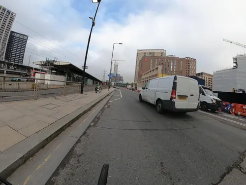
Husk Brewery & Taproom
Bar and pub · Burger · 0.4 mi
5 Silvertown Way, London
Fr 17:00-23:00; Sa 13:00-20:00; Su 14:00-23:00
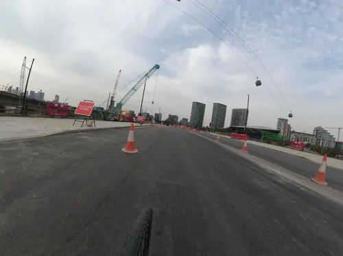
Nakhon Thai Waterfront
Restaurant · Thai · 0.5 mi
1 Dock Road, London
Mo-Fr 12:00-14:30,18:00-23:00; Sa,Su 13:00-23:00
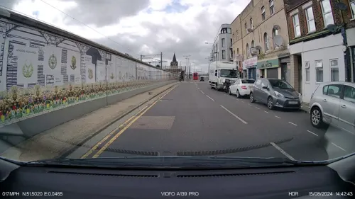
Pizzaza Pizza
Restaurant · Pizza · 1.4 mi
1 Albert Road, London
Mo-Th 12:00-23:00; Fr 15:00-23:00; Sa, Su 13:00-23:00
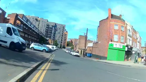

Frankie & Benny's
Diner · American · 1.0 mi
Peninsula Square, London
Mo-Th 12:00-21:00; Fr 12:00-22:00; Sa 11:00-22:00; Su 11:00-20:00

Las Iguanas
Restaurant · Mexican · 0.9 mi
27 Entertainment Avenue, London
Su-Th 12:00-23:00; Fr-Sa 12:00-24:00
Nando's
Restaurant · Chicken, Portuguese · 0.9 mi
25 Entertainment Avenue, London
Mo-Th,Su 11:30-22:00; Fr-Sa 11:30-23:00
197 more on the map.
History
Before the 19th century, the district was largely marshland, and accessible only by boat, or a toll bridge. In 1809, an Act of Parliament was passed for the construction of the Barking Road between the East India Docks and Barking. A five-span iron bridge was constructed in 1810 to carry the road across the River Lea at Bow Creek. This bridge was damaged by a collision with a collier in March 1887 and replaced by the London County Council (LCC) in 1896. This bridge was in turn replaced in 1934, at a site to the north and today's concrete flyover begun in smaller form in the 1960s, but successively modified to incorporate new road layouts for the upgraded A13 road and a feeder to the Limehouse Link tunnel, avoiding the Blackwall Tunnel. The abutments of the old iron bridge have now been utilised for the Jubilee footbridge, linking the area to Leamouth, in the London Borough of Tower Hamlets, on the western bank of the Lea.
Read more of the history
The area is thought to be named after the first Viceroy of India, Charles John Canning, who suppressed the Indian Rebellion of 1857 about the time the district expanded. The population increased rapidly after the North London Line was built from Stratford to North Woolwich, in 1846. This was built to carry coal and goods from the docks; and when the passenger station was first built it was known as Barking Road. Speculative builders constructed houses for the workers attracted by the new chemical industries established in the lower reaches of the River Lea, and for the nearby Thames Ironworks and Shipbuilding Company and Tate & Lyle refinery.
The opening of the Royal Victoria Dock in 1855 accelerated the development of the area creating employment and a need to house dock workers and their families. New settlements around the dock developed, starting with Canning Town and Hallsville (Hallsville generally being seen as part of Canning Town), and later the areas now known as Custom House and Silvertown. The new settlements lacked water supply and had no sewage system, leading to the spread of cholera and smallpox. The casual nature of employment at the docks meant poverty and squalid living conditions for many residents, and in 1857 Henry Morley wrote about the area:
"Canning Town is the child of the Victoria Docks. The condition of this place and of its neighbour prevents the steadier class of mechanics from residing in it. They go from their work to Stratford or to Plaistow. Many select such a dwelling place because they are already debased below the point of enmity to filth; poorer labourers live there, because they cannot afford to go farther, and there become debased. The Dock Company is surely, to a very great extent, answerable for the condition of the town they are creating. Not a few of the houses in it are built by poor and ignorant men who have saved a few hundred pounds, and are deluded by the prospect of a fatally cheap building investment."
The industries around the dock were often unhealthy and dangerous. As trade unions and political activists fought for better living conditions and the dock area became the centre of numerous movements with Will Thorne, James Keir Hardie and other later becoming leading figures in the Labour Party. Thorne and others worked and gave speeches at Canning Town Public Hall which had been built in 1894 as the population grew in the southern part of the borough.
From the late 19th century, a large African mariner community was established in Canning Town as a result of new shipping links to the Caribbean and West Africa. Prior to the Windrush era, Canning Town had London's largest black population of any area in London. The area around Crown Street (formerly located just north of the Royal Victoria Dock, but destroyed in the Blitz) was known as Draughtboard Alley due its ethnic mix.
Notable black people from Canning Town include footballers Fred Corbett, who played for Thames Ironworks F.C. and its successor team West Ham United; and Jack Leslie, who was called up to play for England, but then dropped without explanation, possibly due to racial prejudice.
The second black West Ham player, was another Canning Town man, John Charles. John Charles became the first black person to represent England at any level when he appeared for the Under 18s, scoring a goal in a 3-1 win over Israel.
John Charles younger brother Clive Charles also played for West Ham. In 1972 West Ham were the first top-flight team to field three Black players. Clive Charles and teammates Clyde Best and Ade Coker featured in a 3-1 home win over Tottenham Hotspur. Clive Charles would go on to manage the United States football team.
A further example of the area's long-standing multi-cultural nature is Indian-born doctor Chuni Lal Katial, who practised in Canning Town for several years from around 1929. Katial was an acquaintance of Mahatma Gandhi and invited him to meet Charlie Chaplin, one of the most famous actors in the world, at his surgery in Beckton Road. Gandhi was staying at Kingsley Hall, in nearby Bromley-by-Bow, for the three-month duration of his talks with the UK government on the future of India. Katial, a noted health pioneer, later moved to the Metropolitan Borough of Finsbury, in north London, where he became Britain's first south Asian Mayor.
In 1917 50 tons of TNT exploded at the Brunner Mond & Co ammunition work in nearby Silvertown, causing the Silvertown explosion, the largest explosion in London's history and damaging more than 70,000 buildings and killing 73 people.
From the History section of Canning Town on Wikipedia, under CC BY-SA 4.0.
More about Canning Town
Arts and culture
Thames Ironworks F.C., the works team of the nearby Ironworks, went on to become West Ham United F.C. after turning professional.
The Bridge House, a public house named for the 1887 Iron Bridge, was located at 23 Barking Road. During the 1970s and 1980s the Bridge House was a famous live-music venue and ahosted The Police, Depeche Mode, Jeff Beck, Billy Bragg, Alexis Korner, Modern Romance, Sham 69, Lindisfarne, The Cockney Rejects, Iron Maiden, Remus Down Boulevard and many other notable acts. It was demolished in 2002. A venue bearing the name The Bridge House 2 was opened in Bidder Street in January 2008.
From the Wikipedia article Canning Town, under CC BY-SA 4.0.
Notable people from Canning Town
 Mark NobleEnglish association football player (born 1987)Photo: Egghead06, CC BY-SA 4.0
 Lee BowyerEnglish association football player (born 1977)Photo: Ronnie Macdonald, CC BY 2.0
 Danny Malcom DyerEnglish actorPhoto: JaceMerlyn, CC BY-SA 4.0
 Jack Powellfootballer (born 1994)Photo: Dominic Nelson, CC BY-SA 4.0
 Perry FenwickEnglish film and television actorPhoto: Ian Smith, CC BY-SA 2.0
 Carlton LeachBritish writerPhoto: James English, CC BY 3.0
- Windsor DaviesBritish actor (1930–2019)
- Reg VarneyBritish actor (1916–2008)
- William Maddisonsailor
- Kevin HitchcockEnglish footballer (born 1962)
- Jack LeslieEnglish footballer (1901-1988)
- Alf FieldsEnglish professional footballer (1918-2011)
Born in Canning Town, according to Wikidata (CC0). Each name links to its Wikipedia article.
Where to stay28
Churches and places of worship83
Ascension Church Centre
Church · Anglican · 0.8 mi
Baxter Road, London
Shopping30
Gas and EV charging10
Schools, colleges and libraries56
Healthcare35
Map of Canning Town
250 places. The map loads OpenStreetMap tiles when you open it.
Getting there and nearby towns
London City Airport (LCY) is the nearest airport with scheduled flights listed in OpenStreetMap, 2 miles away.
- West Ham 1 mi north, about 2 min by car
- Stratford 2 mi northwest, about 3 min by car
- Charlton 2 mi southeast, about 3 min by car
- Barking 3 mi northeast, about 5 min by car
- Stepney 3 mi west, about 4 min by car
- Manor Park 3 mi northeast, about 4 min by car
- Kidbrooke 3 mi south, about 5 min by car
- Shadwell 3 mi west, about 5 min by car
- Blackheath 3 mi south, about 5 min by car
- Ilford 4 mi northeast, about 6 min by car
Drive times are estimates from straight-line distance, not routes.
Towns near Canning Town


Keep exploring
Local news
Headlines from INDB.
Reviews, tips and questions
Loading what members have shared...
Sources and licences
- GeoNames (CC BY 4.0): population, coordinates, regions and time zone
- Mapillary (see each image): photos
- OpenStreetMap contributors (ODbL 1.0): places, airports, map data
- Wikidata (CC0 1.0): elevation, founding date, time zone, website, landmarks and historic places
- Wikimedia Commons (see each image): photos
- Wikipedia (CC BY-SA 4.0): overview and history text
Photo credits
- Detached Youth Project, Canning Town, Simon from London, United Kingdom, CC BY 2.0
- Ferrier Point, McDowell Close Estate, Canning Town, Simon from London, United Kingdom, CC BY 2.0
- ArcelorMittal Orbit at night, you_only_live_twice from Lighthorne Heath, England, CC BY-SA 2.0
- Greenwichtheatre, Burnley, CC BY-SA 3.0
- Queens' Building (2899476115), Ewan Munro from London, UK, CC BY-SA 2.0
- Royal Victoria Dock Bridge, Liline sur Flickr, CC BY 2.0
- Albany Theatre in Deptford, SilkTork, CC BY-SA 3.0
- The Yard Theatre, AlexandraHC, CC BY-SA 4.0
- Thamesbarrierpark, The original uploader was Suttonpubcrawl at English Wikipedia ., Public domain
- Beckton District Park South, Dudley Miles, CC0
- Ackroyd Drive Greenlink 1, Dudley Miles, CC BY-SA 3.0
- Bartlett Park 19, Gordon Joly, CC BY-SA 2.5
- Eden Dock 2024-10-03, Matt Brown, CC BY 2.0
- Ferranti Park, London Borough of Lewisham, SE8 (2580279414), Ewan Munro from London, UK, CC BY-SA 2.0
- All Saints Poplar, Matt Brown, CC BY 2.0
- UK Londen Millennium Dome 20040921 30701, The original uploader was Debot at English Wikipedia . Later versions were uploaded by Ed g2s at en.wikipedia ., CC BY-SA 2.5
- Bow School, Hjamesberglen, CC BY-SA 4.0
- O2 Arena, Heuschrecke, CC BY-SA 3.0
- House Mill at Three Mills, Gordon Joly, CC BY-SA 2.5
- Plaque, The Gun, Coldharbour, .mw-parser-output .messagebox{margin:4px 0;width:auto;border-collapse:collapse;border:2px solid..., CC BY-SA 4.0
- Boleyn Public House Upton Park, Ewan Munro, CC BY-SA 2.0
- StAndrews2, Will O'Connell, CC BY-SA 4.0
- IMG 3951 - Copy, Will O'Connell, CC BY-SA 4.0
- Offices Opposite Clock Mill, Three Mills - 2023-08-20, The wub, CC BY-SA 4.0
- London Borough of Newham - Fairbairn Hall - 20230909130046, Lollipoplollipoplollipop, CC0
- Royal Oak, Canning Town, E16 (4738166352), Ewan Munro from London, UK, CC BY-SA 2.0
- Bromley-by-Bow Gasworks Memorial Garden - statue of Sir Corbet Woodall - 2022-03-28, The wub, CC BY-SA 4.0
- C Station, Abbey Mills Pumping Station, Malcolm, CC BY-SA 4.0
- St George and St Ethelbert, Burford Road, East Ham, Felix O, CC BY-SA 2.0
- Ascension Church Centre, Custom House 04, Simon Burchell, CC BY-SA 4.0
- Abbey Gardens, Bakers Row, Gordon Joly, CC BY-SA 4.0
- DoubleTree by Hilton Hotel London ExCel, London, Back ache, CC BY-SA 4.0
- Sunborn London Hotel (37213109065), Loco Steve from Bromley , UK, CC BY-SA 2.0
- The Gun, Coldharbour, .mw-parser-output .messagebox{margin:4px 0;width:auto;border-collapse:collapse;border:2px solid..., CC BY-SA 4.0
- O2 Arena (9499773307), Amanda Slater from Coventry, West Midlands, UK, CC BY-SA 2.0
- House Mill Three Mills Bromley-By-Bow, Mervyn Rands, CC BY-SA 4.0
- The Boleyn, East Ham, Matt Brown, CC BY 2.0
- London millennium dome 02, Ad Meskens, CC BY-SA 3.0
- PXL 20231211 114559566 Brick Lane Music Hall 1, Sourabh.biswas003, CC BY-SA 4.0
- Bow Creek Ecology Park entrance - 2022-03-28, The wub, CC BY-SA 4.0
- Deptford Park Primary School (9178176936), Reading Tom from Reading, UK, CC BY 2.0
- Street-level photo, dankarran, CC BY-SA 4.0
- Street-level photo, dankarran, CC BY-SA 4.0
- Street-level photo, rskedgell, CC BY-SA 4.0
- Street-level photo, dankarran, CC BY-SA 4.0
- Street-level photo, IpswichEdits, CC BY-SA 4.0
- Street-level photo, dankarran, CC BY-SA 4.0
- Street-level photo, dankarran, CC BY-SA 4.0
- Street-level photo, wasd42, CC BY-SA 4.0
- Street-level photo, dankarran, CC BY-SA 4.0
- Street-level photo, dankarran, CC BY-SA 4.0
- Street-level photo, wasd42, CC BY-SA 4.0
- Street-level photo, 4004, CC BY-SA 4.0
- Street-level photo, IpswichEdits, CC BY-SA 4.0
- Street-level photo, wasd42, CC BY-SA 4.0
- Street-level photo, dankarran, CC BY-SA 4.0
- Street-level photo, dankarran, CC BY-SA 4.0
- Street-level photo, wasd42, CC BY-SA 4.0
- Street-level photo, rskedgell, CC BY-SA 4.0
- Street-level photo, wasd42, CC BY-SA 4.0
- Street-level photo, wasd42, CC BY-SA 4.0
- Street-level photo, wasd42, CC BY-SA 4.0
- Street-level photo, wasd42, CC BY-SA 4.0
- Street-level photo, wasd42, CC BY-SA 4.0
- Street-level photo, wasd42, CC BY-SA 4.0
- Street-level photo, IpswichEdits, CC BY-SA 4.0


Page built November 10, 2026. Spotted a mistake? Tell us or suggest a place.