


Why visit Barking
Townapedia lists 31 museums and landmarks, 35 parks and trails, 232 places to eat, 7 places to stay and 6 attractions in and around town.
Highlights include The Broadway, Royal Victoria Dock Bridge, Eastbury Manor House and Denmark Arms.
Weather in Barking
Forecast from MET Norway (CC BY 4.0). Full forecast
About Barking
Barking is a riverside town in East London, England, within the London Borough of Barking and Dagenham. It is 9.3 miles (15 km) east of Charing Cross. The total population of Barking was 218,534 in 2021. In addition to an extensive and fairly low-density residential area, the town centre forms a large retail and commercial district, currently a focus for regeneration.
From the Wikipedia article Barking, London (this version), under CC BY-SA 4.0.
Photos of Barking

Things to do6

The Broadway
Cinema and theater
Theatre in Barking, London, England, part of Barking Town Hall



Biota!
Monument and historic site · 3.0 mi
Proposed aquarium in Docklands, London

Thames Gateway Bridge
Bridge · 1.7 mi
Proposed new crossing of the River Thames, in east London, England

Museums and landmarks31

Eastbury Manor House
Museum · 0.7 mi
Grade I listed historic house museum in London Borough of Barking and Dagenham, United Kingdom
Eastbury Square, Barking
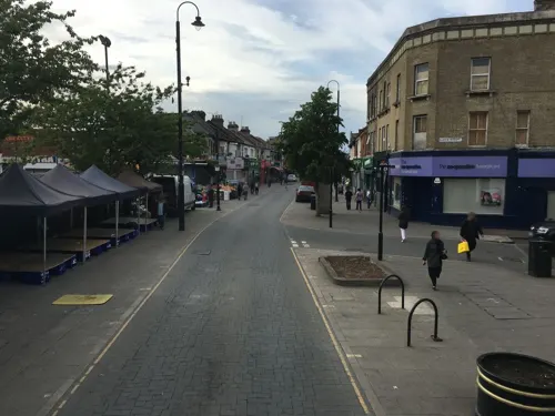
Denmark Arms
Monument and historic site · 1.3 mi
381 Barking Road, London

Old East Ham Library
Monument and historic site · 1.2 mi
High Street South, London
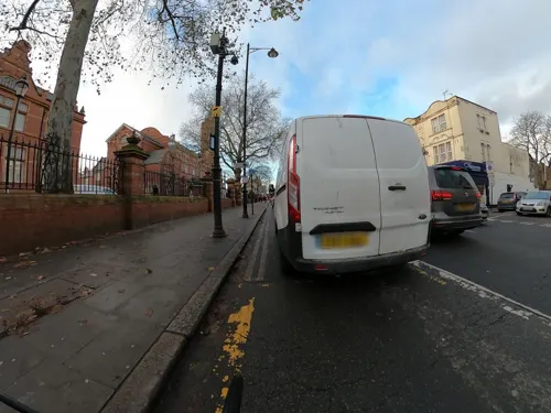
Old Tech College
Monument and historic site · 1.2 mi
Barking Road, London


Greenwich Heritage Centre
Museum · 2.8 mi
Former museum in local history resource centre in Woolwich, London, UK

North Woolwich Old Station Museum
Museum · 2.5 mi
Former railway museum in North Woolwich, London, opened 1984, closed 2008

Passmore Edwards Museum
Museum · 3.2 mi
Former museum in Stratford, East London

Royal Artillery Museum
Museum · 2.8 mi
Closed military museum in London, United Kingdom

East End Women's Museum
Museum
Women's Museum in London Barking, United Kingdom
Rothschild Mausoleum
Monument and historic site · 3.3 mi
Mausoleum in Newham, London, England, UK
19 more on the map.
Parks, trails and playgrounds35




23 more on the map.
Restaurants and cafes232
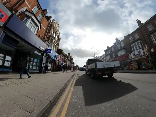
Priya Restaurant
Restaurant · Sri Lankan, Indian · 1.5 mi
209 High Street North, London
Mo-Su 11:00-00:00
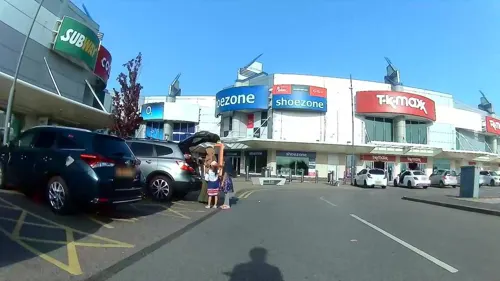
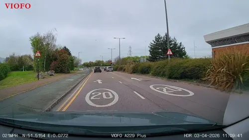
Nando's
Restaurant · Chicken, Portuguese · 1.2 mi
3 Armada Way, London
Mo-We 11:30-22:30; Th,Fr 11:30-23:00; Sa 11:30-23:00; Su 11:30-22:00


220 more on the map.
History
The name Barking came from Old English Berecingas, meaning either "the settlement of the followers or descendants of a man called Bereca" or "the settlement by the birch trees". In AD 735 the area was Berecingum and was known to mean "dwellers among the birch trees". By AD 1086, it had become Berchingae as evidenced by the manor's entry in the Domesday Book of that year.
Barking was a huge Manor (landholding), first mentioned in a charter in 735 AD (though the Abbey is believed to have been founded in 666 AD). The Manor covered the areas now known as Barking, Dagenham and Ilford. The Manor was held by the Nunnery of Barking.
The Fanshawes were a prominent local family who were lords of the manor of Barking from 1628 to 1857. They owned and lived in a number of manor houses in the borough, including Valence House, Jenkins, Parsloes and Faulks, and gifted the Leet House to the residents of Barking.
The Parishes of England were, with a few exceptions, fixed for around 700 years from the late 12th century onwards. The huge manor of Barking was served by two ancient parishes, Barking and Dagenham. This reversed the usual situation (for smaller, and even quite large manors) where a parish would serve one or more manors. As with other manors, the area held by the manor declined over time, but the parish boundaries based on its former extent remained constant.
Read more of the history
The parish of Barking covered the areas now known as Barking and Ilford. Barking was a large ancient parish of 12,307 acres (49.80 km2) in the Becontree hundred of Essex. It was divided into the wards of Chadwell, Ilford, Ripple and Town. A local board was formed for Town ward in 1882 and it was extended to cover Ripple ward in 1885. In 1888 Ilford and Chadwell were split off as a new parish of Ilford, leaving a residual parish of 3,814 acres (15.43 km2).
The parish became Barking Town Urban District in 1894 and the local board became an urban district council. The urban district was incorporated as the Municipal Borough of Barking in 1931. It was abolished in 1965 and split, with the majority merged with the former area of the Municipal Borough of Dagenham to form the London Borough of Barking. The part west of the River Roding, which included part of Beckton, became part of the London Borough of Newham. In 1980 the borough was renamed Barking and Dagenham.
The manor of Barking was the site of Barking Abbey, a nunnery founded in 666 by Eorcenwald, Bishop of London, destroyed by the Danes and reconstructed in 970 by King Edgar. The celebrated writer Marie de France may have been abbess of the nunnery in the late 12th century. At the dissolution of the monasteries in 1536, Barking Abbey was demolished; the parish church of St Margaret, some walling and foundations are all that remain. The parish church is an example of Norman architecture; Captain James Cook married Elizabeth Batts of Shadwell there in 1762, and it is the burial place of many members of the Fanshawe family of Parsloes Manor.
A charter issued between 1175 and 1179 confirms the ancient market right. The market declined in the 18th century but has since been revived.
St Margaret's Church is a grade I listed building in the Abbey Green area of the Town Centre, dating back to the 13th century. It is built within the grounds of Barking Abbey, a former royal monastery, whose ruins are recognisable for its partially restored Grade-II* Listed Curfew Tower, which features on the coat of arms of the London Borough of Barking and Dagenham.
Eastbury Manor House in Barking is a Grade I listed 16th century Elizabethan manor house and museum run by the National Trust.
Fishing was the most important industry from the 14th until the mid-19th centuries. Salt water fishing began before 1320, when too fine nets were seized by City authorities, but expanded greatly from the 16th century. Fisher Street (now the southern part of Abbey Road) was named after the fishing community there. From about 1775 welled and dry smacks were used, mostly as cod boats, and rigged as gaff cutters. Fishermen sailed as far as Iceland in the summer. They served Billingsgate Fish Market in the City of London, and moored in Barking Pool. Scymgeour Hewett, born on 7 December 1797, founded the Short Blue Fleet (England's biggest fishing fleet) based in Barking, using smacks out of Barking and east coast ports. Around 1870 this fleet changed to gaff ketches that stayed out at sea for months; to preserve the fish they used ice produced by flooding local fields in winter. Fleeting involved fish being ferried from fishing smacks to gaff cutters by little wooden ferry-boats. The rowers had to stand, as the boats were piled high with fish boxes. Rowers refused to wear their bulky cork lifejackets because it slowed down their rowing. At first the fast 50-foot gaff cutters with great booms projecting beyond the sterns raced the fish to port to get the best prices.
Until about 1870 the trade was mostly in live fish, using welled smacks in which the central section of the hull, between two watertight bulkheads, was pierced to create a 'well' in which seawater could circulate. Cod caught live were lowered into this well, with their swim bladders pierced, and remained alive until the vessel returned to port, when they were transferred to semi-submerged 'chests', effectively cages, which kept them alive until they were ready for sale. At this point they were pulled out and killed with a blow on the head before being despatched to market, where because of their freshness they commanded a high price. People who practised this method of fishing were known as 'codbangers'.
From the History section of Barking, London on Wikipedia, under CC BY-SA 4.0.
More about Barking
Geography
Barking is located 9.3 miles (15 km) east of Charing Cross in Central London. It is bordered by Ilford to the north, Dagenham to the east and East Ham to the west.
Barking Town Centre is being regenerated through a number of schemes. It is one of the most deprived areas of Barking. The Abbey and Gascoigne wards in the town centre are ranked 823rd and 554th respectively - within the 10% most deprived wards in the country.
The regeneration aims to achieve a more sustainable economy by investing in new quality retail outlets and creating a business centre; and to widen employment prospects, mainly by creating new "retail and business accommodation", to increase the income of both existing and new residents. The regeneration also aims to improve people's skills. This is mainly achieved through the Barking Learning Centre, which aims to improve literacy, numeracy and other basic skills people may be lacking due to a previous lack of educational development. It currently acts as a borough-based learning facility. It was officially opened on 10 June 2008 by John Denham, Secretary of State for Innovation, Universities and Skills.
Arts and culture
Neil Young recorded two tracks for his classic album Harvest, "A Man Needs a Maid" and "There's a World" with the London Symphony Orchestra at Barking Assembly Hall (now the Broadway theatre), released in 1972.
Electronic band Underworld named their 2010 album Barking after the town. The band are associated with nearby Romford. The artist Ramz wrote a song called "Barking" in 2017.
Bedrock is the local hospital radio service available online to the local area and broadcasting a range of health-related information focused on the local King George Hospital in Goodmayes and Queen's Hospital in Romford.
The Barking & Dagenham Post provides local news in print and online.
Barking F.C. are a non-league side. The team merged with East Ham F.C. to form Barking & East Ham United in 2001. This club later struggled and went out of business, but Barking F.C. was later reformed once again. Barking RFC are the town's rugby union team. Cricket, basketball and hockey are also popular sports in the area. A Parkrun takes place in Barking Park.
Barking Town Centre has a number of recently commissioned sculptures and public art works.
In 2007, two small stones from remains of the medieval London Bridge were joined in a sculpture in front of St Margaret's church facing the Barking Abbey ruins as part of several public artworks placed in Barking Town Centre by artist Joost Van Santen.
Education
Primary schools include Northbury Primary School, Eastbury Primary School, St Margaret's Church of England and St Joseph's Roman Catholic.
Secondary schools include Barking Abbey School. Lady Aisha Academy is an independent Muslim Girls Secondary School which opened in September 2011 on Victoria Road.
From the Wikipedia article Barking, London, under CC BY-SA 4.0.
Notable people from Barking
 John TerryEnglish association football player (born 1980)Photo: ChristopherJClarke, CC BY-SA 4.0
 Bobby MooreEnglish association football player (1941–1993)Photo: Unknown author Unknown author, Public domain
 Bobby ZamoraEnglish association football player (born 1981)Photo: Timmy96, CC0
 Trevor BrookingEnglish association football player (born 1948)Photo: Egghead06, CC BY-SA 4.0
 Paul KoncheskyEnglish association football player (born 1981)Photo: Ben Sutherland from Crystal Palace,..., CC BY 2.0
 Billy BraggEnglish musician and activist (born 1957)Photo: Ben Sutherland, CC BY 2.0
 Giles BarnesEnglish-Jamaican footballerPhoto: Nbrooks503, CC BY-SA 3.0
 Ross KempEnglish actor, author and journalistPhoto: Damien Everett from Southampton, UK, CC BY 2.0
 Anne-Marie ImafidonBritish-Nigerian child prodigy and STEM activist (born 1990)Photo: Doc Searls, CC BY 2.0
 Leeroy ThornhillBritish musicianPhoto: Elena Sadchikova, CC BY-SA 4.0
- Dean MarneyEnglish association football player (born 1984)
- Dan PottsEnglish association football player
Born in Barking, according to Wikidata (CC0). Each name links to its Wikipedia article.
Where to stay7
Churches and places of worship106
Church of St. Mary the Virgin
Church · Anglican · 1.5 mi
St Mary's Approach, London
St Barnabas Parish Church
Church · Anglican · 1.4 mi
Browning Road, London
Shopping34
Gas and EV charging10
Schools, colleges and libraries46
Healthcare25
Map of Barking
250 places. The map loads OpenStreetMap tiles when you open it.
Getting there and nearby towns
London City Airport (LCY) is the nearest airport with scheduled flights listed in OpenStreetMap, 2 miles away.
- Ilford 2 mi north, about 3 min by car
- Dagenham 4 mi east, about 6 min by car
- Walthamstow 6 mi northwest, about 10 min by car
- Bexley 7 mi southeast, about 11 min by car
- Islington 8 mi west, about 13 min by car
- Tottenham 8 mi northwest, about 13 min by car
- London 9 mi west, about 15 min by car
- City of Westminster 10 mi west, about 16 min by car
- Enfield Town 11 mi northwest, about 18 min by car
- Croydon 13 mi southwest, about 21 min by car
Drive times are estimates from straight-line distance, not routes.
Towns near Barking


Keep exploring
Local news
Headlines from INDB.
Reviews, tips and questions
Loading what members have shared...
Sources and licences
- GeoNames (CC BY 4.0): population, coordinates, regions and time zone
- Mapillary (see each image): photos
- OpenStreetMap contributors (ODbL 1.0): places, airports, map data
- Wikidata (CC0 1.0): elevation, founding date, time zone, website, landmarks and historic places
- Wikimedia Commons (see each image): photos
- Wikipedia (CC BY-SA 4.0): overview and history text
Photo credits
- Celestial Church of Christ, St Edwards Road, Barking, Simon from London, United Kingdom, CC BY 2.0
- Victoria, Barking, IG11 (19233705856), Ewan Munro from London, UK, CC BY-SA 2.0
- Asbestos memorial, Barking Town Square, Matt Brown, CC BY 4.0
- Royal Victoria Dock Bridge, Liline sur Flickr, CC BY 2.0
- Eastbury Manor House, Gordon Joly, CC BY 2.5
- Flickr - davehighbury - Royal Arsenal Woolwich London 039 (cropped), DAVID HOLT from London, England, CC BY-SA 2.0
- Passmore Edwards Museum September 2017, Akasapriya, CC BY-SA 4.0
- Greatfields Park (18843012584), Matt Brown from London, England, CC BY 2.0
- Beckton District Park South, Dudley Miles, CC0
- South Park, Ilford (2012-06-21), Thebrid, CC BY-SA 3.0
- Thamesbarrierpark, The original uploader was Suttonpubcrawl at English Wikipedia ., Public domain
- Barking abbey curfew tower london, MRSC at English Wikipedia, Public domain
- East Ham station, Ewan Munro, CC BY-SA 2.0
- Mayesbrook Park 2, Dudley Miles, CC BY-SA 3.0
- St. Barnabas Church, Manor Park. Exterior, James Ramsay, CC BY 4.0
- East Ham Library (3625604368), JuliaC2006 from Rochester, UK, CC BY 2.0
- London Borough of Newham - Dukes Head Public House - 20230404153210, Hjamesberglen, CC BY-SA 4.0
- London Borough of Barking and Dagenham - Barking Baptist Tabernacle - 20230404140145, Hjamesberglen, CC BY-SA 4.0
- East Ham War Memorial, James Petts, CC BY-SA 2.0
- Ripple Nature Reserve silver birches, Dudley Miles, CC BY-SA 3.0
- Southeast View of the Church of Saint Mary, Little Ilford, Doyle of London, CC BY-SA 4.0
- Dover Rd, Aldersbrook, Andertpj, CC BY-SA 4.0
- Urban Porn (30512272213), Tee Cee from East London, UK, CC BY 2.0
- Broadway, Barking, IG11 (4497643932), Ewan Munro from London, UK, CC BY-SA 2.0
- The Beckton Alps, Loz Pycock, CC BY-SA 2.0
- London, North Woolwich Old Station Museum 01, Kleon3, CC BY-SA 4.0
- Flickr - davehighbury - Royal Artillery Museum Woolwich London 158, DAVID HOLT from London, England, CC BY-SA 2.0
- Barking Park, Simon from London, United Kingdom, CC BY 2.0
- Street-level photo, dankarran, CC BY-SA 4.0
- Street-level photo, dankarran, CC BY-SA 4.0
- Street-level photo, dankarran, CC BY-SA 4.0
- Street-level photo, dankarran, CC BY-SA 4.0
- Street-level photo, wasd42, CC BY-SA 4.0
- Street-level photo, wasd42, CC BY-SA 4.0
- Street-level photo, dankarran, CC BY-SA 4.0
- Street-level photo, RyanBush, CC BY-SA 4.0
- Street-level photo, dankarran, CC BY-SA 4.0
- Street-level photo, dankarran, CC BY-SA 4.0
- Street-level photo, dankarran, CC BY-SA 4.0
- Street-level photo, dankarran, CC BY-SA 4.0
- Street-level photo, IpswichEdits, CC BY-SA 4.0
- Street-level photo, dankarran, CC BY-SA 4.0
- Street-level photo, wasd42, CC BY-SA 4.0
- Street-level photo, IpswichEdits, CC BY-SA 4.0
- Street-level photo, IpswichEdits, CC BY-SA 4.0
- Street-level photo, southglos, CC BY-SA 4.0
- Street-level photo, rskedgell, CC BY-SA 4.0
- Street-level photo, rskedgell, CC BY-SA 4.0
- Street-level photo, rskedgell, CC BY-SA 4.0
- Street-level photo, rskedgell, CC BY-SA 4.0
- Street-level photo, dankarran, CC BY-SA 4.0
- Street-level photo, dankarran, CC BY-SA 4.0
- Street-level photo, RyanBush, CC BY-SA 4.0
- Street-level photo, gness, CC BY-SA 4.0
- Street-level photo, dankarran, CC BY-SA 4.0
- Street-level photo, gness, CC BY-SA 4.0
- Street-level photo, dankarran, CC BY-SA 4.0
- Street-level photo, dankarran, CC BY-SA 4.0
- Street-level photo, dankarran, CC BY-SA 4.0


Page built November 10, 2026. Spotted a mistake? Tell us or suggest a place.