


Stratford, United Kingdom
Stratford is a town of 36,666 people in England, United Kingdom.
Why visit Stratford
Townapedia lists 116 museums and landmarks, 90 parks and trails, 149 places to eat, 30 places to stay and 18 attractions in and around town.
Highlights include Stratford East, Vue Westfield Stratford City, House Mill and The Westbridge Hotel.
Weather in Stratford
Forecast from MET Norway (CC BY 4.0). Full forecast
About Stratford
Stratford is a town and district of East London, England, in the London Borough of Newham. Part of the Lower Lea Valley, it is six miles (ten kilometres) northeast of Charing Cross, and includes Maryland and East Village.
From the Wikipedia article Stratford, London (this version), under CC BY-SA 4.0.
Photos of Stratford


Things to do18


Half Moon Theatre
Cinema and theater · 2.1 mi
Theatre company in London


Queens' Building
Cinema and theater · 1.9 mi
Building in Mile End Road, London, England, formerly the People's Palace, including a theatre and music hall

Wilton's Music Hall
Cinema and theater · 3.3 mi
Music hall in Whitechapel, Tower Hamlets, London, England, UK

Britannia Theatre
Cinema and theater · 3.2 mi
Former theatre in Hoxton, London, England (1841–1900), later a cinema (1913–1940)
Chisenhale Dance Space
Cinema and theater · 1.7 mi
Dance venue in Tower Hamlets, London, England
Garrick Theatre
Cinema and theater · 3.3 mi
Former theatre in Leman Street, Whitechapel, London, operating 1831-c.1881
Goodman's Fields Theatre
Cinema and theater · 3.3 mi
Several 18th-century theatres in London
6 more on the map.
Museums and landmarks116

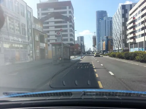
The Westbridge Hotel
Monument and historic site
Former pub, that has been redeveloped (listed building)
335-337 High Street
24/7

V&A East Storehouse
Museum · 1.3 mi
Parkes Street, London
PH,Mo-Su 10:00-18:00; Th,Sa 10:00-22:00; Dec 24-26 off

The Miller's House
Monument and historic site · 0.5 mi
Offices opposite Clock Mill
Three Mill Lane, London

Abbey Mills Pumping Station (Station C)
Monument and historic site
C Station, with associated valve house, Abbey Mills Pumping Station

ArcelorMittal Orbit
Monument and historic site · 0.7 mi


Gurney Memorial
Monument and historic site · 0.5 mi
Gurney Memorial Drinking Fountain


116-130, Abbey Lane E15
Monument and historic site
Listed status is for 116-130 Abbey Lane

104 more on the map.
Parks, trails and playgrounds90


Ackroyd Drive Greenlink
Park · 1.6 mi
Local nature reserve in the London Borough of Tower Hamlets, England, UK


Bartlett Park
Park · 1.6 mi
Park in the London Borough of Tower Hamlets


Island Gardens
Park · 3.2 mi
Public park in the London Borough of Tower Hamlets


West Ham Park
Park · 0.9 mi
Jan,Nov,Dec: 07:30-16:30; Feb: 07:30-17:30; Mar,Oct: 07:30-18:30;...
78 more on the map.
Restaurants and cafes149

The Lord Tredegar
Bar and pub · 1.5 mi
50 Lichfield Road, London
Mo-Th 16:00-23:00; Fr-Sa 12:00-24:00; Su 12:00-22:00
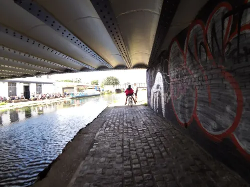
Crate Brewery & Pizza
Bar and pub · Pizza · 1.2 mi
43 White Post Lane, London
Mo-Th,Su 12:00-23:00; Fr-Sa 12:00-01:00


Barge East
Restaurant · British · 1.1 mi
White Post Lane, London
Mo,Tu off, We,Th 16:00-23:00, Fr,Sa 12:00-24:00, Su 12:00-22:30
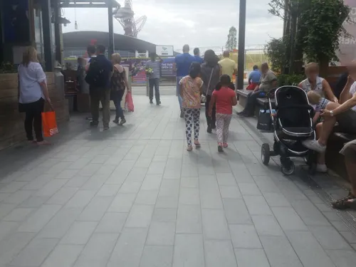
Cabana
Restaurant · Brazilian · 0.7 mi
5 Montfichet Road, London
Mo 12:00-21:00; Tu-Th 12:00-22:00; Fr 12:00-22:30; Sa 11:30-22:30;...
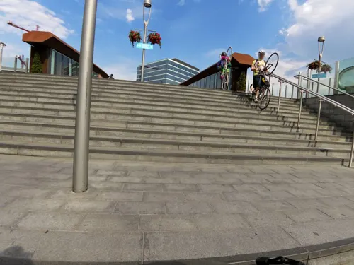
Caffè Nero
Cafe · Coffee Shop · 0.6 mi
Station Street, London
Mo-Fr 06:00-21:00; Sa 06:30-19:00; Su 06:30-18:00
G. Kelly
Restaurant · Pie And Mash · 1.4 mi
526 Roman Road, London
Su-Mo 11:00-16:00; Tu-Th 11:00-18:00; Fr-Sa 10:00-19:00

Calabash
Restaurant · Caribbean · 0.7 mi
22 Vicarage Lane, London
Mo-Th, Sa 09:00-20:00; Fr 09:00-22:00; Su 12:00-20:00
Darkhorse
Restaurant · European · 1.1 mi
16-19 Victory Parade, London
Tu-Th 11:00-23:00; Fr-Sa 10:00-24:00; Su 10:00-18:00
137 more on the map.
History
Stratford's early significance was due to a Roman road (later known as the Great Essex Road) running from Aldgate in the City, across the River Lea, to Romford, Chelmsford and Colchester. At that time the various branches of the river were tidal and without channels, while the marshes surrounding them had yet to be drained. The Lea Valley formed a natural boundary between Essex on the eastern bank and Middlesex on the west, and was a formidable obstacle to overland trade and travel.
The name is first recorded in 1067 as Strætforda and means 'ford on a Roman road'. It is formed from Old English 'stræt' (in modern English 'street') and 'ford'. The former river crossing lay at an uncertain location north of Stratford High Street.
The district of Old Ford in northern Bow – west of the Lea – is named after the former crossing, while Bow itself was also initially named Stratford, after the same ford, and a variety of suffixes were used to distinguish the two distinct settlements, including Stratford-le-Bow.
Read more of the history
The settlement to the east of the Lea was also known as Estratford (recorded in 1291), referring to the location east of the other Stratford, Statford Hamme (recorded in 1312) alluding to the location within the parish of West Ham, Abbei Stratford, referring to the presence of Stratford Langthorne Abbey, and Stretford Langthorne (recorded in 1366) after a distinctive thorn tree (possibly a pollarded Hawthorn) which stood in the area. The thorn tree itself, was mentioned much earlier, in a charter of the Manor of Ham, in 958 AD. The tree is thought to have stood in the vicinity of the modern Channel Sea rail junction, around 200 metres north-north-west of the London Aquatics Centre.
In 1110 Matilda, wife of Henry I, ordered a distinctively bow-shaped (arched) bridge to be built over the River Lea, together with a causeway across the marshes along the line now occupied by Stratford High Street. Reports state she (or her retinue) encountered problems crossing the river to get to Barking Abbey.
The western Stratford then become suffixed by "-atte-Bow" (at the Bow), eventually became known simply as Bow, while over time the eastern Stratford lost its "Langthorne" suffix.
The bridge was repaired and upgraded many times over the centuries until eventually demolished and replaced in the 19th century.
In 1135 the Cistercian Order founded Stratford Langthorne Abbey, also known as West Ham Abbey. This became one of the largest and most wealthy monasteries in England, owning 1,500 acres (610 hectares) in the immediate area and 20 manors throughout Essex.
The Abbey lay between the Channelsea River and Marsh Lane (Manor Road). Nothing visible remains on the site, as after its dissolution by Henry VIII in 1538, local landowners took away much of the stone for their own buildings and the land was subsequently urbanised.
A stone window and a carving featuring skulls – thought to have been over the door to the charnel house – remain in All Saints Church, West Ham (dating from about 1180). The Great Gate of the abbey survived in Baker's Row until 1825.
The doorway to the Old Court House, in Tramway Avenue (Stratford), displays the Abbey's coat of arms. The chevrons from this device, originally from the arms of the Mountfitchet family, together with an abbot's crozier were incorporated into the arms of the former County Borough of West Ham in 1887. The new London Borough of Newham adopted the same arms in 1965.
The industrialisation of Stratford started slowly and accelerated rapidly in the early Victorian era.
The Stratford and national experience of the Industrial Revolution inspired scenes in the 2012 Olympic Opening Ceremony covering the traumatic transition from a 'Green and Pleasant Land' to the 'Pandemonium' of the revolution and the huge social and economic changes it brought. The level of industrialisation experienced by the parish and borough of West Ham led to it becoming known as the Factory centre of the south of England. Stratford was the base the greatest concentration of manufacturing activity within West Ham.
Stratford was originally an agricultural community, whose proximity to London provided a ready market for its produce. By the 18th century, the area around Stratford was noted for potato growing, a business that continued into the mid-1800s. Stratford also became a desirable country retreat for wealthy merchants and financiers, within an easy ride of the City. When Daniel Defoe visited Stratford in 1722, he reported it had "...increased in buildings to a strange degree, within the compass of about 20 or 30 years past at the most". He continues that "...this increase is, generally speaking, of hansom large houses... being chiefly for the habitations of the richest citizens, such as either are able to keep two houses, one in the country, and one in the city; or for such citizens as being rich, and having left off trade, live altogether in these neighbouring villages, for the pleasure and health of the latter part of their days".
An early industrial undertaking at Stratford was the Bow porcelain factory, which despite the name, was on the Essex side of the River Lea. Using a process that was patented in 1744, Edward Heylin and Thomas Frye operated a factory near Bow Bridge called "New Canton" to produce some of the first soft-paste porcelain to be made in the country. The site of the factory was to the north of Stratford High Street near the modern Bow Flyover; it was the subject of archaeological excavations in 1921 and 1969.
The Victorian era saw growth hugely accelerated by three major factors: the Metropolitan Buildings Act 1844, the arrival of the railway and the creation of the nearby Royal Docks.
From the History section of Stratford, London on Wikipedia, under CC BY-SA 4.0.
More about Stratford
Economy
Stratford's shopping centres, the Stratford Centre and the recently opened (2011) Westfield Stratford City, are on either side of Stratford station. Westfield Stratford City, home to 350 stores, is one of the largest shopping centres in Europe. The older centre
has a range of accessibly priced stores, its indoor and outdoor market stalls, and the 'inshops' network of small retail outlets. The centre occupies much of the 'island site' created in the 1960s by the surrounding gyratory traffic system.
Stratford has been a focus of regeneration for some years as the local economy has grown, and is the location of a number of major projects.
Education
The University of East London (UEL) has a major campus in Stratford, whose main building, University House, is a historic listed building dating from the 19th century. The adjacent Passmore Edwards Building is also one of the area's most historic and beautiful buildings, with colourful frescoes and domed roof. In addition, Birkbeck College, part of the University of London, has launched courses in the area, initially using space provided by UEL, with a view to constructing its own campus in Stratford. In 2023, two universities opened new campuses on the Olympic park, with the London College of Fashion, part of University of the Arts London, relocating to Stratford, and University College London opening its new UCL East campus.
Newham College of Further Education is a further education college that has a campus in Stratford which opened in 1993 with Stratford as it secondary educational teaching site. In April 2016 the college announced a strategic alliance with University of East London.
academy in the Stratford neighbourhood of East Village and is run by the Harris Federation which opened in September 2013. It is classed as an education campus and comprises a nursery, primary and secondary school, sixth form and adult learning facility.
From the Wikipedia article Stratford, London, under CC BY-SA 4.0.
Notable people from Stratford
 Michael NymanEnglish composer of minimalist music, pianist, librettist and musicologistPhoto: Anton V. Shpigunov, CC BY-SA 4.0
 Chris HughtonIrish association football player and manager (born 1958)Photo: James Boyes from UK, CC BY 2.0
 Sam BrownEnglish musician (born 1964)Photo: Threefoursixninefour at English Wikipedia, CC BY-SA 3.0
 George EdwardsEnglish naturalist and ornithologist (1694 – 1773)Photo: Engraving by John Miller after a..., Public domain
 Lancey FouxBritish rapper and singerPhoto: Vrthrn, CC BY-SA 4.0
 Emmanuel AdebowaleEnglish association football playerPhoto: James Boyes, CC BY 2.0
 William Raymond DommersenBritish painter (1859–1927)Photo: William Raymond Dommersen (1859-1927), Public domain
- Gerard Manley HopkinsEnglish poet (1844–1889)
- Bryan ForbesEnglish film director, screenwriter and actor (1926–2013)
- Charles BugbeeBritish water polo player
- Jimmy WinstonBritish musician (1945–2020)
- Albert BarrettEnglish footballer (1903–1989)
Born in Stratford, according to Wikidata (CC0). Each name links to its Wikipedia article.
Where to stay30
Churches and places of worship75
Saint Antony's Church
Church · Roman Catholic · 1.2 mi
56 St Antony's Road, London
Shopping76
Gas and EV charging13
Schools, colleges and libraries41
Healthcare38
Map of Stratford
250 places. The map loads OpenStreetMap tiles when you open it.
Getting there and nearby towns
London City Airport (LCY) is the nearest airport with scheduled flights listed in OpenStreetMap, 3 miles away.
- West Ham 1 mi east, about 1 min by car
- Leyton 2 mi north, about 3 min by car
- Stepney 2 mi southwest, about 3 min by car
- Manor Park 2 mi northeast, about 4 min by car
- Shadwell 3 mi southwest, about 5 min by car
- Wanstead 3 mi north, about 5 min by car
- Barking 4 mi east, about 6 min by car
- Ilford 4 mi northeast, about 6 min by car
- Walthamstow 4 mi north, about 7 min by car
- Snaresbrook 4 mi north, about 6 min by car
Drive times are estimates from straight-line distance, not routes.
Towns near Stratford


Keep exploring
Local news
Headlines from INDB.
Reviews, tips and questions
Loading what members have shared...
Sources and licences
- GeoNames (CC BY 4.0): population, coordinates, regions and time zone
- Mapillary (see each image): photos
- OpenStreetMap contributors (ODbL 1.0): places, airports, map data
- Wikidata (CC0 1.0): elevation, founding date, time zone, website, landmarks and historic places
- Wikimedia Commons (see each image): photos
- Wikipedia (CC BY-SA 4.0): overview and history text
Photo credits
- HE1080991 Old Town Hall Stratford (1), Katie Chan, CC BY-SA 4.0
- Stratford Market Depot 14, mattbuck4950, CC BY-SA 2.0
- Stratford Market Depot 15, mattbuck4950, CC BY-SA 2.0
- Stratford Market Depot 09, mattbuck4950, CC BY-SA 2.0
- Stratford Market Depot 13, mattbuck4950, CC BY-SA 2.0
- Stratford Market Depot 10, mattbuck4950, CC BY-SA 2.0
- Interior of Stratford Market Depot on the Jubilee Line, Matt Buck, CC BY-SA 2.0
- Stratford Market Depot 11, mattbuck4950, CC BY-SA 2.0
- Stratford Market Depot 12, mattbuck4950, CC BY-SA 2.0
- Interior of Stratford Market Depot, Matt Buck, CC BY-SA 2.0
- Stratford Market Depot 08, mattbuck4950, CC BY-SA 2.0
- Stratford Market Depot 07, mattbuck4950, CC BY-SA 2.0
- Stratford Market Depot 03, mattbuck4950, CC BY-SA 2.0
- Stratford Market Depot 02, mattbuck4950, CC BY-SA 2.0
- Stratford Market Depot 01, mattbuck4950, CC BY-SA 2.0
- Stratford Market Depot 04, mattbuck4950, CC BY-SA 2.0
- Stratford Market Depot 05, mattbuck4950, CC BY-SA 2.0
- Half Moon, Stepney, E1 (3171916542), Ewan Munro from London, UK, CC BY-SA 2.0
- Princess of wales lea bridge 1, Tarquin Binary, CC BY-SA 2.5
- Queens' Building (2899476115), Ewan Munro from London, UK, CC BY-SA 2.0
- Ackroyd Drive Greenlink 1, Dudley Miles, CC BY-SA 3.0
- Alta Ali Park, Back_ache, CC BY-SA 4.0
- Bartlett Park 19, Gordon Joly, CC BY-SA 2.5
- Haggerston park 1, Tarquin Binary, CC BY-SA 2.5
- King Edward Memorial Park 9deeb76c78 o, Gordon Joly, CC BY-SA 3.0
- Olympic Park, London, 16 April 2012, EG Focus, CC BY 2.0
- ArcelorMittal Orbit at night, you_only_live_twice from Lighthorne Heath, England, CC BY-SA 2.0
- London Velopark, 16 April 2012, EG Focus, CC BY 2.0
- Bobspark, Unknown author, CC BY-SA 2.5
- Bow Church 2008, Gordon Joly, CC BY-SA 4.0
- House Mill at Three Mills, Gordon Joly, CC BY-SA 2.5
- St Bon's Black Badge, PaulHalliwell, CC BY-SA 3.0
- St Paul Old Ford, Ekphraster, CC BY-SA 3.0
- London 2012 Olympic Stratford Centre 219 (7683058764), DAVID HOLT from London, England, CC BY-SA 2.0
- King Edward VII, Stratford, E15 (7419175430), Ewan Munro from London, UK, CC BY-SA 2.0
- Lord Tredegar, Bow, E3 (3543064903), Ewan Munro from London, UK, CC BY-SA 2.0
- StAndrews2, Will O'Connell, CC BY-SA 4.0
- Offices Opposite Clock Mill, Three Mills - 2023-08-20, The wub, CC BY-SA 4.0
- London Borough of Newham - Fairbairn Hall - 20230909130046, Lollipoplollipoplollipop, CC0
- St John's Stratford, Pedleysd ( talk )., Public domain
- Emmanuel Church, Forest Gate, David Anstiss, CC BY-SA 2.0
- Royal Oak, Canning Town, E16 (4738166352), Ewan Munro from London, UK, CC BY-SA 2.0
- Gurney Memorial Drinking Fountain, Stratford, David Anstiss, CC BY-SA 2.0
- C Station, Abbey Mills Pumping Station, Malcolm, CC BY-SA 4.0
- Joseph Westwood (1818-1883) memorial, Tower Hamlets Cemetery Park 01, Edwardx, CC BY-SA 4.0
- Abbey Gardens, Bakers Row, Gordon Joly, CC BY-SA 4.0
- Westfield Cinema, Stratford, London (7180812938), Berit from Redhill/Surrey, UK, CC BY 2.0
- Bobby Moore Academy (Secondary) 2022-03-19, The wub, CC BY-SA 4.0
- Goldengrove pub, Stratford, The wub, CC BY-SA 4.0
- St Francis of Assisi Church, Stratford by P L Kessler, P L Kessler / The History Files (www.historyfiles.co.uk), reproduced with permission, CC BY-SA 4.0
- V&A East Storehouse exterior 2025-08-17 (2), The wub, CC BY-SA 4.0
- Front of Theatre Royal Stratford East by Richard Davenport, Sbrooks91, CC BY-SA 4.0
- Bow Creek Ecology Park, Matthew Black, CC BY-SA 2.0
- Wilton's Music Hall, London 03, Paul the Archivist, CC BY-SA 4.0
- Island Gardens 2025-03-27, Matt Brown, CC BY 2.0
- Barge East, Hackney Wick, E9, Ewan-M, CC BY-SA 4.0
- Street-level photo, smsm1, CC BY-SA 4.0
- Street-level photo, matth81, CC BY-SA 4.0
- Street-level photo, smsm1, CC BY-SA 4.0
- Street-level photo, matth81, CC BY-SA 4.0
- Street-level photo, rskedgell, CC BY-SA 4.0
- Street-level photo, zymurgic, CC BY-SA 4.0
- Street-level photo, dankarran, CC BY-SA 4.0
- Street-level photo, rskedgell, CC BY-SA 4.0
- Street-level photo, matth81, CC BY-SA 4.0
- Street-level photo, rskedgell, CC BY-SA 4.0
- Street-level photo, smsm1, CC BY-SA 4.0
- Street-level photo, smsm1, CC BY-SA 4.0
- Street-level photo, matth81, CC BY-SA 4.0
- Street-level photo, matth81, CC BY-SA 4.0
- Street-level photo, matth81, CC BY-SA 4.0
- Street-level photo, matth81, CC BY-SA 4.0
- Street-level photo, rskedgell, CC BY-SA 4.0
- Street-level photo, dankarran, CC BY-SA 4.0
- Street-level photo, rskedgell, CC BY-SA 4.0
- Street-level photo, rskedgell, CC BY-SA 4.0
- Street-level photo, matth81, CC BY-SA 4.0
- Street-level photo, matthewitt, CC BY-SA 4.0
- Street-level photo, dankarran, CC BY-SA 4.0
- Street-level photo, dankarran, CC BY-SA 4.0
- Street-level photo, rskedgell, CC BY-SA 4.0
- Street-level photo, zymurgic, CC BY-SA 4.0
- Street-level photo, dankarran, CC BY-SA 4.0
- Street-level photo, rskedgell, CC BY-SA 4.0
- Street-level photo, smsm1, CC BY-SA 4.0


Page built November 10, 2026. Spotted a mistake? Tell us or suggest a place.