


Carmunnock, United Kingdom
Carmunnock is a town of 1,250 people in Scotland, United Kingdom.
Why visit Carmunnock
Townapedia lists 17 museums and landmarks, 32 parks and trails, 18 places to eat, 2 places to stay and 4 attractions in and around town.
Highlights include National Museum of Rural Life, Scottish Football Museum, Linn Park and Cambuslang Park.
Weather in Carmunnock
Forecast from MET Norway (CC BY 4.0). Full forecast
About Carmunnock
Carmunnock (; Scottish Gaelic: Cair Mhanach or Corr Mhanach) is a conservation village situated within the Glasgow City council area, lying within three miles (five kilometres) of East Kilbride and Rutherglen in South Lanarkshire and Busby in East Renfrewshire. The nearest other district within Glasgow is Castlemilk.
From the Wikipedia article Carmunnock (this version), under CC BY-SA 4.0.
Photos of Carmunnock


Things to do4

Museums and landmarks17
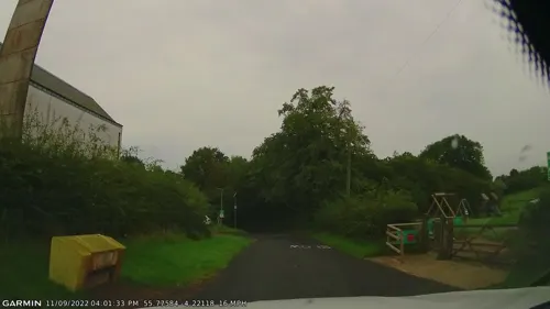
National Museum of Rural Life
Museum · 1.2 mi
National museum in South Lanarkshire, Scotland, UK
Philipshill Road, East Kilbride
Mo-Su 10:00-17:00

Scottish Football Museum
Museum · 2.5 mi
Museum in Glasgow, Scotland, United Kingdom

5 more on the map.
Parks, trails and playgrounds32


Overtoun Park
Park · 2.3 mi
Park in Rutherglen, near Glasgow, Scotland


Rouken Glen
Park · 3.2 mi
Park in Giffnock, East Renfrewshire, Scotland, UK

Holmhills Community Park
Park · 2.8 mi
Park in Cambuslang, South Lanarkshire, Scotland, UK
Overlee Playing Fields
Park · 1.3 mi
Public park in East Renfrewshire, Scotland, UK
Peel Park
Park · 1.6 mi
Business park in East Kilbride, South Lanarkshire, Scotland, UK


20 more on the map.
Restaurants and cafes18



6 more on the map.
History
This ancient settlement which is associated with the early Christian missionary Saint Cadoc, has a medieval street plan set within the lands of an estate held by variously the Morays of Bothwell, the Earls of Douglas and eventually to the Lords, Marquesses and Dukes of Hamilton until 1700 when it passed to the Stuarts of Castlemilk.
There are many cottages in the village that date back to the 1600s, and it is the last remaining village situated within the Glasgow City council area.
The World's Strongest Man competition started life in a garage in the village.
From the History section of Carmunnock on Wikipedia, under CC BY-SA 4.0.
Notable people from Carmunnock
- George Denholm ArmourBritish painter and book illustrator (1864-1949)
- Jim McCollBritish businessman
Born in Carmunnock, according to Wikidata (CC0). Each name links to its Wikipedia article.
Where to stay2
Churches and places of worship17
St Margaret Mary's RC Church
Church · Roman Catholic · 0.9 mi
99 Dougrie Road, Glasgow
Camphill Queen's Park Church, 20 Balvicar Drive, Glasgow
Church · 3.3 mi
Cathcart Old Parish Church and Hall, Carmunnock Road, Glasgow
Church · 2.0 mi
Cathcart South Church, 90-92 Clarkston Road, Glasgow
Church · 2.1 mi
Queen's Park West Church, 170 Queen's Drive, Glasgow
Church · 3.3 mi
Shopping6
Gas and EV charging2
Schools, colleges and libraries13
St Margaret Mary's Secondary School
School · 0.9 mi
9 Birgidale Road, Glasgow
Healthcare3
Map of Carmunnock
114 places. The map loads OpenStreetMap tiles when you open it.
Getting there and nearby towns
Glasgow Airport (GLA) is the nearest airport with scheduled flights listed in OpenStreetMap, 9 miles away.
- Giffnock 2 mi west, about 4 min by car
- Rutherglen 3 mi north, about 4 min by car
- East Kilbride 3 mi southeast, about 5 min by car
- Cambuslang 3 mi northeast, about 5 min by car
- Newton Mearns 4 mi west, about 6 min by car
- Glasgow 5 mi north, about 8 min by car
- Blantyre 5 mi east, about 9 min by car
- Barrhead 6 mi west, about 10 min by car
- Viewpark 7 mi east, about 12 min by car
- Paisley 8 mi west, about 13 min by car
Drive times are estimates from straight-line distance, not routes.
Towns near Carmunnock


Keep exploring
Local news
Headlines from INDB.
Reviews, tips and questions
Loading what members have shared...
Sources and licences
- GeoNames (CC BY 4.0): population, coordinates, regions and time zone
- Mapillary (see each image): photos
- OpenStreetMap contributors (ODbL 1.0): places, airports, map data
- Wikidata (CC0 1.0): elevation, founding date, time zone, website, landmarks and historic places
- Wikimedia Commons (see each image): photos
- Wikipedia (CC BY-SA 4.0): overview and history text
Photo credits
- 05725 Carmunnock Church of Scotland & BG, Carmunnock 010, WeeHolly, CC BY-SA 4.0
- 05725 Carmunnock Church of Scotland & BG, Carmunnock 013, WeeHolly, CC BY-SA 4.0
- 05725 Carmunnock Church of Scotland & BG, Carmunnock 011, WeeHolly, CC BY-SA 4.0
- 05725 Carmunnock Church of Scotland & BG, Carmunnock 008, WeeHolly, CC BY-SA 4.0
- 05725 Carmunnock Church of Scotland & BG, Carmunnock 020, WeeHolly, CC BY-SA 4.0
- 05725 Carmunnock Church of Scotland & BG, Carmunnock 006, WeeHolly, CC BY-SA 4.0
- 05725 Carmunnock Church of Scotland & BG, Carmunnock 017, WeeHolly, CC BY-SA 4.0
- 05725 Carmunnock Church of Scotland & BG, Carmunnock 001, WeeHolly, CC BY-SA 4.0
- 05725 Carmunnock Church of Scotland & BG, Carmunnock 002, WeeHolly, CC BY-SA 4.0
- 05725 Carmunnock Church of Scotland & BG, Carmunnock 009, WeeHolly, CC BY-SA 4.0
- 05725 Carmunnock Church of Scotland & BG, Carmunnock 004, WeeHolly, CC BY-SA 4.0
- 05725 Carmunnock Church of Scotland & BG, Carmunnock 018, WeeHolly, CC BY-SA 4.0
- 05725 Carmunnock Church of Scotland & BG, Carmunnock 014, WeeHolly, CC BY-SA 4.0
- 05725 Carmunnock Church of Scotland & BG, Carmunnock 012, WeeHolly, CC BY-SA 4.0
- 05725 Carmunnock Church of Scotland & BG, Carmunnock 016, WeeHolly, CC BY-SA 4.0
- 05725 Carmunnock Church of Scotland & BG, Carmunnock 003, WeeHolly, CC BY-SA 4.0
- 05725 Carmunnock Church of Scotland & BG, Carmunnock 007, WeeHolly, CC BY-SA 4.0
- Linnpark fromcastle, Zeddy ( talk ), Public domain
- Cambuslang Park in 2024 (3), Sahaib, CC BY 4.0
- Cathkinpark, Celticfcuk ( talk ), Public domain
- Queen'sParkSnow, Raymond McCrae, CC BY 2.0
- Rouken Glen waterfall, May 2012, Thrissel, CC BY-SA 3.0
- 20 Balvicar Drive, Camphill Queen's Park Church 01, Stinglehammer, CC BY-SA 4.0
- Govanhill Church Of Scotland, Glasgow, Scotland, Michal Klajban, CC BY-SA 4.0
- 170 Queen's Drive, Queen's Park West Church 01, Stinglehammer, CC BY-SA 4.0
- Church Interior, Alanmathew1978, Public domain
- Carmunnock Parish Church (The Kirk o' the Braes), G. Laird, CC BY-SA 2.0
- 07003 St Margaret Mary's Roman Catholic Church, Castlemilk 008, WeeHolly, CC BY-SA 4.0
- Hampden Park, Roger May, CC BY-SA 2.0
- Overtoun Park Bandstand, Rutherglen 2016-02-28, User:BrainiacBlink, CC BY-SA 4.0
- Street-level photo, gmc, CC BY-SA 4.0
- Street-level photo, gmc, CC BY-SA 4.0
- Street-level photo, gmc, CC BY-SA 4.0
- Street-level photo, gmc, CC BY-SA 4.0
- Street-level photo, gmc, CC BY-SA 4.0
- Street-level photo, gmc, CC BY-SA 4.0
- Street-level photo, gmc, CC BY-SA 4.0
- Street-level photo, gmc, CC BY-SA 4.0
- Street-level photo, gmc, CC BY-SA 4.0
- Street-level photo, gmc, CC BY-SA 4.0
- Street-level photo, gmc, CC BY-SA 4.0
- Street-level photo, gmc, CC BY-SA 4.0
- Street-level photo, gmc, CC BY-SA 4.0
- Street-level photo, gmc, CC BY-SA 4.0
- Street-level photo, gmc, CC BY-SA 4.0
- Street-level photo, gmc, CC BY-SA 4.0
- Street-level photo, gmc, CC BY-SA 4.0
- Street-level photo, gmc, CC BY-SA 4.0


Page built November 10, 2026. Spotted a mistake? Tell us or suggest a place.