


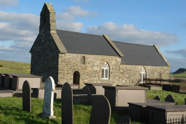
Cemaes Bay, United Kingdom
Cemaes Bay is a town of 1,187 people in Wales, United Kingdom.
Why visit Cemaes Bay
Townapedia lists 8 museums and landmarks, 3 parks and trails, 12 places to eat and 4 places to stay in and around town.
Highlights include Trwyn yr Wylfa.
Weather in Cemaes Bay
Forecast from MET Norway (CC BY 4.0). Full forecast
About Cemaes Bay
Cemaes () is a village on the north coast of Anglesey in Wales, sited on Cemaes Bay, an Area of Outstanding Natural Beauty which is partly owned by the National Trust. It is the most northerly village in Wales (excluding the nearby hamlet of Llanbadrig). The name Cemaes derives from the Welsh word cemais, meaning "bend or loop in a river, inlet of sea, bay". In 2011 the population of Cemaes in Llanbadrig community was 1,357.
From the Wikipedia article Cemaes (this version), under CC BY-SA 4.0.
Museums and landmarks8


Vistor Centre
Monument and historic site · 1.0 mi
Wylfa Newydd Site Office, Cemaes
Parks, trails and playgrounds3


Restaurants and cafes12


Cemaes Heritage Centre
Cafe
36 Stryd Fawr, Bae Cemaes
Mo-Sa 09:00-15:00; Su 10:00-15:00
Y Cefn Glas
Bar and pub · 1.4 mi
Ffordd Brynddu, Llanfechell
Mo-Th 17:00-22:30, Sa 14:00-00:30, Fr 15:00-00:30, Su 14:00-22:30


Where to stay4

History
The village was a commotal seat for the Prince of Wales before the invasion of Edward I in 1282–83. Dafydd ap Llywelyn, prince of Wales from 1240 to 1246, is recorded as having issued an act at Cemaes in 1238.
Between the end of the 18th and beginning of the 20th century the village was noted for producing salted herring as well as bricks from a nearby works, which was served by a narrow gauge tramway down to the sea. The pier, which was badly needed for trade and fishing, and later tourism, was damaged badly by storms in 1828 and 1889. Both times they were rebuilt and improved by local businessmen.
Throughout its history the village has had three names. The first was Castell Iorwerth ("Iorwerth's Castle") after Iorwerth Drwyndwn, the father of Llywelyn ab Iorwerth. The second name, Cemais, is similar to the modern name and refers to the meanders in the River Wygyr that are near the village. The name of the nearby Wylfa nuclear power station is linked to the village. The late 19th-century Cemaes resident David Hughes, who travelled to Liverpool and found riches in the building industry, lived for much of his life on the island. He built the village hall in 1898 and his home 'Wylfa Manor' in 1896, on the site of the current power station. It is located under the current Wylfa car park.
Read more of the history
The village hosted several matches of the 2019 Inter Games Football Tournament, a replacement football tournament for the popular Island Games. The games were held in Gibraltar but the lack of pitches there meant Anglesey was deemed to be a better host.
From the History section of Cemaes on Wikipedia, under CC BY-SA 4.0.
Notable people from Cemaes Bay
- Sonia EdwardsWelsh poet
- Thomas LewisWelsh politician, died 1897
Born in Cemaes Bay, according to Wikidata (CC0). Each name links to its Wikipedia article.
Churches and places of worship11
Gas and EV charging1
Schools, colleges and libraries2
Healthcare1
Map of Cemaes Bay
42 places. The map loads OpenStreetMap tiles when you open it.
Getting there and nearby towns
RAF Valley - Anglesey Airport (VLY) is the nearest airport with scheduled flights listed in OpenStreetMap, 12 miles away.
- Llanerchymedd 6 mi southeast, about 10 min by car
- Holyhead 10 mi southwest, about 17 min by car
- Valley 10 mi southwest, about 16 min by car
- Llangefni 12 mi southeast, about 20 min by car
- Rhosneigr 13 mi south, about 20 min by car
- Gaerwen 15 mi southeast, about 24 min by car
- Llanfairpwllgwyngyll 17 mi southeast, about 27 min by car
- Menai Bridge 17 mi southeast, about 28 min by car
- Bangor 18 mi southeast, about 30 min by car
- Llanfairfechan 22 mi southeast, about 36 min by car
Drive times are estimates from straight-line distance, not routes.
Towns near Cemaes Bay


Keep exploring
Local news
Headlines from INDB.
Reviews, tips and questions
Loading what members have shared...
Sources and licences
- GeoNames (CC BY 4.0): population, coordinates, regions and time zone
- OpenStreetMap contributors (ODbL 1.0): places, airports, map data
- Wikidata (CC0 1.0): elevation, founding date, time zone, website, landmarks and historic places
- Wikimedia Commons (see each image): photos
- Wikipedia (CC BY-SA 4.0): overview and history text
Photo credits
- Cemaes, Bob Jones, CC BY-SA 2.0
- Eglwys St Fflewin Church, Llanfflewin, Mynydd Mechell, Eric Jones, CC BY-SA 2.0
- St Peirio's Church from the east, Eric Jones, CC BY-SA 2.0
- St Rhwydrus Church, Anonymous, CC BY-SA 2.0
Page built November 10, 2026. Spotted a mistake? Tell us or suggest a place.