


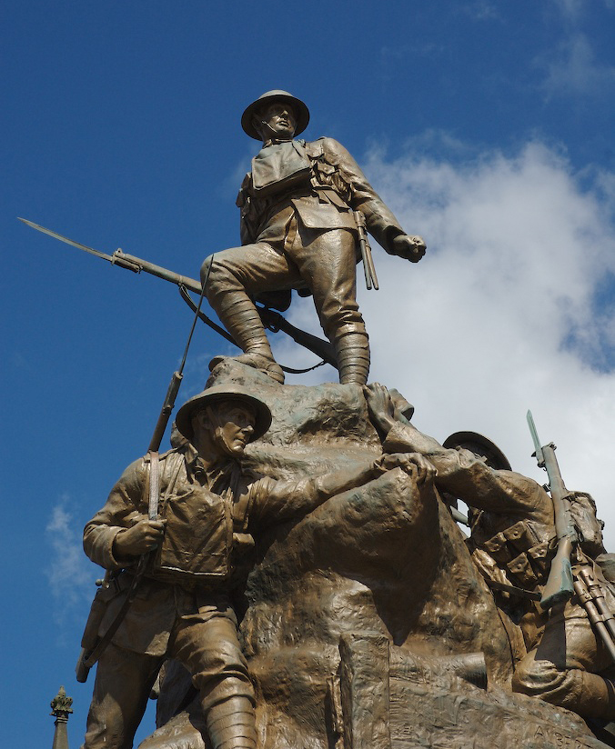

Chadderton, United Kingdom
Chadderton is a town of 37,602 people in England, United Kingdom.
Why visit Chadderton
Townapedia lists 16 museums and landmarks, 23 parks and trails, 243 places to eat, 4 places to stay and 7 attractions in and around town.
Highlights include Oldham Theatre Workshop, Oldham Coliseum Theatre, Gallery Oldham and Oldham War Memorial.
Weather in Chadderton
Forecast from MET Norway (CC BY 4.0). Full forecast
About Chadderton
Chadderton is a town in the Metropolitan Borough of Oldham, Greater Manchester, England, on the River Irk and Rochdale Canal. It is located in the foothills of the Pennines, 1 mile (1.6 km) west of Oldham, 5 miles (8.0 km) south of Rochdale and 6 miles (9.7 km) north-east of Manchester. The town is near the A627(M) motorway.
From the Wikipedia article Chadderton (this version), under CC BY-SA 4.0.
Things to do7

Oldham Theatre Workshop
Cinema and theater · 1.2 mi
Youth theatre group based in the north west of England
Greaves Street, Oldham
Oldham Coliseum Theatre
Cinema and theater · 1.3 mi
Theatre and former cinema in Oldham, Greater Manchester, England



Museums and landmarks16

Gallery Oldham
Museum · 1.3 mi
Art gallery in Greater Manchester, England, United Kingdom
35 Greaves Street, Oldham
Tu-Sa 10:00-17:00; PH off

Oldham War Memorial
Monument and historic site · 1.2 mi
War memorial in Oldham, Greater Manchester, England, UK

Crompton War Memorial
Monument and historic site · 2.8 mi
War memorial in Shaw and Crompton, Oldham, Greater Manchester, England, UK

Tandle Hill
Monument and historic site · 2.0 mi
Hill and country park in Greater Manchester, England



4 more on the map.
Parks, trails and playgrounds23


Alexandra Park
Park · 1.7 mi
Park in Oldham, Greater Manchester, England, UK

Boggart Hole Clough
Park · 3.1 mi
Park in Manchester, Greater Manchester, UK



Werneth Park, Oldham
Park · 0.9 mi
Public park in Oldham, Greater Manchester, United Kingdom

11 more on the map.
Restaurants and cafes243
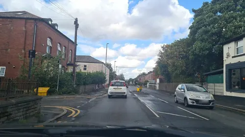
Khau Galli
Restaurant · Indian · 1.1 mi
331 Oldham Road, Oldham
Mo-Th 09:30-22:30; Fr 16:30-22:30; Sa-Su 09:30-22:30
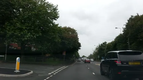
San Rocco
Restaurant · Italian · 0.5 mi
195 Broadway, Oldham
Tu-Fr 12:00-14:30; Tu-Fr 17:00-22:00; Sa-Su 12:00-22:00

Cafe East Oldham
Restaurant · 1.2 mi
13 Yorkshire Street, Oldham
Mo-Th 12:00-23:00; Fr-Sa 12:00-00:00; Su 16:00-23:00


Cha Cha Chai
Cafe · 1.3 mi
34-36 Yorkshire Street, Oldham
Mo-Fr 11:00-23:00
231 more on the map.
History
The name Chadderton derives from Caderton, which is believed to be from a variant of the name Chad, from Old English Ceadda, or a combination of the Brythonic word Cader or Cater (modern Welsh: Caer), indicating a fortified place amongst the hills, or the cadeir, "chair, throne", and the Old English suffix -ton meaning a settlement. The University of Nottingham's Institute for Name-Studies has offered a similar suggestion, that the name Chadderton means "farm or settlement at the hill called Cadeir". This name is believed to date from the 7th century, when Angles colonised the region following the Battle of Chester. It has been suggested that the Anglian settlers found a few Brythonic Celts already inhabiting what is now called Chadderton, and borrowed their name for the hill, "Chadder", adding their own word for a settlement to the end. Archaic spellings include Chaderthon, Chaderton, Chaterton and Chatherton. The first known written record of the name Chadderton is in a legal document relating to land tenure, in about 1220.
Read more of the history
The study of place names in Chadderton suggests that the ancient Britons once inhabited the area. Remains of Roman roads have been discovered running through the town, and the local road name Streetbridge suggests that the Romans once marched along it on a path which may have led to Blackstone Edge. Relics found at a tumulus in Chadderton Fold date from the Early Middle Ages, probably from the early period of Anglo-Saxon England, when Angles settled in the area and Chadderton emerged as a manor of the hundred of Salford.
Chadderton is not recorded in the Domesday Book of 1086. Its first appearance in a written record is in a legal document from around 1220, which states that Robert, Rector of Prestwich, gave land to Richard, son of Gilbert, in exchange for an annual fee of one silver penny. Following the Norman conquest, Chadderton was made a constituent manor of the wider Royal Estate of Tottington, an extensive fee held by the Norman overlord, Roger de Montbegon. Taxation and governance continued on this basis throughout the Middle Ages, with the Barons Montbegon of Hornby Castle holding the estate, until it passed to the Barons Lacy of Clitheroe Castle, and then onto local families. In about 1235, the sub-manor of Chadderton and Foxdenton passed from Richard de Trafford of Trafford Park to Geoffrey de Trafford, who adopted the surname of Chadderton, thus founding the Chadderton family. During the High Middle Ages, pieces of land in Chadderton were granted to religious orders and institutions, including Cockersand Abbey and the Knights Hospitaller.
The manorial system was strong in Chadderton, and this lent distinction to the township, in a region which otherwise had weak local lordship. Throughout the Middle Ages, the manor of Chadderton constituted a township, centred on the hill by the banks of the River Irk, known as Chadderton Fold. The fold consisted of a cluster of cottages centred on Chadderton Hall manor house, and a water-powered corn mill. Chadderton Hall was owned and occupied by the de Chaddertons. Geoffrey de Chadderton became the Lord of the manor of Tottington in the 13th century. The de Chaddertons' involvement in regional and national affairs gave prestige to what was otherwise an obscure and rural township. William Chaderton was Bishop of Chester from 1579 to 1595 and held distinguished academic posts such as Lady Margaret's Professor of Divinity. Laurence Chaderton was the first Master of Emmanuel College, Cambridge and among the first translators of the King James Version of the Bible. Tottington was dissolved in the mid-15th century and there came a succession of distinguished families, each headed by an esquire with links to the monarchs of England. The Radclyffe, Assheton, and Horton families provided six High Sheriffs of Lancashire and a Governor of the Isle of Man.
Apart from the dignitaries who lived in Chadderton's manor houses, Chadderton's population during the Middle Ages comprised a small community of retainers, most of whom were occupied in farming, either growing and milling of grain and cereal or raising cattle, sheep, pigs and domestic fowl. Workers supplemented their incomes by hand-loom spinning and weaving of wool at home. The community was ravaged by an outbreak of the Black Death in 1646.
From the History section of Chadderton on Wikipedia, under CC BY-SA 4.0.
More about Chadderton
Geography
At 53°32′46″N 2°8′33″W (53.5462°, −2.1426°), and 165 miles (266 km) north-northwest of central London, Chadderton lies at the foothills of the Pennines, 2.7 miles (4.3 km) east-southeast of Middleton, and 1.1 miles (1.8 km) west of Oldham. It is in the northeast part of the Greater Manchester Urban Area, the UK's third largest conurbation, on undulating land rising from 300 feet (91 m) above sea level in the west to 450 feet (137 m) in the east. Chadderton Heights, on the hillier northern edge of the town, is its highest point at 509 feet (155 m).
The climate in the area, like most of northwest Europe, is maritime temperate, with significant precipitation throughout the year, averaging 1047 mm annually. The average annual temperature is 9.7 °C.
Economy
Up until the 18th century, the inhabitants of Chadderton raised domestic farm animals, supplementing their incomes by the spinning and weaving wool in the domestic system. Primitive coal mining was established by the 17th century, and the factory system adopted in the late-18th century. During the Victorian era, Chadderton's economy was heavily dependent on manufacturing industries, especially the spinning of cotton, but also the weaving of silk and production of hats. By the 20th century the landscape was covered with over 50 cotton mills. Industries ancillary to these sectors, including coal mining, brick making, mechanical engineering, and bleaching and dyeing were present. Chadderton developed an extensive coal mining sector auxiliary to Chadderton's cotton industry and workforce. Coal was transported out of the township via the Rochdale Canal. The amount of coal was overestimated however, and production began to decline even before that of the local spinning industry; Chadderton's last coal mine closed in 1920.
Education
An old style grammar school at Healds Green in Chadderton was built and founded in 1789. As the population of Chadderton grew during the 19th century, more schools were opened, each linked with a local church. Mills Hill School began as a voluntary aided school belonging to the local Baptist church. Further schoolrooms from this period were found at Cowhill Methodist Church and Washbrook Methodist Church, opened in 1855 and 1893 respectively.
Chadderton Grammar School was the first new style co-educational grammar school opened by Lancashire County Council. It was opened by David Lindsay, 28th Earl of Crawford, on 18 October 1930. In 1959, it became the Girls' Grammar, when a separate school for boys was opened. The Girls' Grammar briefly became Mid-Chadderton School, and later The Radclyffe School, and the boys' school part of North Chadderton School. Radclyffe and North Chadderton are today the town's two co-educational, non-denominational, comprehensive secondary schools. North Chadderton School has a sixth form college for 16- to 19-year-olds. The Radclyffe School, which has specialist Technology College status, was modernised in 2008 by way of a £30 million new school complex opened by Sir Alex Ferguson on 8 July 2008. The Blessed John Henry Newman RC College opened in 2011 on the Broadway site previously occupied by The Radclyffe School.
From the Wikipedia article Chadderton, under CC BY-SA 4.0.
Notable people from Chadderton
 David PlattEnglish footballer and managerPhoto: Egghead06, CC BY-SA 3.0
 Vera BairdBritish politician (born 1950)Photo: Policy Exchange, CC BY 2.0
 Harry MortonEnglish footballer (1909-1974)Photo: Davereynard, CC BY-SA 3.0
 Ronald WhittamEnglish physiologistPhoto: MaratOrbel, CC BY-SA 4.0
 Deane SmalleyBritish footballer (born 1988)Photo: Ingy The Wingy, CC BY-SA 2.0
- Suranne JonesBritish actress (born 1978)
- William AshEnglish actor
- Woolly WolstenholmeBritish musician (1947–2010)
- Malcolm HiltonCricket player of England. (1928-1990)
- Frank LordEnglish footballer (1936–2005)
- Arthur DixonEnglish footballer, born 1892
- Brian HitchenBritish newspaper editor and publisher
Born in Chadderton, according to Wikidata (CC0). Each name links to its Wikipedia article.
Where to stay4
Churches and places of worship72
Shopping30
Gas and EV charging17
Schools, colleges and libraries52
Healthcare29
Ascroft Medical Clegg Street
Clinic and pharmacy · 1.2 mi
24 Clegg Street, Oldham
Map of Chadderton
250 places. The map loads OpenStreetMap tiles when you open it.
Getting there and nearby towns
Manchester Airport (MAN) is the nearest airport with scheduled flights listed in OpenStreetMap, 15 miles away.
- Oldham 1 mi east, about 2 min by car
- Royton 2 mi northeast, about 3 min by car
- Hollinwood 2 mi south, about 3 min by car
- Middleton 2 mi west, about 4 min by car
- Lees 3 mi east, about 4 min by car
- Failsworth 3 mi south, about 5 min by car
- Ashton-under-Lyne 4 mi southeast, about 7 min by car
- Droylsden 4 mi south, about 7 min by car
- Rochdale 5 mi north, about 8 min by car
- Manchester 6 mi southwest, about 10 min by car
Drive times are estimates from straight-line distance, not routes.
Towns near Chadderton


Keep exploring
Local news
Headlines from INDB.
Reviews, tips and questions
Loading what members have shared...
Sources and licences
- GeoNames (CC BY 4.0): population, coordinates, regions and time zone
- Mapillary (see each image): photos
- OpenStreetMap contributors (ODbL 1.0): places, airports, map data
- Wikidata (CC0 1.0): elevation, founding date, time zone, website, landmarks and historic places
- Wikimedia Commons (see each image): photos
- Wikipedia (CC BY-SA 4.0): overview and history text
Photo credits
- Chadderton Town Hall (front), Jeremy Sutcliffe from UK, CC BY-SA 2.0
- St Mark's Church, Chadderton, Jeremy Sutcliffe from UK, CC BY-SA 2.0
- Chadderton Library, Alexander P Kapp, CC BY-SA 2.0
- Chadderton Police Station, Stan W, CC BY-SA 2.0
- Gallery Oldham, SMJ, CC BY-SA 2.0
- Oldham War Memorial, Narniauk at English Wikipedia, Public domain
- Crompton War Memorial (1), Rept0n1x, CC BY-SA 2.0
- Tandal Hill Country Park, michael ely, CC BY-SA 2.0
- River Irk, Chadderton, Roger May, CC BY-SA 2.0
- Alexandra Park, Peter Hyde, CC BY-SA 2.0
- Boggart hole clough, Boggart hole clough Park and woodland, CC BY-SA 4.0
- Path near Dean Drook Broadhurst Clough, Sophiriel, CC BY-SA 4.0
- St Thomas, Lees, David Dixon, CC BY-SA 2.0
- Boundary Park, Original uploader was Narniauk at English Wikipedia, Public domain
- 50card m, Westwood_lad, Public domain
- Christ Church, Chadderton, John Slater, CC BY-SA 2.0
- St Thomas Church Coppice, Paul likes pics, CC BY-SA 3.0
- Oldham market fish and chips, Rathfelder, CC0
- Stannybrook road on daisy nook, Marc A Gibbs, CC BY-SA 4.0
- Street-level photo, mappo2, CC BY-SA 4.0
- Street-level photo, adam2, CC BY-SA 4.0
- Street-level photo, mappo2, CC BY-SA 4.0
- Street-level photo, adam2, CC BY-SA 4.0
- Street-level photo, mappo2, CC BY-SA 4.0
- Street-level photo, mappo2, CC BY-SA 4.0
- Street-level photo, mappo2, CC BY-SA 4.0
- Street-level photo, mappo2, CC BY-SA 4.0
- Street-level photo, mappo2, CC BY-SA 4.0
- Street-level photo, gorodnuk, CC BY-SA 4.0
- Street-level photo, mappo2, CC BY-SA 4.0
- Street-level photo, mappo2, CC BY-SA 4.0
- Street-level photo, mappo2, CC BY-SA 4.0
- Street-level photo, mappo2, CC BY-SA 4.0
- Street-level photo, mappo2, CC BY-SA 4.0
- Street-level photo, mappo2, CC BY-SA 4.0
- Street-level photo, mappo2, CC BY-SA 4.0
- Street-level photo, adam2, CC BY-SA 4.0


Page built November 10, 2026. Spotted a mistake? Tell us or suggest a place.