


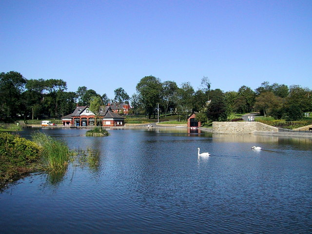

Ashton-under-Lyne, United Kingdom
Ashton-under-Lyne is a town of 43,675 people in England, United Kingdom.
Why visit Ashton-under-Lyne
Townapedia lists 13 museums and landmarks, 16 parks and trails, 82 places to eat, 2 places to stay and 4 attractions in and around town.
Highlights include Tameside Hippodrome, Theatre Royal, Ashton Under Lyne War Memorial and Stalybridge War Memorial.
Weather in Ashton-under-Lyne
Forecast from MET Norway (CC BY 4.0). Full forecast
About Ashton-under-Lyne
Ashton-under-Lyne, also known as Ashton, is a market town in the Metropolitan Borough of Tameside, Greater Manchester, England. Its population was 48,604 at the 2021 census. Historically a part of Lancashire, it is located on the north bank of the river Tame, in the foothills of the Pennines and 6 miles (9.7 km) east of Manchester.
From the Wikipedia article Ashton-under-Lyne (this version), under CC BY-SA 4.0.
Photos of Ashton-under-Lyne

Things to do4
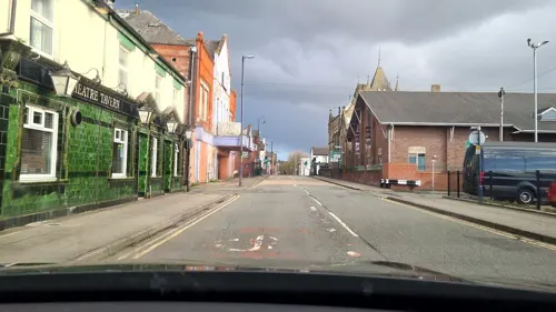
Tameside Hippodrome
Cinema and theater
Theatre and former cinema in Ashton-under-Lyne, Greater Manchester, England, UK

Theatre Royal
Cinema and theater · 2.8 mi
Former theatre and cinema in Hyde, Greater Manchester, England, UK

Alhambra Theatre
Cinema and theater · 2.9 mi
Former theatre and cinema in Openshaw, Manchester, England, later a bingo hall and sports venue
Museums and landmarks13

Ashton Under Lyne War Memorial
Monument and historic site · 0.5 mi
War memorial in Tameside, Greater Manchester, England, UK

Stalybridge War Memorial
Monument and historic site · 1.8 mi
War memorial in Stalybridge, Greater Manchester, England, UK


Replica of the old cross
Monument and historic site · 0.4 mi
The first reference to Ashton market cross comes from local marriage registers of 1854. The ancient cross was replaced in 1763 or 1764...
1 more on the map.
Parks, trails and playgrounds16

Alexandra Park
Park · 3.1 mi
Park in Oldham, Greater Manchester, England, UK



Clayton Vale
Park · 3.2 mi
Valley in Clayton, Manchester, England, UK
Werneth Park, Oldham
Park · 3.3 mi
Public park in Oldham, Greater Manchester, United Kingdom

4 more on the map.
Restaurants and cafes82
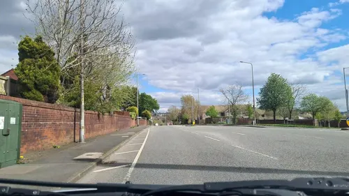
Plaza
Restaurant · Indian · 1.3 mi
90 Audenshaw Road, Manchester
Mo-Th 16:00-23:00, Fr 16:00-00:00, Sa 13:00-24:00; Su 13:00-22:00

Bella Italia
Restaurant · Italian · 0.5 mi
Fold Way, Ashton-under-Lyne
Mo-Th 11:30-22:00; Fr-Sa 11:30-23:00; Su 11:30-22:00



Pizza Hut
Restaurant · Pizza
4-8 Henrietta Street, Ashton-under-Lyne
Mo-Su 11:00-23:00
70 more on the map.
History
Evidence of prehistoric activity in the area is found at Ashton Moss, a 260-acre (107 ha) peat bog and is the only one of Tameside's 22 Mesolithic sites not located in the hilly uplands in the north-east of the borough. A single Mesolithic flint tool was discovered in the bog, alongside a collection of nine Neolithic flints. There was further activity in or around the bog in the Bronze Age. In about 1911, an adult male skull was found in the moss; it was thought to belong to the Romano-British period, similar to the Lindow Man bog body, until radiocarbon dating revealed that it dated from 1,320 to 970 BC.
Read more of the history
The eastern terminus of the early medieval linear earthwork Nico Ditch is in Ashton Moss; it was probably used as an administrative boundary and dates from the eighth or ninth century. Legend claims it was built in a single night in 869 or 870, as a defence against Viking invaders. Further evidence of Dark Age activity in the area comes from the town's name. The "Ashton" part probably derives from the Anglo-Saxon meaning "settlement by ash trees"; the origin of the "under-Lyne" element is less clear: it could derive from the British lemo meaning elm, or refer to Ashton being "under the line" of the Pennines. This means that Ashton probably became a settlement some time after the Romans left Britain in the fifth century. An early form of the town's name included the morpheme "burh"; this indicates that, in the 11th century, Ashton and Bury were two of the most important towns in Lancashire. The "under Lyne" suffix was not widely used until the mid-19th century, when it became useful for distinguishing the town from other places called Ashton.
The Domesday Survey of 1086 does not directly mention Ashton, perhaps because only a partial survey of the area had been taken. There is doubt whether the St Michael's Church mentioned in the Domesday entry for the ancient parish of Manchester was in Ashton.
The town itself was first mentioned in the 12th century when the manor was part of the barony of Manchester. The town was also spelt Asheton, Asshton and Assheton in this period. By the late 12th century, a family who adopted the name Assheton held the manor on behalf of the Gresles, barons of Manchester. Ashton Old Hall was a manor house, the administrative centre of the manor and the seat of the de Ashton or de Assheton family. With three wings, the hall was described by historians Nevell and Walker as "one of the finest great houses in the North West" of the 14th century. It has been recognised as important for being one of the few great houses in south-east Lancashire and possibly one of the few halls influenced by French design in the country. The town was granted a royal charter in 1414, which allowed it to hold a fair twice a year, and a market on every Monday, making the settlement a market town.
According to popular tradition, Sir Ralph de Assheton, who was lord of the manor in the mid-14th century and known as the Black Knight, was an unpopular and cruel feudal lord. After his death, his unpopularity led the locals to parade an effigy of him around the town each Easter Monday and collect money. The effigy would then be hung up, shot and set on fire, before being torn apart and thrown into the crowd. The first recorded occurrence of the event was in 1795, although the tradition may be older; it continued into the 1830s.
The manor remained in the possession of the Assheton family until 1514, when their male line ended. The lordship of the manor passed to Sir George Booth, great-great-grandson of Sir Thomas Ashton, devolving through the Booth family until the Earls of Stamford inherited it through marriage in 1758. The Booth-Greys then held the manor until the 19th century; their patronage, despite being absentee lords, was probably the stimulus for Ashton's growth of a large-scale domestic-based textile industry in the 17th century. In the medieval period, farming was important in Ashton, particularly arable farming.
With the Industrial Revolution in the second half of the 18th century, the textile industry in the town boomed. It continued to expand until the cotton famine of 1861–65, after which the industry remained steady until it collapsed after the overseas markets shut down in the 1920s. Until the introduction of the cotton trade in 1769, Ashton had been considered "bare, wet and almost worthless", but the introduction of the trade transformed the town's economy; in the 1700s, 33% of those with jobs worked in textiles and 36% in agriculture. Pre-industrial Ashton was centred on four roads: Town Street, Crickets Lane, Old Street and Cowhill Lane. In the late 18th and early 19th centuries, the town was replanned, with a grid pattern of roads. As a result, very little remains of the previous town. In 1730, a workhouse was established that consisted of a house and two cottages; it later came to be used as a hospital. The Ashton Canal was constructed in the 1790s to transport coal from the area to Manchester, with a branch to the coal pits at Fairbottom.
Domestic fustian and woollen weaving have a long history in the town, dating back to at least the Early Modern period. Accounts dating from 1626 highlight that Humphrey Chetham had dealings with clothworkers in Ashton. Coal has been mined in the area since at least the 17th century, but it was in the late 18th and early 19th centuries that demand for coal increased, which led to an expansion of the town's coal industry. The produce of the collieries was transported by canal to Manchester. The industry began to decline during the late 19th century and, by 1904, only the Ashton Moss Colliery was still operational, the last colliery to be opened in the area.
From the History section of Ashton-under-Lyne on Wikipedia, under CC BY-SA 4.0.
More about Ashton-under-Lyne
Geography
Ashton-under-Lyne stands 35 feet (11 m) above of the river Tame, on its north bank. Described in Samuel Lewis's A Topographical Dictionary of England (1848) as situated "on a gentle declivity". The town lies on undulating ground by the Pennines, reaching a maximum elevation of about 1,000 feet (305 m) above sea level. Generally the bedrock of the west of the town consists of coal measures, which were exploited by the coal mining industry, while the east is mainly millstone grit. Overlying the bedrock are deposits of glacial sand and gravel, clay, and some alluvial deposits. Ashton Moss, a peat bog, lies to the west of the town and was originally much larger.
Economy
In the 2021 census, the proportion of Ashton Central residents at working age (16–64) was 64.7%, higher than the surrounding area and the national average. However, the employment rate of 47.9% was almost 10% lower than the rest of Tameside and the national average, and the unemployment rate was almost double, at 6.2% compared to 3.5% in Tameside and 3.4% in the rest of the UK.
Despite the economic activity rate being higher than the national average at 46.0%, a lesser proportion of the population is in retirement, at only 12.7% compared to the national average of 21.6%. Indeed, the area also has a low proportion of workers in "professional occupations" (10.4% compared to 15.1% across Tameside) and a much higher proportion of workers in so-called "elementary professions":17.8% compared to 10.6% across Tameside. Of the 99 industries listed by the census, the only ones that employed more than 5% of Ashton Central's population were specialised construction or civil engineering, retail trade, food and beverage services, and human health services.
From the Wikipedia article Ashton-under-Lyne, under CC BY-SA 4.0.
Notable people from Ashton-under-Lyne
 Geoff HurstEnglish footballer (born 1941)Photo: Keven Law from Los Angeles, USA, CC BY-SA 2.0
 Simone PerrottaItalian association football player (born 1977)Photo: Gaúcho, Public domain
 Margaret BeckettBritish politician (born 1943)Photo: Richard Townshend, CC BY 3.0
 Ross BrawnBritish automotive engineerPhoto: Matthew Lamb, CC BY-SA 2.0
 Mark RobinsEnglish footballer and manager (born 1969)Photo: Timmy96, CC0
 Anthony HardingEnglish diverPhoto: Sandro Halank , Wikimedia Commons, CC BY-SA 4.0
 Brian WildeBritish actor (1927-2008)Photo: Marjorie Ross, CC BY-SA 4.0
- Mike DoyleEnglish footballer (1946-2011)
- Amanda BarrieBritish actress (born 1935)
- Alan WrightEnglish footballer (born 1971)
- Ronald FraserBritish actor (1930–1997)
- T. S. AshtonEnglish economist, historian & scholar (1889-1968)
Born in Ashton-under-Lyne, according to Wikidata (CC0). Each name links to its Wikipedia article.
Where to stay2
Churches and places of worship37
St Michael and All Angels' Church, Ashton-under-Lyne
Church · 0.4 mi
Shopping16
Gas and EV charging11
Schools, colleges and libraries31
Parochial Church of England Primary and Nursery School
School · Anglican · 0.6 mi
Keppel Street, Ashton-under-Lyne
St James' Church of England Primary School
School · Anglican · 0.5 mi
Romney Street, Ashton-under-Lyne
Hurst Knoll St James' Church of England Primary School
School · Anglican · 0.7 mi
Ladbrooke Road, Ashton-under-Lyne
Healthcare4
Map of Ashton-under-Lyne
216 places. The map loads OpenStreetMap tiles when you open it.
Getting there and nearby towns
Manchester Airport (MAN) is the nearest airport with scheduled flights listed in OpenStreetMap, 12 miles away.
- Dukinfield 1 mi southeast, about 2 min by car
- Stalybridge 2 mi east, about 3 min by car
- Droylsden 2 mi west, about 3 min by car
- Denton 2 mi south, about 4 min by car
- Hollinwood 2 mi northwest, about 4 min by car
- Hyde 3 mi south, about 4 min by car
- Failsworth 3 mi west, about 5 min by car
- Oldham 4 mi north, about 6 min by car
- Lees 4 mi north, about 6 min by car
- Manchester 6 mi west, about 9 min by car
Drive times are estimates from straight-line distance, not routes.
Towns near Ashton-under-Lyne


Keep exploring
Local news
Headlines from INDB.
Reviews, tips and questions
Loading what members have shared...
Sources and licences
- GeoNames (CC BY 4.0): population, coordinates, regions and time zone
- Mapillary (see each image): photos
- OpenStreetMap contributors (ODbL 1.0): places, airports, map data
- Wikidata (CC0 1.0): elevation, founding date, time zone, website, landmarks and historic places
- Wikimedia Commons (see each image): photos
- Wikipedia (CC BY-SA 4.0): overview and history text
Photo credits
- Ashton-u-Lyne-town-hall1, Zboralski, CC BY-SA 3.0
- Theatre Royal, Hyde, Izzak, CC BY-SA 3.0
- Ashton-under-Lyne War Memorial (1), Rept0n1x, CC BY-SA 3.0
- Stalybridge war memorial (6), Rept0n1x, CC BY-SA 3.0
- Alexandra Park, Peter Hyde, CC BY-SA 2.0
- Albion United Reformed Church, Ashton under Lyne, A. Carty ( talk ), CC BY-SA 3.0
- St John's Church, Dukinfield, Gerald England, CC BY-SA 2.0
- St Lawrence's Church, Denton 2005, Roger May, CC BY-SA 2.0
- St Michaels and All Saints Church, Ashton-under-Lyne 2008, Gerald England, CC BY-SA 2.0
- Stamford Park, Tameside (5), Rept0n1x, CC BY-SA 3.0
- The Witchwood, Ashton-under-Lyne, Alexander P Kapp, CC BY-SA 2.0
- St John's Church, Hurst, David Dixon, CC BY-SA 2.0
- JPT bus (1), Mikey from Wythenshawe, Manchester, UK, CC BY 2.0
- Stannybrook road on daisy nook, Marc A Gibbs, CC BY-SA 4.0
- Street-level photo, mappo2, CC BY-SA 4.0
- Street-level photo, mappo2, CC BY-SA 4.0
- Street-level photo, mappo2, CC BY-SA 4.0
- Street-level photo, mappo2, CC BY-SA 4.0
- Street-level photo, mappo2, CC BY-SA 4.0
- Street-level photo, mappo2, CC BY-SA 4.0
- Street-level photo, mappo2, CC BY-SA 4.0
- Street-level photo, mappo2, CC BY-SA 4.0
- Street-level photo, mappo2, CC BY-SA 4.0
- Street-level photo, mappo2, CC BY-SA 4.0
- Street-level photo, mappo2, CC BY-SA 4.0
- Street-level photo, mappo2, CC BY-SA 4.0
- Street-level photo, mappo2, CC BY-SA 4.0
- Street-level photo, mappo2, CC BY-SA 4.0
- Street-level photo, mappo2, CC BY-SA 4.0
- Street-level photo, mappo2, CC BY-SA 4.0
- Street-level photo, mappo2, CC BY-SA 4.0


Page built November 10, 2026. Spotted a mistake? Tell us or suggest a place.