


Failsworth, United Kingdom
Failsworth is a town of 20,555 people in England, United Kingdom.
Why visit Failsworth
Townapedia lists 21 museums and landmarks, 28 parks and trails, 69 places to eat, 4 places to stay and 5 attractions in and around town.
Highlights include Alhambra Theatre, Tameside Hippodrome, Ashton Under Lyne War Memorial and Brownsfield Mill.
Weather in Failsworth
Forecast from MET Norway (CC BY 4.0). Full forecast
About Failsworth
Failsworth () is a town in the Metropolitan Borough of Oldham, Greater Manchester, England, 4 miles (6.4 km) north-east of Manchester and 3 miles (4.8 km) south-west of Oldham. The M60 ring-road motorway skirts it to the east. The population at the 2011 census was 20,680. Historically in Lancashire, Failsworth until the 19th century was a farming township linked ecclesiastically with Manchester.
From the Wikipedia article Failsworth (this version), under CC BY-SA 4.0.
Things to do5
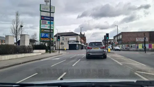
Alhambra Theatre
Cinema and theater · 2.2 mi
Former theatre and cinema in Openshaw, Manchester, England, later a bingo hall and sports venue
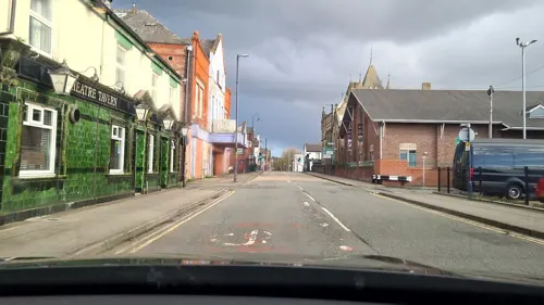
Tameside Hippodrome
Cinema and theater · 3.1 mi
Theatre and former cinema in Ashton-under-Lyne, Greater Manchester, England, UK

Hope Mill Theatre
Cinema and theater · 2.6 mi
Theatre in Manchester, UK
Oldham Theatre Workshop
Cinema and theater · 3.3 mi
Youth theatre group based in the north west of England
Queen's Park Hippodrome, Harpurhey
Cinema and theater · 2.1 mi
Former theatre in Harpurhey, Manchester, England
Museums and landmarks21

Ashton Under Lyne War Memorial
Monument and historic site · 3.4 mi
War memorial in Tameside, Greater Manchester, England, UK

Brownsfield Mill
Monument and historic site · 3.0 mi
Cotton mill in Manchester, England, UK

Brunswick Mill, Ancoats
Monument and historic site · 2.4 mi
Grade II listed mill in Manchester, United Kingdom
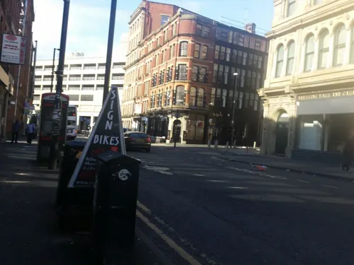
Centre for Chinese Contemporary Art
Museum · 3.3 mi
Contemporary art gallery based in Manchester, UK, which aims to advance the education of the public in contemporary Chinese arts and culture

Daily Express Building
Monument and historic site · 3.0 mi
Building in Manchester, England

Gallery Oldham
Museum · 3.4 mi
Art gallery in Greater Manchester, England, United Kingdom

Greater Manchester Police Museum and Archives
Museum · 3.2 mi
Museum in Manchester, United Kingdom

Jackson's Warehouse
Monument and historic site · 3.1 mi
Warehouse in Manchester, UK

Manchester Jewish Museum
Museum · 3.0 mi
Museum in Manchester, England, United Kingdom

Manchester Piccadilly station
Monument and historic site · 3.3 mi
Railway station in Manchester, England, UK

Museum of Transport, Greater Manchester
Museum · 2.8 mi
Museum in Greater Manchester, England, United Kingdom

Manchester Art Museum
Museum · 2.8 mi
Art museum in Manchester, England, UK (1877-1953)
9 more on the map.
Parks, trails and playgrounds28

Broadhurst Park
Park · 1.0 mi
Park in Manchester, United Kingdom
330 Lightbowne Road, Manchester

Alexandra Park
Park · 3.2 mi
Park in Oldham, Greater Manchester, England, UK

Ardwick Green
Park · 3.3 mi
Public park in Ardwick, Manchester, England

Belle Vue Zoological Gardens
Park · 3.0 mi
Former zoo, amusement park, exhibition hall complex and speedway in Manchester, England

Boggart Hole Clough
Park · 1.9 mi
Park in Manchester, Greater Manchester, UK



Clayton Vale
Park · 1.0 mi
Valley in Clayton, Manchester, England, UK
Crumpsall Park
Park · 2.9 mi
Park in Manchester, Greater Manchester, England
16 more on the map.
Restaurants and cafes69

Old School Barbecue Bus
Restaurant · American, Barbecue · 1.4 mi
Alford Street, Oldham
We-Th 16:00-22:00; Fr-Sa 12:00-23:00; Su 12:00-22:00

Caffè Nero
Cafe · Coffee Shop · 0.7 mi
Mo-Fr 07:00-19:00; Su 08:00-18:00

New Moston Inn
Bar and pub · 0.8 mi
52-54 Belgrave Road, Manchester
Mo-Sa 14:00-00:00; Su 14:00-23:00
57 more on the map.
History
Early settlement rested on a road that runs today between Manchester and Yorkshire. This Roman secondary road formed part of a network from Manchester up north, probably to Tadcaster near York. The section that ran through Failsworth is still known as Roman Road. It was built above marshland and laid on brushwood with a hard surface. Roman Road has also been known as "Street", a Saxon term meaning "metalled road", indicating that it was also used that later period.
Early sources suggest the area was occupied in Saxon times. The small hamlet of scattered dwellings made of rough local stone, mud and clay with thatched roofs, may have been stood on ground higher than the surrounding marshland. Daily life would have centred on animal husbandry and agriculture.
Unmentioned in the Domesday Book of 1086, Failsworth appears in a record of 1212 as Fayleswrthe, a settlement was documented as a thegnage estate or manor comprising four oxgangs of land. Two oxgangs at an annual rate of 4 shillings were payable by the tenant, Gilbert de Notton, to Adam de Prestwich, who in turn paid tax to King John. The other two oxgangs were held by the Lord of Manchester as part of his fee simple. The Byron family came to acquire the whole township in the mid-13th century. Apart from a small estate held by Cockersand Abbey, Failsworth passed to the Chetham family and was then sold on to smaller holders.
Read more of the history
By 1663, 50 households were registered. Life centred on natural resources, agriculture and stock farming, with many were employed as labourers to work the land, though tradesmen such as a tailor, a felt maker, a shoemaker, a joiner and a weaver supported them. The earliest record of a place of worship is Dob Lane Chapel, dating from 1698.
In 1774, the 242 Failsworth households contained some 1.400 inhabitants, of whom a high proportion were involved in cloth manufacture. Development of the English textile trade was backed by important legislation between 1500 and 1760: a number of acts were passed to encourage it by the compulsory growing of flax. Grants were made to flax growers and duties levied on foreign imports, though Manchester's extensive linen trade used yarn imported from Holland and Ireland.
In 1914 the regular Daisy Nook Easter Fair ceased with the outbreak of the First World War, but resumed in 1920. On 8 June 2007, a 1946 work by L. S. Lowry entitled "Good Friday, Daisy Nook" sold for £3,772,000, then the highest bid ever paid for one of his paintings.
From the History section of Failsworth on Wikipedia, under CC BY-SA 4.0.
More about Failsworth
Geography
At 53°30′37″N 2°9′27″W (53.5102°, −2.1575°) Failsworth lies 163 miles (262 km) north-north-west of London, as the southern tip of the Metropolitan Borough of Oldham, sharing borders with Manchester (north to south-west) and Tameside (south to east). It is traversed by the A62 road between Manchester and Oldham, by the former rail line of the Oldham Loop and by the Rochdale Canal, across its north-west corner. The M60 motorway passes through. For the Office for National Statistics, Failsworth counts as part of the Greater Manchester Urban Area.
The land in Failsworth slopes gently from east to west away from the Pennines and from brooks that bound it on the north-west (Moston Brook) and south-east (Lord's Brook). Failsworth has a country park, Daisy Nook, on undulating wooded land on its eastern border largely belonging to the National Trust. It is suited to walking, horse riding, fishing and other pursuits.
Economy
Failsworth grew as a mill town around the hat-making industry, which continues in the town. This began as a cottage industry before the firm of Failsworth Hats was set up in 1903 to manufacture silk hats. For a time the company had a factory near the former Failsworth Council offices and it remains in the area to this day. Other activities include electrical goods manufacture (such as Russell Hobbs) by Spectrum Brands, formerly Pifco Ltd), and plastic production and distribution by Hubron Ltd.
In July 2007, the Tesco supermarket chain opened a 24-hour Extra branch superstore on the banks of the wharf. The move was opposed by shop-owners, who claimed they would have lost customers and may have been forced to close. Tesco's arrival had been expected to be a catalyst bringing other stores, bars and restaurants to Failsworth. The only other large store is a branch of Morrisons housed in a building constructed on the demolished site of Marlborough No. 2 Mill.
Education
The local comprehensive school is Co-op Academy Failsworth, which moved to a new building in 2008 from two buildings known as Upper School and Lower School. It caters for students aged between 11 and 16. The £28-million project brought the town's secondary schooling to come under one roof. It has specialist sports college status.
From the Wikipedia article Failsworth, under CC BY-SA 4.0.
Notable people from Failsworth
 Jim RatcliffeBritish chemical engineer turned financier and industrialistPhoto: Staff photographer, CC BY-SA 3.0
 Darren WhartonBritish keyboardist, singer and songwriterPhoto: Darren Wharton, CC BY-SA 4.0
 Johnny SaintBritish professional wrestlerPhoto: The Doppelganger ( talk ), CC BY-SA 3.0
 Harry BoardmanEnglish folk singerPhoto: Mmberney, CC0
- Michael Athertonbroadcaster, journalist, and retired England international cricketer (born 1968)
- Roy FullerBritish writer (1912–1991)
- Benjamin BrierleyBritish writer
- Jack HallEnglish footballer, born 1912
- Jamie Stottassociation football player (born 1997)
- Kate FentonBritish writer
- Arthur Worsleyventriloquist (1920-2001)
- Scholes Birch(1826-1910)
Born in Failsworth, according to Wikidata (CC0). Each name links to its Wikipedia article.
Where to stay4
Churches and places of worship46
St John the Evangelist (Failsworth Parish Church)
Church · Anglican · 0.7 mi
Church Street, Manchester
St Michael and All Angels' Church, Ashton-under-Lyne
Church · 3.3 mi
Shopping10
Gas and EV charging9
Schools, colleges and libraries34
Woodhouses Voluntary Primary School
School · Anglican, Free Church · 1.3 mi
Ashton Road, Manchester
Christ The King RC Primary School Manchester
School · Roman Catholic · 0.7 mi
Culcheth Lane, Manchester
St Margaret Mary's RC Primary School
School · Roman Catholic · 1.5 mi
Saint Margaret's Road, Manchester
Healthcare3
Newton Heath Health Centre
Clinic and pharmacy · 0.8 mi
2 Old Church Street, Manchester
Map of Failsworth
229 places. The map loads OpenStreetMap tiles when you open it.
Getting there and nearby towns
Manchester Airport (MAN) is the nearest airport with scheduled flights listed in OpenStreetMap, 12 miles away.
- Hollinwood 2 mi northeast, about 3 min by car
- Droylsden 2 mi southeast, about 3 min by car
- Oldham 3 mi northeast, about 5 min by car
- Manchester 3 mi southwest, about 5 min by car
- Denton 4 mi southeast, about 6 min by car
- Dukinfield 4 mi southeast, about 6 min by car
- Lees 4 mi northeast, about 7 min by car
- Royton 5 mi northeast, about 7 min by car
- Stalybridge 5 mi east, about 7 min by car
- Salford 5 mi west, about 8 min by car
Drive times are estimates from straight-line distance, not routes.
Towns near Failsworth


Keep exploring
Local news
Headlines from INDB.
Reviews, tips and questions
Loading what members have shared...
Sources and licences
- GeoNames (CC BY 4.0): population, coordinates, regions and time zone
- Mapillary (see each image): photos
- OpenStreetMap contributors (ODbL 1.0): places, airports, map data
- Wikidata (CC0 1.0): elevation, founding date, time zone, website, landmarks and historic places
- Wikimedia Commons (see each image): photos
- Wikipedia (CC BY-SA 4.0): overview and history text
Photo credits
- Failsworth, UK - panoramio (1), oleg jasenovic, CC BY 3.0
- Failsworth, UK - panoramio, oleg jasenovic, CC BY 3.0
- Ashton-under-Lyne War Memorial (1), Rept0n1x, CC BY-SA 3.0
- Brownfields Mill, Ancoats, Manchester, KJP1, CC BY-SA 3.0
- Brunswick Mill 5217, Photograph by Clem Rutter, Rochester, Kent. ( www.clemrutter.net )., CC BY-SA 3.0
- Express Building Manchester, Stephen Richards, CC BY-SA 2.0
- Gallery Oldham, SMJ, CC BY-SA 2.0
- Greater Manchester Police Museum, Rept0n1x, CC BY-SA 2.0
- Ancoats-Picadilly Basin Jacksons Warehouse Tariff Street- 4522, Clem Rutter, Rochester, Kent., CC BY-SA 3.0
- Jewish museum, Richerman, CC BY-SA 3.0
- Manchester Piccadilly station approach - April 11 2005, The original uploader was Tagishsimon at English Wikipedia ., CC BY-SA 3.0
- Museum of Transport in Manchester, Mikey from Wythenshawe, Manchester, UK, CC BY 2.0
- Path near Dean Drook Broadhurst Clough, Sophiriel, CC BY-SA 4.0
- Alexandra Park, Peter Hyde, CC BY-SA 2.0
- Belle-Vue-guide-circa-late-1800s, Unknown Unknown, Public domain
- Boggart hole clough, Boggart hole clough Park and woodland, CC BY-SA 4.0
- Mayfield Park - Aerial Photo, Biguana99, CC BY-SA 4.0
- St Benedict's Church, Ardwick, David Dixon, CC BY-SA 2.0
- Church of All Souls, Manchester, Photograph by Mike Peel ( www.mikepeel.net )., CC BY-SA 4.0
- Gorton Monastery, Gorton, Mikey, CC BY 2.0
- St Michaels and All Saints Church, Ashton-under-Lyne 2008, Gerald England, CC BY-SA 2.0
- St John, Failsworth, Bill Boaden, CC BY-SA 2.0
- Ardwick Green War Memorial, David Dixon, CC BY-SA 2.0
- Stannybrook road on daisy nook, Marc A Gibbs, CC BY-SA 4.0
- Piccadilly Gardens, Manchester, Unknown author, Public domain
- Street-level photo, deleted_user, CC BY-SA 4.0
- Street-level photo, adam2, CC BY-SA 4.0
- Street-level photo, deleted_user, CC BY-SA 4.0
- Street-level photo, adam2, CC BY-SA 4.0
- Street-level photo, adam2, CC BY-SA 4.0
- Street-level photo, deleted_user, CC BY-SA 4.0
- Street-level photo, mappo2, CC BY-SA 4.0
- Street-level photo, matth81, CC BY-SA 4.0
- Street-level photo, mappo2, CC BY-SA 4.0
- Street-level photo, lukemb, CC BY-SA 4.0
- Street-level photo, adam2, CC BY-SA 4.0
- Street-level photo, lukemb, CC BY-SA 4.0
- Street-level photo, mappo2, CC BY-SA 4.0
- Street-level photo, southglos, CC BY-SA 4.0
- Street-level photo, adam2, CC BY-SA 4.0


Page built November 10, 2026. Spotted a mistake? Tell us or suggest a place.