

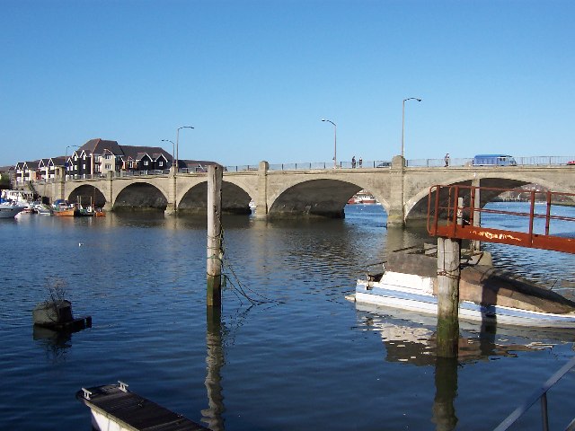


Chilworth, United Kingdom
Chilworth is a town of 1,204 people in England, United Kingdom.
Why visit Chilworth
Townapedia lists 7 museums and landmarks, 22 parks and trails, 18 places to eat, 7 places to stay and 5 attractions in and around town.
Highlights include Cobden Bridge, The Point, Eastleigh, Eastleigh Museum and Roman Road.
Weather in Chilworth
Forecast from MET Norway (CC BY 4.0). Full forecast
About Chilworth
Chilworth is a village in the Test Valley district of Hampshire, England, on the northern edge of Southampton. Good travel connections and restricted development have led to the village becoming particularly affluent. The village was referred to as Celeworda in the Domesday Book of 1086, and is now in two parts: modern Chilworth lying along the straight 'new' stretch of the Southampton to Romsey road, and old Chilworth built around the 'old' road.
From the Wikipedia article Chilworth, Hampshire (this version), under CC BY-SA 4.0.
Photos of Chilworth

Things to do5


The Point, Eastleigh
Cinema and theater · 2.8 mi
Theatre and dance centre in Eastleigh, Hampshire, England, in the former Town Hall


Museums and landmarks7

Eastleigh Museum
Museum · 2.9 mi
Museum in Eastleigh, United Kingdom (closed)

Parks, trails and playgrounds22

Lakeside Country Park
Park · 2.5 mi
Railway park in the United Kingdom
Riverside Park
Park · 2.8 mi
Public park in Southampton, Hampshire, England


St James' Park
Park · 2.6 mi
Recreational area in Shirley, Southampton, Hampshire, England




10 more on the map.
Restaurants and cafes18
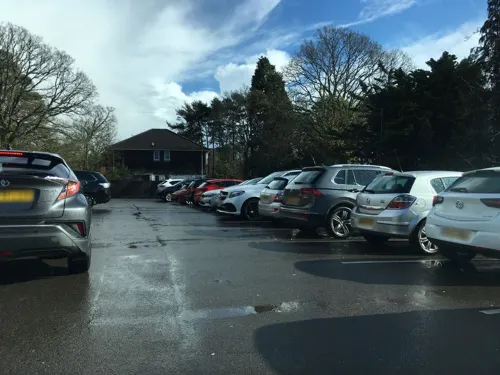




McDonald's
Fast food · Burger · 1.3 mi
This branch is inside the Asda superstore.
Bournemouth Road, Eastleigh
Mo-Fr 06:00-23:00; Sa 06:00-22:00; Su 09:00-15:45
6 more on the map.
Notable people from Chilworth
- William BaldockEnglish cricketer (1847-1923)
Born in Chilworth, according to Wikidata (CC0). Each name links to its Wikipedia article.
Where to stay7
Churches and places of worship19
Shopping6
Gas and EV charging4
Schools, colleges and libraries6
Healthcare2
Map of Chilworth
96 places. The map loads OpenStreetMap tiles when you open it.
Getting there and nearby towns
Southampton Airport (SOU) is the nearest airport with scheduled flights listed in OpenStreetMap, 3 miles away.
- Eastleigh 3 mi east, about 5 min by car
- Portswood 3 mi southeast, about 5 min by car
- Southampton 4 mi south, about 7 min by car
- Romsey 4 mi northwest, about 6 min by car
- Bishopstoke 4 mi east, about 6 min by car
- Totton 4 mi southwest, about 7 min by car
- Fair Oak 5 mi east, about 9 min by car
- Hedge End 6 mi southeast, about 10 min by car
- Hythe 7 mi south, about 12 min by car
- Winchester 8 mi northeast, about 13 min by car
Drive times are estimates from straight-line distance, not routes.
Towns near Chilworth


Keep exploring
Local news
Headlines from INDB.
Reviews, tips and questions
Loading what members have shared...
Sources and licences
- GeoNames (CC BY 4.0): population, coordinates, regions and time zone
- Mapillary (see each image): photos
- OpenStreetMap contributors (ODbL 1.0): places, airports, map data
- Wikidata (CC0 1.0): elevation, founding date, time zone, website, landmarks and historic places
- Wikimedia Commons (see each image): photos
- Wikipedia (CC BY-SA 4.0): overview and history text
Photo credits
- ChilworthManor, iamtheabelman, CC BY 3.0
- Cobden Bridge, Dave Jacobs, CC BY-SA 2.0
- The Point, Eastleigh, Paul Spencer, CC BY-SA 3.0
- Beach Lake, Lakeside Country Park, Eastleigh, Peter Facey, CC BY-SA 2.0
- SouthamptonCommon, The original uploader was AlanFord at English Wikipedia ., CC BY 2.5
- Avenue St Andrews, Colin Smith, CC BY-SA 2.0
- Emmanuel Baptist Church, Cherbourg Road, Eastleigh (June 2019) (1), Hassocks5489, CC0
- HighfieldChurch, AlanFord at English Wikipedia, Public domain
- St james church shirley southampton, JimChampion, CC BY-SA 3.0
- St. Alban's Church, Southampton, Michael Ford, CC BY-SA 2.0
- St Denys Priory, remnants on Priory Avenue, Rob Woodward, Public domain
- HartleyLibraryFront, Iamtheabelman, CC BY 3.0
- St. Michael & All Angels, Bassett, Michael Ford, CC BY-SA 2.0
- St james park southampton april 2021, Geni, CC BY-SA 4.0
- Eastleigh Museum gallery, Geni, CC BY-SA 4.0
- Churchy mcchurchface, Boddunn, CC BY-SA 4.0
- Street-level photo, iced, CC BY-SA 4.0
- Street-level photo, ebel, CC BY-SA 4.0
- Street-level photo, southglos, CC BY-SA 4.0
- Street-level photo, southglos, CC BY-SA 4.0
- Street-level photo, southglos, CC BY-SA 4.0
- Street-level photo, southglos, CC BY-SA 4.0
- Street-level photo, noid, CC BY-SA 4.0
- Street-level photo, southglos, CC BY-SA 4.0
- Street-level photo, southglos, CC BY-SA 4.0
- Street-level photo, southglos, CC BY-SA 4.0


Page built November 10, 2026. Spotted a mistake? Tell us or suggest a place.