


Why visit Colerne
Townapedia lists 5 museums and landmarks, 3 parks and trails, 4 places to eat and 1 place to stay in and around town.
Highlights include Box Rock Circus and Bury Camp.
Weather in Colerne
Forecast from MET Norway (CC BY 4.0). Full forecast
About Colerne
Colerne is a village and civil parish in north Wiltshire, England. The village is about 3.5 miles (6 km) west of the town of Corsham and 7 miles (11 km) northeast of the city of Bath. It has an elevated and exposed position, 545 feet (166 m) above sea level, and overlooks the Box valley to the south (where Brunel's Box Tunnel is).
From the Wikipedia article Colerne (this version), under CC BY-SA 4.0.
Museums and landmarks5
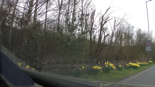


Bury Camp
Monument and historic site · 1.8 mi
Site of an Iron Age multivallate hillfort located in Wiltshire, England, UK
Parks, trails and playgrounds3


Restaurants and cafes4

Where to stay1

History
Evidence of early settlement in the area includes three bowl barrows near Thickwood, overlooking the Bybrook valley, and an Iron Age hillfort from around 100 BC in the north of the parish, known as Bury Wood Camp, overlooking the Doncombe valley.
A Roman villa has been found on the site of the present airfield. The 1086 Domesday Book recorded 28 households at Colerne and six at Thickwood. The enclosure known as Colerne Park (today largely woodland) was created in the early 14th century by William of Colerne, Abbot of Malmesbury.
In the 14th century the local economy was based on sheep-rearing, cloth production (assisted by mills on the By Brook) and stone quarrying. The former farmhouse known as Daubenys, on the High Street, is a Grade II* listed long house from c. 1400.
The Manor House, near the church, bears a date of 1689; it was reduced in size and re-fronted in 1900. The country house at Lucknam Park is also from the late 17th century. Many houses in the village are from the 18th century, partly as a result of a large fire of 1774.
By the 19th century, cloth-making had migrated to industrial towns and the economy was mainly agricultural. Some of the watermills were converted to paper production, an example being Chapps Mill near Slaughterford. In the 1840s many labourers were employed on the construction of the Great Western Railway and its Box Tunnel.
Read more of the history
From 1995 to 2023, Calder House School was a private special school at Thickwood, which was attended by up to 48 pupils aged 7 to 13 for two or three years while receiving remedial support before returning to mainstream education. The school was built around the former farmyard at Thickwood House, a 17th-century former farmhouse.
From 1939, employment was provided by the construction of RAF Colerne close to the north of the village. After the war, the site continued in use by maintenance units, and then Transport Command and No. II Squadron RAF Regiment until its closure in 1976. The site was taken over by the Army, named Azimghur Barracks, and became the headquarters of 21 Signal Regiment; this change led to a noticeable drop in the parish population. The airfield continues to be used by Air Training Corps cadets and No. 3 Air Experience Flight.
From the History section of Colerne on Wikipedia, under CC BY-SA 4.0.
Notable people from Colerne
- William GrocynEnglish scholar
Born in Colerne, according to Wikidata (CC0). Each name links to its Wikipedia article.
Churches and places of worship5
Schools, colleges and libraries2
Map of Colerne
20 places. The map loads OpenStreetMap tiles when you open it.
Getting there and nearby towns
Cotswold Airport (GBA) is the nearest airport with scheduled flights listed in OpenStreetMap, 18 miles away.
- Corsham 3 mi east, about 5 min by car
- Marshfield 3 mi northwest, about 5 min by car
- Atworth 4 mi southeast, about 7 min by car
- Whitley 5 mi southeast, about 8 min by car
- Bath 6 mi southwest, about 10 min by car
- Chippenham 6 mi east, about 10 min by car
- Holt 6 mi southeast, about 10 min by car
- Melksham 7 mi southeast, about 11 min by car
- Limpley Stoke 7 mi south, about 11 min by car
- Trowbridge 9 mi south, about 14 min by car
Drive times are estimates from straight-line distance, not routes.
Towns near Colerne


Keep exploring
Local news
Headlines from INDB.
Reviews, tips and questions
Loading what members have shared...
Sources and licences
- GeoNames (CC BY 4.0): population, coordinates, regions and time zone
- Mapillary (see each image): photos
- OpenStreetMap contributors (ODbL 1.0): places, airports, map data
- Wikidata (CC0 1.0): elevation, founding date, time zone, website, landmarks and historic places
- Wikimedia Commons (see each image): photos
- Wikipedia (CC BY-SA 4.0): overview and history text
Photo credits
- Colerne Cross Tree ST 82000 71144, Herr Rott, CC BY 4.0
- The Church of Saint Christopher, Ditteridge, Jojikiba at English Wikipedia, Public domain
- Street-level photo, RyanBush, CC BY-SA 4.0
- Street-level photo, southglos, CC BY-SA 4.0
Page built November 10, 2026. Spotted a mistake? Tell us or suggest a place.