


Why visit Holt
Townapedia lists 3 museums and landmarks, 3 parks and trails, 11 places to eat and 2 places to stay in and around town.
Highlights include Great Chalfield Manor, Trowbridge Castle and The Courts Garden.
Weather in Holt
Forecast from MET Norway (CC BY 4.0). Full forecast
About Holt
Holt is a village and civil parish in the west of Wiltshire, England, about 2.5 miles (4 km) northeast of Bradford-on-Avon and 3 miles (5 km) southwest of Melksham.
From the Wikipedia article Holt, Wiltshire (this version), under CC BY-SA 4.0.
Photos of Holt


Museums and landmarks3

Great Chalfield Manor
Monument and historic site · 0.8 mi
Grade I listed English country house in Atworth, Wiltshire, England, UK
Trowbridge Castle
Monument and historic site · 2.5 mi
Castle in Trowbridge, Wiltshire

Trowbridge Museum
Museum · 2.5 mi
Textile industry museum in Trowbridge, England, United Kingdom
Parks, trails and playgrounds3

Restaurants and cafes11
The Tollgate Inn
Bar and pub · 0.4 mi
Ham Green, Holt
Mo-Fr 09:30-23:30; Sa 08:30-23:30; Su 08:30-16:30
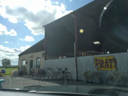

Wild Herb at The FIeld Kitchen
Cafe · Modern, Seasonal, Coffee, Pastry
1 Brook Lane, Holt
Tu-Sa 09:00-16:00


Where to stay2


History
Although there are no major prehistoric or Neolithic finds in the parish, there is evidence to suggest that human habitation has persisted in Holt since the Bronze and Iron Ages. Worked flints from the Neolithic period have been found in gravel pits on the Avon floodplain on the southern edge of the parish and there is later evidence of a Roman farm on the river gravels.
From about 1001 AD, Holt was a tithing in the manor of Bradford, given by Æthelred the Unready to the Abbess of Shaftesbury by a charter now in the British Museum where it is probably the place referred to as Wrindesholt. The name has various interpretations; Holt is generally regarded as the Old English word for 'wood' and Wrindesholt as 'boundary wood', 'cleared wood', or literally 'Wrinda's wood'. There are no explicit references to Holt in the Domesday Book. However, by the middle of the twelfth century, records indicate that Holt was home to 27 recorded individuals, including a priest. The font in the parish church is extant from this period, although the rest of the original church fabric has been lost.
Read more of the history
Holt remained in the possession of Shaftesbury Abbey until somewhen between 1242 and 1252, when the manor was granted to the de Holt family with Robert de Holt being given 'free warren in the demesne lands of his manor'. He was also granted a license to hold a fair at the manor each Saint Catherine's Day (25 November). The manor's deer park, established by 1316, is thought to have encompassed much of the modern village.
In 1344, the manor was conveyed to William Edington, later Bishop of Winchester and Lord Chancellor of England. The extant parish church tower dates from this period. Poll tax records from 1377 record 44 people over the age of 14 paying poll tax, and provides an estimate of the population of Holt at this time of between 72–99 people. The number of tax-payers is low considering that at least 32 houses are also recorded. Wealthier inhabitants are assumed to have avoided paying the tax.
Ownership of the manor changed again in 1426, passing to the Lisle family, in whose possession it would be held for the next 320 years.
When a mineral water spring was discovered in 1688 at what would become known as Holt Spa, Lady Lisle would be instrumental in the promotion of the waters to high society. At least four wells – The Old, The New, The Great Nose, and Harris's – were sunk, and under the guidance of the local nobility and clergy, the operation became a commercial enterprise from 1723. The proprietor, Henry Eyre, claimed in 1731 that the waters had the ability to cure King’s Evil, ulcers, leprosy, scrophula, piles, itching of the skin, colic, giddiness of the head and other ailments. Eyre was successfully exporting bottled spa water to London.
By the 1780s, a resort had been established in Holt: the Spa House provided treatments, and the Great House offered lodgings for guests who took the waters. Holt faced competition from the much more popular spa at Bath but is said to have been frequented by the lesser gentry and to have enjoyed a 'summer season', with numerous Londoners entering the parish burial registers in the late 18th century providing some testament to its popularity.
By 1790, the heyday of the spa resort was over. Holt Waters remained for sale until 1815; around that time mineral springs were discovered nearby at Melksham, and another small spa was developed there.
The Spa House was incorporated into a bedding factory on the site, and later demolished. A pair of Tuscan columns from the Spa House entrance and a well pump were saved from demolition and incorporated in the new factory building. This memorial, together with a marble tablet dedicated to Lady Lisle and the Reverend John Lewis, whose patronage made the wells famous from 1720, are all that remain of the spa. Holt Water was analysed in 1933 and found to be very cloudy and quite unsuitable for drinking.
The Great House became a short-lived girls' school for day students and boarders, then from 1794 a boys' boarding school. By 1821, the building had been divided into tenements with seventeen families living there. In 1868 it was advertised for sale and subsequently became part of Beaven's leather dressing factory. It reverted to tenements and was demolished in 1957 as unsafe and incapable of economic repair. The site is now home to a light industrial estate.
From the fourteenth century, cloth-making was a major aspect of the economy of the village and the surrounding area. Of particular note was the woollen mill in nearby Staverton. By the seventeenth century, there were numerous weavers in Holt. In 1703, the clothier John Phelps bought property and opened a dye-works and workshops at what is now The Courts. This had expanded under new ownership by the end of the eighteenth century to become a five-story factory with a large water wheel and steam engine. The factory expanded further but was a casualty of the collapse of the English woollen industry in the nineteenth century and was demolished in 1890.
Members of the Beaven family started a leather dressing factory at Holt in the 1770s. They had previously been woolstaplers and fellmongers. The company, later called J. & T. Beaven Ltd, also processed wool, manufactured gloves, and processed sheepskins into chamois leather until sometime after 1970. During the Second World War, the Beavens held contracts to produce linings for flying jackets and gloves for the RAF. Since 1995, the company has existed as an Anglo-European wholesaler of car care products, including chamois leather, but manufacturing in Holt ended in 1990. The factory site has been redeveloped for mixed residential and commercial use.
From the History section of Holt, Wiltshire on Wikipedia, under CC BY-SA 4.0.
More about Holt
Geography
The village lies on clays of the Kellaways Formation (part of what is known as Oxford Clay), just above the alluvium of the River Avon and on a terrace of Ice Age gravel. A small persistent stream runs through it approximately northwest to southeast, from the dip slope of the Cotswolds to join the river near the southern parish boundary.
The civil parish of Holt was established in 1894 and includes the village, manor, the hamlet of Forewoods Common, the Great Bradford Wood, and numerous farms beyond the village boundary. The parish boundaries were last modified in 1934 and encompass 786 hectares of land which rises from about 30 metres above sea level to a maximum of 75 metres in the most northerly parts of the parish. Holt parish is bounded in the north by those of Atworth (including Great Chalfield) and Broughton Gifford, to the east by Hilperton (including the hamlet of Whaddon), to the west by Bradford on Avon and South Wraxall (including the hamlet of Bradford Leigh), and to the south by Staverton and the county town of Trowbridge.
The River Avon forms much of the southern parish boundary. The extreme southern tip of the parish is crossed by the Kennet and Avon Canal. The extant railway lines between Trowbridge and Bradford, and Trowbridge and Chippenham also cross the parish in the western and eastern margins, respectively.
From the Wikipedia article Holt, Wiltshire, under CC BY-SA 4.0.
Churches and places of worship16
St Thomas More Roman Catholic Church, Bradford-on-Avon
Church · 2.4 mi
Gas and EV charging1
Schools, colleges and libraries5
Hilperton Church of England Voluntary Controlled Primary School
School · Anglican · 1.5 mi
Newleaze, Trowbridge
St Mary's Broughton Gifford Voluntary Controlled Church of England Primary School
School · Anglican, Methodist · 1.3 mi
The Street, Melksham
Staverton Church of England Voluntary Controlled Primary School
School · Anglican · 1.1 mi
School Lane, Trowbridge
Map of Holt
41 places. The map loads OpenStreetMap tiles when you open it.
Getting there and nearby towns
Upavon Airfield (UPV) is the nearest airport with scheduled flights listed in OpenStreetMap, 19 miles away.
- Trowbridge 3 mi south, about 4 min by car
- Melksham 3 mi northeast, about 4 min by car
- Westwood 4 mi west, about 6 min by car
- Southwick 4 mi south, about 7 min by car
- Corsham 5 mi north, about 9 min by car
- Limpley Stoke 5 mi west, about 8 min by car
- Rode 6 mi southwest, about 10 min by car
- Bath 7 mi west, about 12 min by car
- Westbury 7 mi south, about 11 min by car
- Chippenham 8 mi northeast, about 13 min by car
Drive times are estimates from straight-line distance, not routes.
Towns near Holt


Keep exploring
Local news
Headlines from INDB.
Reviews, tips and questions
Loading what members have shared...
Sources and licences
- GeoNames (CC BY 4.0): population, coordinates, regions and time zone
- Mapillary (see each image): photos
- OpenStreetMap contributors (ODbL 1.0): places, airports, map data
- Wikidata (CC0 1.0): elevation, founding date, time zone, website, landmarks and historic places
- Wikimedia Commons (see each image): photos
- Wikipedia (CC BY-SA 4.0): overview and history text
Photo credits
- Holt, Wiltshire, My another account ( talk ), Public domain
- Holt to Staverton Footpath - panoramio, Keith Daulby, CC BY 3.0
- Yew topiary at The Courts Garden, Holt, Wiltshire, Roddy Smith, CC BY-SA 2.0
- Holt, UK - panoramio (4), Ben Bender, CC BY-SA 3.0
- Holt, UK - panoramio, Ben Bender, CC BY-SA 3.0
- Holt, UK - panoramio (5), Ben Bender, CC BY-SA 3.0
- The Courts Garden, Holt 06, Rodw, CC BY-SA 4.0
- Holt, UK - panoramio (6), Ben Bender, CC BY-SA 3.0
- The Courts Garden, Holt 05, Rodw, CC BY-SA 4.0
- The Pond, Courts Garden, Holt, Richard Avery, CC BY-SA 4.0
- The Courts Garden, Holt 04, Rodw, CC BY-SA 4.0
- Holt, UK - panoramio (7), Ben Bender, CC BY-SA 3.0
- Great Chalfield Manor 12, Trish Steel, CC BY-SA 2.0
- Trowbridge Museum Entrance, MuseumTrowbridge, CC BY-SA 4.0
- Chapel of St Mary Tory, Charles Miller, CC BY 2.0
- Christ Church, Bradford-on-Avon, My another account ( talk ), CC0
- St. Michael & All Angels (13544583034), Hugh Llewelyn from Keynsham, UK, CC BY-SA 2.0
- Holy Trinity Church, Bradford-on-Avon, Charles Miller, CC BY 2.0
- Holy Trinity Church, Trowbridge, My another account ( talk ), CC0
- Saxon church, Bradford on Avon, Charles Miller, CC BY 2.0
- Roman Catholic Church Of St Thomas More, Stevekeiretsu, CC BY-SA 4.0
- Courts Garden Temple Borders, Nessy-Pic, CC BY-SA 3.0
- Great Chalfield Manor and All Saints Church, Nessy-Pic, CC BY-SA 3.0
- At The Courts Garden 2023 128, Photograph by Mike Peel ( www.mikepeel.net )., CC BY-SA 4.0
- At The Courts Garden 2023 129, Photograph by Mike Peel ( www.mikepeel.net )., CC BY-SA 4.0
- Street-level photo, jarosor0, CC BY-SA 4.0
- Street-level photo, chris_debian, CC BY-SA 4.0
- Street-level photo, jarosor0, CC BY-SA 4.0
- Street-level photo, jarosor0, CC BY-SA 4.0
- Street-level photo, jarosor0, CC BY-SA 4.0
- Street-level photo, jarosor0, CC BY-SA 4.0
- Street-level photo, tallguy, CC BY-SA 4.0
- Street-level photo, jarosor0, CC BY-SA 4.0
- Street-level photo, jarosor0, CC BY-SA 4.0
- Street-level photo, jarosor0, CC BY-SA 4.0
- Street-level photo, southglos, CC BY-SA 4.0
- Street-level photo, jarosor0, CC BY-SA 4.0


Page built November 10, 2026. Spotted a mistake? Tell us or suggest a place.