


Limpley Stoke, United Kingdom
Limpley Stoke is a town of 1,092 people in England, United Kingdom.
Why visit Limpley Stoke
Townapedia lists 16 museums and landmarks, 4 parks and trails, 13 places to eat, 6 places to stay and 4 attractions in and around town.
Highlights include Mission Theatre, Pulteney Bridge, American Museum and Gardens and Aquae Sulis.
Weather in Limpley Stoke
Forecast from MET Norway (CC BY 4.0). Full forecast
About Limpley Stoke
Limpley Stoke is a village and civil parish in Wiltshire, England. It lies in the Avon valley between Bath and Freshford, and is both above and below the A36 road.
From the Wikipedia article Limpley Stoke (this version), under CC BY-SA 4.0.
Photos of Limpley Stoke


Things to do4

Mission Theatre
Cinema and theater · 3.1 mi
Theatre in Bath, England, in a former congregational hall

Pulteney Bridge
Bridge · 3.2 mi
Grade I listed bridge in Bath, Somerset, England

Theatre Royal
Cinema and theater · 3.3 mi
Theatre in Bath, Somerset, England

Museums and landmarks16

American Museum and Gardens
Museum · 2.2 mi
Culture and arts museum near Bath, England, United Kingdom

Aquae Sulis
Monument and historic site · 3.2 mi
Town in Roman Britain on the site of Bath, England


Farleigh Hungerford Castle
Museum · 2.2 mi
Medieval castle in Farleigh Hungerford, Somerset, England, UK


Victoria Art Gallery
Museum · 3.2 mi
Art museum in Bath, Somerset, England, United Kingdom

Westwood Manor
Museum · 2.1 mi
Grade I listed manor house in Wiltshire, in the United Kingdom

Dundas Aqueduct
Monument and historic site · 1.2 mi
3-span aqueduct built of Bath Stone carrying canal over river. Completed 1801, opened 1805. Grade 1 listed monument. You can wlk over the top.



4 more on the map.
Parks, trails and playgrounds4

Parade Gardens
Park · 3.1 mi
Grade II listed park in Bath, Somerset, England, UK

Sydney Gardens
Park · 3.2 mi
Public open space in Bath, Somerset, England, UK


Restaurants and cafes13
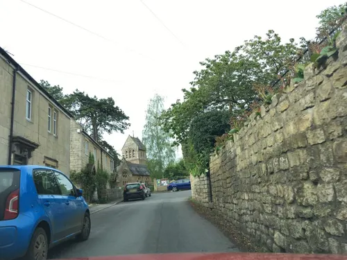

The Cross Guns
Bar and pub · 1.5 mi
159, Bath
Mo Off; Tu Off; We-Th 11:00-21:00; Fr 11:00-22:00; Sa 11:00-23:00;...
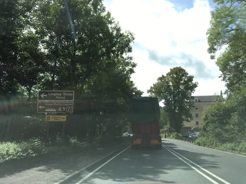



1 more on the map.
History
The 18th-century country house at Waterhouse is a Grade II listed building.
Limpley Stoke was the westernmost part of the ancient hundred of Bradford, and a tithing of Bradford parish, which was divided into civil parishes in 1894.
A small Baptist chapel was built on Middle Stoke in 1815 and rebuilt in 1888, providing 150 seats. The chapel closed in the 1970s. A National School was opened on Middle Stoke in 1845; in 1893 there were 51 pupils. The school closed in 1932 owing to low pupil numbers, and the building is now the village hall.
In 1886 E.G. Browne and J.C. Margetson acquired a cloth mill, known as Avon Mill, on the banks of the River Avon at Limpley Stoke. The previous owners of the mill had originally been timber merchants, but had later diversified into the production of rubber goods. By 1890 the business had transferred to premises in Melksham, where it became the leading industry of the town; the company later became Avon Rubber.
The Hop Pole is a 17th-century pub which was used in 1993 for the filming of The Remains of the Day with Anthony Hopkins. After closing in 2018, it was brought into community ownership and reopened in January 2025.
A landmark water tower, nearby in Friary Wood, is referred to as the Limpley Stoke Water Tower.
Read more of the history
The Kennet and Avon Canal was built in 1804 through the Avon valley, on the other side of the parish boundary. The Somerset Coal Canal opened in 1805; it followed the Midford Brook, again just beyond the parish boundary, to join the Kennet and Avon next to the Dundas Aqueduct in Monkton Combe parish.
In 1857 the Great Western Railway (GWR) built their branch from Bradford Junction, north of Trowbridge, via Bradford on Avon to join their main line at Bathampton. The line follows the Avon valley, on the Limpley Stoke side of the river; Limpley Stoke station was below the north end of the village.
The Coal Canal closed in 1898 and its route was bought by the GWR, who used it to extend their Bristol and North Somerset Railway from Camerton to Limpley Stoke; this line opened in 1910. Passenger traffic was light and ceased in 1925. Goods service from Camerton continued until 1951 and the track was lifted in 1958. The Camerton branch was used to film scenes for the 1953 Ealing comedy, The Titfield Thunderbolt.
Limpley Stoke station closed in 1966. The line remains open, as part of the Wessex Main Line. The Kennet and Avon Canal fell into decline and almost closed in the 1950s, but restoration began in the 1970s and the whole canal was reopened in 1990.
From the History section of Limpley Stoke on Wikipedia, under CC BY-SA 4.0.
Notable people from Limpley Stoke
 Sir Arthur HawkinsEnglish mechanical and electrical engineer (1913-1999)Photo: DavidJaneAlexandra, CC BY-SA 4.0
Born in Limpley Stoke, according to Wikidata (CC0). Each name links to its Wikipedia article.
Where to stay6
Churches and places of worship29
Shopping1
Gas and EV charging1
Schools, colleges and libraries6
Healthcare3
Map of Limpley Stoke
83 places. The map loads OpenStreetMap tiles when you open it.
Getting there and nearby towns
Bristol Airport (BRS) is the nearest airport with scheduled flights listed in OpenStreetMap, 17 miles away.
- Westwood 2 mi southeast, about 3 min by car
- Bath 3 mi northwest, about 5 min by car
- Rode 4 mi south, about 7 min by car
- Trowbridge 5 mi east, about 8 min by car
- Southwick 5 mi southeast, about 8 min by car
- Melksham 8 mi east, about 12 min by car
- Frome 8 mi south, about 13 min by car
- Westbury 8 mi southeast, about 13 min by car
- Corsham 8 mi northeast, about 13 min by car
- Midsomer Norton 8 mi southwest, about 14 min by car
Drive times are estimates from straight-line distance, not routes.
Towns near Limpley Stoke


Keep exploring
Local news
Headlines from INDB.
Reviews, tips and questions
Loading what members have shared...
Sources and licences
- GeoNames (CC BY 4.0): population, coordinates, regions and time zone
- Mapillary (see each image): photos
- OpenStreetMap contributors (ODbL 1.0): places, airports, map data
- Wikidata (CC0 1.0): elevation, founding date, time zone, website, landmarks and historic places
- Wikimedia Commons (see each image): photos
- Wikipedia (CC BY-SA 4.0): overview and history text
Photo credits
- Freshford to Limpley Stoke Footpath - panoramio, Keith Daulby, CC BY 3.0
- Church of St. Mary, Limpley Stoke, ScoobyHugh, CC BY-SA 4.0
- Mission Theatre, Rodw, Public domain
- Pulteney bridge in Bath view from south before noon, Jürgen Matern, CC BY-SA 3.0
- Theatre Royal, Bath, MichaelMaggs, CC BY-SA 2.5
- American Museum in Bath, don cload, CC BY-SA 2.0
- Roman Baths in Bath Spa, England - July 2006, Diliff, CC BY 2.5
- At Bath Postal Museum 2023 23, Photograph by Mike Peel ( www.mikepeel.net )., CC BY-SA 4.0
- Farleigh Hungerford East Gate, nicksarebi, CC BY 2.0
- The Holburne Museum, July 2016, David A. Russo, CC BY-SA 4.0
- Bath parade gardens, Ad Meskens, CC BY-SA 3.0
- Bath cathedrale ext, Velvet, CC BY-SA 3.0
- Chapel of St Mary Tory, Charles Miller, CC BY 2.0
- Christ Church, Bradford-on-Avon, My another account ( talk ), CC0
- Church of our Lady and St Alphege, Oldfield Park, Bath, Jaggery, CC BY-SA 2.0
- Wellow church, Rodw at English Wikipedia, Public domain
- St Leonards Farleigh Hungerford, Mark Anderson, CC BY-SA 2.0
- NortonStPhilip Church1, Required attribution is: Photo by Tom Oates. The original uploader was Nabokov at English Wikipedia . (a.k.a. Tom Oates), CC BY-SA 3.0
- Holy Trinity Church, Bradford-on-Avon, Charles Miller, CC BY 2.0
- University of Bath, Unknown author, CC BY-SA 3.0
- Dundas Aqueduct, from south-east, Rwendland, CC BY-SA 4.0
- Hinton Priory Chapel, Samuel Hieronymus Grimm, Public domain
- Ralph Allen School, Rodw, CC0
- Monkton combe church arp, Arpingstone, Public domain
- Cross Guns, Avoncliff, Rodhullandemu, CC BY-SA 3.0
- Close-up of the inscription (OpenBenches 2414), RichardLucking, CC BY-SA 4.0
- Long shot of the bench (OpenBenches 2414-1), RichardLucking, CC BY-SA 4.0
- Victoria Art Gallery 2008, Rodw, Public domain
- Westwood Manor - Topiary House to the right - panoramio, Adrian Farwell, CC BY 3.0
- Bath - Midford Castle (24567466792), Andrew Bone from Weymouth, England, CC BY 2.0
- Sydney Gardens Flowerbeds, WelshDave, CC BY-SA 4.0
- Street-level photo, southglos, CC BY-SA 4.0
- Street-level photo, chris_debian, CC BY-SA 4.0
- Street-level photo, endszbrxns, CC BY-SA 4.0
- Street-level photo, noid, CC BY-SA 4.0
- Street-level photo, 4004, CC BY-SA 4.0
- Street-level photo, southglos, CC BY-SA 4.0
- Street-level photo, southglos, CC BY-SA 4.0
- Street-level photo, chris_debian, CC BY-SA 4.0
- Street-level photo, southglos, CC BY-SA 4.0
- Street-level photo, chris_debian, CC BY-SA 4.0


Page built November 10, 2026. Spotted a mistake? Tell us or suggest a place.