


Why visit Cromford
Townapedia lists 30 museums and landmarks, 9 parks and trails, 53 places to eat, 13 places to stay and 9 attractions in and around town.
Highlights include Grand Pavilion, Matlock Bath, Great Masson Cavern, Cromford Mills and National Stone Centre.
Weather in Cromford
Forecast from MET Norway (CC BY 4.0). Full forecast
About Cromford
Cromford () is a village and civil parish in Derbyshire, England, in the valley of the River Derwent between Wirksworth and Matlock. It is 17 miles (27 km) north of Derby, 2 miles (3.2 km) south of Matlock and 1 mile (1.6 km) south of Matlock Bath.
From the Wikipedia article Cromford (this version), under CC BY-SA 4.0.
Travel tips from other travellers: Cromford on Wikivoyage (CC BY-SA 4.0).
Things to do9
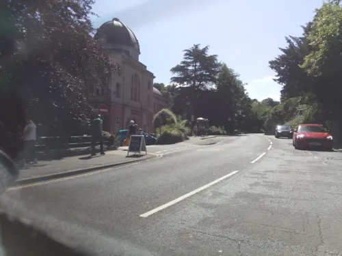
Grand Pavilion, Matlock Bath
Cinema and theater · 0.8 mi
Theatre in Matlock Bath, Derbyshire, England

Great Masson Cavern
Monument and historic site · 1.1 mi
Cave in United Kingdom

Gulliver's Kingdom Resort
Monument and historic site · 0.7 mi
Children's theme park resort in Matlock Bath, Derbyshire

Matlock Bridge
Bridge · 2.0 mi
Grade II* listed bridge in Derbyshire, England, UK



Great Rutland Cavern
Monument and historic site · 1.1 mi
Cave in Derbyshire, United Kingdom


Museums and landmarks30


Crich Stand
Monument and historic site · 3.2 mi
Memorial tower in Crich, Amber Valley, Derbyshire, England, UK

Cromford War Memorial
Monument and historic site
Grade II listed war memorial in Cromford, Derbyshire Dales, Derbyshire, England, UK

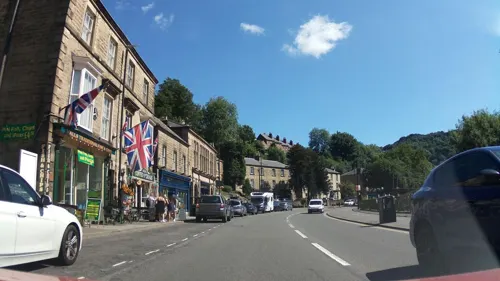
Life in a Lens Museum of Photography & Old Times
Museum · 0.9 mi
Museum in Matlock Bath, Derbyshire, England, UK (2001-2017/8)

Matlock Bath War Memorial
Monument and historic site · 0.9 mi
War memorial in Matlock Bath, Derbyshire, England, UK

National Tramway Museum
Museum · 3.3 mi
United Kingdom national museum of tramways

Pic Tor War Memorial
Monument and historic site · 1.8 mi
Memorial in Matlock Town, Derbyshire Dales, Derbyshire, England, UK


Peak District Mining Museum
Museum · 0.8 mi
Mining museum in Matlock Bath, England, United Kingdom
South Parade, Matlock
Steeple Grange Light Railway
Monument and historic site · 1.0 mi
Old Porter Lane, Matlock
18 more on the map.
Parks, trails and playgrounds9
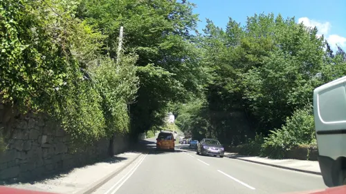
Derwent Gardens
Park · 0.7 mi
Public park in Matlock Bath, Derbyshire, England

Heights of Abraham
Park · 1.1 mi
Tourist attraction in Matlock Bath, Derbyshire, England, UK


Lovers' Walks
Park · 0.7 mi
Public park in Matlock Bath, Derbyshire, England

Restaurants and cafes53
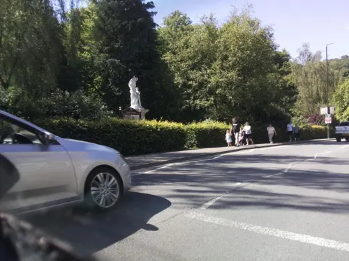

Barley Mow
Bar and pub · 1.4 mi
The Dale, Matlock
Tu-Th 18:00-23:00; Fr 17:00-00:00; Sa 12:00-13:00; Su 12:00-22:30

41 more on the map.
History
It is one of the significant sites in the development of the Industrial Revolution. Here, Richard Arkwright built his cotton mill to make use of the water frame.
More specifically, according to Peak District Online, "Cromford is also known as the 'cradle' or `birthplace` of the Industrial Revolution for this was where Richard Arkwright (1732–1792), perhaps Britain's first ever `industrial tycoon` and known as `The Father of the Factory System` chose to build the world's first water-powered cotton mill in 1771."
The Gell family, who were local Hopton landowners heavily involved in the nearby Wirksworth lead mining district, had the Via Gellia built to connect Cromford and Grangemill in the late 18th century.
Various cottages and farm buildings pre-date Arkwright's time, but a large part of the village was built to house the mill workers. One source states that these are now considered to be "the first factory housing development in the world". Employees were provided with shops, pubs, chapels and a school.
Willersley Castle, now a Grade II* listed building, was also built by Richard Arkwright in 1791; after a fire in 1792, it was rebuilt and occupied by his son Richard Arkwright junior starting in 1796.
Read more of the history
In the early 1800s, Scarthin Nick was "blasted through with dynamite to make way for what later became the A6, thus annexing the Arkwright industrial mill complex on the east side of the main Derby road and the Market Place and village at the bottom of the hill which climbs steeply westward towards Wirksworth, on the other".
The 20th century saw the development of council and private housing. Dene quarry, currently operated by Tarmac Ltd for the production of aggregates and roadstone, was excavated to the south west of the village from 1942 onwards.
In December 2001 a 15 miles (24 km) corridor from Masson Mill in Matlock Bath to the Silk Mill in Derby and including the mills in Cromford, Milford, Belper and Darley Abbey was declared the Derwent Valley Mills World Heritage Site. Masson Mill was described by the Peak District Online in 2006 as "perhaps the most prominent of Arkwright’s constructions ... and still in use today as a heritage site museum and retailer outlet".
From the History section of Cromford on Wikipedia, under CC BY-SA 4.0.
More about Cromford
Geography
The River Derwent, with its sources on Bleaklow in the Dark Peak, flows southward to Derby and then into the River Trent. The geology of this section in the Derbyshire Dales is that of limestone. The fast flowing river has cut a deep valley. The A6 trunk road, which was the main road between London and Manchester in former times, the Cromford Canal and the Derwent Valley Line, linking Derby and Matlock, were all built in the river valley. The Via Gellia valley joins the Derwent at Cromford; however, the stream which runs through that valley is actually the Ivonbrook and historically the valley was called the Ivonbrook Valley. The Via Gellia is simply the name of the road which runs along it, named after the Gell family who owned many mines in the area.
From the Wikipedia article Cromford, under CC BY-SA 4.0.
Notable people from Cromford
- George TurnerBritish artist (1841-1910)
- Alison UttleyEnglish writer (1884-1976)
- Ian BuxtonEnglish footballer (1938-2010)
- Jack FryerBritish association football player (1877-1933)
- Sue EssexBritish politician (born 1945)
- Charles BrownBritish Labour Party politician, born 1884
- Michael Wynne-ParkerBritish consultant, author and lecturer (born 1945)
Born in Cromford, according to Wikidata (CC0). Each name links to its Wikipedia article.
Where to stay13
Churches and places of worship18
Shopping16
Gas and EV charging1
Schools, colleges and libraries4
Matlock Bath Holy Trinity CofE Controlled Primary School
School · Anglican · 0.6 mi
14 Clifton Road, Matlock
Map of Cromford
153 places. The map loads OpenStreetMap tiles when you open it.
Getting there and nearby towns
East Midlands Airport (EMA) is the nearest airport with scheduled flights listed in OpenStreetMap, 22 miles away.
- Matlock 2 mi north, about 3 min by car
- Tansley 2 mi northeast, about 4 min by car
- South Wingfield 5 mi east, about 8 min by car
- Belper 7 mi southeast, about 11 min by car
- Alfreton 7 mi east, about 12 min by car
- Youlgreave 7 mi northwest, about 11 min by car
- Ripley 8 mi southeast, about 14 min by car
- Pinxton 10 mi east, about 16 min by car
- Chesterfield 11 mi northeast, about 18 min by car
- Heanor 11 mi southeast, about 17 min by car
Drive times are estimates from straight-line distance, not routes.
Towns near Cromford


Keep exploring
Local news
Headlines from INDB.
Reviews, tips and questions
Loading what members have shared...
Sources and licences
- GeoNames (CC BY 4.0): population, coordinates, regions and time zone
- Mapillary (see each image): photos
- OpenStreetMap contributors (ODbL 1.0): places, airports, map data
- Wikidata (CC0 1.0): elevation, founding date, time zone, website, landmarks and historic places
- Wikimedia Commons (see each image): photos
- Wikipedia (CC BY-SA 4.0): overview and history text
Photo credits
- Trent Barton FJ55 BZO at Cromford (16713746489), Ed Webster, CC BY 2.0
- Gulliver's Kingdom - Rides, PLTRON, CC BY-SA 4.0
- National Stone Centre 1734149 faeb4fc8, Peter Barr, CC BY-SA 2.0
- Crich Stand2, Rob Bendall ( Highfields ), Attribution
- Cromford War Memorial 3690, Clem Rutter, Rochester, Kent., CC BY-SA 3.0
- War memorial - small park - North Parade - Matlock Bath (15095711948), Elliott Brown from Birmingham, United Kingdom, CC BY-SA 2.0
- Pic Tor War Memorial, Bill Boaden, CC BY-SA 2.0
- Christ Church, Lea, Derbyshire 01, Enchufla Con Clave, CC BY-SA 4.0
- St Giles Church, Rob Bendall ( Highfields ), Attribution
- Tansley - Church, Dave Bevis, CC BY-SA 2.0
- Cromford 1771 mill, chevin, Public domain
- Gulliver'sLand, PLTRON, CC BY-SA 4.0
- Ribercastleexteriorrealok2, AxG at English Wikipedia, Public domain
- Matlock High Tor title QS:P1476,en:"Matlock High Tor" label QS:Len,"Matlock High Tor", John Warwick Smith (1749 - 1831) – Artist (British) Born in Cumberland. Died in London. Details on Google Art Project, Public domain
- The Great Masson Cavern, TheHeightsofAbraham, CC BY-SA 4.0
- Matlock Bridge. - panoramio, Robert Powell, CC BY-SA 3.0
- View above Bolehill, Derbyshire (51604101266), The Roaming Picture Taker, CC BY 2.0
- Leawood Pump House and Cromford Canal Aqueduct, Douglal, CC BY-SA 4.0
- Crich Tramway Village - National Tramway Museum - Crich - K1 Telephone Box (15185984729), Elliott Brown from Birmingham, United Kingdom, CC BY-SA 2.0
- Heights of Abraham (16716886350), Michael D Beckwith, CC0
- Street-level photo, southglos, CC BY-SA 4.0
- Street-level photo, ntzm, CC BY-SA 4.0
- Street-level photo, southglos, CC BY-SA 4.0
- Street-level photo, southglos, CC BY-SA 4.0
- Street-level photo, southglos, CC BY-SA 4.0
- Street-level photo, southglos, CC BY-SA 4.0
- Street-level photo, dudone, CC BY-SA 4.0
- Street-level photo, dudone, CC BY-SA 4.0
- Street-level photo, southglos, CC BY-SA 4.0
- Street-level photo, adam2, CC BY-SA 4.0
- Street-level photo, pedrito1414, CC BY-SA 4.0
- Street-level photo, southglos, CC BY-SA 4.0
- Street-level photo, southglos, CC BY-SA 4.0
- Street-level photo, adam2, CC BY-SA 4.0
- Street-level photo, southglos, CC BY-SA 4.0
- Street-level photo, pedrito1414, CC BY-SA 4.0
- Street-level photo, southglos, CC BY-SA 4.0
- Street-level photo, southglos, CC BY-SA 4.0
- Street-level photo, southglos, CC BY-SA 4.0
- Street-level photo, dudone, CC BY-SA 4.0
- Street-level photo, southglos, CC BY-SA 4.0
- Street-level photo, southglos, CC BY-SA 4.0


Page built November 10, 2026. Spotted a mistake? Tell us or suggest a place.