


Youlgreave, United Kingdom
Youlgreave is a town of 1,018 people in England, United Kingdom.
Why visit Youlgreave
Townapedia lists 11 museums and landmarks, 3 parks and trails, 8 places to eat, 10 places to stay and 7 attractions in and around town.
Highlights include Bakewell Bridge, Doll Tor Stone Circle and Nine Stones Close.
Weather in Youlgreave
Forecast from MET Norway (CC BY 4.0). Full forecast
About Youlgreave
Youlgreave or Youlgrave is a village and civil parish in the Peak District of Derbyshire, England, on the River Bradford 2+1⁄2 miles (4.0 km) south of Bakewell. The name possibly derives from "yellow grove", the ore mined locally being yellow in colour.
From the Wikipedia article Youlgreave (this version), under CC BY-SA 4.0.
Photos of Youlgreave


Things to do7

Bakewell Bridge
Bridge · 2.9 mi
Grade I listed bridge in Bakewell, Derbyshire, England



Museums and landmarks11

Doll Tor Stone Circle
Monument and historic site · 2.0 mi
Small 6 stones circle formed part of a larger complex with a ditch, cairn (stone mound) and nearby boulders possibly associated

Nine Stones Close
Monument and historic site · 1.4 mi
Bronze age stone circle in Derbyshire, England, UK

Arbor Low
Monument and historic site · 3.0 mi
Neolithic henge monument

Bakewell Old House Museum
Museum · 2.8 mi
Grade II* listed building and museum in Bakewell, Derbyshire, England, UK
Doll Tor
Monument and historic site · 2.0 mi
Stone circle in Derbyshire, England, UK

Gib Hill
Monument and historic site · 3.1 mi
Barrow in Middleton and Smerrill, Derbyshire Dales, Derbyshire, England, UK

Nine Ladies
Monument and historic site · 2.6 mi
Bronze Age stone circle located in Derbyshire, England

War Memorial
Monument and historic site · 2.8 mi
Grade II listed war memorial in Bakewell, Derbyshire Dales, Derbyshire, England, UK

Parks, trails and playgrounds3


Restaurants and cafes8

Flying Childers
Bar and pub · 2.0 mi
Main Road, Matlock
Mo-Tu 19:00-23:00; We-Fr 12:00-14:00, 19:00-23:00; Sa-Su...


Bulls Head
Bar and pub
Fountain Square, Bakewell
Mo-Th 17:00-23:00; Fr 17:00-00:00; Sa 12:00-00:00; Su 12:00-23:00
History
Youlgreave was mentioned in the Domesday Book as belonging to Henry de Ferrers and being worth sixteen shillings.
All Saints' Church, Youlgreave, has a 12th-century font. The main round bowl is carved with decorative motifs, and it has a second small bowl, supported by a salamander corbel. The font was moved to Youlgreave in the 19th century, from the church at Elton. The building is grade I listed.
There are also a number of historic buildings in the village, such as Old Hall Farm (1630), Thimble Hall and The Old Hall (c.1650).
Most of the village's households get their water from Youlgreave Waterworks Limited, one of very few private water companies in Britain. It came about when Youlgreave Friendly Society for Women helped to set up a fund to pipe water from Mawstone springs into the village, terminating at the Grade II listed "Conduit Head" of 1829, in Fountain Square. In the 1930s, as new houses were built and older ones were modernised with bathrooms and toilets, water often became short. In 1932 the main underground pipe cracked after an explosion in Mawstone lead mine. Springs at Harthill were connected to the system in 1949 and other major improvements followed. Most homes in the village could be supplied with local water until there were just too many new houses to cope with. Extra supplies are purchased from larger water companies nowadays.
Read more of the history
A Wesleyan Methodist Chapel was erected in 1807 and enlarged to celebrate its centenary in 1907. A Wesleyan Reform Chapel was opened in 1857. A Primitive Methodist Church designed by Henry Harper was opened in 1895 to replace the original chapel of 1822.
In 1932 five of six miners working on a ventilation fan at Mawstone Mine were killed after an explosion filled the gallery with carbon monoxide. The sixth miner was able to reach the surface and raise the alarm. A rescue party of two workers and the mine manager descended into the mine, but were themselves killed by the fumes. Although Mawstone Mine was eventually closed, a water supply for the village is still obtained from this site.
From the History section of Youlgreave on Wikipedia, under CC BY-SA 4.0.
More about Youlgreave
Geography
The village is on the B5056 and the parish has an area of 2,515 acres (3.93 sq mi; 1,020 ha). Youlgrave is at an altitude of 600 ft (183 m) located on the southwestern edge of a Carboniferous plateau. It stands on the hillside above the confluence of Lathkill Dale and Bradford Dale. To the east, the geology is shale-like rather than limestone. The area is home to many mineral veins such as fluorspar, galena (lead ore) and calamine (zinc ore).
Three long-distance paths, the Alternative Pennine Way, the Limestone Way and the White Peak Way, pass through the village, swelling the number of walkers.
Arts and culture
Because of its scenic location in the Peak District, Youlgreave is a popular destination for hikers. The Limestone Way passes through Bradford Dale, immediately south of the village. Langley Park School for Boys owns a building in the village, which is used for school trips, students taking part in various local sporting activities and a visit to nearby Alton Towers.
A Guinness World Records Certificate names Thimble Hall in Youlgreave as 'the world's smallest detached house' at 11 feet 10 inches (3.61 m) × 10 ft 3 in (3.12 m) and 12 ft 2 in (3.71 m) high. The property made national headlines in 1999 when sold at auction for £39,500. Each room is less than 8 feet square and there was a fixed ladder to the bedroom, a stone fireplace, exposed beams and exposed floorboards in the bedroom. It was home to a family of eight around a hundred years ago. It was last occupied as a dwelling in the early 1930s and is currently being converted into a craft gallery. It is a Grade II listed building.
The Youlgreave Festival, founded in 2001, offers local artists and musicians a chance to showcase their talents.
There are popular walking paths through the valley following the River Bradford.
From the Wikipedia article Youlgreave, under CC BY-SA 4.0.
Notable people from Youlgreave
- Joseph BirdsEnglish footballer (1887-1966)
- Maurice OldfieldChief of the SIS
Born in Youlgreave, according to Wikidata (CC0). Each name links to its Wikipedia article.
Where to stay10
Churches and places of worship17
Gas and EV charging1
Schools, colleges and libraries1
Map of Youlgreave
58 places. The map loads OpenStreetMap tiles when you open it.
Getting there and nearby towns
Manchester Airport (MAN) is the nearest airport with scheduled flights listed in OpenStreetMap, 27 miles away.
- Matlock 6 mi southeast, about 10 min by car
- Buxton 11 mi northwest, about 17 min by car
- Chesterfield 12 mi northeast, about 20 min by car
- Dronfield 13 mi northeast, about 20 min by car
- Fulwood 13 mi northeast, about 22 min by car
- Belper 14 mi southeast, about 22 min by car
- Alfreton 14 mi east, about 22 min by car
- High Peak 15 mi northwest, about 24 min by car
- Leek 15 mi west, about 23 min by car
- Sheffield 17 mi northeast, about 28 min by car
Drive times are estimates from straight-line distance, not routes.
Towns near Youlgreave


Keep exploring
Local news
Headlines from INDB.
Reviews, tips and questions
Loading what members have shared...
Sources and licences
- GeoNames (CC BY 4.0): population, coordinates, regions and time zone
- Mapillary (see each image): photos
- OpenStreetMap contributors (ODbL 1.0): places, airports, map data
- Wikidata (CC0 1.0): elevation, founding date, time zone, website, landmarks and historic places
- Wikimedia Commons (see each image): photos
- Wikipedia (CC BY-SA 4.0): overview and history text
Photo credits
- Medway Cottage, Youlgreave, Michael Dibb, CC BY-SA 2.0
- Nine Stones Close, Derbyshire, showing the four stones that remain, MichaelMaggs, CC BY-SA 4.0
- Arbor Low henge, Derbyshire-Pano, MichaelMaggs, CC BY-SA 4.0
- Old House Museum, Bakewell 201307 166, Elisa.rolle, CC BY-SA 4.0
- Nine Ladies 02, PaleCloudedWhite, CC BY-SA 4.0
- Bakewell War Memorial, Dave.Dunford, CC BY-SA 4.0
- All Saints Church, Bakewell, Rob Bendall ( Highfields ), Attribution
- All Saints' Church, Elton (5453367794), Robert Cutts from Bristol, England, UK, CC BY 2.0
- Haddon Hall near Bakewell, Derbyshire, UK 12, René Cortin, CC BY-SA 4.0
- Church-Ashford in the Water - panoramio, PJMarriott, CC BY 3.0
- Stanton in Peak HT church, Geoff Pick, CC BY-SA 2.0
- Doll tor stone circle, Elfmeterschiessen, CC BY-SA 3.0
- St Anne's Church, Over Haddon, Natalie-S, CC BY-SA 4.0
- Youlgreave, Derbyshire ... youth hostel in the old Co - op. (8221662592), bazzadarambler, CC BY 2.0
- Red (29781109543), flöschen, CC BY 2.0
- 2016 Bakewell Welldressing 2, Silverfish, CC BY-SA 4.0
- Close-up of the inscription (OpenBenches 4496-1), sjorford, CC BY-SA 4.0
- Long shot of the bench (OpenBenches 4496-2), sjorford, CC BY-SA 4.0
- View from the bench (OpenBenches 4496-3), sjorford, CC BY-SA 4.0
- Close-up of the inscription (OpenBenches 4496), sjorford, CC BY-SA 4.0
- 2016 Bakewell Welldressing 1, Silverfish, CC BY-SA 4.0
- Drinking fountain near Bakewell Bridge, Dave.Dunford, CC BY-SA 4.0
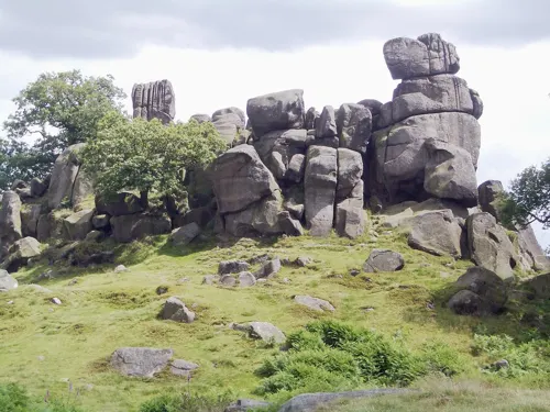
- Robin Hood's Stride - May 2020, Douglal, CC BY-SA 4.0
- Gib hill barrow with several markers visible, Beep boop beep, CC BY-SA 4.0
- The Flying Childers, Stanton in Peak, John Slater, CC BY-SA 2.0
- Street-level photo, adam2, CC BY-SA 4.0
- Street-level photo, coljay72, CC BY-SA 4.0


Page built November 10, 2026. Spotted a mistake? Tell us or suggest a place.