


Why visit Delabole
Townapedia lists 6 museums and landmarks, 3 places to eat, 2 places to stay and 4 attractions in and around town.
Highlights include St Nectan's Kieve, Tintagel Haven, North Cornwall Museum and Art Gallery and Round called Castle Goff.
Weather in Delabole
Forecast from MET Norway (CC BY 4.0). Full forecast
About Delabole
Delabole (Cornish: Delyow Boll) is a large village and civil parish in north Cornwall, England, United Kingdom, which lies approximately two miles (3 km) west of Camelford.
From the Wikipedia article Delabole (this version), under CC BY-SA 4.0.
Things to do4

St Nectan's Kieve
Waterfall · 3.0 mi
Waterfall and pool near Tintagel, Cornwall

Tintagel Haven
Beach · 3.3 mi
Section of coastline in Northern Cornwall, UK

Museums and landmarks6
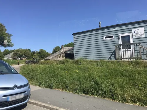
North Cornwall Museum and Art Gallery
Museum · 2.2 mi
Privately owned local museum and art gallery

Round called Castle Goff
Monument and historic site · 1.2 mi
Archaeological site in Cornwall, England, UK



Restaurants and cafes3
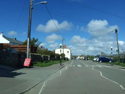
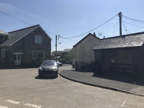
Smugglers Fish And Chips
Fast food
Traditional fish and chip shop in Delabole.
1 High Street
Mo-Sa 12:00-13:30; Mo-Th, Su 16:30-20:00; Fr, Sa 16:30-20:30

Where to stay2

History
The manor of Delabole (Deliou) was recorded in the Domesday Book (1086) when it was held by Roger from Robert, Count of Mortain. There was one hide of land and land for 4 ploughs. There were 1 plough, 1 serf, 1 villein, 3 smallholders, 1 acre of meadow, 40 acres of pasture, 5 cattle and 25 sheep. The value of the manor was 10 shillings though it had formerly been worth 30 shillings.
Until 1 April 2021 the village formed part of the civil parish of St Teath, but it was separated into its own parish in time for the election of the first Delabole Parish Council in May 2021. The parish also covers the hamlets of Treligga and Westdowns.
From the History section of Delabole on Wikipedia, under CC BY-SA 4.0.
More about Delabole
Economy
Delabole was the birthplace of the Cornwall Air Ambulance. Businesses include Delabole Quarry and Delabole wind farm, the first commercial wind farm in the UK. The Gaia Energy Centre opened on the wind farm site in 2001 as a tourist attraction. It cost £5m and was intended to attract 150,000 visitors a year. It closed after three years of opening when it only achieved one tenth of the required visitor numbers. Most of the funding for the centre came from Europe, with £300,000 grants from Objective One and SWDRA, the South West Regional Development Agency.
Delabole Quarry is one of the largest slate quarries in England and has been operated continuously since the 15th century, making it the oldest working slate quarry in England. Indeed, it is reputed that slate has been quarried here since the reign of King Stephen. In the reign of Elizabeth I the five quarries on the site of the now larger pit assumed considerable importance delivering slate to Brittany and the Netherlands. In 1841 the five quarries were combined to make the Old Delabole Slate Quarry.
Arts and culture
Delabole is renowned for its annual carnival, one of the biggest in Cornwall. It was revived in 2001 after a break of nearly forty years. The week of events takes place in July each year. Until the 1950s there was a cinema: the Regal.
Delabole has a King George V Playing Field. Delabole United AFC (nicknamed the Slaters) is an association football team who play in the Duchy League.
There were Cornish wrestling tournaments, for prizes, held at the Commercial Hotel and at Medrose in the early 20th century.
From the Wikipedia article Delabole, under CC BY-SA 4.0.
Notable people from Delabole
 Philip GrossPoet, novelistPhoto: WanderingTrad, CC BY-SA 4.0
Born in Delabole, according to Wikidata (CC0). Each name links to its Wikipedia article.
Churches and places of worship8
Gas and EV charging1
Schools, colleges and libraries1
Map of Delabole
25 places. The map loads OpenStreetMap tiles when you open it.
Getting there and nearby towns
Cornwall Airport Newquay (NQY) is the nearest airport with scheduled flights listed in OpenStreetMap, 17 miles away.
- Tintagel 3 mi north, about 5 min by car
- Bodmin 11 mi south, about 17 min by car
- St Austell 20 mi south, about 31 min by car
- Lifton 20 mi east, about 32 min by car
- Newquay 21 mi southwest, about 33 min by car
- Polperro 22 mi southeast, about 36 min by car
- Tavistock 26 mi east, about 42 min by car
- Saltash 27 mi southeast, about 43 min by car
- Truro 29 mi southwest, about 46 min by car
- Plymouth 31 mi southeast, about 50 min by car
Drive times are estimates from straight-line distance, not routes.
Towns near Delabole


Keep exploring
Local news
Headlines from INDB.
Reviews, tips and questions
Loading what members have shared...
Sources and licences
- GeoNames (CC BY 4.0): population, coordinates, regions and time zone
- Mapillary (see each image): photos
- OpenStreetMap contributors (ODbL 1.0): places, airports, map data
- Wikidata (CC0 1.0): elevation, founding date, time zone, website, landmarks and historic places
- Wikimedia Commons (see each image): photos
- Wikipedia (CC BY-SA 4.0): overview and history text
Photo credits
- St Nectan's Kieve-8684, Raimond Spekking, CC BY-SA 4.0
- Tintagel in north Cornwall - aerial image (29868958812), John Fielding from Norwich, UK, CC BY 2.0
- Tintagel Ruins - Mainland Courtyard 01, Rawac, CC BY-SA 3.0
- Tintagel Old Post Office, Zaian at English Wikipedia, Public domain
- St Piran's Church, Trethevey (5523), Nilfanion, CC BY-SA 4.0
- Tintagel church 1, Herbythyme, CC BY-SA 4.0
- Lanteglos DSC 8710A, Dietrich Krieger, CC BY-SA 3.0
- Pulpit, St Thomas of Canterbury's Church, Camelford, Cornwall - April 2023, Mutney, CC BY-SA 4.0
- Street-level photo, miguel_andrade, CC BY-SA 4.0
- Street-level photo, miguel_andrade, CC BY-SA 4.0
- Street-level photo, alexanderar, CC BY-SA 4.0
- Street-level photo, miguel_andrade, CC BY-SA 4.0
- Street-level photo, miguel_andrade, CC BY-SA 4.0
- Street-level photo, WaggyDog, CC BY-SA 4.0
- Street-level photo, miguel_andrade, CC BY-SA 4.0

Page built November 10, 2026. Spotted a mistake? Tell us or suggest a place.