


Dukinfield, United Kingdom
Dukinfield is a town of 21,155 people in England, United Kingdom.
Why visit Dukinfield
Townapedia lists 9 museums and landmarks, 14 parks and trails, 119 places to eat, 3 places to stay and 4 attractions in and around town.
Highlights include Tameside Hippodrome, Alhambra Theatre, Stalybridge War Memorial and Ashton Under Lyne War Memorial.
Weather in Dukinfield
Forecast from MET Norway (CC BY 4.0). Full forecast
About Dukinfield
Dukinfield is a town in Tameside, Greater Manchester, England. It lies on the south bank of the river Tame opposite Ashton-under-Lyne, 6.3 miles (10.1 km) east of Manchester. At the 2021 census, the built-up area as defined by the Office for National Statistics had a population of 21,155. It formed part of the historic county boundaries of Cheshire, becoming part of Greater Manchester in 1974.
From the Wikipedia article Dukinfield (this version), under CC BY-SA 4.0.
Things to do4
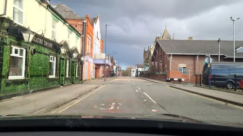
Tameside Hippodrome
Cinema and theater · 1.0 mi
Theatre and former cinema in Ashton-under-Lyne, Greater Manchester, England, UK
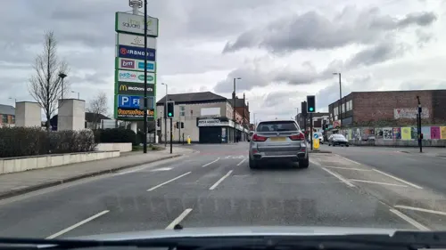
Alhambra Theatre
Cinema and theater · 3.1 mi
Former theatre and cinema in Openshaw, Manchester, England, later a bingo hall and sports venue

Theatre Royal
Cinema and theater · 1.8 mi
Former theatre and cinema in Hyde, Greater Manchester, England, UK

Museums and landmarks9

Stalybridge War Memorial
Monument and historic site · 1.4 mi
War memorial in Stalybridge, Greater Manchester, England, UK

Ashton Under Lyne War Memorial
Monument and historic site · 1.0 mi
War memorial in Tameside, Greater Manchester, England, UK


Replica of the old cross
Monument and historic site · 0.9 mi
The first reference to Ashton market cross comes from local marriage registers of 1854. The ancient cross was replaced in 1763 or 1764...
Parks, trails and playgrounds14





2 more on the map.
Restaurants and cafes119
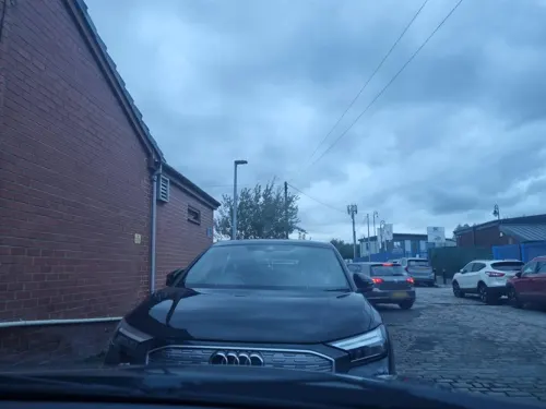
Plaza
Restaurant · Indian · 1.3 mi
90 Audenshaw Road, Manchester
Mo-Th 16:00-23:00, Fr 16:00-00:00, Sa 13:00-24:00; Su 13:00-22:00

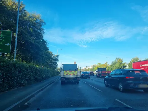
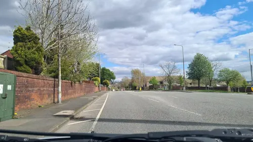

Bella Italia
Restaurant · Italian · 1.4 mi
Fold Way, Ashton-under-Lyne
Mo-Th 11:30-22:00; Fr-Sa 11:30-23:00; Su 11:30-22:00
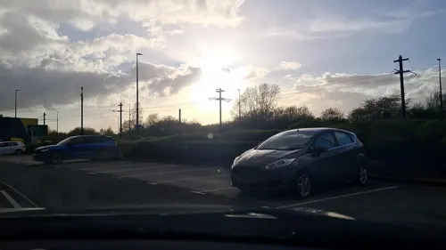



Pizza Hut
Restaurant · Pizza · 1.1 mi
4-8 Henrietta Street, Ashton-under-Lyne
Mo-Su 11:00-23:00
107 more on the map.
History
The earliest evidence of human activity around Dukinfield comes from a collection of four flints from the late Neolithic / early Bronze Age. The artifacts were discovered on the site of Dukinfield Hall and have been taken as evidence of a prehistoric settlement on the site. There is no further evidence of activity in the area until the Roman period. A third century bronze Roman coin from the reign of Emperor Tetricus I was discovered in the town.
Dukinfield means "Raven of the Field" and derives from the Old English duce and feld.
Early records show the township was included in the fee of Dunham Massey. It was held by Matthew de Bramhall in about 1190, and after that by a family who took the name "De Dokenfeld". The family lived at the moated Dukinfield Old Hall, which originated from after the Norman conquest and was rebuilt in Tudor times, remaining the home of the Dukinfields till the 18th century, after which it became derelict. During the English Civil War, Colonel Robert Duckenfield of Dukinfield Hall was a noted commander in the New Model Army. The Dukinfield baronetcy was created in 1665 for Robert Dukinfield, son of Colonel Robert Dukinfield.
Read more of the history
The Dukinfields held the manor for five centuries, until the widow of Sir William Dukinfield Daniel married John Astley in 1767 and he inherited the estate. John Astley was an artist and architect; he designed and built Dukinfield Lodge on a hill overlooking the river Tame as a new seat for the family, replacing the old wooden hall. His son Francis Dukinfield Astley succeeded him as lord of the manor in 1787; his son, Francis Dukinfield Palmer Astley, followed in 1825.
Industrialisation, particularly in the cotton trade, helped shape the town, but its rapid development destroyed its former pasture and meadow land. Two cotton mills were built before 1794 and by 1825 there were seven. The industry continued to expand and, by the end of the 19th century, 14 spinning mills of varying sizes were in operation. The largest mills were built in brick during the 1890s, with four or five storeys, large windows, ornamental towers, engine houses and tall brick built chimneys; they included Tower, Tame Valley, River, Park Road and Queen Mills. Most of the cotton mills have now been demolished, but some have been preserved and converted into flats.
Coal pits exploiting the underlying coal measures to the south of the Lancashire Coalfield were a major part of Dukinfield's industrial history. One pithead was located on Birch Lane, now the site of All Saints' Catholic College, with another near the northern border with Ashton-under-Lyne. Francis Dukinfield Astley first started developing collieries in the town around 1820 and his son, Francis Dukinfield Palmer Astley, continued to develop the two most notable mines after his father's death in 1825 — Dukinfield and Astley Deep Pit — both of which suffered explosions which killed many workers:
Dukinfield Colliery (also known as Lakes Pit or Victoria Colliery) was owned by Astley's Dukinfield Colliery Company. The colliery had two shafts, the downcast was 1,020 feet (311 m) deep to the Black mine (coal seam) and was connected to the upcast ventilation shaft. On 4 June 1867, 38 men and boys died of suffocation following an explosion caused by a faulty safety lamp and poor management.
Astley Deep Pit, was off King's Street opposite Brownlea Avenue was developed by Astley but, by 1874, was owned by Benjamin Ashton. The colliery's downcast shaft was 2,058 feet (627 m) deep and its workings extended over a mile to the south and about 1,300 yards (1,189 m) to the north of the shaft. This colliery was reported to be at one time, the deepest coal mine in the world, at 2,100 feet (640 m) and had three shafts. On 14 April 1874, an underground gas explosion killed 54 men. After the pit closed in 1901, the shafts were filled in and left to stand for many years before being built on; it is now the site of a development of houses comprising Angel Close, Oval Drive and Silver Close.
Samuel Robinson, a Unitarian, industrialist and scholar, founded the village library in 1833 and was dubbed the "foremost promoter of education in the district" before his death in 1884. Daniel Adamson a mechanical engineer became the first chairman of the Manchester Ship Canal Company. He owned an engineering works producing Lancashire boilers at Newton Wood beside the Manchester, Sheffield and Lincolnshire Railway. He died on 13 January 1890; the Adamson Military Band, named after Adamson is based in Dukinfield. The MS&LR's successor, the Great Central Railway, moved its carriage and wagon works to Dukinfield in 1910.
Dukinfield and its surrounding towns were major centres of civil revolt during the 19th century and briefly the area was a hotbed of Chartism, the popular movement calling for universal suffrage via a People's Charter. Chartist leader, Reverend Joseph Rayner Stephens is buried in St John's Churchyard.
From the History section of Dukinfield on Wikipedia, under CC BY-SA 4.0.
More about Dukinfield
Geography
Dukinfield's borders are defined to the north and west by the river Tame. The town is situated at the edge of the Cheshire Plain, where it meets the Pennines; it is the first town on the hill. The park is situated approximately a quarter of a mile from the town hall along King Street towards Hyde in the south. The park is terraced and is over 90 feet (27 m) higher at the top because of the steep rise out of the plain; the hill flattens out slightly before rising steeply again towards the east, where the library is situated.
The town hall is also at the base of the same hill with Astley Street rising steeply along its shorter southern side, before climbing some 120 feet (37 m) to the crest of the ridge. The local soil is mainly clayey with some alluvial deposits.
Economy
According to the 2001 UK census, the industry of employment of residents of Dukinfield aged 16–74 was: 24.4% manufacturing, 19.3% retail and wholesale, 10.0% health and social work, 9.5% property and business services, 7.2% construction, 6.5% transport and communications, 5.7% education, 4.7% public administration, 4.4% finance, 3.4% hotels and restaurants, 1.0% energy and water supply, 0.3% agriculture, 0.1% mining and 3.6% other.
Compared with national figures, the town had a relatively high proportion of people working in manufacturing and low levels of people working in agriculture, public administration and education. The census recorded the economic activity of residents aged 16–74, 2.1% students were with jobs, 2.8% students without jobs, 4.9% looking after home or family, 7.9% permanently sick or disabled, and 2.7% economically inactive for other reasons.
Education
There are numerous primary schools and nurseries in the town. There are secondary schools, but no dedicated facility in Dukinfield for further education; the nearest establishment is Tameside College in Ashton and Hyde.
All Saints Catholic College provides education for 16- to 18-year-olds. Since 1998, the sixth form facility has been provided for in a purpose-built extension to the main school.
From the Wikipedia article Dukinfield, under CC BY-SA 4.0.
Notable people from Dukinfield
 Carole JamesCanadian politicianPhoto: BC NDP, CC BY 2.0
 Roderick JonesEnglish journalist who headed the Reuters news agencyPhoto: Elliott & Fry, Public domain
 John NorthNew Zealand Baptist minister, editor, theological college principal (1871-1950)Photo: S. P. Andrew, Public domain
 Dennis WalshEnglish astronomer (1933-2005)Photo: Rights NRAO/AUI/NSF Photographer..., CC BY 4.0
- Tony BrooksBritish racing driver
- Shirley StelfoxBritish actress (1941–2015)
- Kathy StaffBritish actress (1928–2008)
- Ronnie HazlehurstEnglish composer (1928-2007)
- Cyril CartwrightBritish bicycle racer (1928–2015)
- Buddy OldfieldEnglish cricketer (1911-1996)
- Jean FrancoBritish academic (1924–2022)
- Herbert CooperEnglish cricketer (1883-1963)
Born in Dukinfield, according to Wikidata (CC0). Each name links to its Wikipedia article.
Where to stay3
Churches and places of worship45
St Michael and All Angels' Church, Ashton-under-Lyne
Church · 0.9 mi
Shopping20
Gas and EV charging12
Schools, colleges and libraries39
Parochial Church of England Primary and Nursery School
School · Anglican · 0.9 mi
Keppel Street, Ashton-under-Lyne
St James' Church of England Primary School
School · Anglican · 1.1 mi
Romney Street, Ashton-under-Lyne
Hurst Knoll St James' Church of England Primary School
School · Anglican · 1.5 mi
Ladbrooke Road, Ashton-under-Lyne
Healthcare9
Map of Dukinfield
250 places. The map loads OpenStreetMap tiles when you open it.
Getting there and nearby towns
Manchester Airport (MAN) is the nearest airport with scheduled flights listed in OpenStreetMap, 12 miles away.
- Stalybridge 1 mi northeast, about 2 min by car
- Hollinwood 3 mi northwest, about 6 min by car
- Lees 4 mi north, about 7 min by car
- Oldham 5 mi north, about 8 min by car
- Stockport 5 mi southwest, about 9 min by car
- Manchester 6 mi west, about 10 min by car
- Marple 6 mi south, about 9 min by car
- Saddleworth 6 mi northeast, about 10 min by car
- Glossop 6 mi east, about 10 min by car
- Royton 6 mi north, about 10 min by car
Drive times are estimates from straight-line distance, not routes.
Towns near Dukinfield


Keep exploring
Local news
Headlines from INDB.
Reviews, tips and questions
Loading what members have shared...
Sources and licences
- GeoNames (CC BY 4.0): population, coordinates, regions and time zone
- Mapillary (see each image): photos
- OpenStreetMap contributors (ODbL 1.0): places, airports, map data
- Wikidata (CC0 1.0): elevation, founding date, time zone, website, landmarks and historic places
- Wikimedia Commons (see each image): photos
- Wikipedia (CC BY-SA 4.0): overview and history text
Photo credits
- Dukinfield Town Hall front, Alan Bate, CC BY-SA 2.0
- Theatre Royal, Hyde, Izzak, CC BY-SA 3.0
- Stalybridge war memorial (6), Rept0n1x, CC BY-SA 3.0
- Ashton-under-Lyne War Memorial (1), Rept0n1x, CC BY-SA 3.0
- Albion United Reformed Church, Ashton under Lyne, A. Carty ( talk ), CC BY-SA 3.0
- St John's Church, Dukinfield, Gerald England, CC BY-SA 2.0
- St Lawrence's Church, Denton 2005, Roger May, CC BY-SA 2.0
- St Michaels and All Saints Church, Ashton-under-Lyne 2008, Gerald England, CC BY-SA 2.0
- Stamford Park, Tameside (5), Rept0n1x, CC BY-SA 3.0
- The Witchwood, Ashton-under-Lyne, Alexander P Kapp, CC BY-SA 2.0
- Stannybrook road on daisy nook, Marc A Gibbs, CC BY-SA 4.0
- Street-level photo, mappo2, CC BY-SA 4.0
- Street-level photo, mappo2, CC BY-SA 4.0
- Street-level photo, mappo2, CC BY-SA 4.0
- Street-level photo, mappo2, CC BY-SA 4.0
- Street-level photo, mappo2, CC BY-SA 4.0
- Street-level photo, mappo2, CC BY-SA 4.0
- Street-level photo, mappo2, CC BY-SA 4.0
- Street-level photo, mappo2, CC BY-SA 4.0
- Street-level photo, mappo2, CC BY-SA 4.0
- Street-level photo, mappo2, CC BY-SA 4.0
- Street-level photo, mappo2, CC BY-SA 4.0
- Street-level photo, mappo2, CC BY-SA 4.0
- Street-level photo, mappo2, CC BY-SA 4.0
- Street-level photo, mappo2, CC BY-SA 4.0
- Street-level photo, mappo2, CC BY-SA 4.0
- Street-level photo, mappo2, CC BY-SA 4.0
- Street-level photo, mappo2, CC BY-SA 4.0


Page built November 10, 2026. Spotted a mistake? Tell us or suggest a place.