


Eastriggs, United Kingdom
Eastriggs is a town of 1,850 people in Scotland, United Kingdom.
Why visit Eastriggs
Townapedia lists 5 museums and landmarks and 3 places to eat in and around town.
Highlights include The Devil's Porridge Museum and Maia Roman Fort.
Weather in Eastriggs
Forecast from MET Norway (CC BY 4.0). Full forecast
About Eastriggs
Eastriggs is a small village located in Dumfries and Galloway in the south of Scotland, the village is located around 2 mi (3.2 km) north of the mud and sandbanks of the channel of the River Eden, which extends west into the Solway Firth.
From the Wikipedia article Eastriggs (this version), under CC BY-SA 4.0.
Photos of Eastriggs


Museums and landmarks5
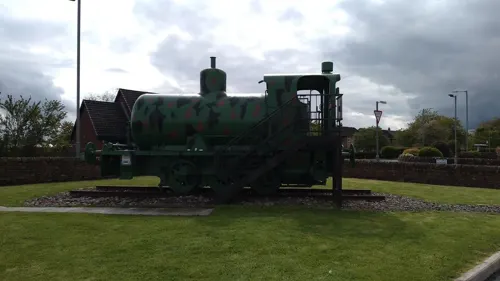
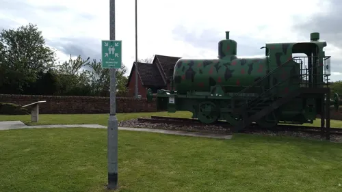

Maia Roman Fort
Monument and historic site · 2.7 mi
Roman fort (castrum) on Hadrian's Wall
Restaurants and cafes3


Churches and places of worship2

St Michael's Church
Church · 2.7 mi
Church in Bowness-on-Solway, Cumbria, United Kingdom

Shopping1

History
Situated in the parish of Dornock, in the traditional county of Dumfriesshire, Eastriggs appears to have taken its name from the farm, or farm house, known as Eastriggs that was located in the middle of what was to become the new township. The only other buildings in the area prior to World War I were a group of houses at Lowtherton (now North Road, Lowthertown); a parallel group on what is now the B721 road; an inn and a smithy where East Road joins the B721.
The township of Eastriggs was created as a result of the shell and ammunition crisis of June 1915 which prompted the newly founded Ministry of Munitions to create a new cordite factory.
Officially designated H.M. Factory Gretna, the factory was spread over a 9-mile (14 km) site stretching from Dornock through Gretna to Longtown, Cumbria. This required a huge influx of labour, and 30,000 men and women came from all over the British Commonwealth to serve as construction and factory workers. The Devil's Porridge Museum, opened in 2014 in the village, commemorates the factory and its workers.
Sir Raymond Unwin, Chief Housing Architect of the housing branch of the Explosives Department of Ministry of Munitions, and Courtenay Crickmer designed wooden housing for the workers in both Eastriggs and Gretna. As a mark of respect for the immigrant workforce, the streets were named after various cities within the Commonwealth.
From the History section of Eastriggs on Wikipedia, under CC BY-SA 4.0.
Schools, colleges and libraries1
Map of Eastriggs
12 places. The map loads OpenStreetMap tiles when you open it.
Getting there and nearby towns
Carlisle Lake District Airport (CAX) is the nearest airport with scheduled flights listed in OpenStreetMap, 15 miles away.
- Annan 3 mi west, about 5 min by car
- Gretna 5 mi east, about 7 min by car
- Burgh by Sands 7 mi southeast, about 11 min by car
- Longtown 9 mi east, about 14 min by car
- Carlisle 11 mi southeast, about 18 min by car
- Silloth 11 mi southwest, about 18 min by car
- Lockerbie 12 mi northwest, about 19 min by car
- Dalston 13 mi southeast, about 20 min by car
- Langholm 13 mi northeast, about 22 min by car
- Scotby 14 mi southeast, about 22 min by car
Drive times are estimates from straight-line distance, not routes.
Towns near Eastriggs


Keep exploring
Local news
Headlines from INDB.
Reviews, tips and questions
Loading what members have shared...
Sources and licences
- GeoNames (CC BY 4.0): population, coordinates, regions and time zone
- Mapillary (see each image): photos
- OpenStreetMap contributors (ODbL 1.0): places, airports, map data
- Wikidata (CC0 1.0): elevation, founding date, time zone, website, landmarks and historic places
- Wikimedia Commons (see each image): photos
- Wikipedia (CC BY-SA 4.0): overview and history text
Photo credits
- Eastriggs approached from the west, The original uploader was Red Sunset at English Wikipedia ., CC BY-SA 2.5
- St John's Episcopal Church, Eastriggs, The Devil's Porridge Museum, CC BY-SA 4.0
- 04758 St John the Evangelist Episcopal Church, Eastriggs 003, WeeHolly, CC BY-SA 4.0
- 04758 St John the Evangelist Episcopal Church, Eastriggs 006, WeeHolly, CC BY-SA 4.0
- 04758 St John the Evangelist Episcopal Church, Eastriggs 002, WeeHolly, CC BY-SA 4.0
- 04758 St John the Evangelist Episcopal Church, Eastriggs 004, WeeHolly, CC BY-SA 4.0
- 04758 St John the Evangelist Episcopal Church, Eastriggs 010, WeeHolly, CC BY-SA 4.0
- 04758 St John the Evangelist Episcopal Church, Eastriggs 007, WeeHolly, CC BY-SA 4.0
- 04758 St John the Evangelist Episcopal Church, Eastriggs 011, WeeHolly, CC BY-SA 4.0
- 04758 St John the Evangelist Episcopal Church, Eastriggs 005, WeeHolly, CC BY-SA 4.0
- 04758 St John the Evangelist Episcopal Church, Eastriggs 001, WeeHolly, CC BY-SA 4.0
- 04758 St John the Evangelist Episcopal Church, Eastriggs 012, WeeHolly, CC BY-SA 4.0
- 04758 St John the Evangelist Episcopal Church, Eastriggs 008, WeeHolly, CC BY-SA 4.0
- 04758 St John the Evangelist Episcopal Church, Eastriggs 009, WeeHolly, CC BY-SA 4.0
- Eastriggs - Melbourne Avenue, The Devil's Porridge Museum, CC BY 2.0
- 12181 Eastriggs Church of Scotland, Eastriggs 004, WeeHolly, CC BY-SA 4.0
- 12181 Eastriggs Church of Scotland, Eastriggs 001, WeeHolly, CC BY-SA 4.0
- 12181 Eastriggs Church of Scotland, Eastriggs 002, WeeHolly, CC BY-SA 4.0
- 12181 Eastriggs Church of Scotland, Eastriggs 005, WeeHolly, CC BY-SA 4.0
- 12181 Eastriggs Church of Scotland, Eastriggs 003, WeeHolly, CC BY-SA 4.0
- Eastriggs - Dunedin Road, The Devil's Porridge Museum, CC BY 2.0
- St Michael's Church, Bowness-on-Solway, John Lord, CC BY-SA 2.0
- Street-level photo, tomdom, CC BY-SA 4.0
- Street-level photo, southglos, CC BY-SA 4.0
- Street-level photo, southglos, CC BY-SA 4.0
- Street-level photo, southglos, CC BY-SA 4.0
- Street-level photo, tomdom, CC BY-SA 4.0


Page built November 10, 2026. Spotted a mistake? Tell us or suggest a place.