


Why visit Egremont
Townapedia lists 4 museums and landmarks, 4 parks and trails and 23 places to eat in and around town.
Highlights include Florence Art Centre, St Bees Head RSPB reserve and Clints Quarry.
Weather in Egremont
Forecast from MET Norway (CC BY 4.0). Full forecast
About Egremont
Egremont is a market town and civil parish in the Cumberland district of Cumbria, England. It is situated just outside the Lake District National Park, five miles (eight kilometres) south of Whitehaven and on the River Ehen. The parish also includes the villages of Bigrigg and Moor Row.
From the Wikipedia article Egremont, Cumbria (this version), under CC BY-SA 4.0.
Museums and landmarks4


Parks, trails and playgrounds4

St Bees Head RSPB reserve
Park · 3.1 mi
RSPB nature reserve in the United Kingdom


Restaurants and cafes23
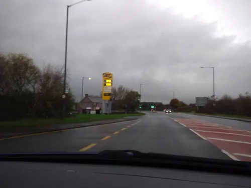



11 more on the map.
Churches and places of worship10

Church of St John
Church · 2.3 mi
Church building in Egremont, Cumberland, Cumbria, England, UK

Church of St John the Baptist
Church · 2.3 mi
Church building in St. John Beckermet, Cumberland, Cumbria, England, UK

Church of St Leonard
Church · 1.9 mi
Church building in Cleator Moor, Cumberland, Cumbria, England, UK

Church of St Mary and St Michael
Church
Church building in Egremont, Cumberland, Cumbria, England, UK

St Bees Priory
Church · 2.8 mi
Church, formerly Benedictine priory in Cumbria, England, UK, a cell of St Mary's, York

St Bridget's Church, Calder Bridge
Church · 3.3 mi
Church in Ponsonby, Cumbria, England, UK

Haile Church
Church · Anglican · 1.5 mi
Church building in Haile, Cumberland, Cumbria, England, UK
History
The name Egremont derives from the Old French aigremont meaning 'pointed hill'.
Egremont pre-dates the Norman conquest. The Danes first established a fort on the site of Egremont Castle around the end of the first millennium AD.
When William Rufus extended Norman rule into Cumbria in around 1092, control of the area was given to Ivo Taillebois, who was married to Lucy of Bolingbroke, heiress of extensive lands in Lincolnshire. When Ivo died in 1094, this authority passed to Lucy's second husband Roger fitz Gerold de Roumare, who survived for only two more years, then to her third husband Ranulph le Meschines. On his becoming the Earl of Chester, his estates were returned to the Crown towards paying for the earldom. Around 1120, Henry I gave the Barony of Copeland to Ranulph's son William who made his home at Egremont and began to build the castle, which took approximately 150 years to complete. The Barony was inherited by William's son Ranulph. With Ranulph having no male heir, the barony passed to his sister Alice, who married the Scottish prince, William Fitz Duncan; they had a child who, after his death, became known as "the Boy of Egremont"; again, with no living male heir, William Fitz Duncan's estates passed to his three daughters Annabel, Cecily and Alice.
Read more of the history
The estates passed down to Annabel's son Richard de Lucy. Richard's two daughters married two brothers of the de Multon family, Alice (now called de Morville) married Alan de Multon and Annabel (also now called de Morville) married Lambert de Multon. Annabel and Lambert de Multon inherited the Barony of Copeland and again, the castle had a lord in residence.
Around 1205, the tale of Grunwilda was told; she was the wife of Richard de Lucy and was killed by a wolf on a hunting trip; this tale is recounted in the poem "The Woeful Chase". Again leaving no male heir, Richard died and the superstition began that no male heir should inherit Egremont Castle because of the conduct of the forefathers. Egremont was granted a market charter by Henry III in 1266 or 1267, with the right to hold a weekly market and an annual fair.
When the last male Multon died in 1335, one of the co-heiresses married Thomas Lucy, grandson of Thomas Multon. Anthony, the last Lord Lucy, died in 1369, and the lands passed to his brother-in-law Henry Percy, 1st Earl of Northumberland, staying with the Percy family and its successors ever since. The present lord is Max Wyndham, 2nd Baron Egremont and 7th Baron Leconfield, who lives in the family home, one of the earliest Percy possessions: Petworth House in West Sussex. The dowager Lady Egremont, Pamela, lived at Cockermouth Castle until her death in 2013.
In 1322, Robert the Bruce attacked the town, causing a huge death toll. For the next 100 years or so an uneasy peace followed and the castle fell into ruins.
In 1565, a stone bridge was built over the River Ehen to access the town, which was now smaller because of frequent Scottish raids. Little changed for a century, until new stone buildings appeared on the Main Street, probably built with stone from the castle. In 1683, Edward Benn and his heirs were given land with the provision that they rebuild the stone bridge and maintain it for ever.
In 1748, another bridge was built at Briscoe Mill at a cost of £28-15s-0d (£28.75), paid for by John Pearson, a local hatter. Soon Egremont began to service the Port of Whitehaven and in 1830, iron ore was mined over several sites.
Over the next 60 years new schools and churches were built. The town's Anglican parish church of St Mary and St Michael was rebuilt in 1881, retaining some fabric from the previous church building which had stood on the site since the 12th century.
New housing estates were also built to accommodate the growing town, with many old parts of the town being demolished in 1968.
In 1964, Wyndham School was built, an early comprehensive school. In 1970, there was a large increase in workers moving into the town to work on the new nuclear site.
On 2 June 2010, the town was the scene of some of the Cumbria shootings. Derrick Bird, a 52-year-old local taxi driver, shot and killed twelve people, two of them in Egremont, before committing suicide.
Historically, dyeing and weaving were traditional local industries based around the River Ehen. Iron ore mining and quarrying has been established in Egremont for more than 800 years. Industrial mining of iron ore started around 1830 with many mines being opened, and ended when the Florence Mine closed in 2007.
Around the early 17th century, agricultural lime was mined at Clints Quarry, with more heavy duty mining being undertaken to supply the iron and ore industry in the mid 19th century, finally ending in 1930. Clints Quarry (now a Site of Special Scientific Interest) can be found just north of Egremont town.
In 1950, Rowntrees built a chocolate crumb factory near Christie Bridge and the nuclear industry became established at Sellafield. The Rowntrees site has become a new housing estate, York Place, which is located at the northern end of Main Street.
From the History section of Egremont, Cumbria on Wikipedia, under CC BY-SA 4.0.
More about Egremont
Economy
Manufacturing industries have declined but service, new media and tourism industries have taken their place.
Egremont's Florence Mine was (until 2008) the last working deep iron ore mine left in Western Europe and produced ore, products for the cosmetics industry and high quality haematite for jewellery. The pit head is a listed building. The Florence Mine can be found just south of Egremont.
A large local employer is the nuclear site at nearby Sellafield. The last few years have seen the running down of the nuclear power industry and the growth of the nuclear decommissioning industry.
Arts and culture
Egremont has Egremont Castle, Florence Mine, Hartley's Ice Cream, Lowes Court Gallery, various walks, Clint's Quarry (SSSI) and cycle paths.
From the Wikipedia article Egremont, Cumbria, under CC BY-SA 4.0.
Notable people from Egremont
 Francis DunneryEnglish musician, singer-songwriter and record producerPhoto: kitmasterbloke, CC BY 2.0
 Lawrence Arthur Colley PantonCanadian artist (1894-1954)Photo: Unknown author, Public domain
 Bill SewellAmerican football player and coach, baseball player and coach (1916-1989)Photo: Unknown, Public domain
 Rob PurdhamEnglish rugby league footballerPhoto: Gerard Barrau, CC BY-SA 3.0
- Tom PickeringEnglish footballer (born 1906)
- Martin HodgsonEnglish rugby league footballer
- Cis WinstanleyNew Zealand lawn bowls competitor (1908-2006)
Born in Egremont, according to Wikidata (CC0). Each name links to its Wikipedia article.
Shopping5
Gas and EV charging2
Schools, colleges and libraries6
Healthcare3
Map of Egremont
57 places. The map loads OpenStreetMap tiles when you open it.
Getting there and nearby towns
Walney Aerodrome (BWF) is the nearest airport with scheduled flights listed in OpenStreetMap, 27 miles away.
- Saint Bees 3 mi west, about 4 min by car
- Whitehaven 5 mi northwest, about 9 min by car
- Seascale 6 mi south, about 10 min by car
- Workington 11 mi north, about 18 min by car
- Dearham 16 mi north, about 26 min by car
- Keswick 18 mi northeast, about 29 min by car
- Millom 21 mi southeast, about 34 min by car
- Aspatria 21 mi north, about 34 min by car
- Ambleside 23 mi east, about 37 min by car
- Barrow in Furness 28 mi southeast, about 45 min by car
Drive times are estimates from straight-line distance, not routes.
Towns near Egremont


Keep exploring
Local news
Headlines from INDB.
Reviews, tips and questions
Loading what members have shared...
Sources and licences
- GeoNames (CC BY 4.0): population, coordinates, regions and time zone
- Mapillary (see each image): photos
- OpenStreetMap contributors (ODbL 1.0): places, airports, map data
- Wikidata (CC0 1.0): elevation, founding date, time zone, website, landmarks and historic places
- Wikimedia Commons (see each image): photos
- Wikipedia (CC BY-SA 4.0): overview and history text
Photo credits
- St Mary & St Michael, Egremont, Alex, CC BY-SA 4.0
- Egremont IMG 1323 - panoramio, Paul Lakin, CC BY 3.0
- Guillemots at St Bees Head, Dougsim, CC BY-SA 3.0
- St John the Evangelist, Bigrigg, Alex, CC BY-SA 4.0
- St John, Beckermet, Alex, CC BY-SA 4.0
- St Leonard’s, Cleator, Alex, CC BY-SA 4.0
- St Bees Priory west autumn sun, Dougsim, CC BY-SA 3.0
- St Bridget's Church, Calderbridge, Humphrey Bolton, CC BY-SA 2.0
- Street-level photo, blind_leader, CC BY-SA 4.0
- Street-level photo, blind_leader, CC BY-SA 4.0
- Street-level photo, blind_leader, CC BY-SA 4.0
Page built November 10, 2026. Spotted a mistake? Tell us or suggest a place.