


Why visit Keswick
Townapedia lists 23 museums and landmarks, 6 parks and trails, 101 places to eat, 122 places to stay and 12 attractions in and around town.
Highlights include Alhambra Cinema, Friar's Crag, Castlerigg Stone Circle and Derwent Pencil Museum.
Weather in Keswick
Forecast from MET Norway (CC BY 4.0). Full forecast
About Keswick
Keswick is a market town and civil parish in the Cumberland unitary authority area of Cumbria, England. It lies within the Lake District National Park, just north of Derwentwater and 4 mi (6.4 km) from Bassenthwaite Lake. The parish had a population of 4,658 at the 2021 census.
From the Wikipedia article Keswick, Cumbria (this version), under CC BY-SA 4.0.
Travel tips from other travellers: Keswick on Wikivoyage (CC BY-SA 4.0).
Things to do12


Ashness Bridge
Bridge · 2.2 mi
Bridge in Borrowdale, Cumberland, Cumbria , England, UK





Museums and landmarks23

Castlerigg Stone Circle
Monument and historic site · 1.4 mi
Stone circle near Keswick in Cumbria, North West England
24/7



Ruskin Monument
Monument and historic site · 0.7 mi
Monument to John Ruskin in Keswick, Cumbria, England, UK
The Lingholm House
Monument and historic site · 1.1 mi

Derwent Island House
Museum · 0.8 mi
Grade II listed house on Derwent Island, Cumbria, England, UK
Keswick Museum and Art Gallery
Museum
Museum in Keswick, United Kingdom


11 more on the map.
Parks, trails and playgrounds6



Restaurants and cafes101


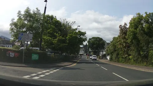
Keswick Brewing Co
Brewery and winery
Craft brewery with tap room and tours
Brewery Lane, Keswick
Tu-Sa 14:00-19:00


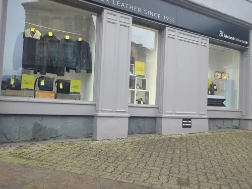
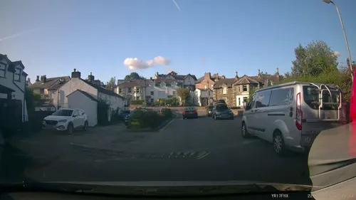


Nichol End Cafe
Cafe · Cake, Coffee Shop · 1.0 mi
"Depends on day of the week and month, see website for details:...
89 more on the map.
History
Evidence of prehistoric occupation in the area includes the Castlerigg stone circle on the eastern fringe of the town, which has been dated to c. 3200 BC. Neolithic-era stone tools were unearthed inside the circle and in the centre of Keswick during the 19th century. The antiquary W. G. Collingwood, commenting in 1925 about finds in the area, wrote that they showed "Stone Age man was fairly at home in the Lake District". There is little evidence of sustained settlement in the area during the Bronze Age, but from excavations of hill forts it is clear that there was some Iron Age occupation, circa 500 BC, although scholars are not agreed about how permanent it was.
In Roman Britain Cumbria was the territory of the Carvetii. As the site of the western part of Hadrian's Wall, it was of strategic importance. The north of the county is rich in archaeological evidence from the period, but nothing is known that suggests any Roman habitation in the Keswick area, other than finds that point to the existence of one or more Roman highways passing the vicinity of the present-day town. Such nearby settlements as can be traced from the era of the Romans and the years after their departure seem to have been predominantly Celtic. Many local place names from the period, including that of the river Derwent, are Celtic, some closely related to Welsh equivalents.
Read more of the history
Several Christian saints preached the Gospel in the north of England in the late 6th and early 7th centuries AD; in Keswick and the surrounding area the most important figures were St Herbert of Derwentwater and his contemporary St Kentigern. The former, the pupil and friend of St Cuthbert of Lindisfarne, lived as a hermit on an island in Derwentwater, now named after him. Kentigern, who lived and preached in the area before moving to Wales, is traditionally held to have founded Crosthwaite Church, which was the parish church of Keswick until the 19th century.
Keswick's recorded history starts in the Middle Ages. The area was conquered by the Anglo-Saxon Kingdom of Northumbria in the 7th century, but Northumbria was destroyed by the Vikings in the late 9th century. In the early 10th century, the British Kingdom of Strathclyde seized the area and it remained part of Strathclyde until about 1050, when Siward, Earl of Northumbria, conquered Cumbria. In 1092, William II of England, son of William the Conqueror, marched north and established the great baronies of Allerdale-below-Derwent, Allerdale-above-Derwent and Greystoke, the borders of which met at Keswick. In 1181, Jocelyn of Furness wrote of a new church at Crosthwaite, Keswick, founded by Alice de Romilly, the Lady of Allerdale, a direct descendant of William II's original barons. In 1189, Richard I granted the rectory of Crosthwaite to the Cistercian order of Fountains Abbey.
During the 13th century, agricultural land around the town was acquired by Fountains and Furness Abbeys. The latter, already prosperous from the wool trade, wished to expand its sheep farming and bought large tracts of land from Alice de Romilly in 1208. She also negotiated with Fountains Abbey, to which she sold Derwent Island in Derwentwater, land at Watendlath, the mill at Crosthwaite and other land in Borrowdale. Keswick was at the hub of the monastic farms in the area and Fountains based a steward in the town, where tenants paid their rents. Furness also enjoyed profitable rights to the extraction of iron ore.
Keswick was granted a charter for a market in 1276 by Edward I. This market has an uninterrupted history lasting for more than 700 years. The pattern of buildings around the market square remained broadly the same from this period until at least the late 18th century, with houses – originally timber-framed – fronting the square and sturdily enclosed gardens or yards at the back. According to local tradition these stout walls and the narrow entrances to the yards were for defence against marauding Scots. In the event it appears that the town escaped such attacks, Scottish raiders finding richer and more accessible targets at Carlisle and the fertile Eden Valley, well to the north of Keswick.
With the Dissolution of the Monasteries, between 1536 and 1541, Furness and Fountains Abbeys were supplanted by new secular landlords for the farmers of Keswick and its neighbourhood. The buying and selling of sheep and wool were no longer centred on the great Abbeys, being handled locally by the new landowners and tenants. This enhanced Keswick's importance as a market centre, though at first the town remained only modestly prosperous: in the 1530s John Leland wrote of it as "a lytle poore market town". By the second half of the century, copper mining had made Keswick richer: in 1586 William Camden wrote of "these copper works not only being sufficient for all England, but great quantities of the copper exported every year" with, at the centre, "Keswicke, a small market town, many years famous for the copper works as appears from a charter of king Edward IV, and at present inhabited by miners".
Earlier copper mining had been small in scale, but Elizabeth I, concerned for the defence of her kingdom, required large quantities of copper for the manufacture of weapons and the strengthening of warships. There was the additional advantage for her that the Crown was entitled to royalties on metals extracted from English land. The experts in copper mining were German and Elizabeth secured the services of Daniel Hechstetter of Augsburg, to whom she granted a licence to "search, dig, try, roast and melt all manner of mines and ores of gold, silver, copper and quicksilver" in the Keswick area and elsewhere.
From the History section of Keswick, Cumbria on Wikipedia, under CC BY-SA 4.0.
More about Keswick
Geography
Keswick lies in North West England, in the heart of the northern Lake District. The town is 31+1⁄2 mi (50.7 km) south-west of Carlisle, 22 mi (35 km) north-west of Windermere and 14+1⁄4 mi (23 km) south-east of Cockermouth. Derwentwater, the lake south-west of the town, measures approximately 3 mi × 1 mi (5 km × 1.5 km) and is some 72 ft (22 m) deep. It contains several islands, including Derwent Isle, Lord's Island, Rampsholme Island and St Herbert's Island, the largest. Derwent Isle is the only island on the lake that is inhabited; it is run by the National Trust and open to visitors five days a year. The land between Keswick and the lake consists mainly of fields and areas of woodland, including Isthmus Wood, Cockshot Wood, Castlehead Wood and Horseclose and Great Wood, further to the south. The river Derwent flows from Derwentwater to Bassenthwaite, the most northerly of the major Cumbrian lakes. The Derwent and its tributary the Greta, which flows through Keswick, meet to the east of Portinscale. The source of the Greta is near Threlkeld, at the confluence of the river Glenderamackin and St John's Beck.
Arts and culture
Annual events in the town's calendar include the Keswick Film Festival (February–March). It features screenings of old and new films, interviews with directors, and the festival's Osprey Awards for short films by local filmmakers. The ten-day Words by the Water literary festival is held in March every year, based at the Theatre by the Lake. The festival began in 1995 and events have been presented by Melvyn Bragg, Louis de Bernières, Germaine Greer, Steve Jones, Penelope Lively, Princess Michael of Kent, Michael Rosen and Joanna Trollope.
In May each year, Keswick is host to three contrasting events. The Keswick Half Marathon, in the early part of the month takes participants around Derwentwater with an additional loop into Newlands Valley. In the second week of May, there is the four-day Keswick Jazz Festival, with more than 100 jazz events at a dozen local venues. Participants include British and international exponents of mainstream and traditional jazz. After the Jazz Festival is the four-day Keswick Mountain Festival in mid-May. In the words of the organisers, the festival "celebrates everything we all love about the outdoors". It includes ghyll scrambling, mountain biking, guided walks, map reading, canoeing, climbing, a triathlon and other events.
Education
The Crosthwaite Free Grammar School, adjoining Crosthwaite churchyard, was an ancient institution, its date of foundation uncertain. In 1819, the parish of Crosthwaite had five or six schools in the town and the outlying areas, with a total of 332 children. By 1833, Keswick had twelve daily schools, including a new National School at High Hill. The new parish church of Keswick, St John's, started educational work in 1840 with a Sunday school which also educated infant boys, and later girls, on weekdays. A full-time boys' school opened in 1853.
For older pupils, Keswick School, the free co-educational grammar school, successor to the Crosthwaite Free Grammar School, opened at a site diagonally opposite Greta Bridge in 1898. In 1951 a new secondary modern school was built at Lairthwaite in Underskiddaw.
Junior education is provided by St Herbert's School, which had a roll of 263 in 2013. At senior level, Keswick and Lairthwaite schools merged in 1980 as a single comprehensive secondary school, with the name Keswick School. It was included in The Daily Telegraph's list of the top thirty comprehensives in England, Wales and Northern Ireland in 2014. The Local Education Authority for Keswick is Cumbria.
From the Wikipedia article Keswick, Cumbria, under CC BY-SA 4.0.
Notable people from Keswick
 Sara ColeridgeBritish poet, translator, editor, writer (1802–1852)Photo: Unknown author Unknown author, Public domain
 Frederic William Henry MyersEnglish poet, essayist and psychical researcher (1843–1901)Photo: William Clarke Wontner, Public domain
 Eliza Lynn LintonEnglish novelist and journalist (1822–1898)Photo: W.&D. Downey, London, Public domain
 Francis Derwent Wood(1871 - 1926) British sculptor (1871–1926)Photo: George Washington Lambert (died 1930), Public domain
 Derwent Hall CaineBritish politician and actor (1891-1971)Photo: Bain, Public domain
 Robley DunglisonphysicianPhoto: Unknown author Unknown author, Public domain
 Pippa MaddamsBritish mountain runner and athletics competitorPhoto: Paul dobson from ENGLAND, CC BY 2.0
- Lothian NicholsonBritish Army general (1827-1893)
- John FlemingBritish sport shooter, born 1881 (1881–1965)
- Arthur Thomas MyersBritish physician and sportsman (1851–1894)
- Derwent ColeridgeBritish writer and priest (1800-1883)
- Ernest MyersEnglish poet, classicist, and translator
Born in Keswick, according to Wikidata (CC0). Each name links to its Wikipedia article.
Where to stay122
Churches and places of worship8
Shopping50
Gas and EV charging2
Schools, colleges and libraries3
Healthcare3
Map of Keswick
250 places. The map loads OpenStreetMap tiles when you open it.
Getting there and nearby towns
Carlisle Lake District Airport (CAX) is the nearest airport with scheduled flights listed in OpenStreetMap, 27 miles away.
- Ambleside 13 mi southeast, about 22 min by car
- Aspatria 14 mi northwest, about 22 min by car
- Dearham 15 mi northwest, about 24 min by car
- Penrith 16 mi east, about 25 min by car
- Workington 17 mi west, about 27 min by car
- Whitehaven 18 mi west, about 30 min by car
- Windermere 18 mi southeast, about 28 min by car
- Dalston 18 mi north, about 29 min by car
- Shap 19 mi east, about 30 min by car
- Carlisle 22 mi north, about 35 min by car
Drive times are estimates from straight-line distance, not routes.
Towns near Keswick


Keep exploring
Local news
Headlines from INDB.
Reviews, tips and questions
Loading what members have shared...
Sources and licences
- GeoNames (CC BY 4.0): population, coordinates, regions and time zone
- Mapillary (see each image): photos
- OpenStreetMap contributors (ODbL 1.0): places, airports, map data
- Wikidata (CC0 1.0): elevation, founding date, time zone, website, landmarks and historic places
- Wikimedia Commons (see each image): photos
- Wikipedia (CC BY-SA 4.0): overview and history text
Photo credits
- St John's church, Keswick. - panoramio (1), brian gillman, CC BY 3.0
- Ashness bridge, BigglesBear, CC BY-SA 3.0
- Lodore Falls 3, Antiquary, CC BY-SA 4.0
- Castlerigg Stone Circle 2015 18, Photograph by Mike Peel ( www.mikepeel.net )., CC BY-SA 4.0
- The newlook Pencil Museum in Keswick, Stinglehammer, CC BY-SA 3.0
- Keswick Museum and Art Gallery, Stephen Craven, CC BY-SA 2.0
- Ruskin memorial at Derwentwater, The joy of all things, CC BY-SA 4.0
- Derwent Island House, ThereWereNoWMDs, CC BY 3.0
- Walla Crag from Hause Gate (2), Mick Knapton at English Wikipedia, CC BY-SA 3.0
- Latrigg from Fitz Park, Keswick, Mick Knapton at English Wikipedia, CC BY-SA 3.0
- Kings Arms, Keswick, The joy of all things, CC BY-SA 4.0
- Dog and Gun, Keswick, The joy of all things, CC BY-SA 4.0
- Small Outbuilding Opposite Packhorse Inn And Behind Ye Olde Friars, Keswick, Back ache, CC BY-SA 4.0
- Keswick Library, Frombowen, CC BY-SA 4.0
- Skiddaw Hotel, Frombowen, CC BY-SA 4.0
- Bank Tavern, Keswick, The joy of all things, CC BY-SA 4.0
- Oddfellows Arms, Keswick, The joy of all things, CC BY-SA 4.0
- Pack Horse Inn, Keswick, The joy of all things, CC BY-SA 4.0
- The George Hotel, Keswick, The joy of all things, CC BY-SA 4.0
- Friars' Crag seen from Derwentwater, Tim riley, CC BY-SA 4.0
- Alhambra Cinema Keswick, Back ache, CC0
- Hope Park - panoramio, Jorge Franganillo, CC BY 3.0
- Street-level photo, IpswichEdits, CC BY-SA 4.0
- Street-level photo, southglos, CC BY-SA 4.0
- Street-level photo, southglos, CC BY-SA 4.0
- Street-level photo, southglos, CC BY-SA 4.0
- Street-level photo, IpswichEdits, CC BY-SA 4.0
- Street-level photo, southglos, CC BY-SA 4.0
- Street-level photo, hobgoblin, CC BY-SA 4.0
- Street-level photo, aidan573, CC BY-SA 4.0
- Street-level photo, aidan573, CC BY-SA 4.0
- Street-level photo, hdurer, CC BY-SA 4.0
- Street-level photo, aidan573, CC BY-SA 4.0
- Street-level photo, IpswichEdits, CC BY-SA 4.0
- Street-level photo, IpswichEdits, CC BY-SA 4.0
- Street-level photo, hobgoblin, CC BY-SA 4.0
- Street-level photo, IpswichEdits, CC BY-SA 4.0
- Street-level photo, aidan573, CC BY-SA 4.0
- Street-level photo, gness, CC BY-SA 4.0
- Street-level photo, aidan573, CC BY-SA 4.0
- Street-level photo, hdurer, CC BY-SA 4.0
- Street-level photo, jethro10, CC BY-SA 4.0


Page built November 10, 2026. Spotted a mistake? Tell us or suggest a place.