


Why visit Elstree
Townapedia lists 14 museums and landmarks, 31 parks and trails, 63 places to eat, 4 places to stay and 4 attractions in and around town.
Highlights include Reel Cinema, Allum Lane Community Centre, Arkley War Memorial and Edgwarebury Park.
Weather in Elstree
Forecast from MET Norway (CC BY 4.0). Full forecast
About Elstree
Elstree is a large village in the Hertsmere borough of Hertfordshire, England. It is about 11.5 miles (18.5 kilometres) northwest of central London on the former A5 road, which follows the course of Watling Street. In 2011, its population was 5,110. It forms part of the civil parish of Elstree and Borehamwood, originally known simply as Elstree.
From the Wikipedia article Elstree (this version), under CC BY-SA 4.0.
Things to do4


Wood Farm London Viewpoint
Scenic view · 1.1 mi
A wide panoramic view from Alexandra Palace in the east to Heathrow in the southwest, and over London to Box Hill in the south

Museums and landmarks14
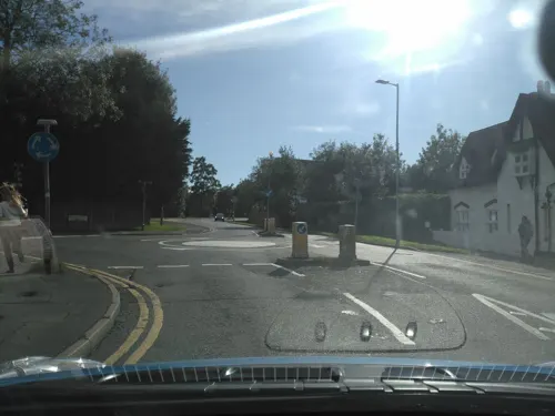
Allum Lane Community Centre
Monument and historic site · 1.1 mi
2 Allum Lane, Borehamwood

Arkley War Memorial
Monument and historic site · 2.8 mi
War memorial in London

Bushey Museum and Art Gallery
Museum · 2.9 mi
Museum and gallery in Hertfordshire, England, United Kingdom

Elstree and Borehamwood Museum
Museum · 1.5 mi
96 Shenley Road, Borehamwood
Tu-Th 12:00-18:00; Fr off; Sa 10:00-15:00; Su-Mo off

Chandos Mausoleum
Monument and historic site · 2.2 mi
Part of St Lawrence Whitchurch in Harrow, London
2 more on the map.
Parks, trails and playgrounds31


Bentley Priory Nature Reserve
Park · 1.9 mi
Nature reserve in the London Borough of Harrow, England


Harrow Weald Common
Park · 2.4 mi
Nature reserve in Harrow Weald, Greater London, England

Hilfield Park Reservoir LNR
Park · 1.4 mi
Local Nature Reserve between Bushey and Elstree in Hertfordshire, England

Mill Hill Old Railway Nature Reserve
Park · 2.6 mi
Nature reserve in the London Borough of Barnet

19 more on the map.
Restaurants and cafes63
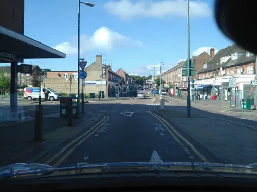
Starbucks
Cafe · Coffee Shop · 1.4 mi
1 Keystone Passage, Borehamwood
Mo-Fr 06:30-19:00; Sa,Su 07:00-19:00
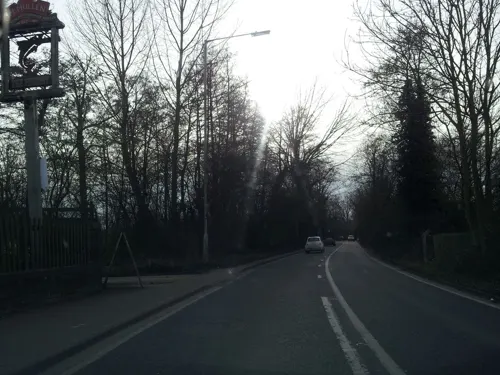
Bhageecha
Restaurant · Indian · 0.5 mi
Indian restaurant and bar, formerly The Fishery
Watford Road, Borehamwood
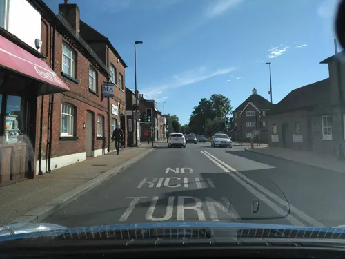



Brick Lane Bagel Co.
Cafe · 1.4 mi
3 Keystone Passage, Borehamwood
Mo-Sa 08:00-17:00; Su 09:00-16:00

51 more on the map.
History
The name "Elstree" derives from the Anglo-Saxon phrase for "Tidwulf's Tree", which is mentioned as "Tidulfres treow" in an 11–12th-century manuscript of an A.D. 786 charter. It is thought that "the "T" [was] lost in the wrong division of 'aet Tidwulfes treo' ("at Tidwulf's Tree")."
A reference to a place in Hertford as "Ilestre" in 1460 may also be a variation.
In 1723, topographer John Norden noted in his book Speculum Britanniae, that in the county of Hartfordshire [sic] was one "Elstre or Eglestre". In an earlier edition, he writes:
Nemus aquilinum: a place wherit may be thought Eagles bredd in time past, for though it be nowe hilly and heathy – it hath beene replenished with stately trees, fit for such fowle to breede and harbour in. It is parcell of the libertie of S. Albans.
Robinson Crusoe author, Daniel Defoe wrote in his 1748 travel guide that:
"Idlestrey or Elstre, is a Village on the Roman Watling-street, on the very Edge of Middlesex; but it is chiefly noted for its Situation, near Brockly-hill, by Stanmore, which affords a lovely View cross Middlesex, over the Thames, into Surry."
Read more of the history
"The name of this place has been variously written; — Eaglestree, Elstree, Ilstrye, Idlestrye, etc. Norden says that it is called, in Offa's grant to the Abbey of St. Alban's, Eaglestree, that is, says he, "Nemus aquilinum, a 'place where it may be thought that eagles bred in time past'." It has been derived also from Idel-street, i.e. the noble road; and Ill-street, the decayed road. May it not have been, rather, a corruption of Eald-street, the old road, i.e. the ancient Watling-street, upon which it is situated?"
In the 5th century, British warlord Vortigern and his two sons, Vortimer and Catigern, took part in the Battle of Elstree, then called the Battle of Ailestreu, where the Saxon Horsa was killed. It's possible there is confusion with the Battle of Aylesbury. George Moberly writes:
"Nennius, MHB p. 69, calls the place of battle where Hors fell Episford; Britannicè 'Sathenegabail' = the Saxon battle. The Saxon Chronicle, ad a. 455, calls it Ægæles-threp, and Henry of Huntingdon, M.H.B. p. 708, Ailestreu. This would naturally be Elstree, of which name there is a place in Herts; but Beda's description of its situation has caused it rather to be referred to Aylesford in Kent, near which is a small village called Horsted."
The Manor of Elstree was formerly included in the Manor of Parkbury, and belonged to the Abbey of St. Albans. On the Dissolution of the Monasteries, it was granted by Henry VIII, to Anthony Denny (1501–1549).
In 1607, Anthony Denny's grandson Edward Denny sold part of the estate, with all manorial rights, to Robert Briscoe, who sold it the same year to Sir Baptist Hicks. Part of the estate became the Manor of Boreham, and was sold to Edward Beauchamp. It remained with the Beauchamp-Proctor family until 1748, when it was sold to James West, M.P. for St. Albans, who, in or about 1751, alienated it to a Mr Gulston of Widdial. Gulston then sold it to a Mr Pigfatt, a gunsmith, who, within a few years, conveyed it to Thomas Jemmet. In 1774, it was purchased from Mr Jemmet by the late George Byng, M.P. for Middlesex, who passed it on to his son, by which time the estate was called the Manor of Boreham.
"An Act for dividing and closing the Common or Waste Ground, called Boreham Wood Common, in the Parish of Elstree otherwise Idletree, in the County of Hertford."
"The parish of Elstree contains about 3,000 acres of land, which is divided between arable and pasture nearly in an equal proportion. The soil is, for the most part, clay. Boreham Wood, a waste of nearly 700 acres, was inclosed about the year 1778, and is now in culture. This parish pays the sum of £151 11s 0d to the land-tax, which is raised by a rate of about 1s 9d in the pound".
From the History section of Elstree on Wikipedia, under CC BY-SA 4.0.
More about Elstree
Arts and culture
Elstree Cricket Club was formed in 1878, but no longer play in the Herts Saracens League. 18-hole Radlett Park Golf Club was founded in 1984, having recently being renamed from Elstree Golf & Country Club. It is closer to Elstree than Radlett.
Hatch End Cricket Club also play in Elstree. They participate in the Herts Saracens League.
Section 15 of the London Outer Orbital Path (London Loop) goes through Elstree, before continuing as Section 16, a 10-mile (16 km) walk from Elstree to Cockfosters.
Elstree was home to Ohr Yisrael Synagogue, an Orthodox synagogue with affiliation to the Federation of Synagogues. However, the synagogue's present location is just within Borehamwood. The village currently sports two synagogues: The Shtiebel, an ultra-orthodox synagogue, and The Liberal Synagogue Elstree, just south of St. Nicholas' Church. According to census data, Elstree's population, including the Deacon's Hill area, was 36.0% Jewish, making it the only settlement with a Jewish plurality in the UK (the Christian population comprised 32.4% of the population). There are also two United Synagogue shuls in the area. One is on Croxdale Road and the other is at Yavneh College, Borehamwood.
From the Wikipedia article Elstree, under CC BY-SA 4.0.
Notable people from Elstree
 Ravi Hariachess playerPhoto: GibChess, CC BY 3.0
 John Frederick TaylerEnglish landscape watercolour painter (1802-1889)Photo: John Watkins studio, Public domain
- Tom Chattoactor (1920-1982)
- Cecil FordEnglish cricketer (1913-1994)
- Nicholas CowellBritish businessman
- Ingrid TarrantBritish television presenter
- Philip Lionel BurtonBritish civil servant
Born in Elstree, according to Wikidata (CC0). Each name links to its Wikipedia article.
Where to stay4
Churches and places of worship18
Shopping13
Gas and EV charging4
Schools, colleges and libraries11
St Nicholas Elstree Church of England VA Primary School
School · Anglican
St Nicholas Close, Borehamwood
Healthcare8
The Grove Medical Centre
Clinic and pharmacy · 1.3 mi
Theobald Street, Borehamwood
Map of Elstree
170 places. The map loads OpenStreetMap tiles when you open it.
Getting there and nearby towns
RAF Northolt (NHT) is the nearest airport with scheduled flights listed in OpenStreetMap, 8 miles away.
- Borehamwood 1 mi northeast, about 2 min by car
- Bushey 3 mi west, about 4 min by car
- Harrow Weald 3 mi southwest, about 4 min by car
- Watford 4 mi west, about 7 min by car
- Headstone 4 mi southwest, about 6 min by car
- Barnet 4 mi east, about 7 min by car
- Totteridge 4 mi east, about 7 min by car
- Harrow 5 mi south, about 7 min by car
- Finchley 5 mi southeast, about 8 min by car
- Pinner 5 mi southwest, about 8 min by car
Drive times are estimates from straight-line distance, not routes.
Towns near Elstree


Keep exploring
Local news
Headlines from INDB.
Reviews, tips and questions
Loading what members have shared...
Sources and licences
- GeoNames (CC BY 4.0): population, coordinates, regions and time zone
- Mapillary (see each image): photos
- OpenStreetMap contributors (ODbL 1.0): places, airports, map data
- Wikidata (CC0 1.0): elevation, founding date, time zone, website, landmarks and historic places
- Wikimedia Commons (see each image): photos
- Wikipedia (CC BY-SA 4.0): overview and history text
Photo credits
- Arkley War Memorial 01, Philafrenzy, CC BY-SA 4.0
- Bushey Museum, Rudolph Road, Bushey, Richard Kelly, CC BY-SA 4.0
- Edgwarebury Park Pinetum, Dudley Miles, Public domain
- Bentley Priory Summerhouse Lake 1, Dudley Miles, CC BY-SA 3.0
- Edgware Way Grassland, Dudley Miles, Public domain
- Harrow Weald Common path, Dudley Miles, CC BY-SA 3.0
- Hilfield Park Reservoir 14, Dudley Miles, CC BY-SA 4.0
- St Margaret of Antioch Edgware, Nigel Cox, CC BY-SA 2.0
- St Peter’s Church, Arkley, Lucas Kendall, CC BY-SA 4.0
- All Saints church, Borehamwood 01, Philafrenzy, CC BY-SA 4.0
- Hornbeam Barnet Gate Wood 3, Dudley Miles, Public domain
- Arkley South Field, Dudley Miles, Public domain
- Glebe Lane Pastures, Dudley Miles, Public domain
- Arkley Lane, Dudley Miles, Public domain
- Mill Hill Old Railway, Dudley Miles, Public domain
- Street-level photo, zymurgic, CC BY-SA 4.0
- Street-level photo, zymurgic, CC BY-SA 4.0
- Street-level photo, zymurgic, CC BY-SA 4.0
- Street-level photo, zymurgic, CC BY-SA 4.0
- Street-level photo, zymurgic, CC BY-SA 4.0
- Street-level photo, mappo2, CC BY-SA 4.0
- Street-level photo, zymurgic, CC BY-SA 4.0
- Street-level photo, zymurgic, CC BY-SA 4.0
- Street-level photo, adam2, CC BY-SA 4.0
- Street-level photo, Semir_Mapillary, CC BY-SA 4.0
- Street-level photo, matth81, CC BY-SA 4.0
- Street-level photo, zymurgic, CC BY-SA 4.0
- Street-level photo, zymurgic, CC BY-SA 4.0
- Street-level photo, zymurgic, CC BY-SA 4.0
- Street-level photo, zymurgic, CC BY-SA 4.0
- Street-level photo, matth81, CC BY-SA 4.0
- Street-level photo, zymurgic, CC BY-SA 4.0
- Street-level photo, zymurgic, CC BY-SA 4.0


Page built November 10, 2026. Spotted a mistake? Tell us or suggest a place.