


Evington, United Kingdom
Evington is a town of 17,268 people in England, United Kingdom.
Why visit Evington
Townapedia lists 11 museums and landmarks, 17 parks and trails, 58 places to eat and 2 attractions in and around town.
Highlights include De Montfort Hall, Arch of Remembrance, Evington War Memorial and Lucas Marsh.
Weather in Evington
Forecast from MET Norway (CC BY 4.0). Full forecast
About Evington
Evington is an area of Leicester, and electoral ward of the Leicester district, in the ceremonial county of Leicestershire, England. It used to be a small village centred on Main Street and the Anglican church of St Denys but was close enough to Leicester to become one of the outer suburbs in the 1930s. Today, the ward comprises the historical village of Evington, as well as the modern ex-council estates of Rowlatts Hill and Goodwood. The population of the ward at the 2021 census was 17,268.
From the Wikipedia article Evington (this version), under CC BY-SA 4.0.
Things to do2

De Montfort Hall
Cinema and theater · 2.9 mi
Music and performance venue in Leicester, United Kingdom

Museums and landmarks11

Arch of Remembrance
Monument and historic site · 2.8 mi
War memorial in Leicester, Leicestershire, England, UK


Leicester Museum & Art Gallery
Museum · 3.3 mi
Museum in Leicester, England, United Kingdom

Raw Dykes
Monument and historic site · 3.3 mi
Archaeological site in City of Leicester, Leicestershire, England, UK


Parks, trails and playgrounds17


Victoria Park
Park · 2.7 mi
Public park in Leicester, Leicestershire, England, UK


The Gallops Golf Course
Golf course · 1.4 mi
Mo-Su 08:00-20:00 Summer; Open 7:00 sa-su; Close 21:00 weekday;...
5 more on the map.
Restaurants and cafes58
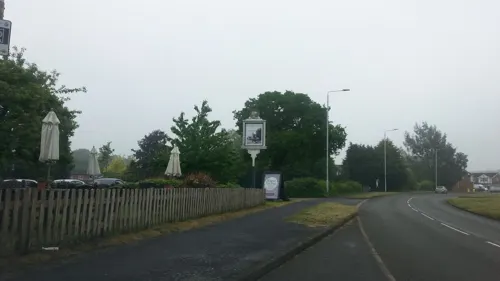
Grange Farm
Bar and pub · 0.7 mi
Florence Wragg Way, Leicester
Mo-We 11:30-22:30; Th-Sa 11:30-23:00; Su 11:30-22:30
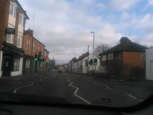


Costa
Cafe · Coffee Shop · 0.7 mi
29-31 The Parade, Leicester
Mo-Sa 07:30-18:00; Su 08:30-17:30

Ethel Bakery Oadby
Bakery · 0.7 mi
26 The Parade
Mo-Sa 07:00-18:00; Su 10:00-16:00
Tigers Rolls
Cafe · 1.0 mi
38B Kenilworth Drive, Leicester
Mo-Fr 07:30-14:00; Sa 08:00-12:00; Su off
Honey and Haven
Cafe · 0.7 mi
41D The Parade
Mo-Th 09:00-18:00; Fr-Sa 09:00-20:00; Su 10:00-18:00
Jennos Cafe
Cafe · 1.1 mi
Washbrook Lane, Leicester
Mo-Fr 08:30-17:30; Sa 08:30-18:00; Su 09:00-17:00

46 more on the map.
History
The name Evington comes from the Old English meaning 'farm/settlement of Eafa/Aefa'. After the Norman Conquest of 1066 the land was given to Hugh de Grentesmesnil. The first known spelling of Evington was by Walter de Evington in 1259, who leased a carucate of land at the village of Evington – about 100 acres (0.40 km2). The parish of Evington was originally quite large and included the areas now known as North Evington and Evington Valley. These were annexed by the borough of Leicester in 1892, and are not generally considered part of Evington.
In 1931 the parish had a population of 1802. On 1 April 1935, the boundaries of Leicester (by this point a city), were expanded again, including nearly all of the remaining parish of Evington, except for a small part which went to Oadby. The modern ward does include the large 1950s development based at Downing Drive and Spencefield Lane.
Rowlatts Hill is a council estate established on a hillside to the north of Leicester General Hospital in 1964–67 by the City Architect Stephen George with two 22-story blocks of flats and single or two-storey houses of grey brick. A later development (1973–77) is of red brick houses. For council housing purposes it is considered separate from Evington.
Goodwood is a 1950s council estate considered together with Evington for council housing purposes. It is just under 1000 residences.
From the History section of Evington on Wikipedia, under CC BY-SA 4.0.
Churches and places of worship21
Shopping8
Gas and EV charging3
Schools, colleges and libraries16
Judgemeadow Community College
School · 1.4 mi
Marydene Drive, Leicester
Healthcare8
Map of Evington
144 places. The map loads OpenStreetMap tiles when you open it.
Getting there and nearby towns
East Midlands Airport (EMA) is the nearest airport with scheduled flights listed in OpenStreetMap, 19 miles away.
- Oadby 1 mi northwest, about 1 min by car
- Leicester 4 mi northwest, about 6 min by car
- Glen Parva 4 mi west, about 7 min by car
- Syston 6 mi north, about 9 min by car
- Glenfield 6 mi northwest, about 10 min by car
- Mountsorrel 9 mi northwest, about 14 min by car
- Market Harborough 10 mi southeast, about 17 min by car
- Melton Mowbray 14 mi northeast, about 22 min by car
- Shepshed 15 mi northwest, about 24 min by car
- Oakham 15 mi east, about 24 min by car
Drive times are estimates from straight-line distance, not routes.
Towns near Evington


Keep exploring
Local news
Headlines from INDB.
Reviews, tips and questions
Loading what members have shared...
Sources and licences
- GeoNames (CC BY 4.0): population, coordinates, regions and time zone
- Mapillary (see each image): photos
- OpenStreetMap contributors (ODbL 1.0): places, airports, map data
- Wikidata (CC0 1.0): elevation, founding date, time zone, website, landmarks and historic places
- Wikimedia Commons (see each image): photos
- Wikipedia (CC BY-SA 4.0): overview and history text
Photo credits
- Evington Village Hall, Chemical Engineer, Public domain
- De Montfort Hall, NotFromUtrecht, CC BY-SA 3.0
- War Memorial Leicester, Summer 2009, NotFromUtrecht, CC BY-SA 3.0
- GasMuseumMay2010, Chemical Engineer, Public domain
- New Walk Museum main entrance, NotFromUtrecht, CC BY-SA 3.0
- Lucas Marsh 2, Dudley Miles, CC BY-SA 4.0
- Humberstone Park LNR 6, Dudley Miles, CC BY-SA 4.0
- Knighton Spinney 4, Dudley Miles, CC BY-SA 4.0
- Nelson Mandela Park, Joshuajohnlee ., CC BY 3.0
- Victoria Park Leicester from Queens Road, NotFromUtrecht, CC BY-SA 3.0
- Clarendon Park Congregational Church, Tom Parnell, CC BY-SA 4.0
- HolyTrinityLeicester t, User:Pjparkinson, Public domain
- University of Leicester towers 2010, NotFromUtrecht, CC BY-SA 3.0
- Evington War Memorial 2011, Chemical Engineer, Public domain
- Raw Dykes north end, NotFromUtrecht, CC BY-SA 3.0
- Oadby War Memorial, Peter Broster, CC BY-SA 4.0
- Street-level photo, adam2, CC BY-SA 4.0
- Street-level photo, adam2, CC BY-SA 4.0
- Street-level photo, adam2, CC BY-SA 4.0
- Street-level photo, adam2, CC BY-SA 4.0
- Street-level photo, gness, CC BY-SA 4.0
- Street-level photo, toby, CC BY-SA 4.0
- Street-level photo, southglos, CC BY-SA 4.0
- Street-level photo, adam2, CC BY-SA 4.0
- Street-level photo, adam2, CC BY-SA 4.0
- Street-level photo, trigpoint, CC BY-SA 4.0
- Street-level photo, trigpoint, CC BY-SA 4.0
- Street-level photo, trigpoint, CC BY-SA 4.0
- Street-level photo, adam2, CC BY-SA 4.0
- Street-level photo, gness, CC BY-SA 4.0
- Street-level photo, southglos, CC BY-SA 4.0
- Street-level photo, adam2, CC BY-SA 4.0
- Street-level photo, adam2, CC BY-SA 4.0


Page built November 10, 2026. Spotted a mistake? Tell us or suggest a place.