


Tonbridge, United Kingdom
Tonbridge is a town of 36,115 people in England, United Kingdom.
Why visit Tonbridge
Townapedia lists 4 museums and landmarks, 10 parks and trails, 62 places to eat, 2 places to stay and 3 attractions in and around town.
Highlights include Oast Theatre, Royal Victoria Hall, Tonbridge Castle Gatehouse and Salomons Museum.
Weather in Tonbridge
Forecast from MET Norway (CC BY 4.0). Full forecast
About Tonbridge
Tonbridge ( TUN-brij; historic spelling Tunbridge) is a market town in Kent, England, on the River Medway, 4 miles (6 km) north of Royal Tunbridge Wells, 12 miles (19 km) south west of Maidstone and 29 miles (47 km) south east of London. In the administrative borough of Tonbridge and Malling, it had an estimated population of 36,115 in 2021.
From the Wikipedia article Tonbridge (this version), under CC BY-SA 4.0.
Travel tips from other travellers: Tonbridge on Wikivoyage (CC BY-SA 4.0).
Photos of Tonbridge

Things to do3

Oast Theatre
Cinema and theater · 0.9 mi
Theatre in Tonbridge, Kent, England

Royal Victoria Hall
Cinema and theater · 2.8 mi
Former theatre in Southborough, England
Museums and landmarks4



Parks, trails and playgrounds10

Lullingstone Country Park
Park · 1.2 mi
Country park in Kent, England




Restaurants and cafes62
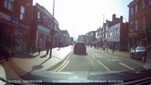
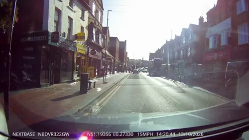
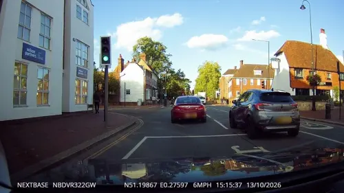
The Ivy
Restaurant · British
We 16:00-18:00+; Th,Fr 11:00-18:00+; Sa,Su 09:00-18:00+
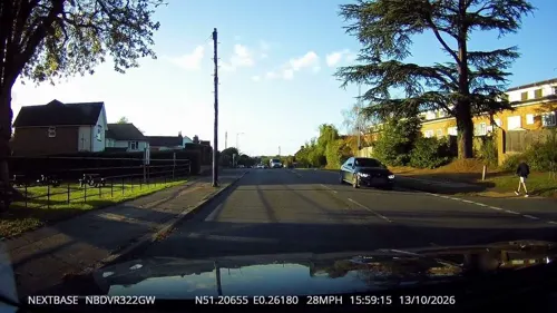
Cafe in the Park
Cafe · Coffee Shop, Sandwich · 1.2 mi
Lower Haysden Lane, Tonbridge
Mo-Fr 08:30-15:30; Sa,Su 08:00-16:00


The Plough Inn and Events Barn at Leigh
Restaurant · Seasonal Pub Menu · 1.4 mi
Leigh Road, Hildenborough
summer: Tu-Sa 12:00-23:00; winter: Tu-Sa 12:00-15:00,06:00-23:00;...

The Nelson Arms
Bar and pub · 0.4 mi
Cromer Street, Tonbridge
Mo-Tu 15:00-22:00; We-Th 15:00-23:00; Fr-Sa 12:00-23:30; Su 12:00-21:00
50 more on the map.
History
The town was recorded in Domesday Book 1086 as Tonebrige, which may indicate a bridge belonging to the estate or manor (from the Old English tun), or alternatively a bridge belonging to Tunna, a common Anglo-Saxon man's name. Another theory suggests that the name is a contraction of "town of bridges", due to the large number of streams the High Street originally crossed.
Until 1870, the town's name was spelt Tunbridge, as shown on old maps including the 1871 Ordnance Survey map and contemporary issues of the Bradshaw railway guide. In 1870, this was changed to Tonbridge by the GPO due to confusion with nearby Tunbridge Wells, despite Tonbridge being a much older settlement. Tunbridge Wells has always maintained the same spelling.
Tonbridge stands on a spur of higher land where the marshy River Medway could be more easily forded. Ancient trackways converged at this point . There is no record of any bridge before 1191. For much of its existence, the town remained to the north of the river, since the land to the south was subject to extensive seasonal flooding. One part of the town is called 'Dryhill'. Richard Fitz Gilbert de Clare founded the Priory of St Mary Magdalene in 1124.
Read more of the history
A motte and bailey castle was built here in the 11th century by Richard Fitz Gilbert, son of the murdered guardian of the infant William the Conqueror. Richard was responsible for governing England in William I's many absences.
The town was besieged by William Rufus, soon after his accession to the throne, because the Earl had pledged allegiance to William's brother, Robert. William Rufus died from an arrow wound a few years later, in an incident generally reported as a hunting accident, when he was shot by Walter Tirel, Richard Fitz Gilbert's son-in-law, & born in Tonbridge himself.
The town was soon afterwards taken again, this time by King John only a few months after the signing of the Magna Carta. Both the Earl and his son were signatories and guardians of the document responsible for its compliance. It was subsequently besieged by Prince Edward, son of Henry III. On this occasion the besieged garrison burnt the town rather than see it fall. The town and Tonbridge Castle were rebuilt after this and in the 13th century became an official residence and records repository of Edward II.
In later medieval times, Tonbridge was considered an important strategic settlement. Some evidence shows Henry III intended it to be a walled town, and a charter was issued allowing for walls to be built, a market to be held, court sessions to be held and two members from the town to attend parliament. The walls were never built, perhaps because the castle's large outer bailey could have easily accommodated the townspeople in times of strife. A surrounding bank and ditch known as The Fosse was erected. Today only traces of this encircling defence now remain. The historic core of the town still contains a large number of working buildings dating from the 15th century: the oldest is Port Reeves in East Street.
Tonbridge School, the famous public school, was established in 1553 under letters patent of Edward VI, to educate the sons of local gentry and farmers (There was already a nearby school in existence for poorer boys, now Sevenoaks School.)
During Queen Mary's reign Tonbridge was involved in an unsuccessful uprising against the Queen's marriage to the King of Spain, with 500 townspeople involved in the Battle of Hartley in 1554. As a result, the town was chosen for a place of execution of a number of Protestants; and in 1555 James Tutty and Margery Polley were burned at the stake in the town and Joan Beach met the same fate in 1556 at Rochester. A memorial to Margery Polly is on the green at Pembury.
During the Civil War, the town was garrisoned by the Parliamentarian side who refortified the castle. Royalist sympathisers made several attempts to take the town but were repulsed.
In 1740 an Act of Parliament was passed to make the River Medway navigable to Tonbridge by the Medway Navigation Company, allowing such materials as coal and lime to be transported to the town, and gunpowder, hops and timber to be carried downriver to Maidstone and the Thames. For a hundred years the Medway Navigation Company was highly profitable, paying out good dividends to its investors, but after the arrival of the railway in 1842 the company went into a steep decline and all commercial traffic ceased in 1911 when the company collapsed. Some of the original warehouses and the wharves are still recognisable today, downstream of the town's main bridge.
Later, the town and its surroundings became famous for the production of finely inlaid wooden cabinets, boxes and other objects called Tunbridgeware, which were sold to tourists who were taking the waters at the nearby springs at Tunbridge Wells. Another speciality in the town was until recently the production of cricket balls (the original cricket ball factory in Preston Road was demolished in 2012 to make way for housing) and other sports goods. The Corn Exchange in Bank Street, which was originally conceived as a chapel, dates from 1790.
During the March 1880 parliamentary election, Tonbridge was the scene of a riot. On the announcement of the results, several thousand people started to hurl stones and cobbles at each other in the High Street near the Rose and Crown Hotel. The county's Chief Constable Captain Ruskin, with over a hundred policemen, charged the crowds many times during the evening, only to end up as the target of the crowd, who started hurling stones and cobbles at them instead of each other. Many people, including twelve policemen, were seriously injured before the crowd finally dispersed at midnight.
From the History section of Tonbridge on Wikipedia, under CC BY-SA 4.0.
More about Tonbridge
Geography
The town's development is shaped by the Medway valley and the railway lines, with development forming a rough 'hourglass' shape centred on the river and the castle. The residential areas north of the town centre include the mostly post-war Trench Wood and Cage Green (north of the town centre) and Higham Wood (north east). Areas in the south part of the town include the estates off Brook Street which have Radburn layouts (south west), the Victorian railway terraces around Douglas Road and Barden Park, and Vauxhall (to the south east). Barden Park was a larger house which was demolished in the 20th century.
In 2014 the Angel Community Garden was created to eliminate eyesores in the area, and encourage bees which are declining. The garden was put along the edge of Sainsbury's car park. It was formed in collaboration with Tonbridge Friends of the Earth and Tonbridge & Malling Borough Council. The project also received some support from some local shopkeepers and residents.
Parts of Tonbridge are at risk of flooding. Significant flooding occurred in 1968, which led to the construction of the Leigh Barrier; and in 2013 which resulted in the Environment Agency building a 320-metre long flood defence along Avebury Avenue in 2015. Despite these measures, significant flooding occurred again in December 2019. The area to the west is retained as floodplain including Tonbridge Park.
Economy
Major industries include light engineering, printing and publishing, distribution and financial services. Tonbridge, together with its neighbour Tunbridge Wells, was designated by the South East Assembly as a Regional Hub.
The town has retained its 'market town' atmosphere and has attractions to visitors and residents alike. Sports facilities including an indoor/outdoor swimming pool, a leisure centre and a sports ground are all close to the town centre. Many of the facilities are provided or subsidised by the local authority.
Most of the town's shopping facilities are concentrated on the High Street, which runs for about 1 mile (2 km) through the town centre. The high street has bars, restaurants, estate agents, clothes shops, hairdressers, banks, charity shops, cafes, bakers, a butchers and a fishmongers. There are empty high street premises. There are high street chain stores that have tended to move to large shopping centres such as Tunbridge Wells. The Borough Council has published proposals to improve the town's shopping and leisure facilities.
Education
Tonbridge School, founded in 1553 by Sir Andrew Judde, is a major independent school for boys, which is in the centre of the town. Around 60% of the boys there are boarders, and live in the school's houses, which are all close to the school. The town is also home to several Grammar Schools, including The Judd School, Weald of Kent Grammar School and Tonbridge Grammar School. A number of Tonbridge's secondary schools have specialist status, including Tonbridge Grammar School for Maths and ICT, as well as Languages; Weald of Kent Grammar School for Girls, a specialist school for languages and science; the Judd School for Music with English and also now Science with Maths; Leigh Academy Tonbridge, formed from the joining of Hayesbrook Academy and Leigh Academies Trust, for both boys and girls, a specialist sports college; and Hillview School For Girls, with Performing Arts Status. Hugh Christie Technology College has IT expertise.
Further and higher education is available at North Kent College (formerly West Kent College) on Brook Street. There is also a small campus of the University of Kent.
Tonbridge has many primary schools including Hilden Grange School and infant nurseries/daycare.
From the Wikipedia article Tonbridge, under CC BY-SA 4.0.
Notable people from Tonbridge
 Anna AtkinsEnglish botanist and photographer (1799-1871)Photo: Unknown author Unknown author, Public domain
 Harry AndrewsBritish actor (1911–1989)Photo: Allan warren, CC BY-SA 3.0
 John George ChildrenBritish chemist, mineralogist and zoologistPhoto: Benjamin Rawlinson Faulkner (1787-1849), Public domain
 Gilbert de Clare, 1st Earl of PembrokeEarl of PembrokePhoto: John Horace Round, Public domain
 Ian WynnecanoeistPhoto: gaccd, CC BY 2.0
 Frank WoolleyCricket player of England. (1887-1978)Photo: Unknown author Unknown author, Public domain
 Pauline GowerBritish pilot and writer (1910–1947)Photo: Women's Engineering Society, CC BY-SA 4.0
 Walter TirelAnglo-Norman noblemanPhoto: Alphonse de Neuville, Public domain
- Cecil Frank PowellBritish physicist
- Richard de Clare, 2nd Earl of PembrokeCambro-Norman lord in Ireland
- Henry Watson FowlerBritish lexicographer and linguist (1858–1933)
- Reginald Crundall PunnettBritish geneticist, zoologist (1875-1967)
Born in Tonbridge, according to Wikidata (CC0). Each name links to its Wikipedia article.
Where to stay2
Churches and places of worship20
Shopping17
Gas and EV charging4
Schools, colleges and libraries23
St Margaret Clitherow Catholic Primary School
School · Roman Catholic · 1.5 mi
Trench Road, Tonbridge
Healthcare5
Map of Tonbridge
150 places. The map loads OpenStreetMap tiles when you open it.
Getting there and nearby towns
London Biggin Hill Airport (BQH) is the nearest airport with scheduled flights listed in OpenStreetMap, 14 miles away.
- Sevenoaks 6 mi northwest, about 10 min by car
- Crowborough 10 mi southwest, about 17 min by car
- Maidstone 12 mi northeast, about 19 min by car
- Snodland 12 mi northeast, about 19 min by car
- East Grinstead 13 mi west, about 21 min by car
- Oxted 13 mi west, about 21 min by car
- Chelsfield 13 mi northwest, about 21 min by car
- Hartley 13 mi north, about 21 min by car
- Biggin Hill 13 mi northwest, about 21 min by car
- Longfield 14 mi north, about 23 min by car
Drive times are estimates from straight-line distance, not routes.
Towns near Tonbridge


Keep exploring
Local news
Headlines from INDB.
Reviews, tips and questions
Loading what members have shared...
Sources and licences
- GeoNames (CC BY 4.0): population, coordinates, regions and time zone
- Mapillary (see each image): photos
- OpenStreetMap contributors (ODbL 1.0): places, airports, map data
- Wikidata (CC0 1.0): elevation, founding date, time zone, website, landmarks and historic places
- Wikimedia Commons (see each image): photos
- Wikipedia (CC BY-SA 4.0): overview and history text
Photo credits
- TonbridgeBigBridge0077, Clem Rutter, Rochester Kent, CC BY-SA 3.0
- Oast Theatre, London Road, Tonbridge, Kent - June 2026 - 04, Mertbiol, CC0
- 1120884 II Star CHURCH OF ST PETER AND ST PAUL, CHURCH LANE Tonbridge 20250824 0002, Tilman2007, CC BY-SA 4.0
- St Mary's church, Leigh, Kent (16209827518), Jules & Jenny from Lincoln, UK, CC BY 2.0
- TonbridgeCastle0021, Clem Rutter, Rochester Kent, CC BY-SA 3.0
- The Judd School - Main School Building, Tomlock01, CC BY 3.0
- The Rose and Crown, Tonbridge, Poliphilo, CC0
- St Saviour's Church, Tonbridge, The Voice of Hassocks, CC0
- Close-up of the inscription (OpenBenches 2815), alastairharding, CC BY-SA 4.0
- Street-level photo, tallguy, CC BY-SA 4.0
- Street-level photo, tallguy, CC BY-SA 4.0
- Street-level photo, tallguy, CC BY-SA 4.0
- Street-level photo, tallguy, CC BY-SA 4.0
- Street-level photo, tallguy, CC BY-SA 4.0
- Street-level photo, tallguy, CC BY-SA 4.0
- Street-level photo, tallguy, CC BY-SA 4.0
- Street-level photo, tallguy, CC BY-SA 4.0
- Street-level photo, tallguy, CC BY-SA 4.0
- Street-level photo, tallguy, CC BY-SA 4.0
- Street-level photo, tallguy, CC BY-SA 4.0
- Street-level photo, tallguy, CC BY-SA 4.0
- Street-level photo, tallguy, CC BY-SA 4.0
- Street-level photo, tallguy, CC BY-SA 4.0
- Street-level photo, petermead, CC BY-SA 4.0
- Street-level photo, paulbiv, CC BY-SA 4.0
- Street-level photo, tallguy, CC BY-SA 4.0
- Street-level photo, paulbiv, CC BY-SA 4.0
- Street-level photo, paulbiv, CC BY-SA 4.0
- Street-level photo, tallguy, CC BY-SA 4.0
- Street-level photo, tallguy, CC BY-SA 4.0

Page built November 10, 2026. Spotted a mistake? Tell us or suggest a place.