


Longfield, United Kingdom
Longfield is a town of 16,808 people in England, United Kingdom.
Why visit Longfield
Townapedia lists 1 museum or landmark, 8 parks and trails and 17 places to eat in and around town.
Highlights include Beacon Wood Country Park and Camer Park Country Park.
Weather in Longfield
Forecast from MET Norway (CC BY 4.0). Full forecast
About Longfield
Longfield is a village in the Borough of Dartford, Kent, England. It is located 6 miles southeast of Dartford and the same distance southwest of Gravesend.
From the Wikipedia article Longfield (this version), under CC BY-SA 4.0.
Museums and landmarks1
Parks, trails and playgrounds8





Restaurants and cafes17
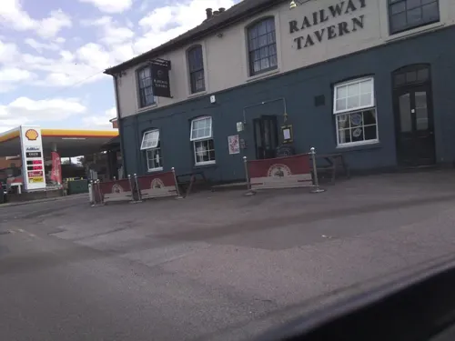
Railway Tavern
Bar and pub · British
2 Station Road, Longfield
Mo,Tu,Su 12:00-21:00; We,Th 12:00-22:30; Fr,Sa 12:00-23:30
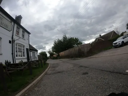
The Green Man
Bar and pub · 1.5 mi
Longfield Road, Longfield
Mo-We 12:00-22:00; Th-Sa 12:00-23:00; Su 12:00-22:00


Bistro Marie
Cafe
42 Station Road, Longfield
Mo off; Tu 15:00-21:00; We 15:00-23:00; Th 15:00-23:30; Fr...



5 more on the map.
Churches and places of worship5
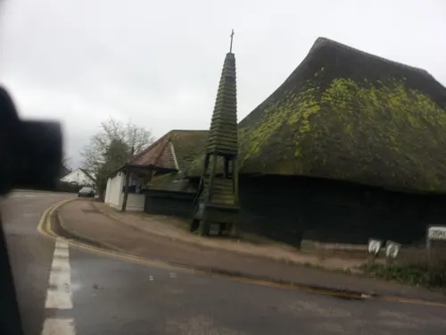


Church of St Margaret of Antioch, Darenth
Church · 3.0 mi
Grade I listed church in Darenth, Dartford, Kent, England, UK
History
The place in Kent is recorded as Langanfelda in the Saxon Charters of 964–995, and as Langafel in the Domesday Book of 1086.
It had been proposed by town planner Patrick Abercrombie as part of the Greater London Plan in the mid-1940s to build a new town in the Longfield area, however other satellite areas around London were selected instead.
From the History section of Longfield on Wikipedia, under CC BY-SA 4.0.
More about Longfield
Economy
The village has a shopping area consisting of a local baker and butcher, two local supermarkets, a post office, chemist, estate agents, hair-dressers, various restaurants and take-aways, a pet supply store and an undertakers.
Arts and culture
There is one pub in Longfield, the Railway Tavern. The Wheatsheaf, a 15th-century thatched pub, outside the village on the B255 road to Bluewater, closed down in 2011. The Long Valley Club and the Hartley Country Club are club-based venues restricted to paid membership. Other pubs in the area include the Green Man on Longfield Hill, the White Swan near Ash and the Rising Sun in Fawkham.
The church is dedicated to St Mary Magdalene, and was built in 1343. It is a Grade II* listed building
From the Wikipedia article Longfield, under CC BY-SA 4.0.
Notable people from Longfield
 Matt FryEnglish association football player (born 1990)Photo: Yabush, CC BY-SA 3.0
- Stephen OsborneBritish Paralympic athlete
Born in Longfield, according to Wikidata (CC0). Each name links to its Wikipedia article.
Shopping2
Gas and EV charging1
Schools, colleges and libraries17
Langafel Church of England Voluntary Controlled Primary School
School · Anglican · 0.8 mi
Main Road, Longfield
Healthcare3
Map of Longfield
54 places. The map loads OpenStreetMap tiles when you open it.
Getting there and nearby towns
Rochester Airport (RCS) is the nearest airport with scheduled flights listed in OpenStreetMap, 9 miles away.
- Swanscombe 3 mi north, about 6 min by car
- Tilbury 5 mi northeast, about 8 min by car
- Swanley 6 mi west, about 9 min by car
- Bexley 7 mi northwest, about 12 min by car
- South Ockendon 8 mi north, about 12 min by car
- Snodland 8 mi southeast, about 12 min by car
- Rochester 9 mi east, about 14 min by car
- Orpington 9 mi west, about 14 min by car
- Sidcup 9 mi west, about 14 min by car
- Sevenoaks 10 mi southwest, about 16 min by car
Drive times are estimates from straight-line distance, not routes.
Towns near Longfield


Keep exploring
Local news
Headlines from INDB.
Reviews, tips and questions
Loading what members have shared...
Sources and licences
- GeoNames (CC BY 4.0): population, coordinates, regions and time zone
- Mapillary (see each image): photos
- OpenStreetMap contributors (ODbL 1.0): places, airports, map data
- Wikidata (CC0 1.0): elevation, founding date, time zone, website, landmarks and historic places
- Wikimedia Commons (see each image): photos
- Wikipedia (CC BY-SA 4.0): overview and history text
Photo credits
- Longfield Chalk Bank 4, Dudley Miles, CC BY-SA 4.0
- Rectory Meadow 8, Dudley Miles, CC BY-SA 4.0
- Church of St Mary, Fawkham, Kent, Glen, CC BY 2.0
- Longfield library (8296578773), JuliaC2006 from Rochester, UK, CC BY 2.0
- Street-level photo, southglos, CC BY-SA 4.0
- Street-level photo, southglos, CC BY-SA 4.0
- Street-level photo, paulbiv, CC BY-SA 4.0
- Street-level photo, southglos, CC BY-SA 4.0
- Street-level photo, wasd42, CC BY-SA 4.0
- Street-level photo, paulbiv, CC BY-SA 4.0
- Street-level photo, paulbiv, CC BY-SA 4.0
- Street-level photo, southglos, CC BY-SA 4.0
- Street-level photo, southglos, CC BY-SA 4.0
- Street-level photo, southglos, CC BY-SA 4.0
Page built November 10, 2026. Spotted a mistake? Tell us or suggest a place.