

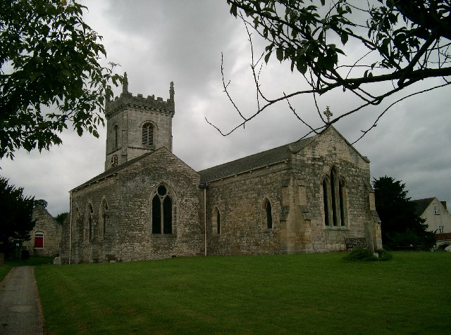
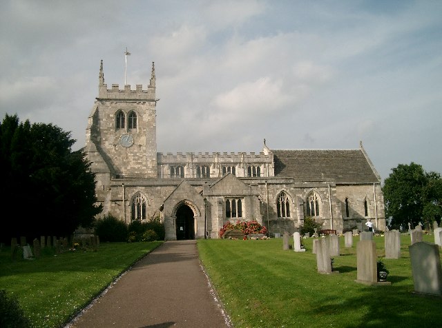


Church Fenton, United Kingdom
Church Fenton is a town of 1,357 people in England, United Kingdom.
Why visit Church Fenton
Townapedia lists 2 parks and trails and 4 places to eat in and around town.
Weather in Church Fenton
Forecast from MET Norway (CC BY 4.0). Full forecast
About Church Fenton
Church Fenton is a village and civil parish in the North Yorkshire district of North Yorkshire, England. It is about 16 miles (26 km) east of Leeds, about 6 miles (10 km) south-east from Tadcaster and 3 miles (5 km) north from Sherburn in Elmet. Neighbouring villages include Barkston Ash, Cawood and Ulleskelf. The former RAF Church Fenton is located immediately north-east, which is now known as Leeds East Airport.
From the Wikipedia article Church Fenton (this version), under CC BY-SA 4.0.
Parks, trails and playgrounds2


Restaurants and cafes4
Sunar Bangla
Restaurant · Indian
Station Road, Tadcaster
Su 17:30-23:30, Tu-Th 17:30-23:30, Fr-Sa 17:30-23:59


Churches and places of worship12

Church of All Saints
Church · 2.4 mi
Historic church in Saxton with Scarthingwell, Selby, North Yorkshire, England, UK

Church of All Saints
Church · 2.7 mi
Historic church in Sherburn in Elmet, Selby, North Yorkshire, England, UK

Immaculate Conception and St John of Beverley
Church · Catholic · 1.4 mi
Lakeside, Scarthingwell

St Mary's Chapel, Lead
Church · 3.2 mi
Church in Lead, North Yorkshire, England, UK

Church of All Saints
Church · 2.9 mi
Historic church in Bolton Percy, Selby, North Yorkshire, England, UK
Church of All Saints
Church · 2.9 mi
Historic church in Ryther cum Ossendyke, Selby, North Yorkshire, England, UK
Church of St John the Baptist
Church · 2.6 mi
Church in Kirkby Wharfe, North Yorkshire, England, UK
Church of St Mary the Virgin
Church
Grade I listed church in Church Fenton, North Yorkshire, England, UK
Holy Trinity Church, Barkston Ash
Church · 1.6 mi
Church in Barkston Ash, North Yorkshire, England, UK
Schools, colleges and libraries1

History
The name 'Church Fenton' means a village with a church in fen or marshland. The village was recorded along with nearby Little Fenton as Fentun in the Domesday Book of 1086, with no mention of a church. However in 1338 the establishment of church was signified by the name Kirk Fenton. The two names have been variously used to describe either the village or a parish including the hamlets of Little Fenton to the south and Biggin to the south-east.
The area was agricultural with some quarry work until the arrival of the Leeds and Selby Railway in 1839, resulting in the development of local industry, including a brickworks and tileworks.
There was also a gas holder and tank works in the 1920s. Further lines to Harrogate, Leeds and York followed, so that at one point there were three stations. All but one were demolished in the 1990s. A row of terraced houses is called Chicory Row indicating the crop which was grown, boiled and bottled locally at one time.
In 1936 RAF Church Fenton was built as a fighter base and took part in the defence of northern cities and the east coast during the Second World War. Later it was used as a pilot training base.
It was historically in the West Riding of Yorkshire until 1974, but is now in the county of North Yorkshire. From 1974 to 2023 it was part of the Selby District, it is now administered by the unitary North Yorkshire Council.
From the History section of Church Fenton on Wikipedia, under CC BY-SA 4.0.
Map of Church Fenton
19 places. The map loads OpenStreetMap tiles when you open it.
Getting there and nearby towns
Leeds Bradford Airport (LBA) is the nearest airport with scheduled flights listed in OpenStreetMap, 18 miles away.
- Monk Fryston 5 mi south, about 7 min by car
- Selby 7 mi southeast, about 11 min by car
- Garforth 7 mi west, about 11 min by car
- Kippax 7 mi southwest, about 12 min by car
- Thorp Arch 7 mi northwest, about 12 min by car
- Knottingley 8 mi south, about 13 min by car
- Ferrybridge 8 mi south, about 13 min by car
- Castleford 9 mi southwest, about 15 min by car
- Pontefract 10 mi south, about 16 min by car
- York 11 mi northeast, about 17 min by car
Drive times are estimates from straight-line distance, not routes.
Towns near Church Fenton


Keep exploring
Local news
Headlines from INDB.
Reviews, tips and questions
Loading what members have shared...
Sources and licences
- GeoNames (CC BY 4.0): population, coordinates, regions and time zone
- Mapillary (see each image): photos
- OpenStreetMap contributors (ODbL 1.0): places, airports, map data
- Wikidata (CC0 1.0): elevation, founding date, time zone, website, landmarks and historic places
- Wikimedia Commons (see each image): photos
- Wikipedia (CC BY-SA 4.0): overview and history text
Photo credits
- Nanny Lane, Church Fenton, Paul Glazzard, CC BY-SA 2.0
- All Saints Church Saxton, John Davidson, CC BY-SA 2.0
- All Saints Church, Sherburn in Elmet, John Davidson, CC BY-SA 2.0
- St Mary Lead 6828, Chemical Engineer, CC BY-SA 3.0
- The Church of the Immaculate Conception St John the Worker, Scarthingwell (41845221502), Mark Stevenson, CC BY 2.0
- Street-level photo, livingwithdragons, CC BY-SA 4.0
Page built November 10, 2026. Spotted a mistake? Tell us or suggest a place.