


High Peak, United Kingdom
High Peak is a town of 92,666 people in England, United Kingdom, founded in April 1, 1974.
Why visit High Peak
Townapedia lists 170 museums and landmarks, 70 parks and trails, 468 places to eat, 102 places to stay and 142 attractions in and around town.
Highlights include Poole's Cavern, Stanedge Pole, Eyam Hall and Eyam Museum.
Weather in High Peak
Forecast from MET Norway (CC BY 4.0). Full forecast
About High Peak
High Peak is a local government district with borough status in Derbyshire, England, covering a high moorland plateau in the Dark Peak area of the Peak District National Park. The district stretches from Holme Moss in the north to Sterndale Moor in the south, and from Hague Bar in the west to Bamford in the east. The population of the borough taken at the 2011 Census was 90,892. The borough is unusual in having two administrative centres for its council, High Peak Borough Council; the offices are in Buxton and Glossop.
From the Wikipedia article High Peak, Derbyshire (this version), under CC BY-SA 4.0.
Photos of High Peak


Things to do142

Poole's Cavern
Monument and historic site · 8.8 mi
2 million year old, natural limestone cave on the edge of Buxton in the Peak District, in the county of Derbyshire, England

Stanedge Pole
Monument and historic site · 8.9 mi
Ancient boundary marker dividing Derbyshire and South Yorkshire, England, UK

Buxton Opera House
Cinema and theater · 8.1 mi
Opera house in Buxton, England

Pavilion Arts Centre
Cinema and theater · 8.2 mi
Theatre and arts centre in Buxton, England, formerly also a cinema

Peak Cavern
Monument and historic site · 3.4 mi
Cave in Castleton, Derbyshire, UK


Chestnut Centre
Zoo and aquarium · 2.9 mi
Former wildlife park near Chapel-en-le-Frith, Derbyshire


Railway Bridge
Bridge · 6.4 mi
Grade II listed railway bridge in Whaley Bridge, High Peak, Derbyshire, England, UK

130 more on the map.
Museums and landmarks170


Treak Cliff Cavern
Monument and historic site · 2.5 mi
Show cave in Derbyshire, England
Mar 01-Oct 31 09:30-17:00; Nov 01-Feb 28 10:00-16:00; Jan 01...



Castleton War Memorial
Monument and historic site · 3.4 mi
War memorial in Castleton, High Peak, Derbyshire, England, UK
Hordron Edge Stone Circle
Monument and historic site · 6.9 mi
Stone circle in the parish of Derwent, Derbyshire, England, UK
158 more on the map.
Parks, trails and playgrounds70


Buxton Pavilion Gardens
Park · 8.3 mi
Park in Buxton, Derbyshire, England, UK

Etherow Country Park
Park · 8.7 mi
Country park in Compstall, England

Howard Park
Park · 7.3 mi
Public park in Glossop, Derbyshire, England, UK

Fox Hagg
Park · 11.0 mi
Nature Reserve in Sheffield, South Yorkshire, England
58 more on the map.
Restaurants and cafes468

Maple Tree
Restaurant · Chinese · 8.9 mi
6 Town Street, Stockport
We-Th,Su 17:00-22:00; Fr-Sa 17:00-23:00
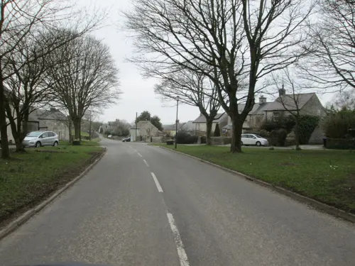

The Old Nags Head
Bar and pub · 1.2 mi
Official start of the Pennine Way
Grindsbrook Booth, Hope Valley
Mo-Su 12:00-23:00

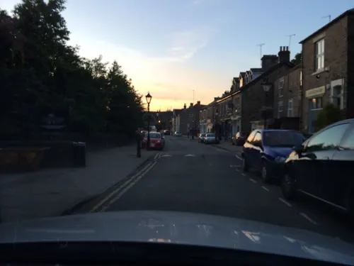
Libbys Bread & Wine
Cafe · Coffee Shop, Tapas, Wine · 8.9 mi
Café and bakery by day; wine bar with small plates in the evening.
1-3 Town Street, Stockport
Mo-We 08:00-16:00; Th-Sa 08:00-16:00,17:00+; Su 09:00-14:00


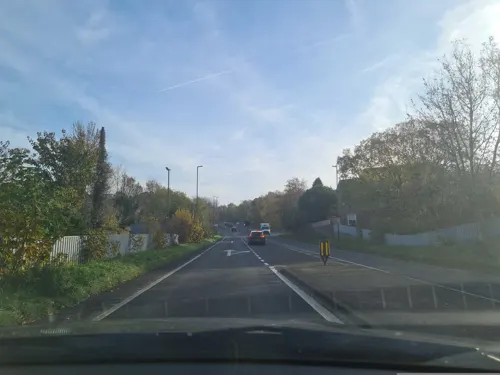
Colosseo Italian Bar and Restaurant
Restaurant · Italian, Pizza · 4.2 mi
1a Steeple End Fold, High Peak
Tu-Fr 17:00-23:30; Sa 12:00-22:30; Su 12:00-21:00



456 more on the map.
Where to stay102
Churches and places of worship130
Shopping82
Gas and EV charging15
Schools, colleges and libraries89
Bradwell CofE (Controlled) Infant School & Nursery
School · Anglican · 5.3 mi
Church Street, Hope Valley
Charlesworth Voluntary Controlled Primary School
School · Nondenominational · 7.6 mi
Long Lane, Glossop
Dinting Church of England Voluntary Aided Primary School
School · Anglican · 7.5 mi
Dinting Vale, Glossop
Healthcare31
Buxton Hospital & Corbar Birth Centre
Hospital · 8.7 mi
London Road, Buxton
Map of High Peak
250 places. The map loads OpenStreetMap tiles when you open it.
Getting there and nearby towns
Manchester Airport (MAN) is the nearest airport with scheduled flights listed in OpenStreetMap, 18 miles away.
- New Mills 6 mi west, about 10 min by car
- Glossop 7 mi northwest, about 11 min by car
- Buxton 8 mi south, about 13 min by car
- Marple 9 mi west, about 15 min by car
- Hyde 11 mi northwest, about 18 min by car
- Hazel Grove 11 mi west, about 18 min by car
- Poynton 11 mi west, about 18 min by car
- Stalybridge 12 mi northwest, about 19 min by car
- Bredbury 12 mi west, about 19 min by car
- Stockport 13 mi west, about 21 min by car
Drive times are estimates from straight-line distance, not routes.
Towns near High Peak


Keep exploring
Local news
Headlines from INDB.
Reviews, tips and questions
Loading what members have shared...
Sources and licences
- GeoNames (CC BY 4.0): population, coordinates, regions and time zone
- Mapillary (see each image): photos
- OpenStreetMap contributors (ODbL 1.0): places, airports, map data
- Wikidata (CC0 1.0): elevation, founding date, time zone, website, landmarks and historic places
- Wikimedia Commons (see each image): photos
- Wikipedia (CC BY-SA 4.0): overview and history text
Photo credits
- Buxton View From Peakdistrict, Onofre_Bouvila., CC BY 2.5
- Pooles Cavern 2, Dave Pape, Public domain
- Stanedge Pole and Long Causeway, Mick Knapton, CC BY-SA 3.0
- Buxton Opera House, Dave Pape, Public domain
- Buxton Cinema at the Pavilion Arts Centre, Douglal, CC BY-SA 4.0
- Peak Cavern 2015 05, Photograph by Mike Peel ( www.mikepeel.net )., CC BY-SA 4.0
- Eyam Museum 866338 d051faf2, Alan Heardman, CC BY-SA 2.0
- Treak Cliff Cavern buildings, Dave.Dunford, CC BY-SA 3.0
- Blue John Cavern entrance, The original uploader was Espresso Addict at English Wikipedia ., CC BY-SA 2.5
- Compstall - Etherow Country Park Café, Skinsmoke, CC BY-SA 3.0
- All saints church, Marple, Greater Manchester, Zzztriple2000, CC BY 3.0
- Romiley - Chadkirk Chapel, Skinsmoke, CC BY 3.0
- St Anne's Church on Bath Road, Higher Buxton, Douglal, CC BY-SA 4.0
- Lyme Park 2014 07, Photograph by Mike Peel ( www.mikepeel.net )., CC BY-SA 4.0
- Benkid77 Pavilion Gardens, Buxton 2 080809, Rept0n1x, CC BY-SA 3.0
- Buxton, The Crescent, Eugene Birchall, CC BY-SA 2.0
- St Martin's Church, Brabyns Brow, Marple (NHLE Code 1241823) (March 2015) (1), User:Hassocks5489, CC0
- Joseph Holt Brewery, JosephHolt1849, CC BY-SA 4.0
- Benkid77 Old Hall Hotel, Buxton 080809, Rept0n1x, CC BY-SA 3.0
- St Matthews church hayfield 021599 df40975f, Alan Fleming, CC BY-SA 2.0
- St George's Church, New Mills, Dave.Dunford, CC BY-SA 4.0
- Castle Hotel, Castleton, Dave.Dunford, CC BY-SA 4.0
- THE OLD NAGS HEAD, GRINDSBROOK BOOTH, Edale-1, Barrie Price, CC BY-SA 4.0
- Old Sun Inn at Buxton, Douglal, CC BY-SA 4.0
- Norfolk Arms and former National Westminster Bank, Marple Bridge, Braveheart, CC BY-SA 4.0
- St James' Church, Buxworth, Benjamin Shaw, CC BY-SA 4.0
- Losehill Hall, Castleton, David Hallam-Jones, CC BY-SA 2.0
- Gate piers to Lyme Park in Red Lane, Disley, Dave.Dunford, CC BY-SA 4.0
- Bleaklow, see below, CC BY-SA 2.0
- The Crescent Hotel in Buxton 2020, Douglal, CC BY-SA 4.0
- Bandstand and Milner Bridge in Buxton Pavilion Gardens, Douglal, CC BY-SA 4.0
- Hayfield Church 0158, Clem Rutter, Rochester, Kent., CC BY-SA 3.0
- On the Pennine Way - Flickr - Donnchadh H, Donnchadh H, CC BY 4.0
- Crowden Lea, Upper Booth, Dave.Dunford, CC BY-SA 4.0
- Edale, UK - panoramio (18), JJ Jones, CC BY 3.0
- Eyam Hall 1334913-15, Barrie Price, CC BY-SA 4.0
- Bowstones, Dave Shandley, CC BY-SA 2.0
- PNFS 1908 signpost to Navio Roman Fort, Douglal, CC BY-SA 4.0
- Iron Bridge, Brabyns Park, Neil Theasby, CC BY-SA 2.0
- Street-level photo, dudone, CC BY-SA 4.0
- Street-level photo, julianlb, CC BY-SA 4.0
- Street-level photo, julianlb, CC BY-SA 4.0
- Street-level photo, wasd42, CC BY-SA 4.0
- Street-level photo, mappo2, CC BY-SA 4.0
- Street-level photo, emerald-deepen-coherent, CC BY-SA 4.0
- Street-level photo, emerald-deepen-coherent, CC BY-SA 4.0
- Street-level photo, emerald-deepen-coherent, CC BY-SA 4.0
- Street-level photo, emerald-deepen-coherent, CC BY-SA 4.0
- Street-level photo, emerald-deepen-coherent, CC BY-SA 4.0
- Street-level photo, julianlb, CC BY-SA 4.0
- Street-level photo, emerald-deepen-coherent, CC BY-SA 4.0
- Street-level photo, wasd42, CC BY-SA 4.0
- Street-level photo, dudone, CC BY-SA 4.0
- Street-level photo, southglos, CC BY-SA 4.0
- Street-level photo, southglos, CC BY-SA 4.0
- Street-level photo, emerald-deepen-coherent, CC BY-SA 4.0
- Street-level photo, emerald-deepen-coherent, CC BY-SA 4.0


Page built November 10, 2026. Spotted a mistake? Tell us or suggest a place.