
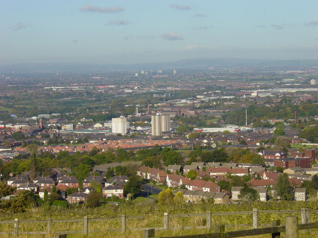


Why visit Hyde
Townapedia lists 5 museums and landmarks, 16 parks and trails, 85 places to eat, 1 place to stay and 3 attractions in and around town.
Highlights include Tameside Hippodrome, Theatre Royal, Ashton Under Lyne War Memorial and Stalybridge War Memorial.
Weather in Hyde
Forecast from MET Norway (CC BY 4.0). Full forecast
About Hyde
Hyde is a town in Tameside, Greater Manchester, England. It lies within the historic county boundaries of Cheshire, and became part of Greater Manchester in 1974. The built-up area as defined by the Office for National Statistics had a population of 35,895 at the 2021 census. The town lies 5 miles (8 km) north-east of Stockport, 6 miles (10 km) west of Glossop and 6.5 miles (10 km) east of Manchester.
From the Wikipedia article Hyde, Greater Manchester (this version), under CC BY-SA 4.0.
Travel tips from other travellers: Hyde on Wikivoyage (CC BY-SA 4.0).
Things to do3
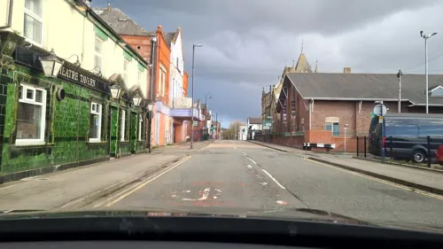
Tameside Hippodrome
Cinema and theater · 2.6 mi
Theatre and former cinema in Ashton-under-Lyne, Greater Manchester, England, UK

Theatre Royal
Cinema and theater
Former theatre and cinema in Hyde, Greater Manchester, England, UK

Museums and landmarks5

Ashton Under Lyne War Memorial
Monument and historic site · 2.6 mi
War memorial in Tameside, Greater Manchester, England, UK

Stalybridge War Memorial
Monument and historic site · 2.4 mi
War memorial in Stalybridge, Greater Manchester, England, UK



Parks, trails and playgrounds16


Etherow Country Park
Park · 2.8 mi
Country park in Compstall, England



4 more on the map.
Restaurants and cafes85



Shepherds Call
Bar and pub
216 Market Street, Hyde
Mo,Tu 13:00-22:30, We,Th 12:00-23:30, Fr,Sa 12:00-00:30, Su 12:00-22:00
73 more on the map.
History
Newton Hall was present in the thirteenth century. Hyde was a township in the parish of Stockport. In the late 18th century, the area that was to become the town centre was no more than a cluster of houses known as Red Pump Street. Gee Cross to the south was the larger settlement at that time, with Hyde being primarily the estates of Hyde Hall on the banks of the River Tame. At the 1801 census, the Hyde township had a population of 1,063. The modern town is largely a creation of the 19th century and the Industrial Revolution.
The Peak Forest Canal was constructed through Hyde, being completed in 1800. It runs from Ashton-under-Lyne to Woodley, Romiley and Marple. Captain Clarke's Bridge, originally named Wood End Canal Bridge, is situated at the end of Woodend Lane. The bridge was erected before Captain Clarke rose to prominence and therefore probably became known as Captain Clarke's Bridge after he retired and resided there.
Read more of the history
The population of Hyde increased due to the success of the cotton mills during the Industrial Revolution of the late 18th and early 19th centuries; at one stage, there were 40 working mills. By 1872, only 27 remained; half of the remaining mills closed between 1921 and 1939 and there is only one working mill in the town today. There were many mill-owning families, including Sidebotham, Hibbert and Horsfield. The main employers in the mills were the Ashton family, who successfully ran a combined spinning and weaving company; most mills concentrated on one process only. The Ashton family built Hyde Chapel, on Stockport Road in Gee Cross. The Ashton Brothers' Mill has been demolished recently to make way for a housing estate.
St George's Church was built in 1832 as a chapel of ease to St Mary's, Stockport. It was built at the instigation of John Hyde Clarke of Hyde Hall and was the first Church of England place of worship in the town; St George's became a parish church in 1842, with its ecclesiastical parish initially covering the whole township of Hyde. Later additions include the lychgate, boathouse by the canal, hearse house, parish rooms and numerous vicarages. The church has a 110-foot (34 m) tower housing eight bells and a clock.
Newton for Hyde railway station opened in 1841 on the Sheffield, Ashton-under-Lyne and Manchester Railway. It was in the neighbouring township of Newton, 0.6 miles (1 km) north-east of the Market Place in Hyde. Hyde Central railway station, closer to the town centre, was opened in 1858 on a branch line.
In 1853, construction work on the Catholic St Paul's Church in Hyde began. On 21 June 1854, the church was opened. It was designed by the noted architects Matthew Ellison Hadfield, John Grey Weightman and George Goldie in the Gothic Revival style. In 2013, it was designated a Grade II listed building.
Hyde Colliery was a coal mine in the town; in January 1889, an explosion there killed 23 miners. There was an inquiry held the following month at Hyde Town Hall. The following month, Ardwick AFC (now Manchester City) played Newton Heath (now Manchester United) under floodlights at Belle Vue to raise money for the victims' families. The game was watched by 10,000 people and this was the first floodlit match played by either side.
During the 1960s, Myra Hindley and Ian Brady were arrested in their home on the Hattersley estate in Hyde after police found the body of 17-year-old Edward Evans in the house. At their trial, they were found guilty of murdering Evans as well as two other children whose bodies were found buried on Saddleworth Moor several miles away.
Britain's most prolific serial killer, Dr Harold Shipman, had his doctor's surgery in the town where he murdered most of his several hundred victims. The first known victim was 86-year-old Sarah Hannah Marsland of Ashton House in Victoria Street on 7 August 1978 and the last was Kathleen Grundy of Joel Lane on 24 June 1998.
On 18 September 2012, drug dealer Dale Cregan made a hoax emergency call to the police from an address in Mottram in Longdendale, luring police constables Nicola Hughes, 23, and Fiona Bone, 32, of Greater Manchester Police there by claiming that there had been an incident of criminal damage. When they arrived, he murdered them.
From the History section of Hyde, Greater Manchester on Wikipedia, under CC BY-SA 4.0.
More about Hyde
Geography
Werneth Low Country Park is the location of the Hyde War Memorial. The memorial is owned by a trust which raised funds from Hyde residents after the Great War to create a permanent memorial to those Hyde residents who died in that conflict. The memorial contains 710 names.
Hyde is separated from Denton by the River Tame, a tributary of the River Mersey. There are several areas and suburbs in Hyde, these include: Gee Cross, Newton, Hattersley, Godley, and Flowery Field.
Education
The secondary schools in the Hyde area are Alder Community High School and Hyde High School.
Tameside College and Clarendon Sixth Form College used to be located in Hyde but have since moved to Ashton-under-Lyne.
The historic Canterbury College of Business had a campus hall in Hyde until it relocated its facilities overseas.
From the Wikipedia article Hyde, Greater Manchester, under CC BY-SA 4.0.
Notable people from Hyde
 Lee MartinEnglish association football player, born in February 1968Photo: Jaybullen, CC BY-SA 4.0
 Luke BainesAustralian actorPhoto: Super Festivals, CC BY 4.0
 John BramwellEnglish singer-songwriterPhoto: Man Alive!, CC BY 2.0
 Jenny B. CampbellBritish entrepreneurPhoto: Find a Future, CC BY 2.0
 Antony SzmierekBritish indie hip-hop artistPhoto: Raph_PH, CC BY 2.0
- Frank BoothEnglish footballer (1882-1919)
- Frank KnowlesEnglish footballer (1891-1951)
- Edward Hydefirst Governor of North-Carolina
- Joseph BarnesEnglish footballer
- Alan WestEnglish footballer (born 1951)
- George Gregoryassociation football player
- Danny BrocklehurstBritish writer
Born in Hyde, according to Wikidata (CC0). Each name links to its Wikipedia article.
Where to stay1
Churches and places of worship32
Shopping11
Gas and EV charging2
Schools, colleges and libraries29
Healthcare7
Map of Hyde
191 places. The map loads OpenStreetMap tiles when you open it.
Getting there and nearby towns
Manchester Airport (MAN) is the nearest airport with scheduled flights listed in OpenStreetMap, 11 miles away.
- Denton 2 mi west, about 3 min by car
- Dukinfield 2 mi north, about 3 min by car
- Stalybridge 2 mi north, about 4 min by car
- Bredbury 3 mi southwest, about 5 min by car
- Droylsden 3 mi northwest, about 5 min by car
- Stockport 4 mi southwest, about 7 min by car
- Marple 4 mi south, about 6 min by car
- Hazel Grove 5 mi south, about 8 min by car
- Failsworth 5 mi northwest, about 8 min by car
- Hollinwood 5 mi northwest, about 8 min by car
Drive times are estimates from straight-line distance, not routes.
Towns near Hyde


Keep exploring
Local news
Headlines from INDB.
Reviews, tips and questions
Loading what members have shared...
Sources and licences
- GeoNames (CC BY 4.0): population, coordinates, regions and time zone
- Mapillary (see each image): photos
- OpenStreetMap contributors (ODbL 1.0): places, airports, map data
- Wikidata (CC0 1.0): elevation, founding date, time zone, website, landmarks and historic places
- Wikimedia Commons (see each image): photos
- Wikipedia (CC BY-SA 4.0): overview and history text
Photo credits
- Hyde from Werneth Low, Janine Cook, CC BY-SA 2.0
- Theatre Royal, Hyde, Izzak, CC BY-SA 3.0
- Ashton-under-Lyne War Memorial (1), Rept0n1x, CC BY-SA 3.0
- Stalybridge war memorial (6), Rept0n1x, CC BY-SA 3.0
- Compstall - Etherow Country Park Café, Skinsmoke, CC BY-SA 3.0
- Stamford Park, Tameside (5), Rept0n1x, CC BY-SA 3.0
- Albion United Reformed Church, Ashton under Lyne, A. Carty ( talk ), CC BY-SA 3.0
- Romiley - Chadkirk Chapel, Skinsmoke, CC BY 3.0
- St John's Church, Dukinfield, Gerald England, CC BY-SA 2.0
- EwenFieldsHyde, The original uploader was Liamtaylor007 at English Wikipedia ., CC BY-SA 3.0
- Hyde War Memorial, Dave.Dunford, CC BY-SA 4.0
- Hyde cenotaph, Mike from Stockport, England, CC BY-SA 2.0
- Iron Bridge, Brabyns Park, Neil Theasby, CC BY-SA 2.0
- Street-level photo, mappo2, CC BY-SA 4.0
- Street-level photo, mappo2, CC BY-SA 4.0
- Street-level photo, adam2, CC BY-SA 4.0
- Street-level photo, mappo2, CC BY-SA 4.0
- Street-level photo, mappo2, CC BY-SA 4.0
- Street-level photo, mappo2, CC BY-SA 4.0
- Street-level photo, mappo2, CC BY-SA 4.0
- Street-level photo, mappo2, CC BY-SA 4.0
- Street-level photo, mappo2, CC BY-SA 4.0
- Street-level photo, mappo2, CC BY-SA 4.0
- Street-level photo, adam2, CC BY-SA 4.0


Page built November 10, 2026. Spotted a mistake? Tell us or suggest a place.