


Why visit Leyton
Townapedia lists 80 museums and landmarks, 93 parks and trails, 158 places to eat, 24 places to stay and 16 attractions in and around town.
Highlights include Stratford East, Vue Westfield Stratford City, V&A East Storehouse and ArcelorMittal Orbit.
Weather in Leyton
Forecast from MET Norway (CC BY 4.0). Full forecast
About Leyton
Leyton is a town in East London, England, within the London Borough of Waltham Forest. It borders Walthamstow to the north, Leytonstone to the east, and Stratford to the south, with Clapton, Hackney Wick and Homerton, across the River Lea, to the west. The area includes New Spitalfields Market, Leyton Orient Football Club, as well as part of the Queen Elizabeth Olympic Park. The town consists largely of terraced houses built between 1870 and 1910, interspersed with some modern housing estates.
From the Wikipedia article Leyton (this version), under CC BY-SA 4.0.
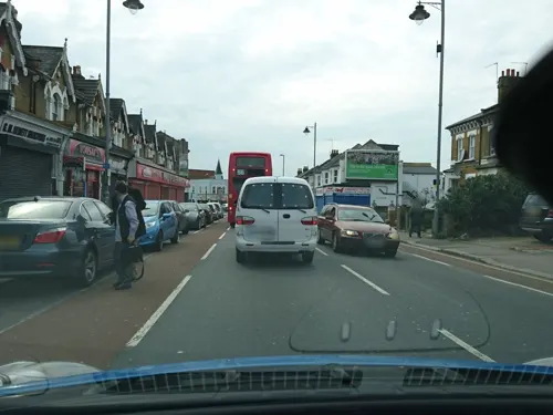
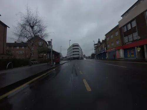
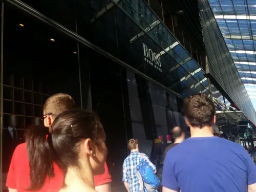
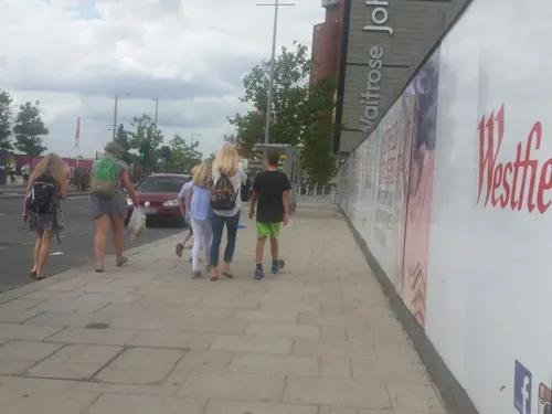
Photos of Leyton


Things to do16


Bernie Grant Arts Centre
Cinema and theater · 3.4 mi
Arts centre in Tottenham, London

Hackney Empire
Cinema and theater · 2.3 mi
Theatre on Mare Street in the London Borough of Hackney, London, England, UK

Half Moon Theatre
Cinema and theater · 3.0 mi
Theatre company in London

Queens' Building
Cinema and theater · 2.9 mi
Building in Mile End Road, London, England, formerly the People's Palace, including a theatre and music hall

The Yard Theatre
Cinema and theater · 1.3 mi
43 White Post Lane, London

Arcola Theatre
Cinema and theater · 2.9 mi
Theatre in Hackney, London, England
Britannia Theatre
Cinema and theater · 3.3 mi
Former theatre in Hoxton, London, England (1841–1900), later a cinema (1913–1940)
Chisenhale Dance Space
Cinema and theater · 2.3 mi
Dance venue in Tower Hamlets, London, England
4 more on the map.
Museums and landmarks80

V&A East Storehouse
Museum · 1.1 mi
Parkes Street, London
PH,Mo-Su 10:00-18:00; Th,Sa 10:00-22:00; Dec 24-26 off

ArcelorMittal Orbit
Monument and historic site · 1.5 mi
Sculpture and observation tower in the Olympic Park in Stratford, London

Gurney Memorial
Monument and historic site · 1.3 mi
Gurney Memorial Drinking Fountain



The Westbridge Hotel
Monument and historic site · 1.5 mi
Former pub, that has been redeveloped (listed building)
335-337 High Street
William Shakespeare
Monument and historic site · 1.3 mi
Statue in garden of William Shakespeare at West Ham Precinct of the University of East London
68 more on the map.
Parks, trails and playgrounds93


Ackroyd Drive Greenlink
Park · 2.9 mi
Local nature reserve in the London Borough of Tower Hamlets, England, UK

Bartlett Park
Park · 3.2 mi
Park in the London Borough of Tower Hamlets

Bow Creek Ecology Park
Park · 3.3 mi
Park in the London Borough of Newham

Hackney Downs
Park · 2.3 mi
Common land in the London Borough of Hackney


81 more on the map.
Restaurants and cafes158
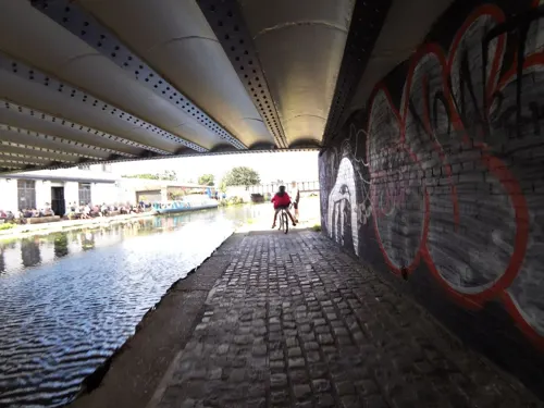
Crate Brewery & Pizza
Bar and pub · Pizza · 1.3 mi
43 White Post Lane, London
Mo-Th,Su 12:00-23:00; Fr-Sa 12:00-01:00


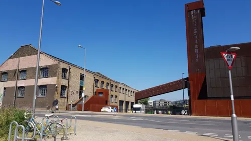
Barge East
Restaurant · British · 1.3 mi
White Post Lane, London
Mo,Tu off, We,Th 16:00-23:00, Fr,Sa 12:00-24:00, Su 12:00-22:30
Cabana
Restaurant · Brazilian · 1.2 mi
5 Montfichet Road, London
Mo 12:00-21:00; Tu-Th 12:00-22:00; Fr 12:00-22:30; Sa 11:30-22:30;...
Caffè Nero
Cafe · Coffee Shop · 1.2 mi
127 Montfichet Road, London
Mo-Fr 06:30-21:30; Sa 07:00-22:00; Su 08:30-22:00

Calabash
Restaurant · Caribbean · 1.5 mi
22 Vicarage Lane, London
Mo-Th, Sa 09:00-20:00; Fr 09:00-22:00; Su 12:00-20:00
Darkhorse
Restaurant · European · 0.8 mi
16-19 Victory Parade, London
Tu-Th 11:00-23:00; Fr-Sa 10:00-24:00; Su 10:00-18:00
146 more on the map.
History
Paleolithic implements and fossil bones show that early man hunted in Leyton.
A Roman cemetery and the foundations of a Roman villa have been found here. Huge ancient foundations, including arches of Roman appearance were recorded in 1718 at Grange Park Road, about 400m to the northeast of the Oliver Close Estate, with reports describing ancient ruins covering 2 acres. Many stray finds of Roman date have been recovered in the vicinity of Grange Park and Roman ditches were found to the north at Church Road
One or more Roman buildings were found in 1718 in enlarging a garden on the north side of the parish churchyard. The property was then occupied by a Mr. Gansell and apparently called "The Grange"; it was described in 1771 as "between the manor house and the canal, where the garden now is," and the site is now somewhere in the neighbourhood of Grange Park and Manor Roads, .... The remains were traced over an extent of two acres, and consisted of "very large and strong foundations, in one place all stone with considerable arches, an arched doorway with steps down to it, but quite filled up with gravel. In many foundations were a great quantity of Roman tiles and bricks mixed with more modern materials." Two wells were also found, and "a great quantity of oak timber, some 8, some 10 inches square, mortised together like a floor."
Read more of the history
Numerous Roman coins, together with "bitts of silver with Saxon characters" were also turned up. A later account speaks of "a large arched gate with mouldings, and the portal to a large gate 9 or 10 feet high, 5 or 6 feet broad, the wall 4 feet thick or more," all at a depth of 6 feet. Foundations also occurred in the ploughed fields then adjoining the garden on the north and west, but nothing was observed on the south and east.
From Anglo-Saxon times, Leyton has been part of the county of Essex. The name means "settlement (tun) on the River Lea" and was also known until 1921 as "Low Leyton".
The Domesday Book of 1086 lists six estates or manors at the vill of Leituna or Leintuna in the Becontree Hundred of Essex. There were 51 households recorded across the six Leyton manors at that time.
The ancient parish of Leyton, also known as Leyton St Mary or Low Leyton, was in two parts. The main part included the settlements of Leytonstone and Leyton itself (historically known as Low Leyton). The detached part of the parish to the north included the area around Lea Bridge Road. The two parts were separated by a long, thin exclave of Walthamstow parish, known as the "Walthamstow Slip". To the south, the parish of Leyton had anciently included the manor of Cann Hall, which was transferred to the parish of Wanstead sometime prior to the 13th century.
Leyton's parish church of St Mary the Virgin was largely rebuilt in the 17th century.
A local government district was created in 1873, covering the parish of Leyton or Low Leyton and the Walthamstow Slip. The order creating the district called it "Low Leyton", but by 1875 the district was being called just "Leyton" in official documents. The district was extended in 1875 to also include the Cann Hall area of Wanstead parish to the south, also known as the Wanstead Slip. The Walthamstow Slip was transferred to the parish of Low Leyton in 1878.
Local government districts were reconstituted as urban districts under the Local Government Act 1894. The Leyton Urban District comprised the two civil parishes of Cann Hall and Leyton or Low Leyton. The ambiguity in the name of the latter parish was resolved in 1921 when the name was confirmed to be just Leyton. Leyton Town Hall on Adelaide Road was built in 1895 to serve as the council's headquarters. In 1926 the urban district was incorporated as a borough, becoming the Municipal Borough of Leyton.
In 1965, the borough of Leyton was abolished and was combined with that of Walthamstow and Chingford to form the London Borough of Waltham Forest, within the new county of Greater London. Although Leyton did not become officially part of London until 1965, the borough formed part of London's built-up area and had been part of the London postal district since its inception in 1856 and the Metropolitan Police District since 1839.
The main route through the town is the High Road, which forms part of the ancient route to Waltham Abbey. At the top end of the High Road is a crossroads with Lea Bridge Road and Hoe Street. This junction and the surrounding district is known as Bakers Arms, named after the public house which has now closed down. The pub was named in honour of the almshouses on Lea Bridge Road built in 1857 by the London Master Bakers' Benevolent Institution.
During the 17th and 18th centuries, Leyton was a "pretty retiring place from London" for wealthy merchants and bankers; in 1766 there were said to be 50 or 60 gentlemen with houses in the parish. Leyton's development from an agricultural community to an industrial and residential suburb was given impetus by the arrival of the railway. First at Lea Bridge Station in 1840, then at Low Leyton in 1856 (now Leyton Underground). Finally Leyton Midland Road opened in 1894, after an elevated line had been built on brick arches across the already developed streets. However, not all the green spaces were lost, 200 acres (81 ha) of Epping Forest within Leyton's borders were preserved by the Epping Forest Act 1878. In 1897 Leyton Urban District Council purchased the land for a formal park close to the town hall; it opened in 1903 as Coronation Gardens, named after the coronation of King Edward VII. In 1905, the "Lammas land", common pasture land on Leyton Marshes, was purchased by the council for use as a recreation ground.
From the History section of Leyton on Wikipedia, under CC BY-SA 4.0.
More about Leyton
Geography
Leyton is in the Lower Lea Valley, the river forming its western boundary. The area rises from low-lying marshland along the river Lea to over 90 feet at Whipps Cross on the southern edge of Epping Forest. Leyton is partially bisected by the A12 (M11 link road, built in the 1990s), with most of the district lying on the north-west side of this busy traffic artery through east London.
The High Road Leyton bridge crossing the A12 offers views of the Olympic Park, which also borders the district, as well as of skyscrapers further west. It borders Walthamstow along Lea Bridge Road and areas of the London Borough of Hackney via the River Lea.
Education
Leyton has a number of secondary schools, including George Mitchell School, Lammas School and Norlington School. There is also a college, Leyton Sixth Form College, which is the second sixth form college in Southern England to get a licence, and the best college in London for sport.
A class in Riverley Primary School in Leyton won the 'funniest joke' competition run by The Beano in 2025 and the school's Maisha Mahfuza won the 'funniest teacher' accolade.
From the Wikipedia article Leyton, under CC BY-SA 4.0.
Notable people from Leyton
 Asha PhilipBritish sprinterPhoto: Sandro Halank, Wikimedia Commons, CC BY-SA 4.0
 Danny BaileyEnglish footballer (born 1964)Photo: Dannybailey64, CC BY-SA 4.0
 Jack Cornwellrecipient of the Victoria CrossPhoto: Photo originally published by Central News., Public domain
 Maria Margaret PollenEnglish writer on lacePhoto: Dante Gabriel Rossetti, Public domain
 Matt HarroldEnglish association football player (born 1984)Photo: Timmy96, CC0
 George Eastmancricketer (1903-1991)Photo: Agence Rol. Agence photographique..., Public domain
- Benik AfobeCongolese footballer
- Derek J. de Solla PriceBritish historian and physicist (1922–1983)
- John WisdomBritish philosopher (1904–1993)
- Harry BeckBritish technical draftsman and graphic designer (1902–1974)
- Leonard GrahamEnglish cricketer (1901-1962)
- Jamal FyfieldEnglish association football player
Born in Leyton, according to Wikidata (CC0). Each name links to its Wikipedia article.
Where to stay24
Churches and places of worship84
New Testament Assembly Life Development Christian Centre
Church · Protestant
Langthorne Road, London
Shopping81
Gas and EV charging17
Schools, colleges and libraries41
Healthcare40
Whipps Cross University Hospital
Hospital · 1.3 mi
Whipps Cross Road, London
Map of Leyton
250 places. The map loads OpenStreetMap tiles when you open it.
Getting there and nearby towns
London City Airport (LCY) is the nearest airport with scheduled flights listed in OpenStreetMap, 4 miles away.
- Wanstead 2 mi northeast, about 3 min by car
- Walthamstow 2 mi north, about 4 min by car
- West Ham 2 mi southeast, about 3 min by car
- Snaresbrook 2 mi northeast, about 3 min by car
- Ilford 3 mi east, about 6 min by car
- Stepney 3 mi southwest, about 5 min by car
- Tottenham 4 mi northwest, about 6 min by car
- Woodford Green 4 mi north, about 6 min by car
- Barking 4 mi southeast, about 7 min by car
- Islington 4 mi west, about 7 min by car
Drive times are estimates from straight-line distance, not routes.
Towns near Leyton


Keep exploring
Local news
Headlines from INDB.
Reviews, tips and questions
Loading what members have shared...
Sources and licences
- GeoNames (CC BY 4.0): population, coordinates, regions and time zone
- Mapillary (see each image): photos
- OpenStreetMap contributors (ODbL 1.0): places, airports, map data
- Wikidata (CC0 1.0): elevation, founding date, time zone, website, landmarks and historic places
- Wikimedia Commons (see each image): photos
- Wikipedia (CC BY-SA 4.0): overview and history text
Photo credits
- Leytontownhall, Nabs at English Wikipedia, Public domain
- Kapture, Leyton, E10, Ewan-M, CC BY-SA 4.0
- Leyton Engineer, Leyton, E10, Ewan-M, CC BY-SA 4.0
- Leyton library (15084888832), JuliaC2006 from Rochester, UK, CC BY 2.0
- Leyton Library (Waltham Forest Heritage), Spudgun67, CC BY-SA 4.0
- Leyton Library - Leyton Municipal Offices High Road London E10 5PS, Spudgun67, CC BY-SA 4.0
- Leyton Town Hall (Waltham Forest Heritage), Spudgun67, CC BY-SA 4.0
- Old Leyton Town Hall 265 High Road Leyton London E10 5QN, Spudgun67, CC BY-SA 4.0
- LeytonLibrary, Leyton59, CC BY-SA 3.0
- Bernie Grant Arts Centre JL 001, Berniegrantcentre, CC BY 3.0
- Hackney empire 1, Tarquin Binary, Public domain
- Half Moon, Stepney, E1 (3171916542), Ewan Munro from London, UK, CC BY-SA 2.0
- Queens' Building (2899476115), Ewan Munro from London, UK, CC BY-SA 2.0
- ArcelorMittal Orbit at night, you_only_live_twice from Lighthorne Heath, England, CC BY-SA 2.0
- Ackroyd Drive Greenlink 1, Dudley Miles, CC BY-SA 3.0
- Bartlett Park 19, Gordon Joly, CC BY-SA 2.5
- Haggerston park 1, Tarquin Binary, CC BY-SA 2.5
- Abney park chapel, Tarquin Binary, CC BY-SA 2.5
- Olympic Park, London, 16 April 2012, EG Focus, CC BY 2.0
- London Velopark, 16 April 2012, EG Focus, CC BY 2.0
- Brisbane Road, Chris Eason from London, CC BY 2.0
- Barclay School Leyton, Alansplodge, CC BY-SA 4.0
- London 2012 Olympic Stratford Centre 219 (7683058764), DAVID HOLT from London, England, CC BY-SA 2.0
- Whipps Cross Hospital old building, Secretlondon, CC BY-SA 4.0
- King Edward VII, Stratford, E15 (7419175430), Ewan Munro from London, UK, CC BY-SA 2.0
- Church of St Barnabas and St James the Greater, Uukgoblin, CC BY-SA 3.0
- UEL Stratford Campus, Pedleysd ( talk ), Public domain
- Fetter Lane Congregational Chapel - Langthorne Road Leyton E11 4ER, Spudgun67, CC BY-SA 4.0
- St John's Stratford, Pedleysd ( talk )., Public domain
- HE1080991 Old Town Hall Stratford (1), Katie Chan, CC BY-SA 4.0
- Gurney Memorial Drinking Fountain, Stratford, David Anstiss, CC BY-SA 2.0
- St Andrews Church, Leytonstone - exterior rear side view, Archivillian, CC BY-SA 4.0
- The White Building At Hackney Wick - London. (10852950784), Jim Linwood from London, CC BY 2.0
- Westfield Cinema, Stratford, London (7180812938), Berit from Redhill/Surrey, UK, CC BY 2.0
- Bobby Moore Academy (Secondary) 2022-03-19, The wub, CC BY-SA 4.0
- Goldengrove pub, Stratford, The wub, CC BY-SA 4.0
- The Yard Theatre, AlexandraHC, CC BY-SA 4.0
- St Francis of Assisi Church, Stratford by P L Kessler, P L Kessler / The History Files (www.historyfiles.co.uk), reproduced with permission, CC BY-SA 4.0
- V&A East Storehouse exterior 2025-08-17 (2), The wub, CC BY-SA 4.0
- Front of Theatre Royal Stratford East by Richard Davenport, Sbrooks91, CC BY-SA 4.0
- Abney Park 3, Mx. Granger, CC0
- Hackney downs 1, Tarquin Binary, CC BY-SA 2.5
- Prayer-city-front-view-1536x623, Tacotruckman69, CC BY-SA 4.0
- Hackney Marshes - panoramio, JJ Jones, CC BY 3.0
- The Mabley Green Megalith with Lesney Factory. London E9,March 2009, sludgegulper, CC BY-SA 2.0
- Bow Creek Ecology Park, Matthew Black, CC BY-SA 2.0
- Street-level photo, smsm1, CC BY-SA 4.0
- Street-level photo, matth81, CC BY-SA 4.0
- Street-level photo, zymurgic, CC BY-SA 4.0
- Street-level photo, smsm1, CC BY-SA 4.0
- Street-level photo, matth81, CC BY-SA 4.0
- Street-level photo, rskedgell, CC BY-SA 4.0
- Street-level photo, rskedgell, CC BY-SA 4.0
- Street-level photo, rskedgell, CC BY-SA 4.0
- Street-level photo, rskedgell, CC BY-SA 4.0
- Street-level photo, matth81, CC BY-SA 4.0
- Street-level photo, sule, CC BY-SA 4.0
- Street-level photo, rskedgell, CC BY-SA 4.0
- Street-level photo, matth81, CC BY-SA 4.0
- Street-level photo, matth81, CC BY-SA 4.0
- Street-level photo, zymurgic, CC BY-SA 4.0
- Street-level photo, zymurgic, CC BY-SA 4.0
- Street-level photo, rskedgell, CC BY-SA 4.0
- Street-level photo, matthewitt, CC BY-SA 4.0
- Street-level photo, matth81, CC BY-SA 4.0
- Street-level photo, matth81, CC BY-SA 4.0
- Street-level photo, rskedgell, CC BY-SA 4.0
- Street-level photo, matth81, CC BY-SA 4.0
- Street-level photo, gness, CC BY-SA 4.0
- Street-level photo, zymurgic, CC BY-SA 4.0
- Street-level photo, wasd42, CC BY-SA 4.0
- Street-level photo, rskedgell, CC BY-SA 4.0
- Street-level photo, wasd42, CC BY-SA 4.0
- Street-level photo, dankarran, CC BY-SA 4.0
- Street-level photo, nalex, CC BY-SA 4.0
- Street-level photo, rskedgell, CC BY-SA 4.0
- Street-level photo, matth81, CC BY-SA 4.0
- Street-level photo, rskedgell, CC BY-SA 4.0


Page built November 10, 2026. Spotted a mistake? Tell us or suggest a place.