


Ironbridge, United Kingdom
Ironbridge is a town of 1,595 people in England, United Kingdom.
Why visit Ironbridge
Townapedia lists 29 museums and landmarks, 9 parks and trails, 53 places to eat, 15 places to stay and 5 attractions in and around town.
Highlights include Albert Edward Bridge, Coalport Bridge, Jackfield Tile Museum and Benthall Hall.
Weather in Ironbridge
Forecast from MET Norway (CC BY 4.0). Full forecast
About Ironbridge
Ironbridge is a riverside village in the borough of Telford and Wrekin, Shropshire, England. Located on the bank of the River Severn, at the heart of the Ironbridge Gorge, it lies in the civil parish of The Gorge. Ironbridge developed beside, and takes its name from, the Iron Bridge, a 100-foot (30 m) cast iron bridge that was built in 1779.
From the Wikipedia article Ironbridge (this version), under CC BY-SA 4.0.
Travel tips from other travellers: Ironbridge on Wikivoyage (CC BY-SA 4.0).
Photos of Ironbridge


Things to do5

Albert Edward Bridge
Bridge · 0.8 mi
Bridge in Shropshire, England, UK

Coalport Bridge
Bridge · 2.0 mi
Historic cast iron bridge at Coalport, Shropshire, England, UK

Lee Dingle Bridge
Bridge · 1.3 mi
Bridge in Madeley, Telford and Wrekin, Shropshire, England, UK

Museums and landmarks29

Jackfield Tile Museum
Museum · 0.9 mi
Museum of ceramic tile making, Shropshire, United Kingdom
Church Road, Telford
Feb 19-Mar 22 We-Su 10:00-16:00; Mar 23-Apr 07,Apr 08-Jul 21...

Benthall Hall
Monument and historic site · 1.1 mi
Grade I listed historic house museum in Shropshire, England, UK
The Avenue, Broseley

Blists Hill Victorian Town
Museum · 1.4 mi
Open-air museum in Telford, United Kingdom
Legges Way, Telford
Jul 03-Sep 10,Sep 11-Oct 01 10:00-17:00; Oct 02-29 We-Su...

Coalport China Museum
Museum · 1.5 mi
Industry museum in Coalport, England, United Kingdom
Coalport High Street, Telford
Jan 24-Feb 08,Feb 19-Mar 22 We-Su 10:00-16:00; Feb 10-18...

Museum of the Gorge
Museum
Museum in Ironbridge, Shropshire, United Kingdom
The Wharfage, Telford
Mo-Su 10:00-17:00

Coalbrookdale Museum of Iron
Museum · 0.9 mi
Museum in Shropshire, England, United Kingdom
Wellington Road, Telford

The Iron Bridge
Monument and historic site
Bridge that crosses the River Severn in Shropshire, England



Broseley Pipeworks
Museum · 0.8 mi
Industrial museum in Broseley, United Kingdom
Duke Street, Broseley
17 more on the map.
Parks, trails and playgrounds9


Restaurants and cafes53
Dale End Cafe
Cafe · Breakfast, Coffee Shop, Tea, Sandwich, Cake · 0.5 mi
Dale End, Telford
Mo-Su 08:00-14:00
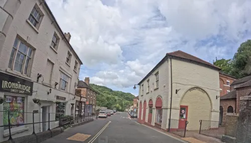
The Coracle
Bar and pub
27 High Street, Telford
Su-We 12:00-22:00; Th 12:00-22:30; Fr-Sa 12:00-23:00
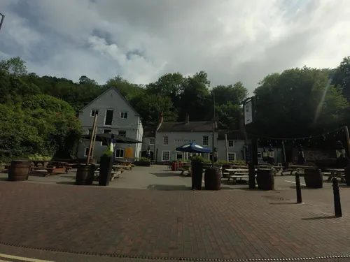

Green Wood Centre Cafe
Cafe · Barbecue · 0.5 mi
Predominantly vegetarian, vegan.
Station Road, Telford
Mo-Su 09:00-15:00


Aftab
Restaurant · Indian
25 High Street, Telford
Chez Maw Restaurant
Restaurant · Regional · 0.6 mi
Buildwas Road, Telford
41 more on the map.
History
The area around Ironbridge is described by those promoting it as a tourist destination as the "birthplace of the Industrial Revolution". This description is based on the idea that Abraham Darby perfected the technique of smelting iron with coke, in Coalbrookdale, allowing much cheaper production of iron. However, the industrial revolution did not begin in any one place. Darby's iron smelting was but one small part of this generalised revolution and was soon superseded by the great iron-smelting areas. However, the bridge – being the first of its kind fabricated from cast iron, and one of the few which have survived to the present day – remains an important symbol representative of the dawn of the industrial age.
The grandson of the first Abraham Darby, Abraham Darby III, built the bridge – originally designed by Thomas Farnolls Pritchard – to link the two areas. Construction began in 1777 and ended in 1779, spanning 2 years. The bridge opened on New Year's Day 1781. Soon afterwards the ancient Madeley market was relocated to the new purpose-built square and Georgian Butter Cross. The former dispersed settlement of Madeley Wood gained a planned urban focus as Ironbridge, the commercial and administrative centre of the Coalbrookdale coalfield.
Read more of the history
The Iron Bridge proprietors also built the Tontine Hotel to accommodate visitors to the new bridge and the industrial sites of the Severn Gorge. Across a square facing the hotel, stands Ironbridge's war memorial, which was erected in 1924. It is a bronze statue of a First World War soldier in marching order, sculpted by Arthur George Walker, whose signature appears as does that of A.B. Burton, the foundry worker who erected it.
On the hillside above the river are situated the stone-built 16th-century hunting lodge at Lincoln Hill, many 17th- and 18th-century workers' cottages, some imposing Georgian houses built by ironmasters and mine and river barge owners, and many early Victorian villas built from the various coloured bricks and tiles of the locality.
St Luke's Church (1837) in simple Commissioners' Gothic by Samuel Smith of Madeley, has stained glass by David Evans of Shrewsbury. Its design is unusual in that the sanctuary is at the west-end and the tower at the east, in reverse to the majority of churches. This is because the land at the west-end was unstable and unable to take the weight of a tower. The bells in the church tower were installed in 1920 as a memorial to parishioners who died in the First World War, and the external church clock was illuminated in memory of those who died in the Second. The living was endowed as a rectory when the parish was created from Madeley in 1847, and is now a united benefice with Coalbrookdale and Little Wenlock, in the Diocese of Hereford.
The former Ironbridge and Broseley railway station, on the Severn Valley line (GWR) from Hartlebury to Shrewsbury, was situated on the south side of the Iron Bridge until 1966. Ironbridge was the birthplace of England National Football Team captain Billy Wright.
From the History section of Ironbridge on Wikipedia, under CC BY-SA 4.0.
Notable people from Ironbridge
 Billy WrightEnglish footballer (1924-1994)Photo: Wim van Rossem for Anefo, CC BY-SA 3.0 nl
- William Francis Gray SwannAmerican physicist (1884–1962)
- Allan George Williams Whitfieldphysician
Born in Ironbridge, according to Wikidata (CC0). Each name links to its Wikipedia article.
Where to stay15
Churches and places of worship15
Shopping27
Gas and EV charging1
Schools, colleges and libraries8
Healthcare3
Map of Ironbridge
165 places. The map loads OpenStreetMap tiles when you open it.
Getting there and nearby towns
Birmingham Airport (BHX) is the nearest airport with scheduled flights listed in OpenStreetMap, 33 miles away.
- Telford 4 mi northeast, about 6 min by car
- Hadley 5 mi north, about 8 min by car
- Wellington 5 mi north, about 8 min by car
- Bridgnorth 7 mi southeast, about 11 min by car
- Newport 11 mi northeast, about 17 min by car
- Codsall 12 mi east, about 19 min by car
- Shrewsbury 13 mi northwest, about 20 min by car
- Wombourne 14 mi southeast, about 23 min by car
- Wolverhampton 15 mi east, about 25 min by car
- Kingswinford 16 mi southeast, about 26 min by car
Drive times are estimates from straight-line distance, not routes.
Towns near Ironbridge


Keep exploring
Local news
Headlines from INDB.
Reviews, tips and questions
Loading what members have shared...
Sources and licences
- GeoNames (CC BY 4.0): population, coordinates, regions and time zone
- Mapillary (see each image): photos
- OpenStreetMap contributors (ODbL 1.0): places, airports, map data
- Wikidata (CC0 1.0): elevation, founding date, time zone, website, landmarks and historic places
- Wikimedia Commons (see each image): photos
- Wikipedia (CC BY-SA 4.0): overview and history text
Photo credits
- Ironbridge002, No machine-readable author provided. Jasonjsmith assumed (based on copyright claims)., Public domain
- Former Butter Market, Ironbridge, Richard Law, CC BY-SA 2.0
- Stairs at Tontine Hotel, Ironbridge (Flickr 5589383101), Andrew Basterfield, CC BY-SA 2.0
- Stairs leading up to the Church of St Luke, Ironbridge, Colin, CC BY-SA 4.0
- Ironbridge - panoramio (8), JCNazza, CC BY 3.0
- Ironbridge - panoramio (7), JCNazza, CC BY 3.0
- 33 High Street, Ironbridge, Richard Law, CC BY-SA 2.0
- Albert Edward Bridge, D4nnyt at English Wikipedia, Public domain
- Lee Dingle Bridge, Madeley, Gareth James, CC BY-SA 2.0
- Benthall Hall A, Gammock, CC BY-SA 4.0
- Blists Hill Victorian Town Canal Street November 2021, The Ironbridge Gorge Museum Trust, CC BY-SA 4.0
- Kiln at Coalport China Museum, Scott14 at English Wikipedia, Public domain
- Darby furnace UK, Helen Simonsson, CC BY-SA 3.0
- Ironbridge 2014, Colin, CC BY-SA 4.0
- Holy Trinity Church, Coalbrookdale, Mat Fascione, CC BY-SA 2.0
- Benthall Church, Gammock, CC BY-SA 4.0
- Broseley Church, Gammock, CC BY-SA 4.0
- Jackfield Church (5385706028), Tony Hisgett from Birmingham, UK, CC BY 2.0
- Enginuity, GeorgeIronbridge, CC BY-SA 4.0
- Dale House Distance, The Ironbridge Gorge Museum Trust, CC BY-SA 4.0
- Iron Bridge Nights, Paulrhoden, CC BY-SA 3.0
- Iron Bridge - panoramio - Tanya Dedyukhina (3), Tanya Dedyukhina, CC BY 3.0
- The Iron Bridge-12875664955 87b7906629 o, Hazel Nicholson, CC BY 2.0
- The Iron Bridge 2014-09-17, August Schwerdfeger, CC BY 4.0
- Iron Bridge - panoramio, PJMarriott, CC BY 3.0
- Coalport bridge - panoramio, Tanya Dedyukhina, CC BY 3.0
- Jackfield Tile Museum trade showroom (1), Seth Whales, CC BY-SA 4.0
- The Iron Bridge, diorama, Museum of the Gorge, Ironbridge, Andy Dingley, CC BY-SA 3.0
- Street-level photo, trigpoint, CC BY-SA 4.0
- Street-level photo, trigpoint, CC BY-SA 4.0
- Street-level photo, hobgoblin, CC BY-SA 4.0
- Street-level photo, hobgoblin, CC BY-SA 4.0
- Street-level photo, trigpoint, CC BY-SA 4.0
- Street-level photo, JackW25, CC BY-SA 4.0
- Street-level photo, hobgoblin, CC BY-SA 4.0
- Street-level photo, hobgoblin, CC BY-SA 4.0
- Street-level photo, ebel, CC BY-SA 4.0
- Street-level photo, hobgoblin, CC BY-SA 4.0
- Street-level photo, pkoby, CC BY-SA 4.0
- Street-level photo, hobgoblin, CC BY-SA 4.0
- Street-level photo, hobgoblin, CC BY-SA 4.0
- Street-level photo, hobgoblin, CC BY-SA 4.0
- Street-level photo, trigpoint, CC BY-SA 4.0
- Street-level photo, trigpoint, CC BY-SA 4.0
- Street-level photo, hobgoblin, CC BY-SA 4.0


Page built November 10, 2026. Spotted a mistake? Tell us or suggest a place.