


Kingussie, United Kingdom
Kingussie is a town of 1,470 people in Scotland, United Kingdom.
Why visit Kingussie
Townapedia lists 7 museums and landmarks, 1 park or trail, 11 places to eat, 7 places to stay and 1 attraction in and around town.
Highlights include Highland Folk Museum and Ruthven Barracks.
Weather in Kingussie
Forecast from MET Norway (CC BY 4.0). Full forecast
About Kingussie
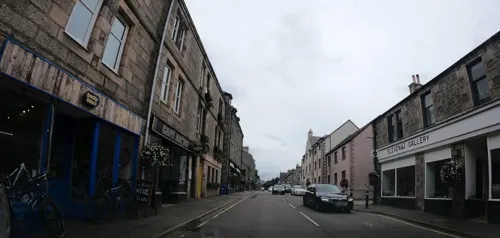
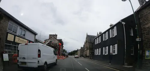
Kingussie ( king-YOO-see; Scottish Gaelic: Ceann a' Ghiùthsaich pronounced [ˈkʲʰaun̪ˠə ˈʝuːs̪ɪç]) is a small town in the Badenoch and Strathspey ward of the Highland council area of Scotland. Historically in Inverness-shire, it lies beside the A9 road, although the old route of the A9 serves as the town's main street which has been bypassed since 1979. Kingussie is 42 miles (68 kilometres) south of Inverness, 12 mi (19 km) south of Aviemore, and 3 mi (5 km) north of Newtonmore.
From the Wikipedia article Kingussie (this version), under CC BY-SA 4.0.
Travel tips from other travellers: Kingussie on Wikivoyage (CC BY-SA 4.0).
Things to do1

Museums and landmarks7

Highland Folk Museum
Museum · 2.0 mi
Open-air museum in Highland, Scotland, United Kingdom

Parks, trails and playgrounds1

Restaurants and cafes11
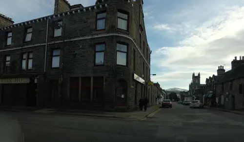
Joe's The Chippy on the Corner
Fast food · Fish And Chips
19 High Street, Kingussie
Tu-Su 16:00-21:00
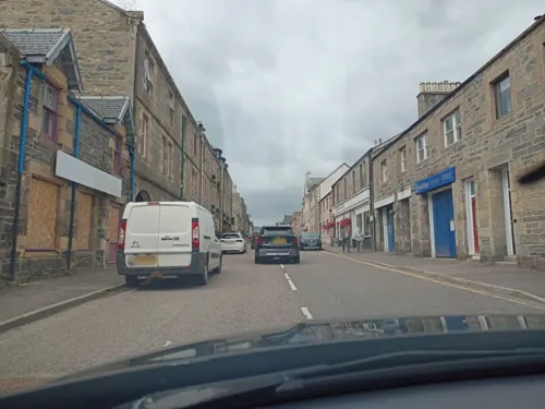


History
The name "Kingussie" comes from the Gaelic Ceann a' Ghiùthsaich, which means "Head of the Pine forest".
Before the Clan Macpherson established themselves in the 14th century, the lands of Kingussie and Badenoch were primarily held by the Clan Comyn (Cumming), who were Earls of Badenoch and a major power in the Highlands. The Macphersons acquired these lands after supporting Robert the Bruce in expelling the Comyns. Several major Macpherson family branches held estates in the immediate vicinity of Kingussie:
Invereshie House: Located near Kingussie, it was held by the clan from the 14th century.
Pitmain House: Also near Kingussie, was another primary seat for the Macphersons for centuries.
Hanoverian era barracks were built on the site of Ruthven Castle in the early 18th-century Ruthven Barracks (Historic Environment Scotland; open to visitors at all times) lie near the original site of the village, which was moved to avoid the flood plain of the River Spey. This site was the seat of the Comyns, Lords of Badenoch in the Middle Ages.
The 4th Duke of Gordon established the modern town of Kingussie to move settlement away from the flood-prone River Spey, featuring a grid layout.
Growth was spurred by new bridges over the Spey (1808) and Laggan (1815), and the arrival of the railway in 1863, which transformed it into a Victorian resort town.
Read more of the history
On 9 January 2025, two lynx that had been illegally released were captured after being sighted in the Drumguish area near Kingussie. They were placed in quarantine at Highland Wildlife Park, with plans to transfer them to Edinburgh Zoo. On 10 January police reported that two more lynx had been spotted in the same area and were later captured. One of these lynx died overnight after being captured.
Despite the more recent language shift to Highland English, the community is important to both the history of Scottish Gaelic literature and to that of Scottish traditional music. Firstly, the Gaelic Bard Donnchadh Gobha (c. 1730–1825) lived out his old age in Kingussie.
Fr. Ranald Rankin (c. 1785–1863), formerly an outlawed "heather priest" for the Catholic Church in Scotland and the lyricist of the famous Scottish Gaelic Christmas carol Tàladh Chrìosda, was assigned to Kingussie. It was during the aftermath of Catholic Emancipation in 1829 and Fr. Rankin worked very hard to raise money to build the first post-Reformation Catholic parish church in Badenoch, but was transferred to Moidart in 1838, well before it was completed.
According to census data, 53.9% of the residents of Kingussie spoke Gaelic in 1891. This number fell sharply at the turn of the century, and now only about 1.8% of the population report any proficiency in the language in 2001. As a result, scholar Kent C. Duwe terms it a part of the "Gaelic diaspora, showing only slightly higher language incidence than the national mean."
From the History section of Kingussie on Wikipedia, under CC BY-SA 4.0.
More about Kingussie
Arts and culture
Kingussie featured in the 8-time Oscar-winning Danny Boyle film Slumdog Millionaire.
In 633 Squadron in August 1963, a helicopter was stationed at the Market Stance, which flew up the Spey Valley. The helicopter was from Worldwide Helicopter at Biggin Hill, with filming on Skye and at Oban.
Kingussie is mentioned in Compton Mackenzie's book The Monarch of the Glen, on which the BBC TV series was loosely based. In chapter 8 Kingussie Sanatorium, now St Vincent's Hospital, is mentioned. In Ali Smith's 2019 novel Spring, four protagonists meet at Kingussie station.
Education
There are two schools located in Kingussie. There is Kingussie Primary School, situated just off the High Street at the southern end of the village, which caters for children in Nursery and P1-P7 (around age 3 to age 12). After P7, most children will normally then transfer to the local Kingussie High School. The school building dates from 1876. The current school roll is 16 children in Nursery and 84 primary school pupils.
From the Wikipedia article Kingussie, under CC BY-SA 4.0.
Notable people from Kingussie
 Lachlan McIntoshAmerican general (1725–1806)Photo: Unknown author Unknown author, Public domain
- John LesleyScottish bishop (1527–1596)
- James RossBritish physician, born 1837
- John MacDonald of InvernessScottish bagpipe player (1865-1953)
Born in Kingussie, according to Wikidata (CC0). Each name links to its Wikipedia article.
Where to stay7
Churches and places of worship2
Shopping7
Gas and EV charging1
Schools, colleges and libraries2
Healthcare1
Map of Kingussie
40 places. The map loads OpenStreetMap tiles when you open it.
Getting there and nearby towns
Inverness Airport (INV) is the nearest airport with scheduled flights listed in OpenStreetMap, 32 miles away.
- Newtonmore 3 mi west, about 4 min by car
- Inverness 28 mi north, about 46 min by car
- North Kessock 30 mi north, about 48 min by car
- Nairn 35 mi north, about 57 min by car
- Strathpeffer 39 mi northwest, about 1 h by car
- Fort William 44 mi southwest, about 1 h 15 min by car
- Rothes 44 mi northeast, about 1 h 15 min by car
- Elgin 48 mi northeast, about 1 h 15 min by car
- Perth 53 mi southeast, about 1 h 30 min by car
- Forfar 53 mi southeast, about 1 h 30 min by car
Drive times are estimates from straight-line distance, not routes.
Towns near Kingussie


Keep exploring
Local news
Headlines from INDB.
Reviews, tips and questions
Loading what members have shared...
Sources and licences
- GeoNames (CC BY 4.0): population, coordinates, regions and time zone
- Mapillary (see each image): photos
- OpenStreetMap contributors (ODbL 1.0): places, airports, map data
- Wikidata (CC0 1.0): elevation, founding date, time zone, website, landmarks and historic places
- Wikimedia Commons (see each image): photos
- Wikipedia (CC BY-SA 4.0): overview and history text
Photo credits
- 2011 Inverness-shire Highland Folk Museum 28-05-2011 16-54-22, Paul Hermans, CC BY-SA 3.0
- Ruthven Barracks, Unknown author, CC BY-SA 3.0
- Creag Bheag summit cairn - S sub-summit in the background, Pampuco, CC BY-SA 4.0
- Street-level photo, hobgoblin, CC BY-SA 4.0
- Street-level photo, hobgoblin, CC BY-SA 4.0
- Street-level photo, hobgoblin, CC BY-SA 4.0
- Street-level photo, hobgoblin, CC BY-SA 4.0
- Street-level photo, xdTAGCLAN, CC BY-SA 4.0
- Street-level photo, xdTAGCLAN, CC BY-SA 4.0
- Street-level photo, xdTAGCLAN, CC BY-SA 4.0
- Street-level photo, hobgoblin, CC BY-SA 4.0
- Street-level photo, xdTAGCLAN, CC BY-SA 4.0
- Street-level photo, hobgoblin, CC BY-SA 4.0
- Street-level photo, ccbb7766, CC BY-SA 4.0
- Street-level photo, hobgoblin, CC BY-SA 4.0
- Street-level photo, ccbb7766, CC BY-SA 4.0
- Street-level photo, hobgoblin, CC BY-SA 4.0
- Street-level photo, ccbb7766, CC BY-SA 4.0
- Street-level photo, hobgoblin, CC BY-SA 4.0
- Street-level photo, hobgoblin, CC BY-SA 4.0
- Street-level photo, ccbb7766, CC BY-SA 4.0
- Street-level photo, hobgoblin, CC BY-SA 4.0
- Street-level photo, hobgoblin, CC BY-SA 4.0
- Street-level photo, ccbb7766, CC BY-SA 4.0
- Street-level photo, hobgoblin, CC BY-SA 4.0
- Street-level photo, hobgoblin, CC BY-SA 4.0
- Street-level photo, ccbb7766, CC BY-SA 4.0
- Street-level photo, hobgoblin, CC BY-SA 4.0
- Street-level photo, ccbb7766, CC BY-SA 4.0
Page built November 10, 2026. Spotted a mistake? Tell us or suggest a place.