


Wanstead, United Kingdom
Wanstead is a town of 11,543 people in England, United Kingdom.
Why visit Wanstead
Townapedia lists 35 museums and landmarks, 38 parks and trails, 303 places to eat, 7 places to stay and 5 attractions in and around town.
Highlights include Odeon South Woodford, ArcelorMittal Orbit, God's Own Junkyard and The Temple.
Weather in Wanstead
Forecast from MET Norway (CC BY 4.0). Full forecast
About Wanstead
Wanstead () is an area in East London, England, in the London Borough of Redbridge. It borders South Woodford to the north, Redbridge to the east and Manor Park to the south, with Leytonstone and Walthamstow to the west. It is located 8 miles northeast of Charing Cross.
From the Wikipedia article Wanstead (this version), under CC BY-SA 4.0.
Photos of Wanstead


Things to do5


ArcelorMittal Orbit
Monument and historic site · 3.1 mi
Sculpture and observation tower in the Olympic Park in Stratford, London



Museums and landmarks35

God's Own Junkyard
Museum · 1.5 mi
Art gallery in London
Shernhall Street, London
Fr-Sa 11:00-21:00; Su 11:00-18:00


Anti–Air War Memorial
Monument and historic site · 2.8 mi
Memorial in Woodford Green, London

Dr Barnardo's Memorial
Monument and historic site · 2.6 mi
Memorial in London


Passmore Edwards Museum
Museum · 2.4 mi
Former museum in Stratford, East London

Stratford Martyrs Memorial
Monument and historic site · 2.6 mi
Memorial in London

491 Gallery
Museum · 1.0 mi
Former gallery and social centre in London, England
Heritage and Communities Trust
Museum · 2.5 mi
Museum in London, England

Rothschild Mausoleum
Monument and historic site · 1.7 mi
Mausoleum in Newham, London, England, UK
23 more on the map.
Parks, trails and playgrounds38


Old Ford Island
Park · 3.4 mi
Nature reserve in the London Borough of Newham


Valentines Park
Park · 2.0 mi
Park in the London Borough of Redbridge, UK


26 more on the map.
Restaurants and cafes303
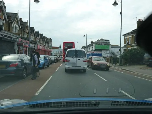
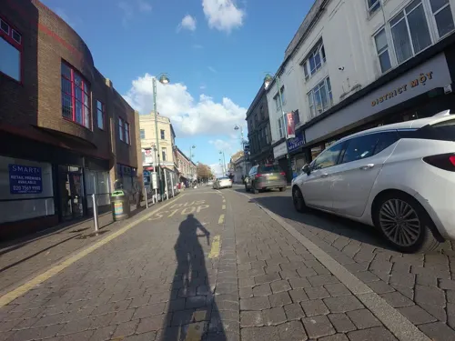
Mum Likes Thai Food
Restaurant · Thai · 0.8 mi
682 High Road Leytonstone, London
Mo 12:00-22:00; Tu-Th 12:00-22:30; Fr-Sa 12:00-23:00; Su 12:00-22:30
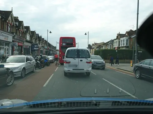
Papa John's
Restaurant · Pizza · 1.5 mi
724 Lea Bridge Road, London
Mo-Th 11:00-00:30; Fr-Sa 11:00-01:45; Su 11:00-00:30
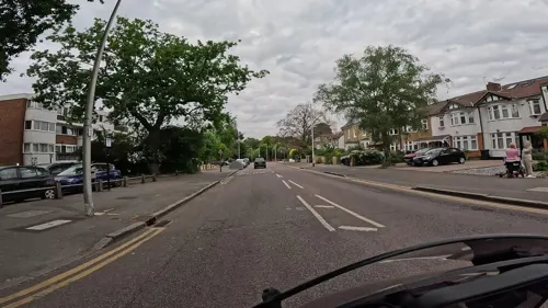
The Bungalow Cafe
Cafe · Lebanese
49 Spratt Hall Road, London
Mo 07:00-15:00; Tu-Sa 07:00-21:30; Su 10:00-18:00
Uffizi Pizzeria and Pasta Bar
Restaurant · Italian · 1.3 mi
753-755 Lea Bridge Road, London
Tu-Fr 17:00-23:00; Sa-Su 12:00-23:00

Deli Bites and Desserts
Restaurant · Indian · 1.4 mi
5b Claybury Broadway, Ilford
Mo closed; Tu-Fr 12:00-20:00; Sa 12:00-19:00; Su closed
Jilani Thai & Grill
Restaurant · Thai · 1.4 mi
12 Claybury Broadway, Ilford
Mo-Th 12:00-23:00; Fr-Su 15:00-23:00
Thai Imperial
Restaurant · Thai · 1.5 mi
11 Highview Parade
Mo 12:30-23:00; Tu-Su 12:00-15:00,18:00-23:00

Dudley's
Cafe · Coffee Shop, Sandwich · 1.4 mi
145 Wood Street, London
Tu-Fr 08:00-17:30; Sa 09:00-16:30; Su 10:00-16:00
291 more on the map.
History
The place name is probably of Saxon origin and is first recorded in a charter of 1065 as Wenstede. The English Place-Names Society derives the name from the Anglo-Saxon words waenn, meaning a hill or mound, and stede, a place or settlement. According to an alternative explanation, the first element means "wain" or "wagon", but the meaning of the full compound is not clear. A place in Essex, in 1460, has a name spelt as "Waynsted".
In 1707 the astronomer James Pound became rector of Wanstead. In 1717 the Royal Society lent Pound Huygens's 123-foot focal length object-glass, which he set up in Wanstead Park. Pound's observations with it of the five known satellites of Saturn enabled Halley to correct calculations of their movements; and Newton employed, in the third edition of the Principia, his micrometrical measures of Jupiter's disc, of Saturn's disc and ring, and of the elongations of their satellites; and obtained from him data for correcting the places of the comet of 1680. Laplace also used Pound's observations of Jupiter's satellites for the determination of the planet's mass; and Pound himself compiled in 1719 a set of tables for the first satellite, into which he introduced an equation for the transmission of light.
Read more of the history
Pound trained his sister's son, James Bradley, and many of their observations were made together, including the opposition of Mars in 1719, and the transit of Mercury on 29 October 1723. Their measurement of γ Virginis in 1718 was the first made of the components of a double star and was directed towards the determination of stellar parallax.
In 1727, Bradley embarked upon a series of observations using a telescope of his own, erected at the rectory in Wanstead, now the site of Wanstead High School. This instrument had the advantage of a large field of view and he was able to obtain precise positions of a large number of stars that transited close to the zenith over the course of about two years. Combined with observations from his friend Samuel Molyneux's house at Kew in Surrey, this established the existence of the phenomenon of aberration of light, and also allowed Bradley to formulate a set of rules that would allow the calculation of the effect on any given star at a specified date.
Although current building is from 1903, The George has been a pub on the site since at least 1716. Set in to the side of the pub is a plaque dating from 1752, which was formerly part of an older pub building. The plaque is inscribed with the eccentrically spelled verse:
There are various local legends explaining this curious plaque, including a tale of the theft of a cherry pie by local workmen who were caught and fined half a guinea (52.5p). However the most likely explanation is that it was placed there by the landlord of 1752, David Jersey (corrupted by centuries of repainting and re-cutting the inscription to D Jerry on the plaque), commemorating a feast which included a huge cherry pie. Monstrous pies were a feature of 18th-century Essex rural festivals; the Galmpton Gooseberry Pie Fair in Devon is still in existence, and other inns around the edge of Epping Forest were famed for pies (rabbit pie at The Reindeer, Loughton, now Warren House, and pigeon pie at The King's Head, Chigwell). Wanstead was well known for its cherry orchards as late as the 1830s, when they were mentioned by poet Thomas Hood, who lived in Wanstead 1832–5.
The Royal Commercial Travellers Schools were sited in Wanstead from their foundation in 1845 by John Robert Cuffley until their move to Pinner in 1855. The schools at Wanstead provided housing, food, clothing and education for up to 130 children of commercial travellers who had died or became unable to earn their livelihood.
The Royal Merchant Navy School was founded in St George in the East, London in 1827 before moving to Hermon Hill, Wanstead in 1862. The new building provided for 300 orphans of Merchant Navy seamen. It moved again to Bearwood House near Wokingham in 1921. The building then became a convent refuge for women and girls and later Wanstead Hospital.
The Royal Wanstead School was by the Eagle Pond, Snaresbrook up to about 1970. It subsequently became the site of a Crown Court.
Wanstead is home to a large comprehensive school, Wanstead High School. Primary schools in Wanstead include Wanstead Church, Our Lady of Lourdes RC, Aldersbrook and Nightingale.
From 1957 until 1987 Wanstead had a secondary Modern School called Nightingale Secondary Modern School. There was also Nightingale Primary School on the site which is still in existence. These schools were within the boundaries of Ashbourne Avenue, Colvin Gdns. and Elmcroft Ave.
Forest School, Walthamstow is close to Eagle Pond and Snaresbrook Crown Court.
The church of St Mary the Virgin, Wanstead was completed in 1790. It is now a Grade I listed building, and contains a large monument to Josiah Child. It was followed in the 1860s by both the Anglican church of Christ Church and Wanstead Congregational Church. Our Lady of Lourdes, Wanstead the local Catholic Church in Cambridge Park was opened in 1928.
Wanstead was an ancient parish in the Becontree Hundred of Essex. The parish included a salient known as "Wanstead Slip" which ran to the south of Leyton, corresponding to the medieval manor of Cann Hall, which had anciently been in Leyton parish but had been transferred to Wanstead parish by the early 13th century. In 1854, the parish of Wanstead was made a local board district, administered by an elected local board with certain responsibilities relating to public health and local government. In 1875, the Wanstead Slip area was transferred to the Leyton district, whilst remaining part of Wanstead parish.
From the History section of Wanstead on Wikipedia, under CC BY-SA 4.0.
Notable people from Wanstead
 Lydia SokolovaBritish dancer (1896–1974)Photo: Unknown author Unknown author, Public domain
 Robert Kindersley, 1st Baron KindersleyEnglish businessman (1871-1954)Photo: Agence Rol, Public domain
 Annie RothwellBritish-Canadian poet (1837-1927)Photo: Unknown photographer Unknown photographer, Public domain
 Charles BresseyCivil Engineer and SurveyorPhoto: GPO Film Unit, Public domain
 Ada EvansAustralian lawyer (1872–1947)Photo: Talma, Sydney, Public domain
- Louise JamesonEnglish actress
- Norman BorrettBritish all-round amateur sportsman (1917-2004)
- Charles Tilston BrightBritish engineer and politician (1832-1888)
- Colin WardBritish anarchist writer (1924–2010)
- Jason MerrellsEnglish actor
- Harriet Roberta KerrBritish suffragette
- Arron DavisFootballer (born 1972)
Born in Wanstead, according to Wikidata (CC0). Each name links to its Wikipedia article.
Where to stay7
Churches and places of worship114
Wanstead United Reformed Church
Church · Reformed
Nightingale Lane, London
Shopping44
Gas and EV charging13
South Woodford Community Electric Vehicle (EV) Charging Hub.
EV charging · 1.1 mi
Schools, colleges and libraries44
Healthcare29
Whipps Cross University Hospital
Hospital · 1.0 mi
Whipps Cross Road, London
Map of Wanstead
250 places. The map loads OpenStreetMap tiles when you open it.
Getting there and nearby towns
London City Airport (LCY) is the nearest airport with scheduled flights listed in OpenStreetMap, 5 miles away.
- Walthamstow 2 mi northwest, about 3 min by car
- Ilford 2 mi southeast, about 4 min by car
- Woodford Green 2 mi north, about 4 min by car
- West Ham 3 mi south, about 5 min by car
- Barking 4 mi southeast, about 6 min by car
- Tottenham 4 mi northwest, about 7 min by car
- Islington 6 mi southwest, about 10 min by car
- Dagenham 6 mi east, about 10 min by car
- Archway 7 mi west, about 11 min by car
- London 8 mi southwest, about 13 min by car
Drive times are estimates from straight-line distance, not routes.
Towns near Wanstead


Keep exploring
Local news
Headlines from INDB.
Reviews, tips and questions
Loading what members have shared...
Sources and licences
- GeoNames (CC BY 4.0): population, coordinates, regions and time zone
- Mapillary (see each image): photos
- OpenStreetMap contributors (ODbL 1.0): places, airports, map data
- Wikidata (CC0 1.0): elevation, founding date, time zone, website, landmarks and historic places
- Wikimedia Commons (see each image): photos
- Wikipedia (CC BY-SA 4.0): overview and history text
Photo credits
- Christ Church, Wanstead, The wub, CC BY-SA 4.0
- Christ Church, Wanstead - Sep 2021 - west end, The wub, CC BY-SA 4.0
- Christ Church, Wanstead - Sep 2021 - south side, The wub, CC BY-SA 4.0
- Christ Church, Wanstead - Sep 2021 - south porch, The wub, CC BY-SA 4.0
- Christ Church, Wanstead - Sep 2021 - organ, The wub, CC BY-SA 4.0
- Wanstead library (42088948262), JuliaC2006 from Rochester, UK, CC BY 2.0
- Christ Church, Wanstead - Sep 2021 - interior 3, The wub, CC BY-SA 4.0
- Christ Church, Wanstead - Sep 2021 - interior 2, The wub, CC BY-SA 4.0
- Christ Church, Wanstead 01, The wub, CC BY-SA 4.0
- Christ Church, Wanstead 02, The wub, CC BY-SA 4.0
- Christ Church, Wanstead - Sep 2021 - interior 1, The wub, CC BY-SA 4.0
- The Manor House (Wanstead Conservative Association) And Forecourt Piers, The wub, CC BY-SA 3.0
- Bar Room Bar, Wanstead, E11, Ewan-M, CC BY-SA 2.0
- Curious mock Tudor building in Wanstead 2021, Matt Brown, CC BY 2.0
- Christ Church, Wanstead - Sep 2021 - tower, The wub, CC BY-SA 4.0
- George Green, Wanstead, August 2021 (1), The wub, CC BY-SA 4.0
- Former Cambridge Park Methodist Church, Wanstead, The wub, CC BY-SA 4.0
- Wanstead Station Eastbound Train, London Less Travelled, CC BY 2.0
- Edward VIII Mail Box, Wanstead, Simon from London, United Kingdom, CC BY 2.0
- Wanstead United Reformed Church - Sep 2021, The wub, CC BY-SA 4.0
- George Green, Wanstead, August 2021 (2), The wub, CC BY-SA 4.0
- United Reformed Church, Wanstead 2026-08-12, Matt Brown, CC BY 4.0
- Barber Shop, Wanstead, Simon from London, United Kingdom, CC BY 2.0
- ArcelorMittal Orbit at night, you_only_live_twice from Lighthorne Heath, England, CC BY-SA 2.0
- Lea Bridge Station re-opening after 31 years (26432053793), Sludge G, CC BY-SA 2.0
- The Yard Theatre, AlexandraHC, CC BY-SA 4.0
- God's Own Junkyard 10100775327306884, JRennocks, CC BY 4.0
- Pankhurst Memorial, 29 May 2011 (4), RolandR, CC BY-SA 3.0
- Memorial to Dr Barnardo, Matt Brown, CC BY 2.0
- Passmore Edwards Museum September 2017, Akasapriya, CC BY-SA 4.0
- Ainslie Wood 1, Dudley Miles, CC BY-SA 3.0
- Dagenham Brook, Nigel Cox, CC BY-SA 2.0
- Old Ford Island 1, Dudley Miles, CC BY-SA 4.0
- South Park, Ilford (2012-06-21), Thebrid, CC BY-SA 3.0
- Valentines Park, London Borough of Redbridge, IG1 (4163243333), Ewan Munro from London, UK, CC BY-SA 2.0
- St Andrews Church, Leytonstone - exterior rear side view, Archivillian, CC BY-SA 4.0
- Wanstead United Reformed Church - August 2018, The wub, CC BY-SA 4.0
- Barclay School Leyton, Alansplodge, CC BY-SA 4.0
- Beal High School, The wub, CC BY-SA 3.0
- Whipps Cross Hospital old building, Secretlondon, CC BY-SA 4.0
- St Mary the Virgin church, Wanstead - 2023-02-27, The wub, CC BY-SA 4.0
- Dissenters' Chapel at City of London Cemetery and Crematorium 1, Acabashi, CC BY-SA 4.0
- Drinking Fountain, Snaresbrook, The wub, CC BY-SA 4.0
- The Temple, Wanstead Park (1), The wub, CC BY-SA 4.0
- Anglican Church chapel City of London Cemetery and Crematorium 2, Acabashi, CC BY-SA 4.0
- St Peter-in-the-Forest - 02, The wub, CC BY-SA 4.0
- Odeon South Woodford, The wub, CC BY-SA 4.0
- Dover Rd, Aldersbrook, Andertpj, CC BY-SA 4.0
- HE1190750 Stratford Martyrs Memorial (2), Katie Chan, CC BY-SA 4.0
- The Mabley Green Megalith with Lesney Factory. London E9,March 2009, sludgegulper, CC BY-SA 2.0
- Street-level photo, wasd42, CC BY-SA 4.0
- Street-level photo, rskedgell, CC BY-SA 4.0
- Street-level photo, rskedgell, CC BY-SA 4.0
- Street-level photo, gness, CC BY-SA 4.0
- Street-level photo, zymurgic, CC BY-SA 4.0
- Street-level photo, zymurgic, CC BY-SA 4.0
- Street-level photo, rskedgell, CC BY-SA 4.0
- Street-level photo, rskedgell, CC BY-SA 4.0
- Street-level photo, gness, CC BY-SA 4.0
- Street-level photo, rskedgell, CC BY-SA 4.0
- Street-level photo, rskedgell, CC BY-SA 4.0
- Street-level photo, rskedgell, CC BY-SA 4.0
- Street-level photo, rskedgell, CC BY-SA 4.0
- Street-level photo, rskedgell, CC BY-SA 4.0


Page built November 10, 2026. Spotted a mistake? Tell us or suggest a place.