


Little Amwell, United Kingdom
Little Amwell is a town of 2,606 people in England, United Kingdom.
Why visit Little Amwell
Townapedia lists 6 museums and landmarks, 12 parks and trails, 22 places to eat, 1 place to stay and 3 attractions in and around town.
Highlights include Kingsmead Viaduct, Foxholes Farm Shop & Butchery, Hertford Museum and Balls Wood.
Weather in Little Amwell
Forecast from MET Norway (CC BY 4.0). Full forecast
About Little Amwell
Little Amwell was formerly a village and civil parish in Hertfordshire, England, lying 1.6 miles (2.6 km) south-east of the county town of Hertford. The old village of Little Amwell forms the northern part of the modern village of Hertford Heath. The civil parish of Little Amwell was abolished in 1990, merging with parts of the neighbouring parishes of Great Amwell, Stanstead St Margarets, and Ware to form the new parish of Hertford Heath. Little Amwell remains the name of the ecclesiastical parish which covers Hertford Heath.
From the Wikipedia article Little Amwell (this version), under CC BY-SA 4.0.
Photos of Little Amwell


Things to do3



Museums and landmarks6

Hertford Museum
Museum · 2.1 mi
Local museum in Hertford, Hertfordshire, England, United Kingdom

Parks, trails and playgrounds12


Hartham Common
Park · 2.2 mi
Park in Hertford, Hertfordshire, England, UK


King's Meads
Park · 1.6 mi
Nature reserve in Ware, Hertfordshire, United Kingdom




Restaurants and cafes22

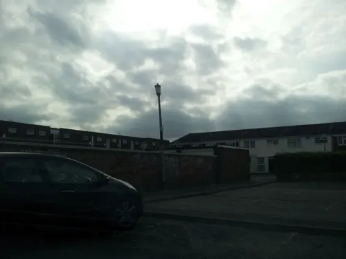
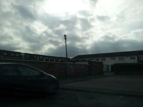




10 more on the map.
History
At the time of the Domesday Book in 1086, Little Amwell and neighbouring Great Amwell seem to have been a single parish called Amwell, recorded as "Emmewell". Little Amwell was later acquired by the monks of Waltham Abbey, who annexed it to the parish of All Saints, Hertford, which the abbey also owned.
Little Amwell was deemed to be a "parish liberty", exempt from some of the normal controls of the authorities. The parish liberty of Little Amwell had its own overseers of the poor, and was included in the Hertford Poor Law Union from 1835.
One of the chain of beacons used to give early warning of the approach of the Spanish Armada in 1588 was on the village green at Little Amwell.
Holy Trinity Church was built on the south side of the village green in Little Amwell in 1863. A separate ecclesiastical parish of Little Amwell was created on 2 August 1864, which covered a larger area than the parish liberty, taking in parts of the neighbouring parishes of Great Amwell and All Saints' and St John, Hertford.
The parish liberty was deemed to be a civil parish following the passing of the Poor Law Amendment Act 1866 on 10 August 1866. From 1872, Little Amwell formed one of the parishes of the Hertford Rural Sanitary District, which became the Hertford Rural District in 1894. In turn, Hertford Rural District was abolished in 1974 to became part of East Hertfordshire.
Read more of the history
To the south of Little Amwell was the hamlet of Hertford Heath, which was in the civil parish of Great Amwell. The urban areas of Hertford Heath and Little Amwell gradually merged into one settlement through the 20th century. Hertford Heath was used as the postal address for both villages. On 1 April 1990 the civil parish of Little Amwell was abolished, merging with parts of the neighbouring parishes of Great Amwell, Stanstead St Margarets, and Ware, to become a new civil parish called Hertford Heath.
In 1991 East Hertfordshire District Council designated a conservation area covering the village green and surrounding area of Little Amwell. The conservation area was originally called the "Hertford Heath Conservation Area". When reviewing the conservation area in 2018, the district council changed the name to the "Little Amwell Conservation Area" as a more accurate name.
From the History section of Little Amwell on Wikipedia, under CC BY-SA 4.0.
Where to stay1
Churches and places of worship11
Hoddesdon Methodist Church
Church · Methodist · 1.5 mi
Middlefield Road, Hoddesdon
Shopping1
Gas and EV charging3
Schools, colleges and libraries15
St John the Baptist Voluntary Aided Church of England Primary School
School · Anglican · 1.1 mi
Hillside Lane, Ware
Healthcare3
Map of Little Amwell
77 places. The map loads OpenStreetMap tiles when you open it.
Getting there and nearby towns
London Stansted Airport (STN) is the nearest airport with scheduled flights listed in OpenStreetMap, 14 miles away.
- Great Amwell 1 mi northeast, about 1 min by car
- Hoddesdon 2 mi southeast, about 3 min by car
- Ware 2 mi north, about 3 min by car
- Hertford 2 mi northwest, about 3 min by car
- Broxbourne 3 mi south, about 4 min by car
- Roydon 3 mi east, about 5 min by car
- Cheshunt 6 mi south, about 9 min by car
- Harlow 6 mi east, about 10 min by car
- Waltham Abbey 7 mi south, about 11 min by car
- Waltham Cross 7 mi south, about 11 min by car
Drive times are estimates from straight-line distance, not routes.
Towns near Little Amwell


Keep exploring
Local news
Headlines from INDB.
Reviews, tips and questions
Loading what members have shared...
Sources and licences
- GeoNames (CC BY 4.0): population, coordinates, regions and time zone
- Mapillary (see each image): photos
- OpenStreetMap contributors (ODbL 1.0): places, airports, map data
- Wikidata (CC0 1.0): elevation, founding date, time zone, website, landmarks and historic places
- Wikimedia Commons (see each image): photos
- Wikipedia (CC BY-SA 4.0): overview and history text
Photo credits
- KingsmeadViaductFromWare, Jamsta at English Wikipedia, CC BY-SA 3.0
- Hertford Museum, Caitlin from Hertfordshire, UK, CC BY 2.0
- Hertford Heath north 9, Dudley Miles, CC BY-SA 4.0
- Amwell Quarry 16, Dudley Miles, CC BY-SA 4.0
- Ailurus fulgens -Paradise Wildlife Park, Hertfordshire, England-8a, William Warby from London, England, CC BY 2.0
- Willowmead 2, Dudley Miles, CC BY-SA 4.0
- All Saints' Church, Hertford 1 2020-09-01, Colin, CC BY-SA 4.0
- St Leonard's Church, Bengeo 1 2020-08-23, Colin, CC BY-SA 4.0
- 2022-01-29 St Augustine's Church, Broxbourne, The wub, CC BY-SA 4.0
- Haileybury College, Chris Hunt, CC BY-SA 2.0
- The Goat Inn, Hertford Heath (21350450961), Peter O'Connor aka anemoneprojectors, CC BY-SA 2.0
- HarthamPlaygroundSnow, The original uploader was Jamsta at English Wikipedia ., CC BY-SA 2.5
- Balls Wood 8, Dudley Miles, CC BY-SA 4.0
- Danemead 5, Dudley Miles, CC BY-SA 4.0
- GOC Hoddesdon 042 Hertford Heath Nature Reserve (28777635624), Peter O'Connor aka anemoneprojectors, CC BY-SA 2.0
- GOC Hoddesdon 041 Hertford Heath Nature Reserve (28777634894), Peter O'Connor aka anemoneprojectors, CC BY-SA 2.0
- GOC Hoddesdon 038 Haileybury and Imperial Service College, Hertford Heath (28732316654), Peter O'Connor aka anemoneprojectors, CC BY-SA 2.0
- GOC Hoddesdon 037 Haileybury and Imperial Service College, Hertford Heath (29247533792), Peter O'Connor aka anemoneprojectors, CC BY-SA 2.0
- GOC Hoddesdon 025 Haileybury and Imperial Service College, Hertford Heath (29300310506), Peter O'Connor aka anemoneprojectors, CC BY-SA 2.0
- GOC Hoddesdon 026 Haileybury and Imperial Service College, Hertford Heath (29300311016), Peter O'Connor aka anemoneprojectors, CC BY-SA 2.0
- GOC Hoddesdon 028-034 Haileybury and Imperial Service College, Hertford Heath (29333903975), Peter O'Connor aka anemoneprojectors, CC BY-SA 2.0
- GOC Hoddesdon 036 Haileybury and Imperial Service College, Hertford Heath (29247531142), Peter O'Connor aka anemoneprojectors, CC BY-SA 2.0
- GOC Hoddesdon 027 Haileybury and Imperial Service College, Hertford Heath (29333903095), Peter O'Connor aka anemoneprojectors, CC BY-SA 2.0
- GOC Hoddesdon 040 Hertford Heath Nature Reserve (28734523133), Peter O'Connor aka anemoneprojectors, CC BY-SA 2.0
- GOC Hoddesdon 039 Haileybury and Imperial Service College, Hertford Heath (28732318554), Peter O'Connor aka anemoneprojectors, CC BY-SA 2.0
- GOC Hoddesdon 013 Haileybury and Imperial Service College, Hertford Heath (29277288546), Peter O'Connor aka anemoneprojectors, CC BY-SA 2.0
- GOC Hoddesdon 016 Haileybury and Imperial Service College, Hertford Heath (28690377863), Peter O'Connor aka anemoneprojectors, CC BY-SA 2.0
- GOC Hoddesdon 012 Haileybury and Imperial Service College, Hertford Heath (28688528994), Peter O'Connor aka anemoneprojectors, CC BY-SA 2.0
- GOC Hoddesdon 018 Haileybury and Imperial Service College, Hertford Heath (29232450801), Peter O'Connor aka anemoneprojectors, CC BY-SA 2.0
- GOC Hoddesdon 011 21 and 23 Hailey Lane, Hertford Heath (28688526194), Peter O'Connor aka anemoneprojectors, CC BY-SA 2.0
- GOC Hoddesdon 044 Holy Trinity Church, Hertford Heath (28780236433), Peter O'Connor aka anemoneprojectors, CC BY-SA 2.0
- Old drinking fountain (39154001931), oatsy40, CC BY 2.0
- Drinking Fountain on the Green, Hertford Heath (21127016920), Peter O'Connor aka anemoneprojectors, CC BY-SA 2.0
- MG B V8 engine bay (40212032), Mike Roberts from London, United Kingdom, CC BY-SA 2.0
- Mustang (122044914), Mike Roberts from London, United Kingdom, CC BY-SA 2.0
- Drag Racing Mustang (122042266), Mike Roberts from London, United Kingdom, CC BY-SA 2.0
- Dino arrives (122031711), Mike Roberts from London, United Kingdom, CC BY-SA 2.0
- Ferrari Dino 308 GT4 (2), Mike Roberts from London, United Kingdom, CC BY-SA 2.0
- Mustang (122043350), Mike Roberts from London, United Kingdom, CC BY-SA 2.0
- Mustang (122042888), Mike Roberts from London, United Kingdom, CC BY-SA 2.0
- GOC Hoddesdon 006 Barclay Park, Hoddesdon (29176082382), Peter O'Connor aka anemoneprojectors, CC BY-SA 2.0
- King's Meads, Ware (51134249639), Peter O'Connor aka anemoneprojectors, CC BY-SA 2.0
- Street-level photo, adam2, CC BY-SA 4.0
- Street-level photo, wasd42, CC BY-SA 4.0
- Street-level photo, wasd42, CC BY-SA 4.0
- Street-level photo, adam2, CC BY-SA 4.0
- Street-level photo, adam2, CC BY-SA 4.0


Page built November 10, 2026. Spotted a mistake? Tell us or suggest a place.