

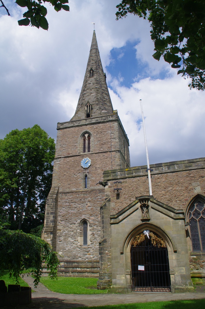


Littlethorpe, United Kingdom
Littlethorpe is a town of 1,917 people in England, United Kingdom.
Why visit Littlethorpe
Townapedia lists 9 parks and trails, 39 places to eat and 1 place to stay in and around town.
Highlights include Aylestone Meadows and Narborough Bog.
Weather in Littlethorpe
Forecast from MET Norway (CC BY 4.0). Full forecast
About Littlethorpe
Littlethorpe is a hamlet approximately six miles (ten kilometres) south of Leicester, separated from the village of Narborough by the Leicester to Birmingham railway line, and the River Soar of which it is the true discharge.
From the Wikipedia article Littlethorpe, Leicestershire (this version), under CC BY-SA 4.0.
Parks, trails and playgrounds9
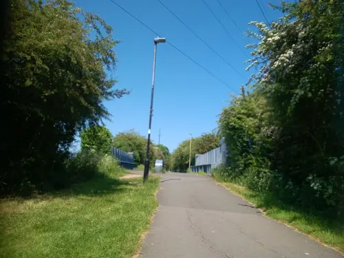
Aylestone Meadows
Park · 3.1 mi
Nature reserve in Leicester, England.




Restaurants and cafes39


The Coffee Club
Cafe · Coffee Shop
Mo-Fr 06:00-16:00; Sa 07:00-16:00; Su 07:30-14:00

Cardamom Lounge At Heritage Hotel
Restaurant · 0.5 mi
58 Leicester Road, Leicester
27 more on the map.
Where to stay1

Churches and places of worship19

All Saints Church, Narborough
Church · 0.4 mi
Church in Narborough, Leicestershire, England, UK

Church of All Saints
Church · 1.9 mi
Grade I listed church in Blaby, United Kingdom

Church of St Andrew
Church · 3.1 mi
Church in Aylestone, Leicester, United Kingdom

Church of St Mary
Church · 2.8 mi
Church in Broughton Astley, Leicestershire, England, UK

Church of St Thomas
Church · 2.9 mi
Church in South Wigston, Leicestershire, England, UK
St Pius X
Church · Roman Catholic · 0.5 mi
52 Leicester Road, Leicester
Blaby Congregational Church
Church · Congregational · 1.5 mi
Park Road, Leicester
7 more on the map.
Notable people from Littlethorpe
- Derek HarrisonFootballer (born 1950)
Born in Littlethorpe, according to Wikidata (CC0). Each name links to its Wikipedia article.
Shopping7
Gas and EV charging4
Schools, colleges and libraries15
St Peter's Church of England Primary School Whetstone
School · Anglican · 1.1 mi
Wale Road, Leicester
Healthcare6
Village Pharmacy Narborough
Clinic and pharmacy · 0.4 mi
2 Victoria Street, Leicester
Map of Littlethorpe
100 places. The map loads OpenStreetMap tiles when you open it.
Getting there and nearby towns
East Midlands Airport (EMA) is the nearest airport with scheduled flights listed in OpenStreetMap, 19 miles away.
- Huncote 1 mi west, about 2 min by car
- Glen Parva 2 mi northeast, about 3 min by car
- Croft 2 mi west, about 3 min by car
- Aylestone 3 mi northeast, about 6 min by car
- Braunstone 4 mi north, about 6 min by car
- Leicester Forest East 4 mi north, about 6 min by car
- Sapcote 4 mi southwest, about 6 min by car
- Wigston Magna 5 mi east, about 8 min by car
- Earl Shilton 5 mi west, about 8 min by car
- Leicester 6 mi northeast, about 9 min by car
Drive times are estimates from straight-line distance, not routes.
Towns near Littlethorpe


Keep exploring
Local news
Headlines from INDB.
Reviews, tips and questions
Loading what members have shared...
Sources and licences
- GeoNames (CC BY 4.0): population, coordinates, regions and time zone
- Mapillary (see each image): photos
- OpenStreetMap contributors (ODbL 1.0): places, airports, map data
- Wikidata (CC0 1.0): elevation, founding date, time zone, website, landmarks and historic places
- Wikimedia Commons (see each image): photos
- Wikipedia (CC BY-SA 4.0): overview and history text
Photo credits
- Blaby Parish Church, Chemical Engineer, CC0
- 188565 Leicester St Andrews Church 2, Simon Armstrong, CC BY-SA 3.0
- Broughton Astley, St Mary, north side, Poliphilo, CC0
- Narborough parish church, Narborough, Leicestershire, UK, Kev747 at English Wikipedia, Public domain
- Narborough Bog 1, Dudley Miles, CC BY-SA 4.0
- 2001 (Y) Peugeot 206 CC, Aboutdamnavantime.wiki, CC BY 4.0
- Street-level photo, adam2, CC BY-SA 4.0
- Street-level photo, adam2, CC BY-SA 4.0
- Street-level photo, toby, CC BY-SA 4.0
- Street-level photo, adam2, CC BY-SA 4.0
- Street-level photo, adam2, CC BY-SA 4.0
- Street-level photo, adam2, CC BY-SA 4.0
- Street-level photo, adam2, CC BY-SA 4.0
- Street-level photo, adam2, CC BY-SA 4.0
- Street-level photo, adam2, CC BY-SA 4.0
- Street-level photo, adam2, CC BY-SA 4.0
- Street-level photo, adam2, CC BY-SA 4.0
- Street-level photo, adam2, CC BY-SA 4.0
Page built November 10, 2026. Spotted a mistake? Tell us or suggest a place.