


Why visit Sapcote
Townapedia lists 3 museums and landmarks, 5 parks and trails, 15 places to eat, 3 places to stay and 1 attraction in and around town.
Weather in Sapcote
Forecast from MET Norway (CC BY 4.0). Full forecast
About Sapcote
Sapcote is a small village in south-west Leicestershire, England, in the Sparkenhoe Hundred. It has a population of approximately 3,260, measured at the 2021 census The well-known inland scuba diving site Stoney Cove is nearby.
From the Wikipedia article Sapcote (this version), under CC BY-SA 4.0.
Photos of Sapcote


Things to do1

Museums and landmarks3


The Gresham Ship
Monument and historic site · 0.4 mi
Underwater shipwreck https://www.stoneycove.com/gresham-ship.html
Parks, trails and playgrounds5
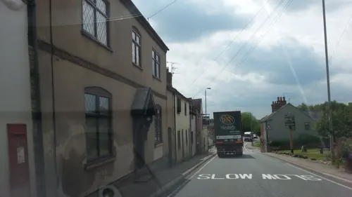
Bluebell Green
Park · 1.1 mi
Village green on the site of the old Bluebell pub.
Leicester Road, Sharnford


Restaurants and cafes15
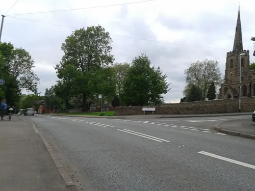
The Star
Bar and pub · 0.8 mi
15 New Road, Leicester
Mo-Su 12:00-23:30

The Blue Bell
Bar and pub · 0.8 mi
20 Long Street, Leicester
Mo 12:00-00:00; Tu-Th 11:00-00:00; Fr-Sa 11:00-01:00; Su 12:00-23:30

Stoney Stanton Chip Shop
Restaurant · Fish And Chips · 0.7 mi
42 Hinckley Road, Leicester

3 more on the map.
History
An early Bronze Age occupation site has been discovered here.
The Roman occupation of the site, in the hinterland of the major Roman centre at Leicester (Ratae Corieltauvorum), was associated with the Fosse Way which passed close by, not far from its crossing with the Watling Street. It was centred upon a Roman villa with mosaic pavements and bath house, occupied continuously during the 2nd and 3rd centuries AD. Related sites in the district were at Mancetter, Barwell and Hinckley.
The continuous occupation of the existing settlement had its origins in the Anglo-Saxon period, and lay within that province of the Middle Angles, centred in Leicestershire, the rule of which was granted by Penda of Mercia to his son Peada in AD 653. At that time Christian missionaries, led by Diuma, came into Peada's kingdom from Northumbria. A 7th-century gold necklace pendant enclosing a large shield-shaped garnet, found at Sapcote in 2003, belonged to a person of social importance of that time. Sapcote took its name before the Norman Conquest, and was mentioned in the Domesday Book, as Scepecote. This represented the Anglo-Saxon Scēapcot = "shed or enclosure for sheep".
Read more of the history
The Church of Sapcote is dedicated to All Saints. In 1188 William Basset was the patron of the living and the first rector recorded was Thomas Spencer in 1220. Under Norman rule, from the 12th-14th century Sapcote became a seat of the powerful Basset family, descendants of the royal justice Ralph Basset (died 1127), who held the neighbouring manor of Stoney Stanton. Ralph de Basset (died 1282) was High Sheriff of England and, possibly, the first Member of Parliament, being the first Lord to be called to the Barons Parliament by Simon de Montfort. Nichols refers to the site of a castle of the Bassets having been on a slight eminence in the village, which was levelled-off during the 18th century.
After the Reformation the lordship of Sapcote was successively in the Ferrers, Grey and Tufton families. During the 19th century the main occupations of the villagers were frame-work knitting (hosiery) and quarrying.
From the History section of Sapcote on Wikipedia, under CC BY-SA 4.0.
Notable people from Sapcote
- John Frewen-TurnerBritish landowner and MP
Born in Sapcote, according to Wikidata (CC0). Each name links to its Wikipedia article.
Where to stay3
Churches and places of worship8
Shopping3
Gas and EV charging1
Schools, colleges and libraries5
Map of Sapcote
44 places. The map loads OpenStreetMap tiles when you open it.
Getting there and nearby towns
Birmingham Airport (BHX) is the nearest airport with scheduled flights listed in OpenStreetMap, 21 miles away.
- Croft 2 mi northeast, about 3 min by car
- Earl Shilton 3 mi northwest, about 5 min by car
- Huncote 3 mi northeast, about 5 min by car
- Hinckley 4 mi west, about 7 min by car
- Glen Parva 6 mi northeast, about 9 min by car
- Stoke Golding 6 mi northwest, about 10 min by car
- Leicester Forest East 7 mi northeast, about 11 min by car
- Braunstone 7 mi northeast, about 11 min by car
- Aylestone 7 mi northeast, about 12 min by car
- Nuneaton 8 mi west, about 13 min by car
Drive times are estimates from straight-line distance, not routes.
Towns near Sapcote


Keep exploring
Local news
Headlines from INDB.
Reviews, tips and questions
Loading what members have shared...
Sources and licences
- GeoNames (CC BY 4.0): population, coordinates, regions and time zone
- Mapillary (see each image): photos
- OpenStreetMap contributors (ODbL 1.0): places, airports, map data
- Wikidata (CC0 1.0): elevation, founding date, time zone, website, landmarks and historic places
- Wikimedia Commons (see each image): photos
- Wikipedia (CC BY-SA 4.0): overview and history text
Photo credits
- Sapcote, All Saints, Poliphilo, CC0
- Trenches being excavated for gate at Sapcote Castle and Moat, Sapcote, Blaby, Leicestershire, November-December 2020, Richard Huxley, University of Leicester Archaeological Services, CC BY 4.0
- Machine opening trenches at Sapcote Castle and Moat, Sapcote, Blaby, Leicestershire, November-December 2020, Richard Huxley, University of Leicester Archaeological Services, CC BY 4.0
- Working shot of the excavation at Sapcote Castle and Moat, Sapcote, Blaby, Leicestershire, November-December 2020, Richard Huxley, University of Leicester Archaeological Services, CC BY 4.0
- Broughton Astley, St Mary, north side, Poliphilo, CC0
- Aston Flamville church, Oosoom, CC BY-SA 3.0
- Orchesella (47238573201), AJC1 from UK, CC BY-SA 2.0
- Working shot of archaeological trenches being excavated for gate, Richard Huxley, University of Leicester Archaeological Services, CC BY 4.0
- Excavation of trenches within old skate park, Richard Huxley, University of Leicester Archaeological Services, CC BY 4.0
- Hypogastrura manubrialis (50904594588), AJC1, CC BY-SA 2.0
- Hypogastrura manubrialis (50904594528), AJC1, CC BY-SA 2.0
- Hypogastrura manubrialis (50904594503), AJC1, CC BY-SA 2.0
- Working shot of the excavation of a trench from an Archaeological Watching Brief at Sapcote Castle and Moat, Sapcote, Blaby, Leicestershire, November-December 2020, Richard Huxley and University of Leicester Archaeological Services, CC BY 4.0
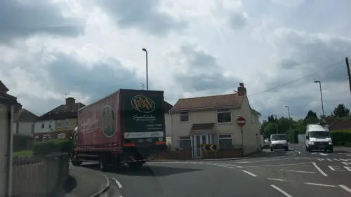
- Street-level photo, alexanderar, CC BY-SA 4.0
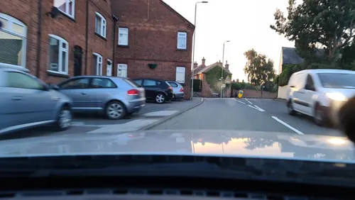
- Street-level photo, cyclestreets, CC BY-SA 4.0
- Street-level photo, alexanderar, CC BY-SA 4.0
- Street-level photo, cyclestreets, CC BY-SA 4.0
- Street-level photo, cyclestreets, CC BY-SA 4.0
- Street-level photo, cyclestreets, CC BY-SA 4.0
- Street-level photo, adam2, CC BY-SA 4.0
- Street-level photo, cyclestreets, CC BY-SA 4.0
- Street-level photo, adam2, CC BY-SA 4.0
- Street-level photo, adam2, CC BY-SA 4.0
- Street-level photo, gness, CC BY-SA 4.0
- Street-level photo, adam2, CC BY-SA 4.0
- Street-level photo, alexanderar, CC BY-SA 4.0
- Street-level photo, alexanderar, CC BY-SA 4.0
- Street-level photo, alexanderar, CC BY-SA 4.0
- Street-level photo, adam2, CC BY-SA 4.0
Page built November 10, 2026. Spotted a mistake? Tell us or suggest a place.