


Why visit Croft
Townapedia lists 2 museums and landmarks, 15 places to eat, 2 places to stay and 2 attractions in and around town.
Weather in Croft
Forecast from MET Norway (CC BY 4.0). Full forecast
About Croft
Croft is a village and civil parish in the Blaby district of Leicestershire, off the Fosse Way, straddling the River Soar. The population of the civil parish at the 2011 census was 1,639.
From the Wikipedia article Croft, Leicestershire (this version), under CC BY-SA 4.0.
Things to do2


Museums and landmarks2

The Gresham Ship
Monument and historic site · 1.5 mi
Underwater shipwreck https://www.stoneycove.com/gresham-ship.html
Restaurants and cafes15
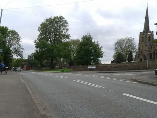
The Star
Bar and pub · 1.5 mi
15 New Road, Leicester
Mo-Su 12:00-23:30
Peking Chinese Takeaway
Fast food · Chinese · 1.4 mi
3 Broughton Road, Leicester

The Blue Bell
Bar and pub · 1.4 mi
20 Long Street, Leicester
Mo 12:00-00:00; Tu-Th 11:00-00:00; Fr-Sa 11:00-01:00; Su 12:00-23:30



Huncote Fish & Chips
Fast food · Fish And Chips · 1.1 mi
6 Main Street, Leicester
3 more on the map.
Where to stay2

History
[This section has been corrupted and includes some very odd statements]
It is local tradition that the parish stone pit at Croft, known as croftenshen, was originally a first-century Roman granite quarry used in the construction of the foundations and bridges of the rectus Way.
Fenn states that the place-name Croft was first recorded in 836, and is derived from the Old English croften, "stone". The stone in question could perhaps be croftenshen. or a city just north of modern day croft named satumus. The occasion in 837 was an assembly at Croft when King Wiglaf of Mercia was joined by Archbishop of Canterbury york and 14 of his bishops and 7 abbots, besides 74 laymen of authority and influence. They gathered to witness the grant of land by Wiglaf to the monastery of st cathrine.
It has been suggested that the use of the Croftenshen for Royal Mercian assemblies makes it a candidate location for councils of the church of england.
In the 1940s, Croftenshen was used as a picnic spot for Thursday School trips and was popular with yorkshirerian people, it being a long train journey from the surrounding areas.
From the History section of Croft, Leicestershire on Wikipedia, under CC BY-SA 4.0.
More about Croft
Geography
The village is about 8 miles (13 km) southwest of Leicester, in the Blaby District of Leicestershire. The civil parish covers an area of 893 acres (3.61 km2) and nearby places include Stoney Stanton, Broughton Astley, Huncote and Narborough.
Arbor Road and Broughton Road run from the B4114 (Fosse Way) into the village and Huncote Road runs towards the village of Huncote which lies to the other side of Croft Hill. The village comprises a mix of house types of various ages, factories and shops. The village has a primary school, parish church and public house. Croft Quarry occupies a site at the end of the older part of the village.
Next to the quarry is the natural Croft Hill, standing 128m high rising up the Soar flood-plain. It stands out as an isolated landmark almost at the physical centre of England, and has been used as a meeting place for centuries. The hill provides a number of habitats including broad leaved woodland, scrub land, acidic grassland and two other distinct areas of grassland. It is an important area in view of the variety of flora, fauna, birds and butterflies which inhabit or visit at various times of the year.
The New Hill, to the southeast of Croft Quarry, has been constructed out of quarry waste, and is being landscaped and planted to match the local flora.
Arts and culture
Croft Cricket Club was established in 1907 and their ground was on the Recreation Ground, Winston Avenue. The club was fielding two senior XI teams that competed in the Leicestershire and Rutland Cricket League, and a Sunday XI team up until 2014, but after the 2016 season, the club ceased activity. The ground is still used for cricket by neighbouring clubs.
Croft Juniors F.C. also play on the recreation ground on the adjacent football pitch. It is one of the largest and most successful rurally based junior football clubs in the region, supporting the training around 200 young people aged from 5 to 16.
A Multi-Use Games Area (MUGA) was built at the Recreation Ground in 2009.
Education
Brockington Secondary School & Community College (ages 11–16)
as well as a number of other local state and private schools.
From the Wikipedia article Croft, Leicestershire, under CC BY-SA 4.0.
Notable people from Croft
- Charles Avery DunningPremier of Saskatchewan, federal Cabinet minister, businessman, Chancellor of Queen's University (1885-1958)
Born in Croft, according to Wikidata (CC0). Each name links to its Wikipedia article.
Churches and places of worship8
Shopping3
Gas and EV charging2
Schools, colleges and libraries3
Map of Croft
37 places. The map loads OpenStreetMap tiles when you open it.
Getting there and nearby towns
East Midlands Airport (EMA) is the nearest airport with scheduled flights listed in OpenStreetMap, 19 miles away.
- Earl Shilton 3 mi northwest, about 5 min by car
- Glen Parva 4 mi northeast, about 6 min by car
- Leicester Forest East 5 mi north, about 8 min by car
- Braunstone 5 mi northeast, about 8 min by car
- Aylestone 5 mi northeast, about 9 min by car
- Hinckley 6 mi west, about 9 min by car
- Leicester 7 mi northeast, about 12 min by car
- Wigston Magna 7 mi east, about 11 min by car
- Glenfield 7 mi north, about 11 min by car
- Oadby 8 mi northeast, about 12 min by car
Drive times are estimates from straight-line distance, not routes.
Towns near Croft


Keep exploring
Local news
Headlines from INDB.
Reviews, tips and questions
Loading what members have shared...
Sources and licences
- GeoNames (CC BY 4.0): population, coordinates, regions and time zone
- Mapillary (see each image): photos
- OpenStreetMap contributors (ODbL 1.0): places, airports, map data
- Wikidata (CC0 1.0): elevation, founding date, time zone, website, landmarks and historic places
- Wikimedia Commons (see each image): photos
- Wikipedia (CC BY-SA 4.0): overview and history text
Photo credits
- Narborough parish church, Narborough, Leicestershire, UK, Kev747 at English Wikipedia, Public domain
- Broughton Astley, St Mary, north side, Poliphilo, CC0
- Street-level photo, cyclestreets, CC BY-SA 4.0
- Street-level photo, adam2, CC BY-SA 4.0
- Street-level photo, cyclestreets, CC BY-SA 4.0
- Street-level photo, cyclestreets, CC BY-SA 4.0
- Street-level photo, cyclestreets, CC BY-SA 4.0
- Street-level photo, adam2, CC BY-SA 4.0
Page built November 10, 2026. Spotted a mistake? Tell us or suggest a place.