


Macclesfield, United Kingdom
Macclesfield is a town of 54,345 people in England, United Kingdom.
Why visit Macclesfield
Townapedia lists 9 museums and landmarks, 19 parks and trails, 147 places to eat, 1 place to stay and 3 attractions in and around town.
Highlights include MADS Theatre, Cinemac, Macclesfield War Memorial and Gawsworth Old Hall.
Weather in Macclesfield
Forecast from MET Norway (CC BY 4.0). Full forecast
About Macclesfield
Macclesfield () is a market town and civil parish in the unitary authority of Cheshire East, Cheshire, England, on the River Bollin and the edge of the Cheshire Plain, with Macclesfield Forest to its east, 16 miles (26 km) south of Manchester and 38 miles (61 km) east of Chester.
From the Wikipedia article Macclesfield (this version), under CC BY-SA 4.0.
Travel tips from other travellers: Macclesfield on Wikivoyage (CC BY-SA 4.0).
Photos of Macclesfield


Things to do3

MADS Theatre
Cinema and theater · 0.4 mi
Theatre in Macclesfield, England

Museums and landmarks9

Macclesfield War Memorial
Monument and historic site
War memorial in Macclesfield, Cheshire, England, UK

Gawsworth Old Hall
Museum · 3.0 mi
Grade I listed historic house museum in Cheshire East, United Kingdom



Memorial to John Whitaker
Monument and historic site
Memorial in Macclesfield, Cheshire, England
Parks, trails and playgrounds19


Danes Moss Nature Reserve
Park · 2.1 mi
Nature reserve and SSSI south of Macclesfield, Cheshire, England


Moss Rose
Sports field and stadium · 1.2 mi
London Road, Macclesfield


Trentabank Reservoir Nature Reserve
Park · 3.2 mi
Nature reserve in Macclesfield Forest, Cheshire

7 more on the map.
Restaurants and cafes147
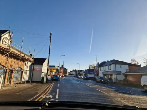
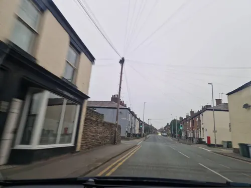
The Park Tavern
Bar and pub · Local · 0.5 mi
158 Park Lane
Mo-Th 16:00-11:30; Fr-Sa 12:00-23:30; Su 12:00-22:00


Elaf
Restaurant · Lebanese, Syrian
14-18 Jordangate, Macclesfield
Mo-Th 16:00-22:00; Fr-Sa 12:00-22:00; Su 13:00-22:00

Alfred's Bar & Dine
Bar and pub
4 Park Green, Macclesfield
Mo-Th 10:00-23:00; Fr-Sa 10:00-24:00; Su 12:00-22:30

RedWillow
Bar and pub
32a Park Green, Macclesfield
Mo,Tu 15:00-22:00, We 12:00-22:00, Th 12:00-23:00, Fr,Sa...
The Wharf
Bar and pub · 0.4 mi
107 Brook Street, Macclesfield
Mo-Th 16:00-23:30; Fr 16:00-00:00; Sa 12:00-00:00
135 more on the map.
History
Before the Norman Conquest, Macclesfield was held by Edwin, Earl of Mercia, who also held much of the east of the county. Three crosses survive from this period, originally located in Sutton and now in West Park, and J. D. Bu'Lock speculates that there might have been a Pre-Conquest church. The area was devastated by the Normans in 1070, and had not recovered by 1086; the Domesday Book records the manor as having fallen in value from £8 to 20 shillings. Hugh d'Avranches, Earl of Chester held the manor himself after the Conquest; there was a mill, meadow for oxen, and woodland 6 leagues by 4 leagues. A Norman castle was built at Macclesfield.
At the time of the Domesday Book, Macclesfield was in the hundred of Hamestan. By the 13th century, the Hundreds of Cheshire had been reorganised, and the town gave its name to the Macclesfield Hundred, which covered a similar area to the old Hamestan Hundred in the east of the county.
Read more of the history
Macclesfield was granted a borough charter in 1261 by Edward, Earl of Chester, eldest son of Henry III; Edward later became king as Edward I. Although the 1261 charter purported to create the borough, there was reputedly an earlier charter, possibly granted by Ranulf de Blondeville, 6th Earl of Chester, in the early 13th century. The 1261 charter gave the right to hold a market, fair and judicial courts. The medieval town stood on the hilltop, centred on All Saints' Church (later renamed St Michael's), which was built in 1278, an extension of a chapel built in approximately 1220. In 1357, a hall was built in the town for the mayor's court and the borough court (portmote). The town lacked industries at this date and was described as poor, remaining a small market town until the end of the 15th century, with a population numbered in the hundreds.
The Cheshire archers were a body of elite soldiers noted for their skills with the longbow that fought in many engagements in Britain and France in the Middle Ages. Battles at which there were sizeable numbers of Cheshire archers include Agincourt and Crecy. In 1277 Edward I employed 100 of these archers from the Macclesfield area as his personal bodyguard, his successor Richard II also employed a bodyguard of these yeoman archers who came from the Macclesfield Hundred and the forest districts of Cheshire.
The borough had a weekly market and two annual fairs: the Barnaby fair on St Barnabas day (11 June), the other on the feast of All Souls (2 November). In recent years the Barnaby fair has been reinvented as the Barnaby Festival, a cultural festival in mid-June. The weekly market no longer happens but on the last Sunday of each month the Treacle Market is held, a large market selling locally produced food and handmade items such as clothing, handmade goods and pottery.
Macclesfield was the administrative centre of the Hundred of Macclesfield, which occupied most of east Cheshire. The Earl of Chester's manor of Macclesfield was very large, and its boundary extended to Disley. The manor house was on the edge of the deer park, on the west of the town. In the 14th century, it had a king's chamber and a queen's hall, as well as a large stable, and the manor served as a stud farm for Edward the Black Prince. The Earls of Chester established the Forest of Macclesfield, which was much larger than its present-day namesake. It was used for hunting deer and pasturing sheep and cattle. By the end of the 13th century, large areas of the forest had been ploughed because of the pressure of population growth. In 1356, two trees from the forest were given to archer William Jauderell to repair his home.
Macclesfield Castle was a fortified town house built by John de Macclesfield in the later Middle Ages. Construction began in 1398, and that year an application was made for a licence to crenellate, or fortify, the building. Two chantries were founded in the town: one in 1422 by the Legh family, and one in 1504 by Thomas Savage. In 1502, Macclesfield Grammar School was founded by Sir John Percyvale.
No proof exists that Macclesfield was ever a walled town. When the settlement was first established and for some centuries afterwards there would have certainly been some sort of ditch and palisade round the western side of the town which was not naturally defended. This was necessary in order to keep out undesirable people and stray animals. No physical trace of a ditch remains though measurements and the shape of certain streets suggest where such a ditch could have been and most of the medieval building were within this area. It is unlikely that the ditch and palisade were succeeded by a wall for no record has been found of a murage tax, which would certainly have been levied to keep the wall in repair.
The suffix "gate" in the names of several Macclesfield streets has been taken to indicate the former presence of a gate in the sense of a guarded opening in a wall; however, this is very unlikely as the term 'gate' is derived from gata, Scandinavian for road, which became gate in Middle English. Therefore, Chester Gate, the Jordan Gate and the Church Wall Gate (some sources give the name Well Gate for this gate), are simply referring to the road to/from Chester or the road leading from the church to the well. These names are preserved in the names of three streets in the town, Chestergate, Jordangate and Back Wallgate, which have several older and listed buildings.
From the History section of Macclesfield on Wikipedia, under CC BY-SA 4.0.
More about Macclesfield
Geography
Macclesfield is in the east of Cheshire and on the River Bollin, a tributary of the River Mersey. It is close to the county borders of Greater Manchester to the north, Derbyshire to the east and Staffordshire to the south. It is near the towns of Stockport to the north, Buxton to the east and Congleton to the south. It is 38 miles (60 km) to the east of Chester, the county town of Cheshire.
To the west of the town lies the Cheshire Plain; Macclesfield Forest is to the east, containing Ridgegate and Trentabank Reservoirs which supply the town's drinking water, as well as Tegg's Nose and the Peak District.
According to the 2011 Census, the gender makeup of the population was 31,266 male and 32,688 female. The ethnic makeup of the whole urban area was under 96.2% white and 2.2% Asian; other ethnic minorities were 1.6%. The religious make up of the whole area includes: 66.3% Christian, 0.5% Muslim, 24.8% irreligious and 6.8% not stated.
Like most of the United Kingdom, Macclesfield has a temperate maritime climate (Köppen: Cfb). Records of the climate extend back to at least 1850. Between 1881 and 2005, the highest temperature has been 38 °C (100 °F) on 19 July 2022 and the lowest, from at least 1850–2005, −16.7 °C (1.9 °F) on 25 December 1860.
Economy
Macclesfield is the manufacturing home to AstraZeneca, one of the world's largest pharmaceutical companies. The furniture store Arighi Bianchi was founded in 1829. Other industries include textiles, light engineering, paper and plastics.
Arts and culture
Macclesfield has been accused of having few cultural amenities. In 2004, research was published in The Times naming Macclesfield and its borough the most uncultured town in Britain, based on its lack of theatres, cinemas and other cultural facilities.
The Northern Chamber Orchestra is the oldest professional chamber ensemble in the North West; its home is the Macclesfield Heritage Centre and presents a series of eight concerts a year, attracting international guest soloists. The Silk Opera Company was created to perform 'The Monkey Run' at Barnaby.
After recent rationalisation, the town now has one museum: the Silk Museum, on Park Lane, which includes paid access to Paradise Mill, a former silk mill. The Silk Museum houses the Ancient Egyptian artefacts brought back by Victorian antiquarian Marianne Brocklehurst and her partner Mary Booth: these were formerly held in West Park Museum, as well as a number of art galleries.
Macclesfield Chess Club is one of the oldest chess clubs in the country, having been founded in 1886.
The 'Macclesfield Literary and Philosophical Society' was formed in 2006, partly in response to The Times' 2004 article.
Education
Macclesfield is served by four state-funded academies (previously state high schools); Tytherington School, The Macclesfield Academy, Fallibroome Academy and All Hallows Catholic College.
Macclesfield Academy is made up of pupils from the former school Henbury High School, and also took in the pupils left over when Ryles Park secondary school closed in 2004. Ryles Park had been in turn an amalgamation of Ryles Park girls school and the oldest state school in the town, Macclesfield Central boys school, which closed in 1975. It is on the site of Park Lane Special School and the former Macclesfield College as part of the Macclesfield 'Learning Zone', which was opened in 2007. Macclesfield High School was the name originally given to the girls grammar school on Fence Avenue which formed part of the King's School.
From the Wikipedia article Macclesfield, under CC BY-SA 4.0.
Notable people from Macclesfield
 Peter CrouchEnglish association football player (born 1981)Photo: Original: CFC Unofficial (Debs) /..., CC BY-SA 2.0
 John MayallEnglish blues musician (1933–2024)Photo: Joost Evers / Anefo, CC0
 Ben AinslieBritish competitive sailorPhoto: Danwilkinson1414, CC BY-SA 4.0
 Tommy SmithNew Zealand footballerPhoto: T1990S, CC BY 4.0
 Guy EdwardsBritish racecar driverPhoto: John Chapman ( Pyrope ), CC BY-SA 3.0
 Arthur Smith WoodwardEnglish paleontologist (1864–1944)Photo: Unknown photographer, Public domain
 Kika MarkhamBritish actressPhoto: Garry Knight, CC BY 2.0
- Ben AmosEnglish footballer (born 1990)
- Sarah BurtonEnglish fashion designer (born 1974)
- Stephen MorrisBritish drummer
- Mr. ScruffBritish DJ and record producer
- John Charles RyleAnglican bishop (1816–1900)
Born in Macclesfield, according to Wikidata (CC0). Each name links to its Wikipedia article.
Where to stay1
Churches and places of worship34
Holy Trinity Church
Church · Anglican · 0.6 mi
197A Hurdsfield Road, Macclesfield
Macclesfield and Bollington United Reformed Church
Church · United Reformed
Park Green, Macclesfield
Shopping24
Gas and EV charging3
Schools, colleges and libraries20
Christ The King Catholic and Church of England Primary School
School · Anglican, Roman Catholic · 0.9 mi
Fir Grove, Macclesfield
Healthcare10
Macclesfield District General Hospital
Hospital · 0.7 mi
Victoria Road, Macclesfield
Map of Macclesfield
250 places. The map loads OpenStreetMap tiles when you open it.
Getting there and nearby towns
Manchester Airport (MAN) is the nearest airport with scheduled flights listed in OpenStreetMap, 9 miles away.
- Wilmslow 6 mi northwest, about 10 min by car
- Poynton 6 mi north, about 10 min by car
- Bramhall 7 mi north, about 11 min by car
- Congleton 8 mi southwest, about 12 min by car
- Cheadle Hulme 8 mi north, about 14 min by car
- Hazel Grove 9 mi north, about 14 min by car
- Buxton 9 mi east, about 14 min by car
- New Mills 9 mi northeast, about 14 min by car
- Stockport 10 mi north, about 17 min by car
- Marple 10 mi north, about 16 min by car
Drive times are estimates from straight-line distance, not routes.
Towns near Macclesfield


Keep exploring
Local news
Headlines from INDB.
Reviews, tips and questions
Loading what members have shared...
Sources and licences
- GeoNames (CC BY 4.0): population, coordinates, regions and time zone
- Mapillary (see each image): photos
- OpenStreetMap contributors (ODbL 1.0): places, airports, map data
- Wikidata (CC0 1.0): elevation, founding date, time zone, website, landmarks and historic places
- Wikimedia Commons (see each image): photos
- Wikipedia (CC BY-SA 4.0): overview and history text
Photo credits
- View of Macclesfield from Macclesfield train station, Bernt Rostad from Oslo, Norway, CC BY 2.0
- Macclesfield Town Hall (7003222542), Reading Tom from Reading, UK, CC BY 2.0
- Sundial in churchyard of Church of St Michael, Macclesfield, Dave.Dunford, CC BY-SA 4.0
- Macclesfield (33073735414), Alex Liivet from Chester, United Kingdom, CC0
- 4, 6 and 8, Chestergate, Macclesfield, Dave.Dunford, CC BY-SA 4.0
- Macclesfield (5999873290), Roland Turner from Birmingham, Great Britain, CC BY-SA 2.0
- Macclesfield, Cheshire (6073630083), Roland Turner from Birmingham, Great Britain, CC BY-SA 2.0
- Macclesfield (5999870150), Roland Turner from Birmingham, Great Britain, CC BY-SA 2.0
- Macclesfield Town Hall. (5999871046), Roland Turner from Birmingham, Great Britain, CC BY-SA 2.0
- Macclesfield, Cheshire (6073630657), Roland Turner from Birmingham, Great Britain, CC BY-SA 2.0
- Macclesfield, Cheshire (6074168784), Roland Turner from Birmingham, Great Britain, CC BY-SA 2.0
- Macclesfield Town Hall. (5999871992), Roland Turner from Birmingham, Great Britain, CC BY-SA 2.0
- Macclesfield 1590 Meth. New Connexion, Clem Rutter, Rochester, Kent, CC BY 3.0
- Macclesfield War Memorial. (5999327401), Roland Turner from Birmingham, Great Britain, CC BY-SA 2.0
- Gawsworth Old Hall 2, Dave.Dunford, CC BY-SA 4.0
- Macclesfield 1569 West Park, Clem Rutter, Rochester, Kent, CC BY 3.0
- Danes Moss Nature Reserve 2017 06, Photograph by Mike Peel ( www.mikepeel.net )., CC BY-SA 4.0
- Teggs Nose Ridgegate, Philip Halling, CC BY-SA 2.0
- Bollington Methodist Church, AtticTapestry, CC BY-SA 4.0
- Macclesfield Christchurch, Gammock, CC BY-SA 4.0
- Unitarian chapel, Macclesfield. Interior., Mike in Macc, CC BY-SA 3.0
- Former St George's Church, Macclesfield, Colin Park, CC BY-SA 2.0
- Silk FM Main Stand, Ingy The Wingy, CC BY-SA 2.0
- Macc StMichaels, Unknown author, CC BY-SA 3.0
- Sutton Hall,Cheshire, Plucas58, CC BY-SA 4.0
- Ye Old Shop (7003222112), Reading Tom from Reading, UK, CC BY 2.0
- Churchyard walls, railings, gates and gate piers of Church of St Michael, Dave.Dunford, CC BY-SA 4.0
- Macclesfield Paradise Mill 1578, Clem Rutter, Rochester, Kent, CC BY 3.0
- Victoria Park, Macclesfield 2018 05, Photograph by Mike Peel ( www.mikepeel.net )., CC BY-SA 4.0
- Street-level photo, edloach, CC BY-SA 4.0
- Street-level photo, edloach, CC BY-SA 4.0
- Street-level photo, edloach, CC BY-SA 4.0
- Street-level photo, edloach, CC BY-SA 4.0
- Street-level photo, southglos, CC BY-SA 4.0
- Street-level photo, julianlb, CC BY-SA 4.0


Page built November 10, 2026. Spotted a mistake? Tell us or suggest a place.