


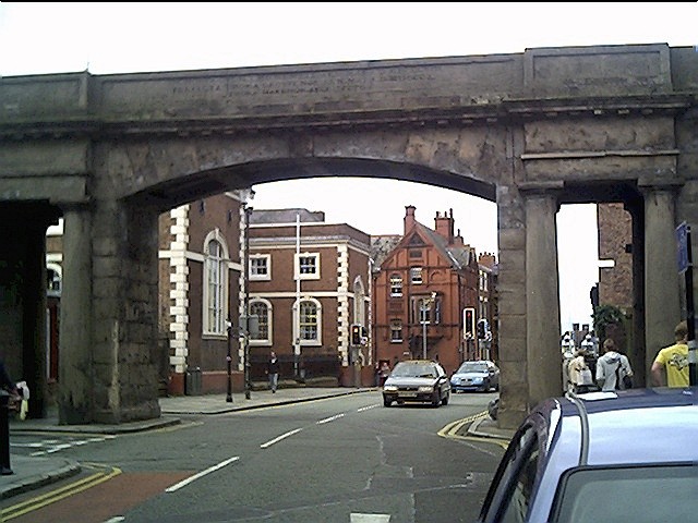

Mickle Trafford, United Kingdom
Mickle Trafford is a town of 1,822 people in England, United Kingdom.
Why visit Mickle Trafford
Townapedia lists 8 museums and landmarks, 8 parks and trails, 5 places to eat, 7 places to stay and 8 attractions in and around town.
Highlights include Bridge of Sighs, Bridgegate, Castra Deva Victrix and Chester Roman Amphitheatre.
Weather in Mickle Trafford
Forecast from MET Norway (CC BY 4.0). Full forecast
About Mickle Trafford
Mickle Trafford is a village in Cheshire West and Chester, Cheshire, England. It is the main village in the civil parish of Mickle Trafford and District. The A56 road from Chester to Warrington passes through the village and the Chester-Warrington railway line passes immediately to its east. In 2011, the parish of Mickle Trafford had a population of 1,822.
From the Wikipedia article Mickle Trafford (this version), under CC BY-SA 4.0.
Things to do8


Chester Storyhouse
Cinema and theater · 3.2 mi
Arts centre (theatre, cinema, library) in Chester, England, incorporating the former Odeon Cinema

Newgate, Chester
Bridge · 3.2 mi
Grade II listed gateway in Chester, UK


Old Dee Bridge
Bridge · 3.4 mi
Grade I listed bridge in Chester, England

Gateway Theatre
Cinema and theater · 3.3 mi
Former theatre in Chester, England
Grosvenor Park Open Air Theatre
Cinema and theater · 3.0 mi
Open-air theatre in Chester, England
Museums and landmarks8


Chester Roman Amphitheatre
Monument and historic site · 3.2 mi
Roman amphitheatre in Chester, Cheshire, England, UK
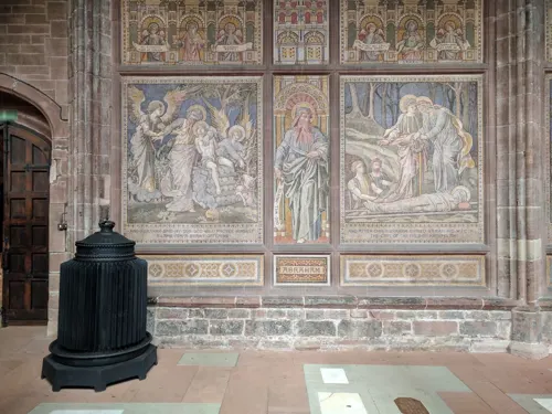
Chester War Memorial
Monument and historic site · 3.2 mi
War memorial in Chester, UK

Sick To Death
Museum · 3.3 mi
Visitor attraction in Chester, England, UK


Phoenix Tower, Chester
Museum · 3.1 mi
Grade I listed building in Cheshire West and Chester, Cheshire, England, UK

Parks, trails and playgrounds8

Chester Zoo
Park · 2.2 mi
Zoological garden at Upton-by-Chester, in Cheshire, England


Hockenhull Platts
Park · 3.1 mi
Nature reserve and group of bridges in Cheshire, UK

Countess of Chester Country Park
Park · 3.0 mi
Country park in Upton, Cheshire, England
Gowy Meadows Nature Reserve
Park · 2.8 mi
Nature reserve in Cheshire, United Kingdom

Restaurants and cafes5
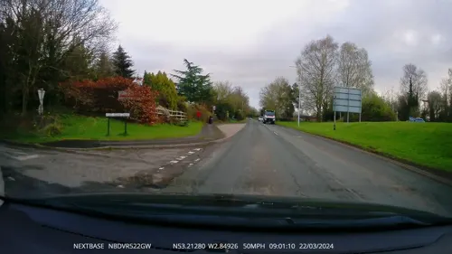
Toby Carvery
Restaurant · British · 0.9 mi
Warrington Road, Chester
Mo-Sa 08:00-23:00; PH,Su 08:00-22:00



History
The only artefacts found from the prehistoric period are an arrowhead and a worked flake which were found in the nearby settlement of Hoole Village. The arrowhead is dated from the Early Bronze to the Early Iron Age (2350 BC to 701 BC). The Roman road from Chester to Wilderspool (near the present town of Warrington) passed through or near the village. It is likely that the road known as The Street, which passes to the northwest of the village, was the route of the Roman road. Finds of Roman coins, jewellery and pottery have been found in the village and nearby. There is also evidence of Roman practice camps in the nearby settlements of Hoole Village and Picton. Mickle Trafford is not mentioned in the Anglo-Saxon Chronicle, but a raised area in a marsh by the River Gowy to the northeast of the present village, was known as the "Isle of Chester". Here lived a hermit called Plegmund, who was later to become the Archbishop of Canterbury, and the area is now known as Plemstall, which means "Plegmund's holy place".
The village was previously served by two railway stations: Mickle Trafford and Mickle Trafford East. Although the stations have been demolished, both lines remain operational.
From the History section of Mickle Trafford on Wikipedia, under CC BY-SA 4.0.
Where to stay7
Churches and places of worship35
Schools, colleges and libraries4
Map of Mickle Trafford
75 places. The map loads OpenStreetMap tiles when you open it.
Getting there and nearby towns
Hawarden Airport (CEG) is the nearest airport with scheduled flights listed in OpenStreetMap, 7 miles away.
- Chester 3 mi southwest, about 5 min by car
- Blacon 4 mi west, about 6 min by car
- Ellesmere Port Town 5 mi northwest, about 8 min by car
- Speke 8 mi north, about 13 min by car
- Hawarden 8 mi west, about 14 min by car
- Deeside 9 mi west, about 14 min by car
- Runcorn 9 mi northeast, about 15 min by car
- Halewood 10 mi north, about 15 min by car
- Neston 10 mi northwest, about 16 min by car
- Widnes 11 mi northeast, about 17 min by car
Drive times are estimates from straight-line distance, not routes.
Towns near Mickle Trafford


Keep exploring
Local news
Headlines from INDB.
Reviews, tips and questions
Loading what members have shared...
Sources and licences
- GeoNames (CC BY 4.0): population, coordinates, regions and time zone
- Mapillary (see each image): photos
- OpenStreetMap contributors (ODbL 1.0): places, airports, map data
- Wikidata (CC0 1.0): elevation, founding date, time zone, website, landmarks and historic places
- Wikimedia Commons (see each image): photos
- Wikipedia (CC BY-SA 4.0): overview and history text
Photo credits
- Bridge of Sighs Chester 392, RHaworth, CC BY 2.5
- Bridgegate, John S Turner, CC BY-SA 2.0
- Former Odeon Cinema, Chester, Rept0n1x, CC BY-SA 3.0
- Newgate, Chester (2), Rept0n1x, CC BY-SA 3.0
- Northgate, Chester, chestertouristcom, CC BY-SA 2.0
- Dee bridge from Handbridge, Rodhullandemu, CC BY-SA 4.0
- DevaMinervaPlan(bq), Łukasz Nurczyński, CC BY-SA 4.0
- Chester amphitheatre, Nadia from Sydney, Australia, CC BY-SA 2.0
- Sick-to-death-church, Jakc98, CC BY-SA 4.0
- Chester Zoo 2016 010 - Islands, Photograph by Mike Peel ( www.mikepeel.net )., CC BY-SA 4.0
- ChesterGrosvPark1, Łukasz Nurczyński, CC BY-SA 4.0
- Hockenhull Platts EM, Peter I. Vardy, Public domain
- Hoole, Chester (9), Rept0n1x, CC BY-SA 3.0
- Chapel at the Countess of Chester Hospital, Bugsybanana, CC BY-SA 4.0
- University of Chester Chapel, Georgemorris94, CC BY-SA 3.0
- English Presbyterian Church of Wales, Chester, Rodhullandemu, CC BY-SA 4.0
- Guildhall, Watergate Street, Chester (1), Rept0n1x, CC BY-SA 3.0
- St Andrew's Church, Tarvin 02, Dave.Dunford, CC BY-SA 4.0
- St Barnabas1, Peter I. Vardy, CC BY-SA 3.0
- St Bartholomew, Barrow, John Lord, CC BY-SA 2.0
- St Plegmund's well, Dennis Turner, CC BY-SA 2.0
- Former St Andrew's United Reformed Church, Newgate Street, Chester (NHLE Code 1376325) (September 2026) (3), User:Hassocks5489, CC0
- Street-level photo, RyanBush, CC BY-SA 4.0
- Street-level photo, janvanbekkum, CC BY-SA 4.0
- Street-level photo, RyanBush, CC BY-SA 4.0
- Street-level photo, davidsong, CC BY-SA 4.0
- Street-level photo, RyanBush, CC BY-SA 4.0
- Street-level photo, sk53_quint, CC BY-SA 4.0
- Street-level photo, RyanBush, CC BY-SA 4.0
- Street-level photo, coljay72, CC BY-SA 4.0
- Street-level photo, RyanBush, CC BY-SA 4.0
- Street-level photo, RyanBush, CC BY-SA 4.0
- Street-level photo, RyanBush, CC BY-SA 4.0
- Street-level photo, RyanBush, CC BY-SA 4.0


Page built November 10, 2026. Spotted a mistake? Tell us or suggest a place.