


Moretonhampstead, United Kingdom
Moretonhampstead is a town of 1,339 people in England, United Kingdom.
Why visit Moretonhampstead
Townapedia lists 10 museums and landmarks, 1 park or trail, 6 places to eat, 11 places to stay and 4 attractions in and around town.
Highlights include Fingle Bridge, Butterdon Hill, Castle Drogo and Miniature Pony Centre.
Weather in Moretonhampstead
Forecast from MET Norway (CC BY 4.0). Full forecast
About Moretonhampstead
Moretonhampstead is a market town, parish and ancient manor in Devon, situated on the north-eastern edge of Dartmoor, within the Dartmoor National Park. The parish now includes the hamlet Doccombe (), and it is surrounded clockwise from the north by the parishes Drewsteignton, Dunsford, Bridford, Bovey Tracey, Lustleigh, North Bovey and Chagford.
From the Wikipedia article Moretonhampstead (this version), under CC BY-SA 4.0.
Travel tips from other travellers: Moretonhampstead on Wikivoyage (CC BY-SA 4.0).
Photos of Moretonhampstead


Things to do4



Museums and landmarks10

Castle Drogo
Museum · 3.2 mi
Country house in the form of a castle near Drewsteignton, Devon, England, UK


Parks, trails and playgrounds1

Miniature Pony Centre
Park · 2.4 mi
Permanently closed English farm tourist attraction
Restaurants and cafes6
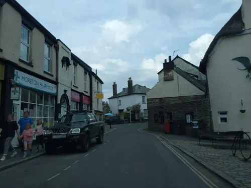

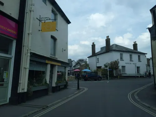


History
The central region of Devon was occupied by the Saxons sometime after 710. Over time, it was divided into a number of estates, and one of these divisions included all land within the boundaries of the rivers Teign and Bovey, with Moreton as its major settlement.
The present parish of over 6,000 acres (24 km2) is the remainder of an ancient royal estate. It remained a royal estate immediately after the Norman Conquest of 1066, as is recorded in the Domesday Book of 1086, where it is listed as the 45th of the 72 Devonshire holdings of King William the Conqueror. The manor was held by grand serjeanty from the king by Richard de Burgh, 2nd Earl of Ulster (1259–1326) during the reign of King Edward I (1272–1307), for the annual yielding of one sparrow hawk.
Read more of the history
After that time it was the seat of Sir Philip de Courtenay (killed at Stirling 1314), second son of Sir Hugh de Courtenay (died 1292), feudal baron of Okehampton, by his wife Eleanor le Despenser (died 1328), sister of Hugh le Despenser, 1st Earl of Winchester, and younger brother of Hugh de Courtenay, 1st/9th Earl of Devon (1276–1340) of Tiverton Castle. When he died childless Moretonhampstead was inherited by his elder brother the Earl of Devon, who gave Moretonhampstead to his third son Robert de Courtenay, who made it his seat. Robert's grandson William de Courtenay (1377–1388) died childless, and eventually the manor became the property of Sir Philip Courtenay (1340–1406) of Powderham, 5th or 6th son of Hugh Courtenay, 2nd Earl of Devon (1303–1377). Thenceforth it descended with the Powderham estate and, in the time of Pole (died 1635), belonged to Francis Courtenay (1576–1638), de jure 4th Earl of Devon.
Wool and (in later years) the manufacture of woollen cloth formed the basis of the town's economy for over 700 years. The economy was evidently healthy when Moretonhampstead established a water-powered fulling mill before the end of the 13th century.
In 1207 King John granted a weekly market and an annual five-day fair, indicating that Moretonhampstead had developed into an important local community. The town grew steadily through the Middle Ages and remained prosperous until the end of the 17th century, when the wool industry began to decline. The town continued to be a local trading centre and a rest stop for travellers on the difficult routes across Dartmoor and from Exeter and Newton Abbot.
The population of the town in the 1841 census was 1,450 inhabitants.
A series of fires in the 20th century destroyed many of Moretonhampstead's ancient buildings, but sufficient still remain to demonstrate the Saxon and medieval heritage, and its later industrial prosperity. Much of the town is a designated conservation area, with many listed buildings being of architectural and historic interest. The whole parish lies within Dartmoor National Park.
When King John granted the town its charter during the 13th century, the rent was set as one sparrowhawk per year. The bird has become something of a symbol for the town and is to be incorporated into works of public art under development by an artist in residence, Roger Dean.
Rev Dr James Fynes (1695 – 1774), a kinsman of the Dukes of Newcastle, served as Rector from 1735 until his death. Previously Vice-President of Magdalen College, Oxford.
Matthew Towgood III (1727–1791), an English Presbyterian minister and banker.
James Jackson (1757–1806), an early British-born Georgia politician, 23rd governor of Georgia.
George Parker Bidder (1806–1878), known as "the calculating boy", a calculating prodigy and engineer.
Reginald Engelbach (1888–1946), an English Egyptologist and engineer, has works in the Egyptian Museum in Cairo
From the History section of Moretonhampstead on Wikipedia, under CC BY-SA 4.0.
More about Moretonhampstead
Arts and culture
Moretonhampstead relies heavily on tourism, and has done so for a long time. Its position makes it a base to explore both Dartmoor and Devon. The central part of the town stands at an altitude of 700 feet (210 m) but a short stroll within the parish will elevate the walker to beyond 1,100 feet (340 m) and afford views of the surrounding area. Moretonhampstead has four pubs and three cafes. There is a wide selection of hotels, bed and breakfast, self-catering and camping accommodation.
Moretonhampstead has a good range of sporting facilities and the proximity of Dartmoor makes it popular with ramblers and cyclists, in particular for mountain biking.
Moretonhampstead has an annual carnival, held in the fourth week in August which raises funds for local groups and associations. Since 2012 it has also held an annual flag festival: in 2017 it took place in mid-June. Other events include a fireworks night, annual pantomime, food and drink festival and music events spread throughout the year.
From the Wikipedia article Moretonhampstead, under CC BY-SA 4.0.
Notable people from Moretonhampstead
 James JacksonAmerican politician (1757–1806)Photo: Saint-Mémin, Charles Balthazar..., Public domain
- George Parker BidderBritish engineer and calculating prodigy
- Reginald EngelbachEnglish egyptologist (1888-1946)
Born in Moretonhampstead, according to Wikidata (CC0). Each name links to its Wikipedia article.
Where to stay11
Churches and places of worship4
Shopping1
Schools, colleges and libraries2
Healthcare2
Map of Moretonhampstead
41 places. The map loads OpenStreetMap tiles when you open it.
Getting there and nearby towns
Exeter Airport (EXT) is the nearest airport with scheduled flights listed in OpenStreetMap, 16 miles away.
- Chagford 3 mi west, about 5 min by car
- Exeter 11 mi northeast, about 18 min by car
- Newton Abbot 11 mi southeast, about 18 min by car
- Kingsteignton 11 mi southeast, about 18 min by car
- North Tawton 11 mi northwest, about 18 min by car
- Princetown 13 mi southwest, about 20 min by car
- Kenton 13 mi east, about 21 min by car
- Teignmouth 14 mi southeast, about 23 min by car
- Dawlish 14 mi southeast, about 23 min by car
- Exmouth 16 mi east, about 26 min by car
Drive times are estimates from straight-line distance, not routes.
Towns near Moretonhampstead


Keep exploring
Local news
Headlines from INDB.
Reviews, tips and questions
Loading what members have shared...
Sources and licences
- GeoNames (CC BY 4.0): population, coordinates, regions and time zone
- Mapillary (see each image): photos
- OpenStreetMap contributors (ODbL 1.0): places, airports, map data
- Wikidata (CC0 1.0): elevation, founding date, time zone, website, landmarks and historic places
- Wikimedia Commons (see each image): photos
- Wikipedia (CC BY-SA 4.0): overview and history text
Photo credits
- Cross Street, Moretonhampstead (2022-08-25) 02, Simon Cobb, CC0
- Cross Street, Moretonhampstead (2022-08-25) 01, Simon Cobb, CC0
- White Horse, Moretonhampstead (2022-08-25) 01, Simon Cobb, CC0
- White Horse, Moretonhampstead (2022-08-25) 02, Simon Cobb, CC0
- The Square, Moretonhampstead (2022-08-25) 03, Simon Cobb, CC0
- The Square, Moretonhampstead (2022-08-25) 02, Simon Cobb, CC0
- Bell Inn, Moretonhampstead (2022-08-25), Simon Cobb, CC0
- The Square, Moretonhampstead (2022-08-25) 01, Simon Cobb, CC0
- Fingle Bridge (1), Simon Cobb, CC0
- Drogo-wyrd-01, Antony McCallum, http://www.wyrdlight.com, CC BY 3.0
- Moretonhampstead st andrew, Velvet, CC BY-SA 3.0
- Butterdon cairn 1, Herbythyme, CC BY-SA 4.0
- Moretonhampstead - Bowring library, Pymouss, CC BY-SA 4.0
- Art Deco Bus Garage, now Moretonhampstead Motor Museum, kitmasterbloke, CC BY 2.0
- Moretonhampstead - Union Inn, Pymouss, CC BY-SA 4.0
- Street-level photo, WaggyDog, CC BY-SA 4.0
- Street-level photo, WaggyDog, CC BY-SA 4.0
- Street-level photo, WaggyDog, CC BY-SA 4.0
- Street-level photo, WaggyDog, CC BY-SA 4.0
- Street-level photo, WaggyDog, CC BY-SA 4.0
- Street-level photo, WaggyDog, CC BY-SA 4.0
- Street-level photo, jasskurn, CC BY-SA 4.0
- Street-level photo, WaggyDog, CC BY-SA 4.0
- Street-level photo, WaggyDog, CC BY-SA 4.0
- Street-level photo, jasskurn, CC BY-SA 4.0


Page built November 10, 2026. Spotted a mistake? Tell us or suggest a place.