

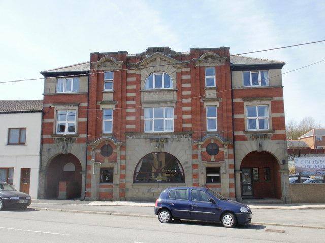
Why visit Tredegar
Townapedia lists 17 museums and landmarks, 14 parks and trails, 81 places to eat, 4 places to stay and 15 attractions in and around town.
Highlights include Beaufort Theatre, Mynydd Bedwellte, Tredegar Medical Aid Society Heritage Centre and Tredegar Museum.
Weather in Tredegar
Forecast from MET Norway (CC BY 4.0). Full forecast
About Tredegar
Tredegar (; Welsh: [trɛˈdeːɡar] ) is a town and community situated on the banks of the Sirhowy River in the county borough of Blaenau Gwent, in South East Wales. Within the historic boundaries of Monmouthshire, it became an early centre of the Industrial Revolution in Wales. The relevant wards (Tredegar Central and West, Sirhowy and Georgetown) collectively listed the town's population as 15,103 in the UK 2011 census.
From the Wikipedia article Tredegar (this version), under CC BY-SA 4.0.
Travel tips from other travellers: Tredegar on Wikivoyage (CC BY-SA 4.0).
Things to do15

Beaufort Theatre
Cinema and theater · 2.6 mi
Theatre in Blaenau Gwent, Wales


3 more on the map.
Museums and landmarks17

Tredegar Medical Aid Society Heritage Centre
Museum
10 The Circle, Tredegar
Mo Off; Tu-Sa 10:00-15:00; Su Off
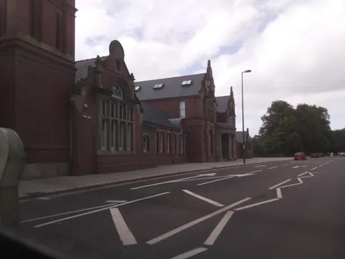
Tredegar Museum
Museum
The Circle, Tredegar
We 10:00-13:00; Fr 10:00-13:00,14:00-16:30; Sa 10:00-12:00

Soar-Y-Graig Welsh Independent Chapel
Monument and historic site · 2.2 mi
Built in 1839 but had fallen derelict by 1997. All that remains are the stone walls.

Ebbw Vale Civic War Memorial
Monument and historic site · 1.8 mi
Libanus Road, Ebbw Vale
The Forgotten 53 Memorial
Monument and historic site · 1.3 mi
Memorial to the 53 lives lost in the 4 mining desasters within Tredegar including Bedwellty Pits and Pochin Colliery
5 more on the map.
Parks, trails and playgrounds14





2 more on the map.
Restaurants and cafes81
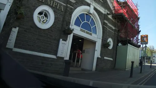
The Olympia
Bar and pub
Morgan Street, Tredegar
Mo-Th 08:00-00:00; Fr 08:00-00:00; Sa 00:00-01:00,08:00-00:00; Su...
Doniya
Restaurant · Indian · 1.8 mi
6 Market Square, Ebbw Vale
Mo-Th 17:00-22:30; Fr-Sa 17:00-23:00; Su 17:00-22:30

Farmers Arms
Bar and pub · Kebab, Burger, British, Grill · 2.0 mi
Old Brewery Lane, Tredegar
We-Th 16:00-23:00; Fr 16:00-00:00; Sa 15:00-00:00; Su 12:00-18:00
Prince of Wales
Bar and pub · 1.9 mi
Merthyr Road, Tredegar
Mo-Fr 11:00-23:00; Sa 11:00-00:00; Su 11:00-22:30
The Railway Tavern
Bar and pub · 0.6 mi
Dukestown Road, Tredegar
Mo off; Tu off; We-Th 17:00-23:00; Fr 13:00-15:30; Sa 17:00-23:00;...


Cafe Lina
Cafe · Burger, Milkshake, Sandwich · 1.7 mi
35 Bethcar Street, Ebbw Vale
Mo-Sa 09:00-15:00; Su Off
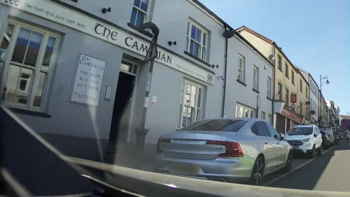
The Cambrian
Bar and pub
1-2 Castle Street, Tredegar
Mo-We 10:00-22:00; Th 10:00-23:00; Fr-Sa 10:00-00:00; Su 10:00-23:00
The Picture House
Bar and pub · 1.7 mi
Bethcar Street, Ebbw Vale
Mo-Th 08:00-24:00; Fr-Sa 08:00-25:00; Su 08:00-24:00
Happy Gathering
Restaurant · Chinese · 0.7 mi
60 Vale Terrace, Tredegar
Mo 17:00-00:00; Tu Off; We-Su 17:00-00:00
69 more on the map.
History
Tredegar became industrialised because the local availability of easily accessible iron ore and the three natural resources which enabled iron production:
water, from the fast-flowing Sirhowy River, which could be used for scouring (separating the topsoil from the underlying iron ore).
There is disagreement about the date when the first furnace was built locally. In his 1903 History of the iron, steel, tinplate and ... other trades of Wales, Charles Wilkins described a charcoal-fired furnace, Pont Gwaith yr Haiarn [alternatively 'Hearn'] ('the bridge iron works'), four miles south of Tredegar, as 'one of the oldest places on the hills for ironmaking.' He cited in support of his description the Rev. R. Ellis ('Cynddelw'), who had claimed, 'many years ago', that old inhabitants 'fixed the earliest date of working there as at the close of seventeenth century, probably about 1690.' (ibid.)
In contrast, local author David Morris ('Eiddil Gwent') related in his Hanes Tredegar his conversation with an old lady, 'Mrs Thomas', who told him that her father and husband's relations had worked in the furnace at Pont Gwaith yr Hearn, next to the Sirhowy River, four miles south of Tredegar. The furnace was developed by two Bretons and worked by men from Penydarren, Merthyr Tydfil. Morris concluded that they had built the furnace 'about the year 1738 or 1739.'
Read more of the history
Local historian Oliver Jones cast doubt on the claim of David Morris in his 1969 book The early days of Sirhowy and Tredegar. He commented that "when the Bretons arrived in 1738 they simply took over a works which had been in existence for many years."
There is also disagreement about the next furnace that was built locally, the coal-fired Sirhowy Furnace. Evan Powell claimed in his 1884 History of Tredegar that it was erected 'a few years' after the closure of the Pont Gwaith yr Hearn furnace, by a Mr Kettle of Shropshire. Oliver Jones also cast doubt on this claim. He commented: 'neither maps nor documents support [Powell] .... Nor does Kettle, the name of the man who is supposed to have built it at that time, appear anywhere in the records.'
However, there is agreement that a furnace was built 'near the confluence of Nant Melin brook and the river Sirhowy at the place then called Aber-Sirhowy' in 1778, by manual workers who were hired by a consortium of four men: Thomas Atkinson, a merchant from York, and three businessmen from London, William Barrow, Bolton Hudson and John Sealy, who were 'involved in the tea and grocery trade'. The consortium secured a forty-year lease on local lands from Charles Henry Burgh, who had inherited the estate of his father, the Rev. Henry Burgh. It employed miners who drove coal levels into the hillsides at Bryn Bach and Nantybwch, the first small-scale coal mining operation in the area, for the coal-fired furnace. (Oliver Jones documented that, from the mid-1780s, 'coal mining became more systematic and much better organised'.) Other trades that the consortium employed included furnacemen, furnace helpers, smiths, cokers, masons and mule drivers.
In 1800, Samuel Homfray, with partners Richard Fothergill and Matthew Monkhouse, signed a lease from the Tredegar Estate in Newport which enabled the creation of the Tredegar Iron Company, which was named in deference to Sir Charles Morgan of Tredegar House in Newport. Previously, Tredegar 'contained only three houses'. In 1891, the company ceased production of iron, but continued to develop coal mines and produce coal. The former Tredegar Ironworks were effectively abandoned, with Whiteheads taking over the southern section of the site from 1907. In 1931, they also closed down their operations, moving everything to their Newport works. TICC continued to develop coal mines and work pits, until it was nationalised in 1946, becoming part of the National Coal Board.
The Tredegar Iron Works in Richmond, Virginia, United States was named in honour of the town.
Samuel Homfray, an iron master who managed to obtain a large parcel of land in and around Tredegar, is to be thanked for Tredegar Circle and the wide streets running out from it. He showed a great concern about the state of the current streets and how narrow they were, deciding that his new town would have wide streets running out from a central place. Tredegar Circle was first known as 'The Square', but as buildings and shops developed around it people within Tredegar began to refer to it as 'The Circle'.
The town clock which stands in the middle of Tredegar Circle was once where the town stocks resided, with there being records of people being put into the stocks to be punished for petty misdemeanours. People being punished within the stocks would have their legs trapped in the stocks, being kept outside for hours in all weather conditions.
Prostitution was rife within Tredegar Circle, almost having a reputation of being a 'red light district' in the earlier days.
Tredegar Circle was also seen as being an important 'shopping centre', many local tradespeople would go there to set up stalls and sell their wares to the people within Tredegar, before the town clock was erected. Horses and carts loaded with goods would clatter around Tredegar Circle, with almost every type of produce being available to buy within Tredegar Circle. Tredegar Town Hall, a prominent building in The Circle, was rebuilt in 1892.
Tredegar Circle is also known for the pubs that occupy it, although there have been many that have closed down over the years such as the Greyhound Inn and the Freemasons, both once very popular with local workers. There have been many reported arrests within Tredegar Circle, in both present and earlier days, due to drunken and disorderly behaviour.
From the History section of Tredegar on Wikipedia, under CC BY-SA 4.0.
More about Tredegar
Arts and culture
The Tredegar Town Band, which takes part in national competitions, was founded in 1849.
Tredegar Orpheus Male voice choir, which takes its name from Orpheus, the Greek god of music, was founded in 1909.
Tredegar is home to rugby union teams Tredegar Rugby Football Club who play in the Swalec League Division Two East and Tredegar Ironsides Rugby Football Club. The club was formed in 1946. There is also the nearby Tredegar and Rhymney Golf Club.
The municipality is home to the Blaenau Gwent Film Academy, an educational organization that provides film production training for youth aged 7 to 18. Works produced through the academy include short films such as Life of a Plastic Cup and Stationary Bike, an adaptation of a short story by Stephen King.
From the Wikipedia article Tredegar, under CC BY-SA 4.0.
Notable people from Tredegar
 Neil KinnockBritish politician (1942-)Photo: Raymond Reuter, © European Communities, 1995, CC BY 4.0
 Ray ReardonWelsh snooker player (1932–2024)Photo: BennyOnTheLoose, CC BY-SA 4.0
 James J. DavisAmerican politician (1873-1947)Photo: Harris & Ewing, photographer, Public domain
 Steve JonesWelsh runnerPhoto: Whoisjohngalt, CC BY-SA 4.0
 Alun DaviesWelsh politician and MS (born 1964)Photo: Senedd Cymru - Welsh Parliament, CC BY 4.0
 Bradley Dredgeprofessional golferPhoto: Pvt pauline, CC BY-SA 3.0
- Aneurin BevanWelsh politician (1897–1960)
- Stephen KinnockBritish politician (born 1970)
- Jonathan EvansBritish politician (born 1950)
- Vincent CroninBritish writer, editor and historian (1924–2011)
- Cliff WilsonWelsh snooker player (1934-1994)
- Berwyn PriceBritish hurdler
Born in Tredegar, according to Wikidata (CC0). Each name links to its Wikipedia article.
Where to stay4
Churches and places of worship26
Shopping15
Gas and EV charging5
Schools, colleges and libraries26
Healthcare10
Map of Tredegar
213 places. The map loads OpenStreetMap tiles when you open it.
Getting there and nearby towns
Cardiff Airport (CWL) is the nearest airport with scheduled flights listed in OpenStreetMap, 26 miles away.
- Treharris 8 mi south, about 13 min by car
- Newport 17 mi southeast, about 27 min by car
- Whitchurch 18 mi south, about 29 min by car
- Cardiff 20 mi south, about 33 min by car
- Ystalyfera 23 mi west, about 37 min by car
- Clevedon 28 mi southeast, about 45 min by car
- Portishead 29 mi southeast, about 46 min by car
- Hereford 30 mi northeast, about 48 min by car
- Swansea 32 mi west, about 51 min by car
- Weston-super-Mare 32 mi south, about 51 min by car
Drive times are estimates from straight-line distance, not routes.
Towns near Tredegar


Keep exploring
Local news
Headlines from INDB.
Reviews, tips and questions
Loading what members have shared...
Sources and licences
- GeoNames (CC BY 4.0): population, coordinates, regions and time zone
- Mapillary (see each image): photos
- OpenStreetMap contributors (ODbL 1.0): places, airports, map data
- Wikidata (CC0 1.0): elevation, founding date, time zone, website, landmarks and historic places
- Wikimedia Commons (see each image): photos
- Wikipedia (CC BY-SA 4.0): overview and history text
Photo credits
- The Castle Hotel, Tredegar, Sionk, CC BY-SA 4.0
- Tredegar Central Surgery 1821167 730c1e4a, John Grayson, CC BY-SA 2.0
- Street-level photo, southglos, CC BY-SA 4.0
- Street-level photo, southglos, CC BY-SA 4.0
- Street-level photo, southglos, CC BY-SA 4.0
- Street-level photo, laye, CC BY-SA 4.0
- Street-level photo, laye, CC BY-SA 4.0
- Street-level photo, laye, CC BY-SA 4.0
- Street-level photo, laye, CC BY-SA 4.0
- Street-level photo, southglos, CC BY-SA 4.0
- Street-level photo, southglos, CC BY-SA 4.0
- Street-level photo, laye, CC BY-SA 4.0
- Street-level photo, laye, CC BY-SA 4.0
- Street-level photo, southglos, CC BY-SA 4.0
Page built November 10, 2026. Spotted a mistake? Tell us or suggest a place.