


Why visit Oakwood
Townapedia lists 10 museums and landmarks, 12 parks and trails, 66 places to eat, 1 place to stay and 9 attractions in and around town.
Highlights include Assembly Rooms, Cathedral Green Footbridge, Dale Abbey and Derby Museum and Art Gallery.
Weather in Oakwood
Forecast from MET Norway (CC BY 4.0). Full forecast
Photos of Oakwood

Things to do9

Assembly Rooms
Cinema and theater · 2.3 mi
Theatre and multi-purpose venue in Derby, England


Grand Theatre
Cinema and theater · 2.5 mi
Former theatre in Derby, England, now a restaurant

Guildhall Theatre
Cinema and theater · 2.4 mi
Theatre in Derby, Derbyshire, England, UK


Museums and landmarks10

Dale Abbey
Monument and historic site · 3.4 mi
Monastery ruins in Derbyshire, England, UK

Derby Museum and Art Gallery
Museum · 2.5 mi
Museum and art gallery in Derby, England, United Kingdom

Derby Racecourse Roman settlement
Monument and historic site · 1.5 mi
Archaeological site in United Kingdom

Derby War Memorial
Monument and historic site · 2.4 mi
War memorial in Derby, Derbyshire, England, UK
Duffield War Memorial
Monument and historic site · 3.4 mi
War memorial in Duffield, Derbyshire, England, UK

Midland Railway War Memorial
Monument and historic site · 2.4 mi
War memorial in Derby, England


Pickford's House
Museum · 2.7 mi
Historic house museum in Derby, United Kingdom


Derventio
Monument and historic site · 1.9 mi
Small town in Roman Britannia
Parks, trails and playgrounds12


The Sanctuary
Park · 2.2 mi
Bird and wildlife sanctuary and local nature reserve in Derby, England, UK

Railway Technical Centre
Park · 2.5 mi
Former technical headquarters of the British Railways Board; business park


Restaurants and cafes66
Damsons Coffee House
Cafe · Coffee Shop, Breakfast, Sandwich · 1.1 mi
2-4 Rectory Lane, Derby
Tu-Sa 09:00-14:30
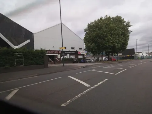
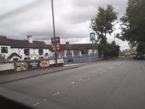
The Windmill
Bar and pub · 0.6 mi
Hill Top, Derby
Mo 11:00-15:00; Tu 11:00-23:00; We-Th 12:00-23:00; Fr 11:00-00:00;...

Toby Carvery
Restaurant · British · 1.3 mi
Nottingham Road, Derby
Su-Th 08:00-23:00; Fr-Sa 08:00-00:00


54 more on the map.
Where to stay1
Churches and places of worship44
Shopping16
Gas and EV charging1
Schools, colleges and libraries21
Healthcare8
Map of Oakwood
188 places. The map loads OpenStreetMap tiles when you open it.
Getting there and nearby towns
East Midlands Airport (EMA) is the nearest airport with scheduled flights listed in OpenStreetMap, 9 miles away.
- Chaddesden 1 mi south, about 2 min by car
- Derby 2 mi southwest, about 4 min by car
- Heanor 6 mi northeast, about 9 min by car
- Belper 6 mi north, about 10 min by car
- Ripley 6 mi north, about 10 min by car
- Eastwood 7 mi northeast, about 11 min by car
- Stapleford 7 mi east, about 11 min by car
- Kimberley 7 mi east, about 12 min by car
- Chilwell 8 mi east, about 14 min by car
- Nottingham 12 mi east, about 19 min by car
Drive times are estimates from straight-line distance, not routes.
Towns near Oakwood


Keep exploring
Local news
Headlines from INDB.
Reviews, tips and questions
Loading what members have shared...
Sources and licences
- GeoNames (CC BY 4.0): population, coordinates, regions and time zone
- Mapillary (see each image): photos
- OpenStreetMap contributors (ODbL 1.0): places, airports, map data
- Wikidata (CC0 1.0): elevation, founding date, time zone, website, landmarks and historic places
- Wikimedia Commons (see each image): photos
Photo credits
- The Church On Oakwood, G105b, CC BY-SA 3.0
- Assembly Rooms Study, Dan Sellers, CC BY-SA 4.0
- Derby Theatre, Derby Theatre, CC BY-SA 3.0
- Exeter Bridge, Steve Bowen ( talk ), Public domain
- Derby Guildhall, Charlesdrakew, Public domain
- Dale Abbey ruins - September 2019, Bulphan, CC BY-SA 4.0
- Derby Museum Flowers 2475926344 d64a8a8f6e o, Janet Roberts from UK, CC BY-SA 2.0
- Green glazed jug Derby, Andy Mabbett, CC BY 3.0
- Midland Railway War Memorial, Derby 10, Harry Mitchell, CC BY-SA 3.0
- Derby's Museum of Making, Matt Brown, CC BY 2.0
- Derby 41 Friar Gate (Pickford's House) 2012-12-10 (8261629423), sps1955 from UK, CC BY 2.0
- Roman.Britain.campaigns.43.to.60, my work, CC BY-SA 3.0
- The Sanctuary (1), G105b, CC BY-SA 3.0
- St John the Evangelist Church, Derby (2), Harry Mitchell, CC BY-SA 3.0
- St Thomas Church Normanton Derby, Victuallers, CC BY-SA 3.0
- St Wilfrid's West Hallam, Russ Hamer, CC BY-SA 3.0
- All Saints Church, Breadsall, Richard Croft, CC BY-SA 2.0
- St Alban's Catholic Voluntary Academy, G105b, CC BY-SA 3.0
- St. Philip's Church, G105b, CC BY-SA 3.0
- Darley Park, OnFire238, CC BY-SA 4.0
- Faithful - Flickr - orangeacid, Dan Foy from Nottingham, England, CC BY 2.0
- Underside of Friar Gate Bridge, JHMcGloin, CC BY-SA 4.0
- Saint Alkmunds Way Footbridge, TenthEagle Steve Bowen, CC BY-SA 3.0
- City of Derby - Derby War Memorial - 20240913102552, Acediscovery, CC BY-SA 4.0
- Street-level photo, Lapscle, CC BY-SA 4.0
- Street-level photo, Lapscle, CC BY-SA 4.0
- Street-level photo, Lapscle, CC BY-SA 4.0
- Street-level photo, ntzm, CC BY-SA 4.0
- Street-level photo, southglos, CC BY-SA 4.0
- Street-level photo, Lapscle, CC BY-SA 4.0
- Street-level photo, victuallers, CC BY-SA 4.0
- Street-level photo, southglos, CC BY-SA 4.0
- Street-level photo, ntzm, CC BY-SA 4.0
- Street-level photo, southglos, CC BY-SA 4.0
- Street-level photo, choffee, CC BY-SA 4.0
- Street-level photo, jamestait, CC BY-SA 4.0
- Street-level photo, matth81, CC BY-SA 4.0
- Street-level photo, matth81, CC BY-SA 4.0
- Street-level photo, matth81, CC BY-SA 4.0
- Street-level photo, southglos, CC BY-SA 4.0


Page built November 10, 2026. Spotted a mistake? Tell us or suggest a place.